Category:Satellite pictures of Severnaya Zemlya
Jump to navigation
Jump to search
Media in category "Satellite pictures of Severnaya Zemlya"
The following 17 files are in this category, out of 17 total.
-
 Bolshevik Island 2020-08-15 Sentinel-2 L2A Highlight Optimized Natural Color.jpg 2,500 × 3,066; 1.37 MB
-
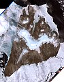 Bolshevik island, Russia, Landsat 7 image.jpg 5,027 × 6,410; 6.92 MB
-
 KomsomoletsIsland Terra MODIS.png 530 × 610; 354 KB
-
 Krupskaya Island 2020-07-06 Sentinel-2 L2A Highlight Optimized Natural Color.jpg 2,500 × 2,019; 1.32 MB
-
 Maly Taymyr Island 2020-08-15 Sentinel-2 L2A True color.jpg 2,468 × 1,860; 530 KB
-
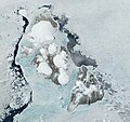
 OctoberRevolutionIsland Terra MODIS.jpg 650 × 700; 136 KB
-
 Octrevis-3dl.jpg 7,098 × 2,522; 3.21 MB
-
 Open Northern Sea Route.jpg 2,500 × 2,500; 3.68 MB
-
 Ostrov-bolshevik.jpg 992 × 654; 143 KB
-
 Pioneer Island 2020-07-17 Sentinel 2.jpg 2,790 × 2,537; 7.91 MB
-
 PioneerIsland Terra MODIS.jpg 272 × 230; 20 KB
-
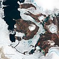
 Schmidt Island 2020-07-17 Sentinel-2 L2A Highlight Optimized Natural Color.jpg 2,500 × 2,331; 2.53 MB
-
 Severnaya Zemlya.jpg 300 × 400; 21 KB
-
 SevernayaZemlya.jpg 1,846 × 1,736; 575 KB
-
 Starokadomsky Island 2020-08-15 Sentinel-2 L2A True color.jpg 2,500 × 2,846; 876 KB
-
 Île de la Révolution d'Octobre vue par le satellite Sentinel 2.jpg 5,000 × 5,000; 23.04 MB
-
 Остров Большевик.png 800 × 850; 968 KB


