Category:Satellite pictures of Victoria Island, Canada
Jump to navigation
Jump to search
Media in category "Satellite pictures of Victoria Island, Canada"
The following 7 files are in this category, out of 7 total.
-
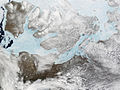 Banks I Victoria I.jpg 1,200 × 900; 283 KB
-
 Canada2.A2002165.1940.250m.jpg 4,000 × 5,200; 2.83 MB
-
 Nameless isle within Victoria Island in Nunavut Territory in Canada.jpg 720 × 480; 322 KB
-
 Phytoplankton Bloom off Victoria Island, Canada (MODIS 2021-10-18).jpg 2,037 × 1,667; 2 MB
-
 Tahiryuaq 2022-07-23 Sentinel-2 L2A True color.jpg 2,500 × 1,787; 4.07 MB
-
 Tunnunik - Landsat OLI 52.png 6,600 × 3,612; 7.8 MB
-
 Wfm victoria island.jpg 1,280 × 948; 198 KB


.jpg)


