Category:Satellite pictures of the Bay of Mont-Saint-Michel
Jump to navigation
Jump to search
Media in category "Satellite pictures of the Bay of Mont-Saint-Michel"
The following 12 files are in this category, out of 12 total.
-
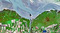 202201114 Mont-Saint-MichelFrance.jpg 4,410 × 2,474; 2.76 MB
-
 Ad hoc (2024-02-13-20-49-49 UMBRA-04).tiff 8,001 × 8,001, 5 pages; 53.05 MB
-
 Baie du Mont Saint-Michel vue par Sentinel-2.jpg 3,080 × 3,080; 9.27 MB
-
 ISS020-E-30988 - View of France.jpg 2,848 × 4,288; 1.18 MB
-
 ISS020-E-30989 - View of France.jpg 4,288 × 2,848; 965 KB
-
 ISS020-E-30990 - View of France.jpg 4,288 × 2,848; 996 KB
-
 ISS020-E-30991 - View of France.jpg 4,288 × 2,848; 1.08 MB
-
 ISS027-E-5975 - View of France.jpg 4,288 × 2,929; 1.19 MB
-
 Mont Saint-Michel, France ESA394286.jpg 5,266 × 4,258; 3.71 MB
-
 Mont Saint-Michel, France ESA394286.tiff 5,266 × 4,258; 128.33 MB
-
 The Bay of Mont Saint-Michel, France.jpg 4,082 × 2,540; 2.89 MB
-
Tides in the Mont-Saint-Michel Bay, France (49983232718).webm 13 s, 1,080 × 1,080; 9.02 MB


