Category:Scenic Hill
Jump to navigation
Jump to search
.jpg) | |||||
| Upload media | |||||
| Instance of | |||||
|---|---|---|---|---|---|
| Location | Hong Kong, PRC | ||||
| Carries | |||||
| Elevation above sea level |
| ||||
 | |||||
English: Scenic Hill is the hill and peninsula in the south of Chek Lap Kok island, which remained unleveled after the airport platform was built. It is connected to Tung Chung by two bridges. Its southern tip faces Tung Chung Bay.
中文:觀景山
Subcategories
This category has the following 2 subcategories, out of 2 total.
A
- Airport Island Angle Station (37 F)
S
- Scenic Hill Tunnel (12 F)
Media in category "Scenic Hill"
The following 41 files are in this category, out of 41 total.
-
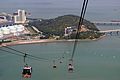 20091002 Hong Kong Ngong Ping 360 Skyrail 6420.jpg 2,900 × 1,939; 1.76 MB
-
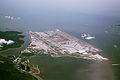 A bird's eye view of Hong Kong International Airport.JPG 4,272 × 2,848; 4.55 MB
-
 A hexagonal pavilion at Chek Lap Kok Scenic Hill.jpg 4,592 × 3,056; 6.43 MB
-
 Airport angle station.jpg 2,272 × 1,704; 1.17 MB
-
 Ancient Kiln Park of HKIA.JPG 4,592 × 3,056; 5.38 MB
-
 Chek Lap Kok Scenic Hill trigonometrical station.jpg 2,550 × 3,400; 2.18 MB
-
 Hau Wong Temple, Tung Chung4.JPG 4,608 × 3,456; 2.98 MB
-
 HK Skyrail cable car.jpg 2,446 × 1,838; 1.61 MB
-
 HK TC Tung Chung North Lantau Highway bridge.JPG 1,280 × 960; 726 KB
-
 HKIA (8559578432).jpg 4,401 × 3,300; 11.39 MB
-
 Hong Kong (2017) - 167.jpg 4,000 × 3,000; 3 MB
-
 Hong Kong (2017) - 360.jpg 4,000 × 3,000; 3.13 MB
-
 Hong Kong (2017) - 361.jpg 4,000 × 3,000; 3.19 MB
-
 Hong Kong Ngong IMG 5547.JPG 2,736 × 3,648; 3.12 MB
-
 Hong Kong Ngong IMG 5562.JPG 3,648 × 2,736; 3.05 MB
-
 Hong Kong Ngong IMG 5563.JPG 3,648 × 2,736; 3.04 MB
-
 Hong Kong Ngong IMG 5658.JPG 2,736 × 3,648; 3.35 MB
-
 Hongkong Chek Lap Kok Airport 1.JPG 3,328 × 1,872; 3.63 MB
-
 Hongkong Chek Lap Kok Airport 2.JPG 3,328 × 1,872; 2.55 MB
-
 Ngong Park, Isla Lantau, Hong Kong - panoramio (2).jpg 4,288 × 3,216; 4.32 MB
-
 Ngong Ping 360 near Chek Nap Kok South Road 2.JPG 1,536 × 2,048; 324 KB
-
 Ngong Ping 360, Hong Kong - panoramio.jpg 3,504 × 2,336; 196 KB
-
 Ngong Ping 360, Tower 2A (Hong Kong).jpg 2,335 × 3,113; 2.1 MB
-
 Ngong Ping 360- Returning to Tung Chung.JPG 3,072 × 2,304; 1.31 MB
-
 Ngong Ping 360.JPG 2,272 × 1,704; 952 KB
-
 Ngong Ping Cable Car Tung Chung View.jpg 4,752 × 3,168; 4.43 MB
-
 North Lantau Expressway.JPG 4,592 × 3,056; 3.79 MB
-
 On Ngong Ping 360 to Tung Chung Terminal 18.JPG 1,536 × 2,048; 542 KB
-
 On Ngong Ping 360 to Tung Chung Terminal 19.JPG 2,048 × 1,536; 562 KB
-
 San Tau Pier 01.jpg 4,503 × 3,377; 3.14 MB
-
 San Tau Pier 02.jpg 4,503 × 3,377; 2.53 MB
-
 San Tau Pier 03.jpg 4,503 × 3,377; 2.2 MB
-
 Scenic Hill Pavilion.jpg 4,000 × 1,846; 4.96 MB
-
 Scenic Hill, Chek Lap Kok (Hong Kong).jpg 3,451 × 2,300; 2.12 MB
-
 Scenic Hill.JPG 3,648 × 2,736; 3.27 MB
-
 Trigonometrical station 236 at Scenic Hill, Tung Chung, Hong Kong.jpg 2,372 × 3,568; 2.13 MB
-
 Tung chung battery 2017.jpg 6,000 × 4,000; 11.36 MB
-
 Tung Chung Bay 東涌灣 - panoramio.jpg 4,896 × 2,785; 6.28 MB
-
 Tung Chung Waterfront Road, Hong Kong.jpg 2,396 × 3,600; 2.21 MB
-
 Views from San Tau Pier 05.jpg 4,503 × 3,377; 2.66 MB
-
 东岸路 - panoramio.jpg 1,600 × 1,049; 789 KB


.jpg)
_-_167.jpg)
_-_360.jpg)
_-_361.jpg)


.jpg)


.jpg)


