Category:Schlosskirche (Rumpenheim)
Jump to navigation
Jump to search
| Object location | | View all coordinates using: OpenStreetMap |
|---|
This is the category of the Hessian Kulturdenkmal (cultural monument) with the ID 78457 (Wikidata)
|
 | |||||
| Upload media | |||||
| Instance of | |||||
|---|---|---|---|---|---|
| Location | Rumpenheim, Offenbach am Main, Darmstadt Government Region, Hesse, Germany | ||||
| Heritage designation | |||||
 | |||||
Media in category "Schlosskirche (Rumpenheim)"
The following 3 files are in this category, out of 3 total.
-
 Rumpenheim, Landgrafengrabmal.JPG 2,848 × 4,288; 6.83 MB
-
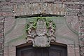 Rumpenheim, Schlosskirchenturm, Wappen.JPG 4,288 × 2,848; 6.43 MB
-
 Rumpenheim, Schlosskirchenturm.jpg 3,096 × 6,072; 18.33 MB

