Category:Schwarza (Lower Austria)
Jump to navigation
Jump to search
Deutsch: Fluss Schwarza in Niederösterreich, ein Quellfluss der Leitha
English: Schwarza river in Lower Austria, which merges into Leitha river
Quellfluss der Leitha  | |||||
| Upload media | |||||
| Instance of | |||||
|---|---|---|---|---|---|
| Location | Lower Austria, Austria | ||||
| Length |
| ||||
| Mouth of the watercourse | |||||
| Drainage basin | |||||
| Tributary | |||||
 | |||||
Subcategories
This category has the following 8 subcategories, out of 8 total.
Media in category "Schwarza (Lower Austria)"
The following 55 files are in this category, out of 55 total.
-
 18-07-05-Payerbach-Schwarza-IMG 20180705 112135 329.jpg 4,016 × 2,776; 10.8 MB
-
 20150812 Schwarza bei Bad Erlach 2428.jpg 4,256 × 2,832; 7.59 MB
-
 20150812 Schwarza bei Bad Erlach 2431.jpg 4,256 × 2,832; 8.45 MB
-
 20150812 Schwarza bei Bad Erlach 2870.jpg 4,256 × 2,832; 7.33 MB
-
 Bmpz 21-73 813 Bad Erlach.jpg 3,899 × 2,599; 8.41 MB
-
 Brückenschild Rechenbrücke Höllental Niederösterreich.jpg 1,924 × 2,568; 3.48 MB
-
 Dry Streambed-Leitha DSC 0016w.jpg 3,872 × 2,592; 6.01 MB
-
 EiserneBrückeNeunkirchen.jpg 4,000 × 3,000; 5.17 MB
-
 Gloggnitz Wasserkraftwerk 5306.JPG 4,256 × 2,832; 6.81 MB
-
 Gloggnitz Wasserkraftwerk 5310.JPG 2,832 × 2,832; 5.07 MB
-
 Großofen mit Rechenbrücke.jpg 1,944 × 2,676; 2.74 MB
-
 Hirschwang - Finkbrücke.JPG 1,772 × 1,182; 2.38 MB
-
 Hochwasser führende Schwarza im Höllental.jpg 3,000 × 2,000; 4.08 MB
-
 Hoellental1.jpg 2,272 × 1,704; 885 KB
-
 Hoellental2.jpg 2,272 × 1,704; 915 KB
-
 Hoellental3.jpg 2,272 × 1,704; 1.82 MB
-
 Höllental 2.JPG 1,575 × 2,362; 4.24 MB
-
 Höllental oberhalb Rechenbrücke.jpg 1,944 × 2,896; 3.79 MB
-
 Höllental oberhalb Wandersteg.jpg 1,944 × 2,896; 3.56 MB
-
 Höllental unterhalb Wanderwegsteg.jpg 1,944 × 2,896; 4.13 MB
-
 Höllental Wanderweg-Steg.jpg 2,896 × 1,944; 4.06 MB
-
 Höllental.jpg 1,488 × 1,984; 667 KB
-
 IMG 0309 - Between Wien and Bruck an der Mur.JPG 3,648 × 2,736; 2.9 MB
-
 Kaiserbrunn Höllental Wasserofen 1876.jpg 2,375 × 1,772; 4.54 MB
-
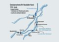 KarteEinspeisnach.jpg 849 × 600; 107 KB
-
 Leitha Pitten Schwarza.JPG 1,984 × 1,488; 1,000 KB
-
 Leitha-Ursprung bei Hochwasser.jpg 3,000 × 2,000; 3.61 MB
-
 Nassbach Schwarza.jpg 6,000 × 4,000; 15.86 MB
-
 Payerbach - Ortsansicht.JPG 3,900 × 2,194; 7.1 MB
-
 Payerbach 1598.JPG 5,184 × 3,456; 7.82 MB
-
 Payerbach 1601.JPG 5,184 × 3,456; 6.98 MB
-
 Payerbach 7010.JPG 5,184 × 3,456; 7.63 MB
-
 Peischinger Wehr.jpg 1,980 × 1,325; 333 KB
-
 Reichenau adR - Hochstegaquädukt in Hirschwang (1).JPG 1,670 × 2,362; 4.64 MB
-
 Reichenau adR - Hochstegaquädukt in Hirschwang (5).JPG 1,772 × 1,181; 2.94 MB
-
 Reichenau an der Rax - Schwarza.jpg 5,597 × 3,731; 19.82 MB
-
 Reichenau an der Rax Schwarza.jpg 4,032 × 3,024; 9.47 MB
-
 Reichenau an der Rax, Fussgaengerbruecke bei Hauptstrasse.jpg 2,736 × 2,304; 2.77 MB
-
 Reichenau an der Rax, Johannesbruecke.jpg 2,304 × 3,072; 2.98 MB
-
 Schwarza (Hochstegbrücke).JPG 1,575 × 2,362; 4.3 MB
-
 Schwarza - Höllental - 01.jpg 2,736 × 3,648; 4.92 MB
-
 Schwarza 1556.JPG 5,184 × 3,456; 8.14 MB
-
 Schwarza Bad Erlach.JPG 2,448 × 3,264; 1.41 MB
-
 Schwarza bei Gloggnitz-St.Valentin.jpg 3,264 × 1,836; 3.07 MB
-
 Schwarza im Höllental Steg Weichtalhaus nach Osten mit unterem Badestrand.jpg 1,468 × 3,264; 4.62 MB
-
 Schwarza im Höllental Steg Weichtalhaus.jpg 2,084 × 4,624; 10.59 MB
-
 Schwarza in Loipersbach.jpg 4,080 × 2,296; 4.26 MB
-
 Schwarza in Ternitz.jpg 2,560 × 1,440; 1.35 MB
-
 Schwarza karte.jpg 382 × 373; 41 KB
-
 Schwarza km16.8 road27 362.jpg 2,560 × 1,920; 2.94 MB
-
 Schwarzatalradroute in Ternitz entlang der Schwarza.jpg 1,440 × 2,560; 1.4 MB
-
 Schwarzatalradroute in Ternitz.jpg 4,080 × 2,296; 4.02 MB
-
 Schwarzatalradroute Wegweiser Loipersbach.jpg 2,032 × 3,386; 1,013 KB
-
 Steinfeld - Luftaufnahme 1.jpg 3,888 × 2,592; 2.89 MB
-
 Steinfeld - Luftaufnahme 2.jpg 3,888 × 2,592; 2.81 MB


.JPG)
.JPG)


.JPG)


