Category:Scole
Jump to navigation
Jump to search
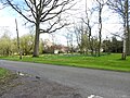
English: Scole is a village (population 2,254) on the Norfolk/Suffolk border in England. It is 19 miles south of Norwich and lay on the old roman road to Caistor St Edmunds, which was the main road until it was bypassed with a dual carriageway. It covers an area of and had a population of 1,339 in 563 households as of the 2001 census.
a village located in South Norfolk, United Kingdom  | |||||
| Upload media | |||||
| Instance of | |||||
|---|---|---|---|---|---|
| Location | South Norfolk, Norfolk, East of England, England | ||||
| Area |
| ||||
 | |||||
Subcategories
This category has the following 6 subcategories, out of 6 total.
A
B
- Billingford Gauging Station (8 F)
C
- The Crossways, Scole (3 F)
F
S
- The Scole Inn, Scole (5 F)
- Scole War Memorial (1 F)
Media in category "Scole"
The following 200 files are in this category, out of 693 total.
(previous page) (next page)-
 A crop of maize - geograph.org.uk - 4111607.jpg 640 × 480; 235 KB
-
 A Quonset house - geograph.org.uk - 1769894.jpg 640 × 480; 197 KB
-
 A1066 Diss Road, Waterloo - geograph.org.uk - 4254100.jpg 3,072 × 2,304; 2.72 MB
-
 A1066 Diss Road, Waterloo - geograph.org.uk - 4254103.jpg 3,072 × 2,304; 3.41 MB
-
 A1066 Diss Road, Waterloo - geograph.org.uk - 4254662.jpg 3,072 × 2,304; 1.79 MB
-
 A1066 Diss Road, Waterloo - geograph.org.uk - 4254686.jpg 3,072 × 2,304; 2.04 MB
-
 A1066 Diss Road, Waterloo - geograph.org.uk - 4255264.jpg 3,072 × 2,304; 1.98 MB
-
 A1066 Diss Road, Waterloo, Scole - geograph.org.uk - 4254501.jpg 3,072 × 2,304; 2.29 MB
-
 A140 Scole Bypass, Scole - geograph.org.uk - 4232521.jpg 3,072 × 2,304; 1.65 MB
-
 A140 Scole Bypass, Scole - geograph.org.uk - 4255961.jpg 3,072 × 2,304; 1.82 MB
-
 A140 Scole Bypass, Thelveton - geograph.org.uk - 4232557.jpg 3,072 × 2,304; 1.94 MB
-
 A140 Scole Bypass, Thelveton - geograph.org.uk - 4249737.jpg 3,072 × 2,304; 1.91 MB
-
 A140 Scole Bypass, Thelveton - geograph.org.uk - 4249745.jpg 3,072 × 2,304; 2.7 MB
-
 A140 to Ipswich - geograph.org.uk - 3916523.jpg 2,767 × 1,894; 821 KB
-
 A140 towards Norwich - geograph.org.uk - 4733495.jpg 640 × 480; 51 KB
-
 A140, northbound - geograph.org.uk - 4261771.jpg 640 × 366; 31 KB
-
 A140, northbound - geograph.org.uk - 4261774.jpg 640 × 411; 40 KB
-
 A140, northbound - geograph.org.uk - 4261786.jpg 640 × 384; 26 KB
-
 A140, northbound - geograph.org.uk - 4261797.jpg 640 × 406; 36 KB
-
 A140, Scole Bypass, Scole - geograph.org.uk - 4255960.jpg 3,072 × 2,304; 1.83 MB
-
 A143 Bungay Road, Billingford - geograph.org.uk - 3916437.jpg 2,197 × 1,952; 349 KB
-
 A143 Bungay Road, Billingford - geograph.org.uk - 4245906.jpg 2,983 × 2,241; 1.65 MB
-
 A143 Bungay Road, Billingford - geograph.org.uk - 4251698.jpg 3,072 × 2,304; 1.45 MB
-
 A143 Bungay Road, Scole - geograph.org.uk - 3916446.jpg 2,253 × 1,990; 356 KB
-
 A143 Bungay Road, Scole - geograph.org.uk - 3916479.jpg 2,347 × 1,931; 349 KB
-
 A143 Bungay Road, Scole - geograph.org.uk - 3916485.jpg 2,438 × 1,834; 437 KB
-
 A143 Lower Street, Billingford - geograph.org.uk - 4242618.jpg 3,072 × 2,304; 1.63 MB
-
 A143 Scole - geograph.org.uk - 2220929.jpg 800 × 531; 142 KB
-
 Approaching a roundabout on the A140 - geograph.org.uk - 4733446.jpg 640 × 480; 52 KB
-
 Approaching Billingford on Bungay Road - geograph.org.uk - 2043892.jpg 640 × 480; 138 KB
-
 Armenia, Threshing Corn (NBY 442576).jpg 3,600 × 2,326; 813 KB
-
 At the junction with the A143 Bungay Road - geograph.org.uk - 5026454.jpg 3,072 × 2,109; 2.92 MB
-
 B.T. Advert - geograph.org.uk - 3086280.jpg 768 × 1,024; 306 KB
-
 Barn conversions at Grove Farm - geograph.org.uk - 4819147.jpg 640 × 614; 552 KB
-
 Barns at Frenze Hall - geograph.org.uk - 1765344.jpg 640 × 432; 86 KB
-
 Belmont Grange - geograph.org.uk - 4251672.jpg 3,072 × 2,304; 1.75 MB
-
 Belmont Grange sign - geograph.org.uk - 4251666.jpg 3,072 × 2,304; 1.6 MB
-
 Bend on Burston Road - geograph.org.uk - 4733522.jpg 640 × 480; 66 KB
-
 Billingford Bridge on Low Road - geograph.org.uk - 3603031.jpg 2,983 × 2,241; 1,002 KB
-
 Billingford Bridge on Low Road - geograph.org.uk - 4179770.jpg 2,463 × 2,056; 477 KB
-
 Billingford Bridge on Low Road - geograph.org.uk - 4242557.jpg 3,072 × 2,304; 1.83 MB
-
 Billingford Bridge ^ walkway - geograph.org.uk - 4242494.jpg 3,072 × 2,304; 1.78 MB
-
 Billingford Dovecote (geograph 7557677).jpg 1,600 × 900; 650 KB
-
 Billingford from the mill - geograph.org.uk - 3534021.jpg 640 × 424; 245 KB
-
 Billingford Gauging Station at Billingford Bridge - geograph.org.uk - 4242560.jpg 2,304 × 3,072; 1.87 MB
-
 Billingford Hall (geograph 7557682).jpg 1,600 × 900; 670 KB
-
 Billingford Mill - Animal stones - geograph.org.uk - 3534010.jpg 424 × 640; 265 KB
-
 Billingford Mill - Bin floor - geograph.org.uk - 3534084.jpg 640 × 424; 221 KB
-
 Billingford Mill - Brake Wheel - geograph.org.uk - 3533993.jpg 424 × 640; 252 KB
-

-
 Billingford Mill - geograph.org.uk - 1841754.jpg 800 × 531; 110 KB
-
 Billingford Mill - geograph.org.uk - 1841756.jpg 800 × 531; 55 KB
-
 Billingford Mill - geograph.org.uk - 2058185.jpg 800 × 531; 89 KB
-
 Billingford Mill - geograph.org.uk - 3572817.jpg 597 × 640; 186 KB
-
 Billingford Mill - geograph.org.uk - 3572818.jpg 425 × 640; 152 KB
-
 Billingford Mill - Governor - geograph.org.uk - 3534059.jpg 640 × 447; 242 KB
-
 Billingford Mill - Governor - geograph.org.uk - 3534063.jpg 640 × 424; 251 KB
-
 Billingford Mill - Governors - geograph.org.uk - 3534041.jpg 640 × 424; 228 KB
-
 Billingford Mill - Governors - geograph.org.uk - 3534053.jpg 640 × 424; 225 KB
-
 Billingford Mill - Hurst frame - geograph.org.uk - 3534049.jpg 424 × 640; 246 KB
-
 Billingford Mill - Into the cap - geograph.org.uk - 3534004.jpg 640 × 428; 272 KB
-
 Billingford Mill - Meal floor - geograph.org.uk - 3534080.jpg 640 × 424; 213 KB
-
 Billingford Mill - Sack hoist - geograph.org.uk - 3533999.jpg 424 × 640; 232 KB
-
 Billingford Mill - Sack hoist drive - geograph.org.uk - 3534015.jpg 640 × 424; 256 KB
-
 Billingford Mill - Stone floor - geograph.org.uk - 3534033.jpg 640 × 424; 242 KB
-
 Billingford Mill - Stone floor - geograph.org.uk - 3534037.jpg 640 × 424; 253 KB
-
 Billingford Village Name sign - geograph.org.uk - 4392399.jpg 2,304 × 3,072; 2.5 MB
-
 Billingford Windmill - geograph.org.uk - 5042651.jpg 1,168 × 1,600; 409 KB
-
 Billingford Windmill Cap - geograph.org.uk - 2058187.jpg 800 × 531; 102 KB
-
 Blackthorn in flower on Burston Road, Thelveton - geograph.org.uk - 4431949.jpg 1,024 × 768; 684 KB
-

-

-
 Boudicca Way - geograph.org.uk - 3086297.jpg 1,024 × 768; 208 KB
-
 Brick Kiln Farm sign - geograph.org.uk - 4250027.jpg 3,072 × 2,304; 1.87 MB
-
 Brickwork in disused sedimentation tank - geograph.org.uk - 4819010.jpg 640 × 480; 508 KB
-
 Brickwork in disused sedimentation tank - geograph.org.uk - 4819013.jpg 640 × 480; 571 KB
-
 Bridge on Burston Road - geograph.org.uk - 4256739.jpg 3,072 × 2,304; 3.24 MB
-
 Bridge over a stream on Burston Road - geograph.org.uk - 4431953.jpg 1,024 × 768; 450 KB
-
 Bridge over the A140 - geograph.org.uk - 4261782.jpg 640 × 417; 35 KB
-
 Bridge Road Bridleway at Scole Pocket Park - geograph.org.uk - 4255350.jpg 3,072 × 2,304; 2.79 MB
-
 Bridge Road bridleway to the A143 Scole Stuston Bypass - geograph.org.uk - 4250883.jpg 2,304 × 3,072; 2.9 MB
-
 Bridge Road bridleway to the A143 Scole Stuston Bypass - geograph.org.uk - 4250884.jpg 2,304 × 3,072; 2.54 MB
-
 Bridge Road sign - geograph.org.uk - 4251558.jpg 3,072 × 2,304; 1.63 MB
-
 Bridge Road, Scole - geograph.org.uk - 4250733.jpg 3,072 × 2,304; 1.92 MB
-
 Bridge Road, Scole - geograph.org.uk - 4250748.jpg 3,072 × 2,304; 1.77 MB
-
 Bridge Road, Scole - geograph.org.uk - 4250916.jpg 3,072 × 2,304; 1.87 MB
-
 Bridleway sign on Scole Common Road - geograph.org.uk - 4255905.jpg 2,304 × 3,072; 1.89 MB
-
 Bridleway to Scole Common Road - geograph.org.uk - 4256019.jpg 3,072 × 2,304; 3.53 MB
-
 Bridleway to the A140 Scole Bypass - geograph.org.uk - 4255907.jpg 3,072 × 2,304; 1.81 MB
-
 Broad Way sign - geograph.org.uk - 4258803.jpg 3,072 × 2,304; 1.88 MB
-
 Broad Way ^ Track - geograph.org.uk - 4259175.jpg 3,072 × 2,304; 3.19 MB
-
 Broad Way, Thelveton - geograph.org.uk - 4258801.jpg 3,072 × 2,304; 3.35 MB
-
 Broad Way, Thelveton - geograph.org.uk - 4258814.jpg 3,072 × 2,304; 3.05 MB
-
 Buck Lane, Warren Hills, Scole - geograph.org.uk - 4533927.jpg 3,072 × 2,304; 1.77 MB
-
 Building at the old sewage works - geograph.org.uk - 4818937.jpg 640 × 480; 514 KB
-
 Bungalow in Scole - geograph.org.uk - 4670201.jpg 640 × 480; 65 KB
-
 Bungay Road east of Billingford - geograph.org.uk - 2043901.jpg 640 × 456; 98 KB
-
 Bungay Road sign - geograph.org.uk - 4251539.jpg 3,072 × 2,304; 1.87 MB
-
 Bungay Road ^ footpath - geograph.org.uk - 4251647.jpg 3,072 × 2,304; 1.68 MB
-
 Bungay Road, Billingford - geograph.org.uk - 4251688.jpg 3,072 × 2,304; 1.71 MB
-
 Bungay Road, Billingford - geograph.org.uk - 4251691.jpg 3,072 × 2,304; 1.81 MB
-
 Bungay Road, Scole - geograph.org.uk - 4251537.jpg 3,072 × 2,304; 1.93 MB
-
 Bungay Road, Scole - geograph.org.uk - 4251548.jpg 3,072 × 2,304; 1.9 MB
-
 Bungay Road, Scole - geograph.org.uk - 4251555.jpg 3,072 × 2,304; 1.75 MB
-
 Bungay Road, Scole - geograph.org.uk - 4251674.jpg 3,072 × 2,304; 1.94 MB
-
 Bungay Road, Scole - geograph.org.uk - 4733467.jpg 640 × 480; 47 KB
-
 Bungay Road, Scole - geograph.org.uk - 5128332.jpg 3,072 × 2,304; 1.83 MB
-
 Burston Road - geograph.org.uk - 4670240.jpg 640 × 480; 56 KB
-
 Burston Road - geograph.org.uk - 4733523.jpg 640 × 480; 65 KB
-
 Burston Road sign - geograph.org.uk - 4256612.jpg 3,029 × 2,276; 4.38 MB
-
 Burston Road sign - geograph.org.uk - 4256636.jpg 3,072 × 2,304; 1.94 MB
-
 Burston Road ^ The Rectory Postbox - geograph.org.uk - 4256408.jpg 3,072 × 2,304; 1.84 MB
-
 Burston Road ^ The Rectory Postbox - geograph.org.uk - 4259109.jpg 3,072 × 2,175; 2.62 MB
-
 Burston Road, Thelveton - geograph.org.uk - 4256366.jpg 3,072 × 2,304; 2.35 MB
-
 Burston Road, Thelveton - geograph.org.uk - 4256621.jpg 3,072 × 2,304; 1.97 MB
-
 Burston Road, Thelveton - geograph.org.uk - 4256626.jpg 3,072 × 2,304; 2.59 MB
-
 Burston Road, Thelveton - geograph.org.uk - 4256629.jpg 3,072 × 2,304; 1.86 MB
-
 Burston Road, Thelveton - geograph.org.uk - 4258818.jpg 3,028 × 2,305; 2.96 MB
-
 Burston Road, Thelveton - geograph.org.uk - 4432008.jpg 1,024 × 768; 360 KB
-
 Burston Road, Thelveton - geograph.org.uk - 4432021.jpg 1,024 × 768; 428 KB
-
 Burton Road - geograph.org.uk - 3087751.jpg 1,024 × 768; 258 KB
-
 Bus stop on Diss Road, Scole - geograph.org.uk - 4733448.jpg 640 × 480; 79 KB
-
 Carved into a tree - geograph.org.uk - 4819065.jpg 640 × 596; 570 KB
-

-
 Cedar House sign - geograph.org.uk - 4255260.jpg 2,279 × 3,042; 2.64 MB
-
 Cereal crop field by Grove Farm - geograph.org.uk - 4818673.jpg 640 × 480; 396 KB
-
 Church Path to St.Andrew's Church - geograph.org.uk - 4255370.jpg 2,304 × 3,072; 1.87 MB
-
 Church Road sign - geograph.org.uk - 4256608.jpg 3,072 × 2,304; 2.63 MB
-
 Church Road ^ New Road signs - geograph.org.uk - 4258808.jpg 3,072 × 2,304; 2.77 MB
-
 Church Road, Thelveton - geograph.org.uk - 4256425.jpg 3,072 × 2,304; 3.87 MB
-
 Church Road, Thelveton - geograph.org.uk - 4258810.jpg 3,072 × 2,304; 2.79 MB
-
 Church Road, Thelveton - geograph.org.uk - 4258817.jpg 2,841 × 2,134; 2.8 MB
-
 Church Road, Thelveton - geograph.org.uk - 4259170.jpg 2,841 × 2,134; 2.72 MB
-
 Church Road, Thelveton - geograph.org.uk - 4432014.jpg 1,024 × 768; 484 KB
-
 Common Farm (farmhouse) - geograph.org.uk - 4111571.jpg 640 × 480; 166 KB
-
 Common Farm, Upper Billingford - geograph.org.uk - 2337821.jpg 640 × 480; 223 KB
-
 Concrete road leading past Site 4 - geograph.org.uk - 4819076.jpg 640 × 480; 304 KB
-
 Concrete track to Upper Billingford - geograph.org.uk - 2337798.jpg 640 × 480; 221 KB
-
 Concrete tracks to nowhere - geograph.org.uk - 1769890.jpg 640 × 480; 167 KB
-
 Concreted hut platform - geograph.org.uk - 4111829.jpg 640 × 480; 225 KB
-
 Concreted road leading to Site 1 - geograph.org.uk - 4111802.jpg 640 × 480; 198 KB
-
 Concreted road linking Sites 3 and 4 - geograph.org.uk - 4819069.jpg 640 × 480; 457 KB
-
 Cottage by the junction of three lanes - geograph.org.uk - 1765321.jpg 640 × 480; 124 KB
-
 Cottage in Pettits Lane, Frenze - geograph.org.uk - 1765326.jpg 640 × 480; 144 KB
-
 Cottages by Common Farm - geograph.org.uk - 4111579.jpg 640 × 480; 184 KB
-
 Cottages by Common Farm - geograph.org.uk - 4111582.jpg 640 × 480; 186 KB
-
 Cottages on Norwich Road - geograph.org.uk - 4670223.jpg 640 × 480; 70 KB
-
 Crop fields by Dickleburgh - geograph.org.uk - 4819225.jpg 640 × 480; 391 KB
-
 Crop fields by Dickleburgh - geograph.org.uk - 4819251.jpg 640 × 350; 285 KB
-
 Crop fields by Long Covert - geograph.org.uk - 4819246.jpg 640 × 373; 291 KB
-
 Crop fields in Upper Street - geograph.org.uk - 4819157.jpg 640 × 480; 349 KB
-
 Crop fields north of Hall Farm - geograph.org.uk - 4111609.jpg 640 × 480; 275 KB
-
 Cultivated field north of The Grange - geograph.org.uk - 1764744.jpg 640 × 480; 146 KB
-
 Cut Mark Scole St Andrews Church - geograph.org.uk - 6022032.jpg 640 × 640; 225 KB
-
 Daffodils on Scole Common - geograph.org.uk - 6089544.jpg 3,264 × 2,448; 1.76 MB
-
 Dark Lane sign - geograph.org.uk - 4255096.jpg 3,072 × 2,304; 1.94 MB
-
 Dark Lane ^ Electricity Pylons - geograph.org.uk - 4256084.jpg 3,072 × 2,304; 2.11 MB
-
 Dark Lane ^ The Gate House - geograph.org.uk - 4255139.jpg 3,072 × 2,304; 1.85 MB
-
 Dark Lane, Frenze - geograph.org.uk - 4255133.jpg 3,072 × 2,304; 2.03 MB
-
 Dark Lane, Frenze - geograph.org.uk - 4255241.jpg 3,072 × 2,304; 1.92 MB
-
 Dark Lane, Frenze - geograph.org.uk - 4255248.jpg 3,072 × 2,304; 2.12 MB
-
 Dark Lane, Frenze - geograph.org.uk - 4256330.jpg 3,072 × 2,304; 2.87 MB
-
 Dead tree at Billingford - geograph.org.uk - 2312432.jpg 640 × 480; 105 KB
-

-

-
 Dilapidated Nissen hut - geograph.org.uk - 4819169.jpg 640 × 532; 596 KB
-
 Dilapidated Nissen hut - geograph.org.uk - 4819258.jpg 640 × 480; 514 KB
-

-
 Diss Business Centre - geograph.org.uk - 4255145.jpg 3,072 × 2,304; 1.88 MB
-
 Diss Business centre - geograph.org.uk - 6089538.jpg 3,264 × 2,448; 1.75 MB
-
 Diss Road, Scole - geograph.org.uk - 4255278.jpg 3,072 × 2,304; 2.03 MB
-
 Disused sewage works tank - geograph.org.uk - 4818977.jpg 640 × 480; 520 KB
-
 Entering Billingford on the A143 Bungay Road - geograph.org.uk - 4392396.jpg 3,033 × 2,272; 3.03 MB
-
 Entering Norfolk on the A143 - geograph.org.uk - 2043114.jpg 640 × 480; 56 KB
-
 Entering Scole on Bungay Road - geograph.org.uk - 4251656.jpg 3,072 × 2,304; 1.73 MB
-
 Entering Scole on Bungay Road - geograph.org.uk - 4251676.jpg 3,072 × 2,304; 1.88 MB
-
 Entering Scole on Norwich Road - geograph.org.uk - 4250606.jpg 3,072 × 2,304; 1.86 MB
-
 Entering Thelveton - geograph.org.uk - 4733499.jpg 640 × 480; 71 KB
-
 Entering Thelveton on Norwich Road - geograph.org.uk - 4248712.jpg 2,522 × 2,229; 2.34 MB
-
 Entering Thelveton on Norwich Road - geograph.org.uk - 4248741.jpg 2,948 × 2,214; 2.13 MB
-
 Entering Thelveton on Norwich Road, Thelveton - geograph.org.uk - 4249552.jpg 3,072 × 2,304; 1.82 MB
-
 Entrance to Belmont Grange - geograph.org.uk - 2214722.jpg 640 × 480; 172 KB
-
 Entrance to Belmont Grange - geograph.org.uk - 4251670.jpg 3,072 × 2,304; 1.96 MB
-
 Entrance to Belmont Grange - geograph.org.uk - 4251694.jpg 3,072 × 2,304; 2.04 MB
-
 Entrance to Billingford Gauging Station - geograph.org.uk - 4242559.jpg 3,072 × 2,304; 1.78 MB
-
 Entrance to Blackthorn Barn - geograph.org.uk - 4249813.jpg 3,072 × 2,304; 1.63 MB
-
 Entrance to Brick Kiln Farm - geograph.org.uk - 4250021.jpg 3,072 × 2,304; 2 MB
-
 Entrance to Brick Kiln Farm - geograph.org.uk - 4250066.jpg 2,304 × 3,072; 1.92 MB
-
 Entrance to Cedar House - geograph.org.uk - 4255254.jpg 3,072 × 2,304; 2.42 MB
-
 Entrance to Common Farm - geograph.org.uk - 4245940.jpg 3,072 × 2,268; 3.02 MB
-
 Entrance to Grange Farm - geograph.org.uk - 1765296.jpg 640 × 480; 139 KB
-
 Entrance to Grove Farm - geograph.org.uk - 4243051.jpg 3,072 × 2,304; 1.84 MB
-
 Entrance to Hall Farm Cottages ^ Thorpe Parva Hall - geograph.org.uk - 5025982.jpg 3,072 × 2,304; 1.83 MB
-

-
 Entrance to Shingle Cottage - geograph.org.uk - 4249549.jpg 3,072 × 2,304; 1.83 MB
-
 Entrance ^ footpath to Thorpe Parva Hall - geograph.org.uk - 5025950.jpg 3,072 × 2,097; 3.09 MB
-
 Ex-airfield track, Upper Billingford - geograph.org.uk - 2337788.jpg 640 × 480; 159 KB
-
 Falling to pieces - geograph.org.uk - 4819173.jpg 640 × 487; 445 KB
-

-
 Farm track past ponds - geograph.org.uk - 4819107.jpg 640 × 480; 483 KB


.jpg)


.jpg)


.jpg)


_-_geograph.org.uk_-_4111571.jpg)


_-_geograph.org.uk_-_4818945.jpg)


_off_Norgate_Lane_-_geograph.org.uk_-_4733488.jpg)
