Category:Seaton, Devon
Jump to navigation
Jump to search
town in Devon, England  | |||||
| Upload media | |||||
| Instance of | |||||
|---|---|---|---|---|---|
| Location | East Devon, Devon, South West England, England | ||||
| Population |
| ||||
| Area |
| ||||
| Different from | |||||
| Said to be the same as | Seaton (Wikimedia duplicated page, civil parish) | ||||
| official website | |||||
 | |||||
Deutsch: Seaton ist ein Ort an der Südküste Englands in der Grafschaft Devon. Er gehört zum Distrikt East Devon und zählte 6817 Einwohner im Jahr 1996.
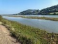
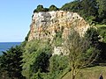
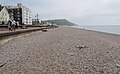
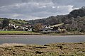
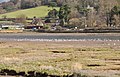
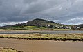
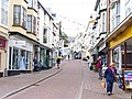
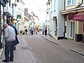
English: Seaton is a seaside town in East Devon on the south coast of England. It faces onto Lyme Bay, to the west of the mouth of the River Axe with red cliffs to one side and white cliffs on the other. Axmouth and Beer are nearby. A sea wall provides access to the mostly shingle beach stretching for about a mile, and a small harbour.
Español: Seaton es una localidad turística costera ubicada en East Devon, condado de Devon, Inglaterra. Se encuentra sobre las aguas de Lyme Bay, en el Canal de la Mancha, al oeste de la desembocadura del río Axe. Axmouth y Beer se hayan cerca de Seaton. Un muro construido en el mar hizo posible el acceso a una playa de alrededor de un kilómetro y medio de largo y a un pequeño puerto.
Nederlands: Seaton is een plaats in het bestuurlijke gebied East Devon, in het Engelse graafschap Devon. In 2004 telde de plaats 7111 inwoners.
Norsk nynorsk: Seaton er ein by i Devon på sørkysten av England. Byen ligg ved bukta Seaton Bay, vest for utløpet til elva Axe.
Norsk bokmål: Seaton er en by i Devon på sørkysten av England. Byen ligger ved Seaton Bay, vest for utløpet til elven Axe.
Polski: Seaton - miasto w Wielkiej Brytanii, w Anglii w hrabstwie Devon nad Kanałem La Manche. nad rzeką Axe. Popularna miejscowość wypoczynku letniego. Miasto znajduje się na zachodnim krańcu Wybrzeża Jurajskiego, na trasie szlaku turystycznego South West Coast Path.
Română: Seaton este un oraş în comitatul Devon, regiunea South West England, Anglia. Oraşul se află în districtul East Devon.
Subcategories
This category has the following 13 subcategories, out of 13 total.
A
- Axmouth Harbour (5 F)
B
- Blue plaques in Seaton (2 F)
- Bridge Cottage, Seaton (3 F)
C
- Check House (4 F)
H
- Haven Cliff House (2 F)
M
- Minerals of Seaton (2 F)
S
- Seaton Beach, Devon (46 F)
- Seaton Town Hall (6 F)
- Seaton tram station (40 F)
T
Media in category "Seaton, Devon"
The following 200 files are in this category, out of 632 total.
(previous page) (next page)-
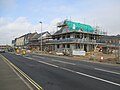 "Pebble Beach" development, Royal Observer Way, Seaton - geograph.org.uk - 5287798.jpg 5,152 × 3,864; 5.04 MB
-
 "Pebble Beach" development, Royal Observer Way, Seaton - geograph.org.uk - 5287815.jpg 5,152 × 3,864; 5.07 MB
-
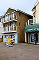 1 Scoop or 2, Seaton - geograph.org.uk - 5786625.jpg 526 × 800; 132 KB
-
 A panoramic view of Seaton promenade - geograph.org.uk - 1042875.jpg 640 × 480; 55 KB
-
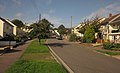
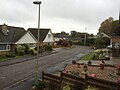 A suburban street in Seaton - geograph.org.uk - 4725077.jpg 3,264 × 2,448; 2.51 MB
-
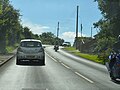 A3052 - geograph.org.uk - 5249906.jpg 640 × 481; 68 KB
-
 A3052 at Stafford Bridge - geograph.org.uk - 3420965.jpg 640 × 459; 78 KB
-
 A3052 Harepath Hill - geograph.org.uk - 6219621.jpg 1,024 × 684; 260 KB
-
 A3052, Harepath Hill - geograph.org.uk - 1370485.jpg 640 × 455; 91 KB
-
 A3052, Harepath Hill - geograph.org.uk - 5249909.jpg 640 × 426; 84 KB
-
 A3052, Harepath Hill - geograph.org.uk - 5249911.jpg 640 × 426; 108 KB
-
 A3052, Seaton Tower - geograph.org.uk - 5249913.jpg 640 × 426; 61 KB
-
 Akermans Ironmongers in Seaton - geograph.org.uk - 5781384.jpg 735 × 800; 132 KB
-
 Allotments off Barnards Hill Lane - geograph.org.uk - 32201.jpg 640 × 480; 143 KB
-
 Allsorts in Seaton - geograph.org.uk - 5786477.jpg 800 × 608; 131 KB
-
 Along the prom at Seaton - geograph.org.uk - 815684.jpg 640 × 427; 202 KB
-
 An aeroplane in the sunset - geograph.org.uk - 2748022.jpg 480 × 640; 39 KB
-

-
 AVMT bus 285, Seaton - geograph.org.uk - 5781978.jpg 800 × 634; 115 KB
-
 Awaiting development - geograph.org.uk - 5260416.jpg 1,024 × 768; 151 KB
-
-
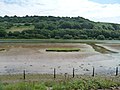
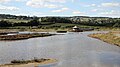
 Axe estuary at Axmouth, on a falling tide - geograph.org.uk - 4084326.jpg 1,024 × 614; 126 KB
-

-
 Axe estuary on a falling tide (1) - geograph.org.uk - 4084300.jpg 1,024 × 768; 135 KB
-
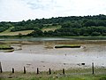 Axe estuary on a falling tide (2) - geograph.org.uk - 4084305.jpg 1,024 × 768; 120 KB
-
 Axe estuary on a falling tide (3) - geograph.org.uk - 4084309.jpg 1,024 × 768; 117 KB
-
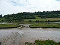 Axe estuary on a falling tide (4) - geograph.org.uk - 4084310.jpg 1,024 × 768; 113 KB
-
 Axe estuary on a falling tide (5) - geograph.org.uk - 4084314.jpg 1,024 × 615; 132 KB
-
 Axe estuary on a falling tide (6) - geograph.org.uk - 4084316.jpg 1,024 × 768; 125 KB
-

-
 Axe Valley Mini Travel buses, Seaton - geograph.org.uk - 5781946.jpg 800 × 452; 75 KB
-
 Axmouth , Harbour - geograph.org.uk - 5850557.jpg 1,600 × 1,067; 543 KB
-
 Axmouth - geograph.org.uk - 3943997.jpg 1,600 × 1,064; 460 KB
-
 Axmouth - geograph.org.uk - 4836724.jpg 640 × 430; 116 KB
-

-
 Axmouth from the Seaton Tramway - geograph.org.uk - 5789099.jpg 1,024 × 768; 243 KB
-
 Axmouth Harbour name sign - geograph.org.uk - 5801199.jpg 800 × 644; 99 KB
-
 Axmouth Marsh, Devon - geograph.org.uk - 4182627.jpg 1,289 × 967; 1.51 MB
-
 B3172 Harbour Road, Seaton - geograph.org.uk - 6219465.jpg 1,024 × 684; 280 KB
-
 B3172 Harbour Road, Seaton - geograph.org.uk - 6219528.jpg 1,024 × 684; 279 KB
-
 B3172 Seaton Down Hill - geograph.org.uk - 6219605.jpg 1,024 × 684; 257 KB
-
 B3174 Beer Road, Seaton - geograph.org.uk - 6219572.jpg 1,024 × 684; 253 KB
-
 B3174 in Beer Brook valley - geograph.org.uk - 3008130.jpg 640 × 480; 89 KB
-
 B3176 approaching Tower Cross - geograph.org.uk - 3008973.jpg 640 × 403; 86 KB
-
 Barking Spa in Seaton - geograph.org.uk - 5783810.jpg 757 × 800; 113 KB
-
 Barnards Hill Lane, Seaton - geograph.org.uk - 3143710.jpg 640 × 381; 46 KB
-
 Bay Court, Seaton - geograph.org.uk - 5781924.jpg 800 × 670; 97 KB
-
 Beach and rocks at Seaton Hole - geograph.org.uk - 5062320.jpg 1,600 × 1,200; 719 KB
-
 Beach huts on the promenade at Seaton - geograph.org.uk - 5062325.jpg 1,600 × 1,200; 784 KB
-
 Beach Road - Harbour Road - geograph.org.uk - 5781754.jpg 640 × 460; 60 KB
-
 Beach Road - Seaton - geograph.org.uk - 3835924.jpg 640 × 476; 60 KB
-
 Beach Road, Seaton - geograph.org.uk - 3577485.jpg 1,024 × 768; 124 KB
-

-
 Beer Road and Old Beer Road - geograph.org.uk - 3007676.jpg 480 × 640; 80 KB
-
 Beer Road,Seaton,Devon - geograph.org.uk - 2488812.jpg 1,600 × 1,200; 423 KB
-
 Beer, Devon - geograph.org.uk - 3197105.jpg 3,648 × 2,736; 4.09 MB
-

-
 Benchmark at Lew Hollow, near Seaton - geograph.org.uk - 5064982.jpg 480 × 640; 90 KB
-
 Benchmark, Castle Hill, Seaton - geograph.org.uk - 5065001.jpg 640 × 480; 79 KB
-
 Birds on the Axmouth Marshes - geograph.org.uk - 2489072.jpg 1,600 × 1,200; 342 KB
-
 Black Hole Marsh Nature Reserve - geograph.org.uk - 6118319.jpg 5,103 × 2,870; 2.46 MB
-
 Black Hole Marsh Nature Reserve, Devon - geograph.org.uk - 4182634.jpg 1,024 × 768; 201 KB
-
 Blue Waters B^B, Seaton - geograph.org.uk - 5781824.jpg 800 × 745; 119 KB
-
 Blue Waters Close, Seaton - geograph.org.uk - 5782008.jpg 800 × 642; 108 KB
-

-
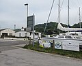
 Boatyard at Seaton - geograph.org.uk - 4723001.jpg 2,592 × 1,944; 1.48 MB
-
 Boatyard at Seaton - geograph.org.uk - 5540574.jpg 1,024 × 768; 130 KB
-
-
 Boundary Close, Seaton - geograph.org.uk - 5219033.jpg 640 × 426; 50 KB
-
 Boundary Close, Seaton - geograph.org.uk - 5219035.jpg 640 × 438; 58 KB
-
 Buildings at Seaton - geograph.org.uk - 3006841.jpg 640 × 472; 66 KB
-
 Burrow Road, Seaton - geograph.org.uk - 5781843.jpg 800 × 759; 131 KB
-

-
 Camping site, Axmouth - geograph.org.uk - 4084332.jpg 1,024 × 768; 134 KB
-
 Car park at Seaton Tramway - geograph.org.uk - 1390073.jpg 640 × 480; 142 KB
-
 Castle Hill, Seaton - geograph.org.uk - 3006830.jpg 640 × 413; 63 KB
-
 Cat on path, Roman Way, Seaton - geograph.org.uk - 3143728.jpg 487 × 640; 126 KB
-
 Central @ Steves News, Seaton - geograph.org.uk - 5781361.jpg 755 × 800; 120 KB
-
 Channel to Channel (1) - geograph.org.uk - 4173380.jpg 800 × 600; 129 KB
-
 Channel to Channel (12) - geograph.org.uk - 4173469.jpg 800 × 600; 155 KB
-
 Channel to Channel (13) - geograph.org.uk - 4173483.jpg 600 × 800; 106 KB
-
 Channel to Channel (14) - geograph.org.uk - 4173486.jpg 800 × 600; 85 KB
-
 Channel to Channel (2) - geograph.org.uk - 4173385.jpg 800 × 600; 125 KB
-
 Channel to Channel (21) - geograph.org.uk - 4173530.jpg 640 × 480; 79 KB
-
 Channel to Channel (3) - geograph.org.uk - 4173397.jpg 800 × 600; 115 KB
-
 Channel to Channel (4) - geograph.org.uk - 4173401.jpg 800 × 600; 120 KB
-
 Channel to Channel (5) - geograph.org.uk - 4173408.jpg 800 × 600; 144 KB
-
 Chine Cafe, Seaton - geograph.org.uk - 771453.jpg 640 × 480; 72 KB
-
 Christmas Tree in Seaton - geograph.org.uk - 2748032.jpg 480 × 640; 56 KB
-
-
 Cliffs and Seaton Hole - geograph.org.uk - 5006826.jpg 1,600 × 1,200; 778 KB
-
 Cliffs at Seaton Hole - geograph.org.uk - 2488867.jpg 1,600 × 1,200; 511 KB
-
 Clifftop flowers, Seaton - geograph.org.uk - 3006867.jpg 640 × 502; 119 KB
-
 Coast between Culverhole Point and Corbin Rocks - geograph.org.uk - 5006774.jpg 1,600 × 1,200; 726 KB
-
 Couchill Common - geograph.org.uk - 3008348.jpg 640 × 438; 87 KB
-
 Country Gifts shop in Seaton - geograph.org.uk - 5786615.jpg 800 × 775; 141 KB
-
 Cows (5115102524).jpg 3,988 × 1,512; 2.71 MB
-
 Cross Street - viewed from Town Hall - geograph.org.uk - 5781596.jpg 640 × 480; 84 KB
-
 Cycle racks outside Seaton Tesco store - geograph.org.uk - 3174763.jpg 1,024 × 768; 601 KB
-
 Daisy's in Seaton - geograph.org.uk - 5782169.jpg 800 × 673; 108 KB
-

-
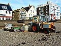 David Brown tractor, Seaton Beach - geograph.org.uk - 3743141.jpg 640 × 480; 130 KB
-

-
 Disused holiday camp (1), Seaton - geograph.org.uk - 815686.jpg 640 × 427; 310 KB
-
 Disused holiday camp (2), Seaton - geograph.org.uk - 815687.jpg 640 × 427; 211 KB
-
 Disused holiday camp (3), Seaton - geograph.org.uk - 815688.jpg 640 × 427; 221 KB
-
 Disused holiday camp (4), Seaton - geograph.org.uk - 815689.jpg 640 × 427; 229 KB
-
 Doesn't quite make the Esplanade - geograph.org.uk - 5540561.jpg 1,024 × 755; 105 KB
-
 Down Fore Street, Seaton - geograph.org.uk - 5781397.jpg 557 × 800; 92 KB
-
 Drained cattle pasture, Seaton Marshes - geograph.org.uk - 4083937.jpg 1,024 × 615; 125 KB
-
 Earth bund, north side, Black Hole Marsh - geograph.org.uk - 4083913.jpg 1,024 × 768; 124 KB
-
 East along Seaton Beach - geograph.org.uk - 5787207.jpg 800 × 496; 119 KB
-

-
 East Devon , Axmouth View - geograph.org.uk - 2808769.jpg 4,288 × 2,848; 5.92 MB
-
 East Devon , Beer Road - geograph.org.uk - 3373297.jpg 4,288 × 2,848; 6.22 MB
-
 East Devon , Beer Road - geograph.org.uk - 3373298.jpg 4,288 × 2,848; 6.34 MB
-
 East Devon , Beer Road B3174 - geograph.org.uk - 3373302.jpg 4,288 × 2,848; 6.24 MB
-
 East Devon , Beer Road B3174 - geograph.org.uk - 3373307.jpg 4,288 × 2,848; 6.34 MB
-
 East Devon , Bird Hut ^ Tram Track - geograph.org.uk - 2807752.jpg 4,230 × 2,758; 4.79 MB
-
 East Devon , Bird Watching Hut - geograph.org.uk - 2808768.jpg 4,288 × 2,848; 4.49 MB
-
 East Devon , Coastal Scenery - geograph.org.uk - 3373323.jpg 4,250 × 2,790; 6 MB
-
 East Devon , Country Road - geograph.org.uk - 3373335.jpg 4,288 × 2,848; 7.01 MB
-
 East Devon , Grassy Field ^ Tractor - geograph.org.uk - 2807714.jpg 4,122 × 2,570; 4.48 MB
-
 East Devon , Pinehurst House - geograph.org.uk - 3373310.jpg 4,288 × 2,848; 6.05 MB
-
 East Devon , River Axe ^ Axmouth - geograph.org.uk - 2807727.jpg 4,288 × 2,848; 6.87 MB
-
 East Devon , River Axe ^ Axmouth - geograph.org.uk - 2807748.jpg 4,250 × 2,790; 4.71 MB
-
 East Devon , Salt Marshes - geograph.org.uk - 2808767.jpg 4,288 × 2,848; 4.46 MB
-
 East Devon , Stovar Long Lane - geograph.org.uk - 3373326.jpg 4,240 × 2,776; 5.34 MB
-
 East Devon , The River Axe - geograph.org.uk - 2807720.jpg 4,200 × 2,710; 5.22 MB
-
 East Devon , The River Axe - geograph.org.uk - 2807741.jpg 4,158 × 2,640; 3.56 MB
-
 East Devon , The River Axe - geograph.org.uk - 2807759.jpg 4,288 × 2,848; 5.5 MB
-
 East Devon , The River Axe - geograph.org.uk - 2807763.jpg 4,288 × 2,848; 6.4 MB
-
 East Devon , The River Axe - geograph.org.uk - 2808773.jpg 4,236 × 2,768; 3.4 MB
-
 East Devon , Tram Track - geograph.org.uk - 2807716.jpg 4,288 × 2,848; 6.28 MB
-
 East Devon , Tram Track - geograph.org.uk - 2807765.jpg 4,246 × 2,784; 4.94 MB
-
 East Devon , Tram Tracks ^ Axe River - geograph.org.uk - 2807624.jpg 4,128 × 2,586; 3.91 MB
-
 East Devon , Tram Tracks ^ Axe River - geograph.org.uk - 2807629.jpg 4,288 × 2,848; 6.03 MB
-
 East Devon , Tram ^ River Axe - geograph.org.uk - 2738270.jpg 4,288 × 2,848; 5.27 MB
-
 East Devon , Van on Axmouth Road - geograph.org.uk - 2808770.jpg 4,288 × 2,848; 6.24 MB
-
 East side of Beach Road, Seaton - geograph.org.uk - 6039193.jpg 1,024 × 944; 204 KB
-
 East Walk, looking West , Seaton - geograph.org.uk - 5597848.jpg 3,264 × 2,448; 2.21 MB
-
 Eastern end of Seaton seafront - geograph.org.uk - 1406546.jpg 640 × 480; 63 KB
-
 Elizabeth Road, Seaton - geograph.org.uk - 3143764.jpg 640 × 435; 55 KB
-
 Elizabeth Road, Seaton - geograph.org.uk - 3143852.jpg 640 × 388; 56 KB
-
 Elizabeth Road, Seaton - geograph.org.uk - 32205.jpg 640 × 480; 134 KB
-
 End of West Walk, Seaton Promenade - geograph.org.uk - 4251221.jpg 3,888 × 2,592; 4.75 MB
-
-

-
 Entrance to Seaton Tramway - geograph.org.uk - 3072942.jpg 1,024 × 652; 556 KB
-
 Esplanade - viewed from Marine Place - geograph.org.uk - 5781734.jpg 640 × 499; 73 KB
-
 Estuary (5115107424).jpg 4,014 × 2,035; 4.22 MB
-
 Everys in Seaton - geograph.org.uk - 5782159.jpg 800 × 800; 125 KB
-
 Exeter and Beer direction sign, Seaton - geograph.org.uk - 6039195.jpg 1,024 × 672; 159 KB
-
 Eyrecourt Road - Sea Hill - geograph.org.uk - 5781583.jpg 640 × 465; 82 KB
-
 Eyrecroft Court - Marine Place - geograph.org.uk - 5781585.jpg 640 × 460; 64 KB
-
 Fire-damaged shelter, Seaton - geograph.org.uk - 3006846.jpg 640 × 440; 76 KB
-
 Fisherman's trailer - geograph.org.uk - 2358827.jpg 640 × 427; 122 KB
-
 Fishing trip sign - geograph.org.uk - 2358832.jpg 427 × 640; 130 KB
-
 Flipside, 40 Harbour Road, Seaton - geograph.org.uk - 5781885.jpg 800 × 600; 101 KB
-
 Flood wall, Seaton - geograph.org.uk - 770896.jpg 640 × 480; 43 KB
-
-
 Fore Street, Seaton (geograph 3006639).jpg 640 × 480; 64 KB
-
 Fore Street, Seaton - geograph.org.uk - 1264180.jpg 640 × 480; 80 KB
-
 Fore Street, Seaton - geograph.org.uk - 3072947.jpg 1,024 × 768; 698 KB
-
 Fore Street, Seaton - geograph.org.uk - 3072969.jpg 1,024 × 682; 573 KB
-
 Fore Street, Seaton - geograph.org.uk - 3072972.jpg 1,024 × 768; 668 KB
-
 Former cinema - off Harbour Road - geograph.org.uk - 5781745.jpg 640 × 480; 61 KB
-
 Former NatWest branch in Seaton - geograph.org.uk - 5783826.jpg 756 × 800; 129 KB
-

-
 Fosse Way Court, Esplanade, Seaton (September 2019).JPG 2,000 × 1,600; 1.21 MB
-
 Fosse Way Court, Seaton - geograph.org.uk - 5781031.jpg 800 × 695; 108 KB
-
 Frydays fish ^ chips in Seaton - geograph.org.uk - 5786517.jpg 800 × 745; 149 KB
-
 Gates shut - geograph.org.uk - 5260424.jpg 1,024 × 768; 152 KB
-
-
 Harbour Mews, Harbour Road, Seaton - geograph.org.uk - 5781772.jpg 735 × 800; 110 KB
-

-
 Harbour Road - Marine Place - geograph.org.uk - 5781584.jpg 640 × 480; 58 KB
-
 Harbour Road view past the new Premier Inn - geograph.org.uk - 5676120.jpg 2,635 × 1,977; 927 KB
-
 Harbour Road, Seaton - geograph.org.uk - 3006813.jpg 640 × 432; 63 KB
-
 Harbour Road, Seaton - geograph.org.uk - 3943931.jpg 1,600 × 1,064; 439 KB
-
 Harbour Road, Seaton, looking east - geograph.org.uk - 1390078.jpg 640 × 480; 175 KB
-
 Harepath Farm and Harepath Hill (A3052) - geograph.org.uk - 3078956.jpg 1,000 × 750; 499 KB
-

-
 Hawkesdown Hill, Axmouth - geograph.org.uk - 2489090.jpg 1,600 × 1,200; 275 KB
-
 Heading west to Seaton, alongside Seaton Marshes - geograph.org.uk - 4083953.jpg 1,024 × 768; 130 KB
-
 Holiday camp, Seaton - geograph.org.uk - 815690.jpg 640 × 427; 208 KB
-
 Holyford Brook valley - geograph.org.uk - 437484.jpg 640 × 480; 114 KB
-
 Homebaye House, Esplanade, Seaton (September 2019).JPG 2,600 × 2,000; 1.78 MB
-
 Homebaye House, Harbour Road, Seaton - geograph.org.uk - 5780993.jpg 800 × 490; 85 KB
-
 Hong Kong in Seaton - geograph.org.uk - 5781651.jpg 800 × 592; 96 KB
-
 Hook and Parrot pub, East Walk, Seaton (September 2019).JPG 2,800 × 1,800; 1.98 MB
-
 Hook ^ Parrot, Seaton - geograph.org.uk - 5786630.jpg 800 × 704; 110 KB
-
 Houses and an access road to a field - geograph.org.uk - 3078911.jpg 1,000 × 750; 518 KB
-
 Houses in the Beer Brook valley - geograph.org.uk - 3008156.jpg 640 × 450; 82 KB
-
 Houses on Drovers Way, Seaton - geograph.org.uk - 5219036.jpg 640 × 438; 50 KB
-
 Housing Development Seaton - geograph.org.uk - 4348688.jpg 3,888 × 2,592; 2.9 MB
-
 Housing on Elizabeth Road, Seaton - geograph.org.uk - 3143787.jpg 640 × 492; 56 KB
-

-
 J. While ^ Sons (closed) - geograph.org.uk - 2358867.jpg 640 × 427; 78 KB
-
 Jasmine Cottage - Fore Street - geograph.org.uk - 5781724.jpg 640 × 480; 68 KB


_-_geograph.org.uk_-_4084300.jpg)
_-_geograph.org.uk_-_4084305.jpg)
_-_geograph.org.uk_-_4084309.jpg)
_-_geograph.org.uk_-_4084310.jpg)
_-_geograph.org.uk_-_4084314.jpg)
_-_geograph.org.uk_-_4084316.jpg)
.JPG)


_-_geograph.org.uk_-_4173380.jpg)
_-_geograph.org.uk_-_4173469.jpg)
_-_geograph.org.uk_-_4173483.jpg)
_-_geograph.org.uk_-_4173486.jpg)
_-_geograph.org.uk_-_4173385.jpg)
_-_geograph.org.uk_-_4173530.jpg)
_-_geograph.org.uk_-_4173397.jpg)
_-_geograph.org.uk_-_4173401.jpg)
_-_geograph.org.uk_-_4173408.jpg)


,_Seaton_-_geograph.org.uk_-_815686.jpg)
,_Seaton_-_geograph.org.uk_-_815687.jpg)
,_Seaton_-_geograph.org.uk_-_815688.jpg)
,_Seaton_-_geograph.org.uk_-_815689.jpg)


.jpg)


.jpg)


.JPG)


_-_geograph.org.uk_-_3078956.jpg)


.JPG)


.JPG)


_-_geograph.org.uk_-_2358867.jpg)

.jpg)