Category:Seebachtal
Jump to navigation
Jump to search
valley in the Ankogel Group in Carinthia  | |||||
| Upload media | |||||
| Instance of | |||||
|---|---|---|---|---|---|
| Location | Mallnitz, Spittal an der Drau District, Carinthia, Austria | ||||
| Elevation above sea level |
| ||||
 | |||||
Subcategories
This category has the following 3 subcategories, out of 3 total.
S
- Seebachtal on 2019-08-20 (73 F)
Media in category "Seebachtal"
The following 153 files are in this category, out of 153 total.
-
 1024 Am Naturlehrweg Seebachtal-2433.jpg 800 × 800; 288 KB
-
 1024 Am Naturlehrweg Seebachtal-2434.jpg 800 × 800; 328 KB
-
 1024 Am Naturlehrweg Seebachtal-2436.jpg 533 × 800; 226 KB
-
 1024 Am Naturlehrweg Seebachtal-2443.jpg 697 × 800; 336 KB
-
 1024 Am Naturlehrweg Seebachtal-2470.jpg 1,024 × 683; 392 KB
-
 1024 am Naturlehrweg Seebachtal-3240.jpg 1,010 × 800; 390 KB
-
 1024 am Naturlehrweg Seebachtal-3241.jpg 1,024 × 758; 369 KB
-
 1024 am Naturlehrweg Seebachtal-3242.jpg 1,024 × 734; 354 KB
-
 1024 am Naturlehrweg Seebachtal-3243.jpg 597 × 800; 284 KB
-
 1024 am Naturlehrweg Seebachtal-3245.jpg 533 × 800; 326 KB
-
 1024 am Naturlehrweg Seebachtal-3246.jpg 904 × 800; 334 KB
-
 1024 am Naturlehrweg Seebachtal-3247.jpg 1,024 × 789; 314 KB
-
 1024 am Naturlehrweg Seebachtal-3248.jpg 643 × 800; 320 KB
-
 1024 am Naturlehrweg Seebachtal-3250.jpg 606 × 800; 331 KB
-
 1024 am Naturlehrweg Seebachtal-3251.jpg 800 × 800; 338 KB
-
 1024 am Naturlehrweg Seebachtal-3254.jpg 447 × 800; 244 KB
-
 1024 am Naturlehrweg Seebachtal-3257.jpg 864 × 800; 359 KB
-
 1024 am Naturlehrweg Seebachtal-3260.jpg 836 × 800; 385 KB
-
 1024 am Naturlehrweg Seebachtal-3262.jpg 698 × 800; 389 KB
-
 1024 am Naturlehrweg Seebachtal-3265.jpg 722 × 800; 345 KB
-
 1024 am Naturlehrweg Seebachtal-3267.jpg 678 × 800; 337 KB
-
 1024 am Naturlehrweg Seebachtal-3268.jpg 990 × 800; 392 KB
-
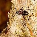 1024 Ameise am Naturlehrweg Seebachtal-2445.jpg 800 × 800; 388 KB
-
 1024 Gold-Fingerkraut (Potentilla aurea) am Naturlehrweg Seebachtal-2442.jpg 1,024 × 683; 394 KB
-

-

-
 1024 im Seebachtal-2897.jpg 1,024 × 683; 398 KB
-
 1024 im Seebachtal-2902.jpg 611 × 800; 255 KB
-
 1024 im Seebachtal-2903.jpg 928 × 800; 360 KB
-
 1024 im Seebachtal-2905.jpg 1,024 × 652; 398 KB
-
 1024 im Seebachtal-2906.jpg 1,024 × 683; 367 KB
-
 1024 im Seebachtal-2908.jpg 1,024 × 683; 396 KB
-
 1024 im Seebachtal-2910.jpg 1,024 × 743; 319 KB
-
 1024 im Seebachtal-2911.jpg 998 × 800; 365 KB
-
 1024 im Seebachtal-2916.jpg 608 × 800; 251 KB
-
 1024 im Seebachtal-2919.jpg 963 × 800; 320 KB
-
 1024 im Seebachtal-2927.jpg 834 × 800; 380 KB
-
 1024 im Seebachtal-2938.jpg 952 × 800; 322 KB
-
 1024 im Seebachtal-2939.jpg 1,024 × 683; 375 KB
-
 1024 im Seebachtal-2940.jpg 1,024 × 623; 333 KB
-
 1024 Pyramiden-Günsel, Ajuga pyramidalis, im Seebachtal-2430.jpg 533 × 800; 363 KB
-
 1024 Pyramiden-Günsel, Ajuga pyramidalis, im Seebachtal-2435.jpg 533 × 800; 382 KB
-
 1024 Seebachtal, Betender Wald-3229.jpg 1,024 × 683; 400 KB
-
 1024 Seebachtal, Käfer-2439.jpg 1,024 × 780; 394 KB
-
 1024 Seebachtal, Quelle-3228.jpg 1,024 × 683; 386 KB
-
 1024 Seebachtal-2388.jpg 1,024 × 683; 396 KB
-
 1024 Seebachtal-2390.jpg 533 × 800; 357 KB
-
 1024 Seebachtal-2404.jpg 1,024 × 683; 396 KB
-
 1024 Seebachtal-2409.jpg 533 × 800; 400 KB
-
 1024 Seebachtal-2414.jpg 1,024 × 683; 366 KB
-
 1024 Seebachtal-2415.jpg 1,024 × 683; 394 KB
-
 1024 Seebachtal-2420.jpg 533 × 800; 382 KB
-
 1024 Seebachtal-2426.jpg 1,024 × 683; 370 KB
-
 1024 Seebachtal-2479.jpg 1,024 × 683; 380 KB
-
 1024 Seebachtal-2482.jpg 1,024 × 683; 385 KB
-
 1024 Seebachtal-2483.jpg 1,024 × 683; 399 KB
-
 1024 Seebachtal-2484.jpg 1,024 × 683; 375 KB
-
 1024 Seebachtal-2485.jpg 1,024 × 683; 384 KB
-
 1024 Seebachtal-2941.jpg 1,024 × 683; 389 KB
-
 1024 Seebachtal-3232.jpg 1,024 × 683; 397 KB
-
 1024 Seebachtal-3261.jpg 1,024 × 683; 382 KB
-
 1024 Trollblumen, Trollius europaeus, im Seebachtal-2431.jpg 600 × 800; 369 KB
-
 Blick auf mallnitz seebachtal1.jpg 900 × 600; 121 KB
-
 Entrance Sign to Nationalpark Hohe Tauern.jpg 3,008 × 2,000; 2.22 MB
-
 Freizeit-Zentrum Seebachtal 20190820 15.jpg 4,000 × 6,000; 17.78 MB
-
 Hohe tauern 2006.jpg 1,024 × 768; 480 KB
-
 Idyllischer Weg am Stappitzer See 20190820 09.jpg 6,000 × 4,000; 14.94 MB
-
 Mallnitz Ankogel 20160808 01.jpg 3,877 × 5,816; 14.29 MB
-
 Mallnitz Ankogel 20160808 02.jpg 5,839 × 3,893; 12.82 MB
-
 Mallnitz Ankogel 20160808 03.jpg 5,842 × 3,895; 13.76 MB
-
 Mallnitz Ankogel 20160808 04.jpg 3,885 × 5,827; 12.7 MB
-
 Mallnitz Ankogel 20160808 05.jpg 5,553 × 3,702; 11.9 MB
-
 Mallnitz Ankogel 20160808 06.jpg 6,000 × 4,000; 8.75 MB
-
 Mallnitz Ankogel 20160808 07.jpg 6,000 × 4,000; 10.93 MB
-
 Mallnitz Ankogel 20160808 08.jpg 6,000 × 4,000; 14.53 MB
-
 Mallnitz Ankogel 20160814 01.jpg 6,000 × 4,000; 13.69 MB
-
 Mallnitz Ankogel 20160814 02.jpg 6,000 × 4,000; 13.82 MB
-
 Mallnitz Ankogel 20161031 01.jpg 6,000 × 4,000; 14.2 MB
-
 Mallnitz Ankogel 20161031 02.jpg 4,000 × 6,000; 16.47 MB
-
 Mallnitz Ankogel 20161031 03.jpg 4,882 × 3,255; 7.34 MB
-
 Mallnitz Ankogel 20200720 01.jpg 6,000 × 4,000; 11.22 MB
-
 Mallnitz Ankogel 20200720 02.jpg 6,000 × 4,000; 9.92 MB
-
 Mallnitz Ankogel 20220816 01.jpg 3,938 × 2,625; 7.33 MB
-
 Mallnitz Ankogel 20220816 02.jpg 6,000 × 4,000; 14.7 MB
-
 Mallnitz Seebach 01.jpg 4,000 × 6,000; 22.29 MB
-
 Mallnitz Seebachtal 01.jpg 5,809 × 3,873; 16.04 MB
-
 Mallnitz Seebachtal 02.jpg 4,781 × 3,187; 9.81 MB
-
 Mallnitz Seebachtal Angermannwald 20161031 01.jpg 5,401 × 3,601; 12.53 MB
-
 Mallnitz Seebachtal Angermannwald 20161031 02.jpg 5,787 × 3,858; 16 MB
-
 Mallnitz Seebachtal Ankogel 20160813.jpg 8,612 × 4,148; 27.92 MB
-
 Mallnitz Seebachtal Lassacher Winkelscharte 01.jpg 5,508 × 3,672; 12.81 MB
-
 Mallnitz Seebachtal Maresenspitze 20160813.jpg 7,342 × 3,671; 16.78 MB
-
 Mallnitz Seebachtal Naturlehrweg Quelle 01.jpg 5,289 × 3,526; 16.98 MB
-
 Mallnitz Seebachtal Naturlehrweg Quelle 02.jpg 4,000 × 6,000; 19.46 MB
-
 Mallnitz Seebachtal Naturlehrweg Quelle Wasseroberfläche 01.jpg 6,000 × 4,000; 20.6 MB
-
 Mallnitz Seebachtal Naturlehrweg Quelle Wasseroberfläche 02.jpg 6,000 × 4,000; 24.12 MB
-
 Mallnitz Seebachtal Naturlehrweg Quelle Wasseroberfläche 03.jpg 6,000 × 4,000; 22.02 MB
-
 Mallnitz Seebachtal Naturlehrweg Quelle Wasseroberfläche 04.jpg 6,000 × 4,000; 16.05 MB
-
 Mallnitz Seebachtal Naturlehrweg Quelle Wasseroberfläche 05.jpg 6,000 × 4,000; 18.01 MB
-
 Mallnitz Seebachtal Naturlehrweg Quelle Wasseroberfläche 06.jpg 6,000 × 4,000; 18.89 MB
-
 Mallnitz Seebachtal Naturlehrweg Quelle Wasseroberfläche 07.jpg 6,000 × 4,000; 18.5 MB
-
 Mallnitz Seebachtal Naturlehrweg Steg 01.jpg 4,000 × 6,000; 18.43 MB
-
 Mallnitz Seebachtal Naturlehrweg Waldpfad 01.jpg 6,000 × 4,000; 22.03 MB
-
 Mallnitz Seebachtal Naturlehrweg Waldpfad 02.jpg 4,000 × 6,000; 23.07 MB
-
 Mallnitz Seebachtal Naturlehrweg Waldpfad 03.jpg 6,000 × 4,000; 20.74 MB
-
 Mallnitz Seebachtal Naturlehrweg Waldpfad 04.jpg 6,000 × 4,000; 21.76 MB
-
 Mallnitz Seebachtal Naturlehrweg Waldpfad 05.jpg 5,969 × 3,979; 19.35 MB
-
 Mallnitz Seebachtal Naturlehrweg Zugang 01.jpg 6,000 × 4,000; 17.69 MB
-
 Mallnitz Seebachtal Schleierfall 01.jpg 4,000 × 6,000; 19.32 MB
-
 Mallnitz Seebachtal Schleierfall 02.jpg 2,983 × 5,966; 14.01 MB
-
 Mallnitz Seebachtal Schleierfall 03.jpg 4,000 × 6,000; 17.6 MB
-
 Mallnitz Seebachtal Stonebeach 01.jpg 5,943 × 3,962; 14.52 MB
-
 Mallnitz Seebachtal Wasserfall A 01.jpg 3,755 × 5,632; 19.68 MB
-
 Mallnitz Seebachtal Wasserfall A 02.jpg 4,000 × 6,000; 18.42 MB
-
 Mallnitz Seebachtal Wasserfall B 01.jpg 3,808 × 5,712; 17.94 MB
-
 Mallnitz Seebachtal Wasserfall B 02.jpg 4,000 × 6,000; 19.87 MB
-
 Mallnitz Seebachtal Wasserfall B 03.jpg 4,000 × 6,000; 18.93 MB
-
 Mallnitz Seebachtal Wasserfall B 04.jpg 4,000 × 6,000; 17.43 MB
-
 Mallnitz Seebachtal Wasserfall B 05.jpg 4,000 × 6,000; 20.84 MB
-
 Mallnitz Seebachtal Wasserfall B 06.jpg 3,874 × 5,811; 18.21 MB
-
 Mallnitz Seebachtal Wasserfall C 01.jpg 4,000 × 6,000; 18.62 MB
-
 Mallnitz Seebachtal Wasserfall C 02.jpg 4,000 × 6,000; 20.17 MB
-
 Mallnitz Seebachtal Wasserfall C 03.jpg 4,000 × 6,000; 17.91 MB
-
 Mallnitz Seebachtal Wasserfall C 05.jpg 4,000 × 6,000; 18.42 MB
-
 Mallnitz Seebachtal Wasserfall C 06.jpg 4,000 × 6,000; 16.27 MB
-
 Mallnitz Seebachtal Wasserfall D 01.jpg 4,000 × 6,000; 21.95 MB
-
 Mallnitz Seebachtal Wasserfälle 01.jpg 5,640 × 3,760; 16.85 MB
-
 Mallnitz Seebachtal Wasserfälle 02.jpg 6,738 × 4,116; 26.21 MB
-
 Mallnitz Stappitz Ankogel-Panorama 01.jpg 13,236 × 4,468; 44.93 MB
-
 Mallnitz Stappitz Ankogel-Panorama 02.jpg 5,751 × 3,834; 10.79 MB
-
 Mallnitz Stappitz Ankogel-Panorama 03.jpg 6,000 × 4,000; 13.67 MB
-
 Mallnitz Stappitzer See Ost 02.jpg 5,816 × 3,877; 15.06 MB
-
 Mallnitz Säuleck 01.jpg 10,284 × 6,148; 31.72 MB
-
 Mallnitz Säuleck 02.jpg 5,899 × 3,933; 13.69 MB
-
 Mallnitz Säuleck 03.jpg 6,000 × 4,000; 12.99 MB
-
 Seebach, Mallnitz.jpg 3,008 × 2,000; 5.11 MB
-
 Seebachtal Mallnitz 2013 08 a.jpg 4,337 × 3,261; 7.23 MB
-
 Seebachtal Mallnitz 2013 08 b.jpg 4,348 × 3,262; 10 MB
-
 Seebachtal Mallnitz 2013 08 c.jpg 4,348 × 3,264; 9.21 MB
-
 Seebachtal Mallnitz 2013 08 d.jpg 4,349 × 3,261; 8.11 MB
-
 Seebachtal Mallnitz 2013 08 e.jpg 4,251 × 3,189; 7.36 MB
-
 Seebachtal Mallnitz 2013 08 f.jpg 4,060 × 3,037; 8.28 MB
-
 Seebachtal Mallnitz 2013 08 g.jpg 3,263 × 4,351; 9.9 MB
-
 Seebachtal Mallnitz 2013 08 h.jpg 4,352 × 3,264; 5.44 MB
-
 Seebachtal Mallnitz, Österreich 1955 a.JPG 2,520 × 1,680; 715 KB
-
 Seebachtal Mallnitz, Österreich 1955 b.JPG 2,520 × 1,680; 691 KB
-
 Seebachtal Mallnitz, Österreich 1955 c.JPG 1,680 × 2,520; 765 KB
-
 Seebachtal Talschluss - Lassacher Winkel.jpg 3,008 × 2,000; 4.01 MB
-
 Stappitzer See im Seebachtal.JPG 3,456 × 2,304; 2.84 MB
-
 Stappitzer See Im Winter.JPG 3,648 × 2,736; 2.01 MB
-
 Stappitzersee Panorama.jpg 9,630 × 2,088; 11.06 MB
-
 Tor Fußweg Seebachtal am Stappitzer See 20190820 07.jpg 4,000 × 6,000; 14.91 MB
-
 Wasserfälle im Seebachtal.JPG 3,456 × 2,304; 4.12 MB


_am_Naturlehrweg_Seebachtal-2442.jpg)
_am_Naturlehrweg_Seebachtal-2453_(cropped).jpg)
_am_Naturlehrweg_Seebachtal-2453.jpg)


