Category:September 2008 in North Yorkshire
Jump to navigation
Jump to search
Ceremonial counties of England: Bedfordshire · Berkshire · Buckinghamshire · Cambridgeshire · Cheshire · Cornwall · Cumbria · Derbyshire · Devon · Dorset · Durham · East Riding of Yorkshire · East Sussex · Essex · Gloucestershire · Greater London · Greater Manchester · Hampshire · Herefordshire · Hertfordshire · Isle of Wight · Kent · Lancashire · Leicestershire · Lincolnshire · Merseyside · Norfolk · North Yorkshire · Northamptonshire · Northumberland · Nottinghamshire · Oxfordshire · Rutland · Shropshire · Somerset · South Yorkshire · Staffordshire · Suffolk · Surrey · Tyne and Wear · Warwickshire · West Midlands · West Sussex · West Yorkshire · Wiltshire · Worcestershire
City-counties: Bristol ·
Former historic counties:
Other former counties:
City-counties: Bristol ·
Former historic counties:
Other former counties:
Deutsch: Bilder, die im September 2008 in North Yorkshire aufgenommen worden sind. Bitte beachten Sie, dass dies weder das Datum des Uploads noch das Datum des Scannens eines Fotos ist.
English: Images/pictures taken in North Yorkshire during September 2008. Note this is not the date of the upload, nor the date a photo was scanned.
Español: Fotografías o imágenes tomadas en North Yorkshire durante septiembre 2008. No es la fecha de subida ni escaneo, sino la fecha en que las fotografías o imágenes se crearon.
Esperanto: Bildoj faritaj en North Yorkshire en septembro 2008. Tio ne estas la dato, kiam la bildoj estis alŝutitaj aŭ skanitaj.
Français : Photographies ou images prises en North Yorkshire durant septembre 2008. Ce n'est pas la date du téléchargement ou du scan.
Galego: Fotografías ou imaxes tomadas en North Yorkshire durante setembro 2008. Non é a data de subida nin escaneamento, senón a data na que se crearon as fotografías ou imaxes.
Italiano: Fotografie o immagini scattate a North Yorkshire nel settembre 2008. Nota bene: la data non si riferisce né a quella di upload né a quella in cui la foto è stata digitalizzata.
Norsk bokmål: Bilder tatt i North Yorkshire i løpet av september 2008. Merk at dette ikke er datoen for opplasting, eller når et bilde har blitt skannet.
Norsk nynorsk: Bilete teke i North Yorkshire i løpet av september 2008. Merk at dette ikkje er datoen for opplasting, eller når eit bilete har vorte skanna.
Русский: Изображения, сделанные в North Yorkshire в течение сентябрь 2008 (не дата загрузки изображения).
Українська: Зображення, зроблені в North Yorkshire протягом вересень 2008. Зауважте, що це не дата завантаження чи дата сканування фотографії.
| September 2007 | ← | September 2008 | → | September 2009 | |||||||
| Jan | Feb | Mar | Apr | May | Jun | Jul | Aug | Sep | Oct | Nov | Dec |
| 132 | 133 | 124 | 106 | 169 | 192 | 124 | 157 | 83 | 58 | 93 | 52 |
|---|---|---|---|---|---|---|---|---|---|---|---|
Subcategories
This category has the following 2 subcategories, out of 2 total.
Media in category "September 2008 in North Yorkshire"
The following 81 files are in this category, out of 81 total.
-
 Kettlewell Beck bridge to Kettlewell Church.jpg 2,573 × 1,800; 1.48 MB
-
 ...Richmond in North Yorkshire ... (2905233213).jpg 1,280 × 960; 250 KB
-

-
 A house for thin people^ - geograph.org.uk - 980737.jpg 480 × 640; 86 KB
-
 A169 to Saltersgate - geograph.org.uk - 985035.jpg 640 × 427; 159 KB
-
 A65 in Hellifield - geograph.org.uk - 960068.jpg 640 × 480; 81 KB
-
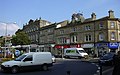
 Alma Terrace, Skipton - geograph.org.uk - 983083.jpg 640 × 480; 182 KB
-
 Annes Cross - geograph.org.uk - 955570.jpg 640 × 480; 44 KB
-
 Approaching Skinningrove along Grove Road - geograph.org.uk - 970471.jpg 640 × 480; 162 KB
-

-
 Boroughbridge 1st railway station (site), Yorkshire (geograph 4285787).jpg 1,024 × 768; 145 KB
-
 Boundary Stone - geograph.org.uk - 955503.jpg 640 × 480; 85 KB
-
 Breakwater at Port Mulgrave - geograph.org.uk - 948283.jpg 640 × 480; 203 KB
-
 Canal Basin - geograph.org.uk - 968462.jpg 640 × 480; 111 KB
-
 Canal from Canal Street - geograph.org.uk - 968333.jpg 640 × 480; 127 KB
-
 Castlegate, Helmsley - geograph.org.uk - 974943.jpg 640 × 439; 82 KB
-
 Cattle grid near Heathfield Caravan Park - geograph.org.uk - 965450.jpg 600 × 400; 314 KB
-
 Cheapside, Settle - geograph.org.uk - 970485.jpg 640 × 480; 94 KB
-
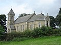 Church at Foxholes. - geograph.org.uk - 1035717.jpg 640 × 480; 79 KB
-
 Close Up of 45231 'Sherwood Foresters' - geograph.org.uk - 985731.jpg 640 × 427; 251 KB
-
 Coach Street Bridge - geograph.org.uk - 968484.jpg 640 × 480; 93 KB
-

-
 Covered Alley - geograph.org.uk - 973045.jpg 427 × 640; 207 KB
-
 East end of Newbiggin - geograph.org.uk - 980728.jpg 640 × 480; 87 KB
-
 Falling Foss Tea Garden - Midge Hall - geograph.org.uk - 955453.jpg 640 × 480; 118 KB
-
 Fields below Haw Pike - geograph.org.uk - 953279.jpg 640 × 480; 59 KB
-
 Fields Near Harland Hill - geograph.org.uk - 974262.jpg 640 × 427; 231 KB
-
 Finkle Street - geograph.org.uk - 985895.jpg 480 × 640; 89 KB
-
 Footbridge over the Seven - geograph.org.uk - 963564.jpg 640 × 427; 102 KB
-
 Footpath Down Cold Moor - geograph.org.uk - 982703.jpg 640 × 427; 199 KB
-
 Footpath near Muker - geograph.org.uk - 1606608.jpg 480 × 640; 78 KB
-
 Footpath to Battersby - geograph.org.uk - 985736.jpg 640 × 427; 298 KB
-

-
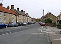
 Frenchgate, Richmond - geograph.org.uk - 987384.jpg 640 × 480; 83 KB
-
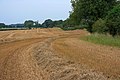 Freshly Harvested Field - geograph.org.uk - 974238.jpg 640 × 427; 251 KB
-
 Freshly Harvested Field - geograph.org.uk - 974243.jpg 640 × 427; 240 KB
-
 Gargrave Station - geograph.org.uk - 968297.jpg 640 × 480; 92 KB
-
 Grosmont Station - geograph.org.uk - 985884.jpg 427 × 640; 208 KB
-
 Half Moon and cottages - geograph.org.uk - 986359.jpg 640 × 466; 75 KB
-
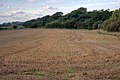 Harvested Field - geograph.org.uk - 985716.jpg 640 × 427; 248 KB
-
 Hasty Bank and Wainstones Before Sunrise - geograph.org.uk - 982677.jpg 640 × 427; 163 KB
-
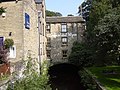 High Corn Mill, Chapel Hill - geograph.org.uk - 968359.jpg 640 × 480; 110 KB
-
 High Street - geograph.org.uk - 968396.jpg 640 × 397; 69 KB
-
 High Street, Skipton - geograph.org.uk - 968446.jpg 640 × 399; 65 KB
-
 Hillside of Simon Fell - geograph.org.uk - 1490439.jpg 640 × 480; 148 KB
-
 John Bonds Sheep House - geograph.org.uk - 955619.jpg 640 × 480; 135 KB
-
 Kirbymoorside railway station.jpg 3,264 × 2,448; 3.79 MB
-
 Knaresborough railway station - platform 2 in 2008.jpg 480 × 640; 98 KB
-
 Lilla Cross - geograph.org.uk - 955598.jpg 480 × 640; 59 KB
-
 Looking along Marine Terrace - geograph.org.uk - 970475.jpg 640 × 480; 141 KB
-
 Masham railway station site, Yorkshire (geograph 3346748).jpg 1,024 × 768; 188 KB
-
 Napier's Restaurant - geograph.org.uk - 968324.jpg 640 × 480; 105 KB
-
 Office, Mill Bridge - geograph.org.uk - 968349.jpg 640 × 480; 141 KB
-
 Old Court House - geograph.org.uk - 968371.jpg 480 × 640; 54 KB
-
 Pickering Beck railway bridge.JPG 3,264 × 2,448; 3.87 MB
-
 River Aire flood plain - geograph.org.uk - 1240352.jpg 640 × 480; 88 KB
-
 River Aire under Newland bridge - geograph.org.uk - 1240402.jpg 640 × 480; 53 KB
-
 Rye Street, Helmsley - geograph.org.uk - 974990.jpg 640 × 459; 80 KB
-
 Shop, Albion Yard - geograph.org.uk - 968391.jpg 640 × 480; 88 KB
-
 Sinderby railway station (site), Yorkshire (geograph 3346769).jpg 1,024 × 768; 231 KB
-
 Skinningrove - geograph.org.uk - 970506.jpg 640 × 480; 182 KB
-
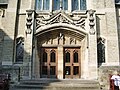
 Skipton Baptist Church, Porch - geograph.org.uk - 983090.jpg 480 × 640; 191 KB
-
 Skipton Baptist Church, Sign - geograph.org.uk - 983087.jpg 480 × 640; 187 KB
-
 Skipton Baptist Church.jpg 628 × 470; 166 KB
-
-

-
 St Andrew's Methodist Church, Skipton.jpg 640 × 480; 171 KB
-
 Staithes UK - village and harbor.jpg 3,504 × 2,336; 5.63 MB
-
 Swinner Gill - geograph.org.uk - 1606635.jpg 640 × 480; 117 KB
-
 Tanfield railway station (site), Yorkshire (geograph 3346755).jpg 1,024 × 768; 214 KB
-

-
 The Half Moon - geograph.org.uk - 988588.jpg 640 × 367; 67 KB
-
 The Talbot, Richmond - geograph.org.uk - 987315.jpg 452 × 640; 70 KB
-
 Topcliffe railway station (site) (geograph 3346841).jpg 1,024 × 768; 141 KB
-
 Track below Draughton Moor - geograph.org.uk - 956700.jpg 640 × 480; 61 KB
-
 Track near Lodge Farm - geograph.org.uk - 1240364.jpg 640 × 480; 55 KB
-

-
 Tractor Rally passing Market Square - geograph.org.uk - 974967.jpg 640 × 420; 80 KB
-

-
 Weir on Foster Beck - geograph.org.uk - 957933.jpg 480 × 640; 122 KB
-
 Wheelie bins on the Pennine Way - geograph.org.uk - 970466.jpg 640 × 478; 116 KB

.jpg)


,_Yorkshire_(geograph_4285787).jpg)


.jpg)


,_Yorkshire_(geograph_3346769).jpg)


,_Yorkshire_(geograph_3346755).jpg)


_(geograph_3346841).jpg)


.jpg)