Category:September 2009 in Northumberland
Jump to navigation
Jump to search
Ceremonial counties of England: Bedfordshire · Berkshire · Buckinghamshire · Cambridgeshire · Cheshire · Cornwall · Cumbria · Derbyshire · Devon · Dorset · Durham · East Riding of Yorkshire · East Sussex · Essex · Gloucestershire · Greater London · Greater Manchester · Hampshire · Herefordshire · Hertfordshire · Isle of Wight · Kent · Lancashire · Leicestershire · Lincolnshire · Merseyside · Norfolk · North Yorkshire · Northamptonshire · Northumberland · Nottinghamshire · Oxfordshire · Shropshire · Somerset · South Yorkshire · Staffordshire · Suffolk · Surrey · Tyne and Wear · Warwickshire · West Midlands · West Sussex · West Yorkshire · Wiltshire · Worcestershire
City-counties: Bristol ·
Former historic counties:
Other former counties:
City-counties: Bristol ·
Former historic counties:
Other former counties:
Deutsch: Bilder, die im September 2009 in Northumberland aufgenommen worden sind. Bitte beachten Sie, dass dies weder das Datum des Uploads noch das Datum des Scannens eines Fotos ist.
English: Images/pictures taken in Northumberland during September 2009. Note this is not the date of the upload, nor the date a photo was scanned.
Español: Fotografías o imágenes tomadas en Northumberland durante septiembre 2009. No es la fecha de subida ni escaneo, sino la fecha en que las fotografías o imágenes se crearon.
Esperanto: Bildoj faritaj en Northumberland en septembro 2009. Tio ne estas la dato, kiam la bildoj estis alŝutitaj aŭ skanitaj.
Français : Photographies ou images prises en Northumberland durant septembre 2009. Ce n'est pas la date du téléchargement ou du scan.
Galego: Fotografías ou imaxes tomadas en Northumberland durante setembro 2009. Non é a data de subida nin escaneamento, senón a data na que se crearon as fotografías ou imaxes.
Italiano: Fotografie o immagini scattate a Northumberland nel settembre 2009. Nota bene: la data non si riferisce né a quella di upload né a quella in cui la foto è stata digitalizzata.
Norsk bokmål: Bilder tatt i Northumberland i løpet av september 2009. Merk at dette ikke er datoen for opplasting, eller når et bilde har blitt skannet.
Norsk nynorsk: Bilete teke i Northumberland i løpet av september 2009. Merk at dette ikkje er datoen for opplasting, eller når eit bilete har vorte skanna.
Русский: Изображения, сделанные в Northumberland в течение сентябрь 2009 (не дата загрузки изображения).
Українська: Зображення, зроблені в Northumberland протягом вересень 2009. Зауважте, що це не дата завантаження чи дата сканування фотографії.
| September 2008 | ← | September 2009 | → | September 2010 | |||||||
| Jan | Feb | Mar | Apr | May | Jun | Jul | Aug | Sep | Oct | Nov | Dec |
| 40 | 34 | 178 | 34 | 28 | 60 | 27 | 38 | 47 | 54 | 10 | 29 |
|---|---|---|---|---|---|---|---|---|---|---|---|
Subcategories
This category has only the following subcategory.
0
Media in category "September 2009 in Northumberland"
The following 46 files are in this category, out of 46 total.
-
 A level crossing on the East Coast Line - geograph.org.uk - 1508283.jpg 640 × 417; 126 KB
-

-
 A sign at Goswick Links - geograph.org.uk - 1511843.jpg 640 × 420; 135 KB
-
 Approaching Ingram - geograph.org.uk - 1509970.jpg 640 × 427; 131 KB
-
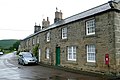
 Ashington Town hall - geograph.org.uk - 1508355.jpg 525 × 640; 77 KB
-
 Beal Point - geograph.org.uk - 1503218.jpg 1,024 × 683; 144 KB
-
 Bondgate Within - geograph.org.uk - 1521823.jpg 640 × 426; 181 KB
-
 Bridge and Refuge, Lindisfarne Causeway - geograph.org.uk - 1503043.jpg 640 × 427; 122 KB
-
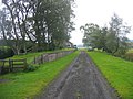
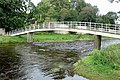 Bridge over the Coquet - geograph.org.uk - 1513543.jpg 640 × 427; 191 KB
-
 Car Park, Lindisfarne Nature Reserve - geograph.org.uk - 1503038.jpg 640 × 427; 130 KB
-
 Cottages at Branton - geograph.org.uk - 1507915.jpg 640 × 427; 172 KB
-
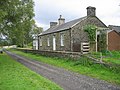 Deadwater Railway Station.jpg 600 × 450; 117 KB
-
-

-

-
-
 Elizabeth II Postbox, Holy Island - geograph.org.uk - 1503128.jpg 427 × 640; 141 KB
-
 Falstone Railway Station - geograph.org.uk - 1515798.jpg 640 × 287; 49 KB
-
 Falstone Railway Station - geograph.org.uk - 1515808.jpg 600 × 450; 86 KB
-
 Falstone Railway Station.jpg 600 × 450; 80 KB
-
 Flooding of the Causeway - geograph.org.uk - 1503214.jpg 1,024 × 683; 125 KB
-
 Follions - geograph.org.uk - 1497891.jpg 640 × 311; 60 KB
-
 Footpath sign to Walltown Crags - geograph.org.uk - 1563218.jpg 640 × 480; 77 KB
-
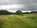
 Footpath to nowhere - geograph.org.uk - 1520225.jpg 640 × 426; 214 KB
-
 Footpath towards Prendwick - geograph.org.uk - 1508061.jpg 640 × 427; 180 KB
-
 Ford at Forest Burn - geograph.org.uk - 1566029.jpg 640 × 480; 137 KB
-
 Former excellence at Hedgeley Station - geograph.org.uk - 1507848.jpg 640 × 427; 225 KB
-
 Heading for Goswick Sands - geograph.org.uk - 1511847.jpg 427 × 640; 121 KB
-
 Horse riders on Goswick Sands - geograph.org.uk - 1511852.jpg 640 × 389; 242 KB
-
 Lindisfarne Castle - geograph.org.uk - 1503150.jpg 683 × 1,024; 154 KB
-
 Rectangular sheepfold east of White Law - geograph.org.uk - 1507601.jpg 640 × 480; 101 KB
-
 Road to Lindisfarne - geograph.org.uk - 1503055.jpg 640 × 427; 113 KB
-
 Road to Lindisfarne - geograph.org.uk - 1503072.jpg 640 × 427; 117 KB
-
 Roundabout on Willowburn Avenue - geograph.org.uk - 1521729.jpg 640 × 427; 184 KB
-
 Royal Tweed Bridge at Berwick-upon-Tweed - geograph.org.uk - 1513441.jpg 425 × 594; 115 KB
-
 Sand Covered Road, Chare Ends - geograph.org.uk - 1503077.jpg 640 × 427; 116 KB
-
 Sheepfold below Yeavering Bell - geograph.org.uk - 1507889.jpg 640 × 481; 109 KB
-
 Sheepfold south of Yeavering Bell - geograph.org.uk - 1508738.jpg 640 × 480; 120 KB
-
 Sheepfolds at Bilton Barns - geograph.org.uk - 1481874.jpg 640 × 480; 65 KB
-
 Silage clamp at Bilton Barns - geograph.org.uk - 1518760.jpg 640 × 426; 165 KB
-
-
 Sunrise, Goswick Sands - geograph.org.uk - 1503192.jpg 1,024 × 683; 124 KB
-
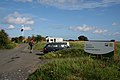
 The Beachcomber campsite at Goswick - geograph.org.uk - 1511839.jpg 640 × 420; 150 KB
-
 Tramway Bridge, Lindisfarne Castle - geograph.org.uk - 1503160.jpg 683 × 1,024; 149 KB
-
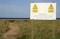
 Warning Sign, Goswick Sands - geograph.org.uk - 1503167.jpg 1,024 × 683; 101 KB
-
 Cattle at Ingram - geograph.org.uk - 1509972.jpg 640 × 427; 182 KB


