Category:Sevier River
Jump to navigation
Jump to search
river in central Utah, United States  | |||||
| Upload media | |||||
| Instance of | |||||
|---|---|---|---|---|---|
| Location |
| ||||
| Length |
| ||||
| Mouth of the watercourse | |||||
| Basin country | |||||
| Tributary |
| ||||
 | |||||
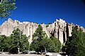
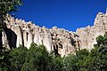
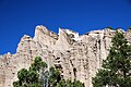
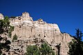
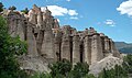
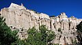
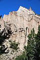
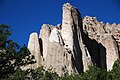
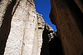
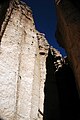
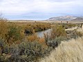
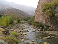
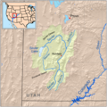
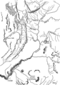
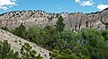
English: Media related to the Sevier River, a river in southwestern Utah, United States that extends 279 miles (449 km) and is the longest river entirely within the state. It drains an extended chain of mountain farming valleys to the intermittent Sevier Lake.
Subcategories
This category has the following 21 subcategories, out of 21 total.
A
B
C
- Circleville, Utah (1 P, 16 F)
D
J
- Junction, Utah (8 F)
K
- Kingston, Utah (6 F)
L
M
- Mammoth Creek (Utah) (2 F)
- Marysvale Bridge (11 F)
P
- Panguitch Creek (3 F)
- Piute State Park (empty)
S
- Sigurd, Utah (3 F)
V
Media in category "Sevier River"
The following 181 files are in this category, out of 181 total.
-
-

-
 Big Rock Candy Mountian - panoramio.jpg 2,592 × 1,944; 1.31 MB
-
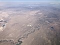
 CannonvilleUT aerial view.jpg 1,650 × 1,126; 2.08 MB
-

-

-

-
 CtyMapSevier.png 936 × 689; 37 KB
-

-
-
 Fall in Utah (15719143625).jpg 5,456 × 3,632; 8.32 MB
-
 Fishlake National Forest Map.jpg 743 × 945; 127 KB
-
 LAVA FROM VALLEY OF LOWER SEVIER, UTAH, VOLUME III PLATE XII - NARA - 524371.jpg 3,000 × 2,415; 3.23 MB
-
 Mountain Meadows BHoU-p550.png 1,760 × 3,126; 156 KB
-
 OldSpanishTrailUT.gif 765 × 600; 84 KB
-

-

-
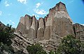
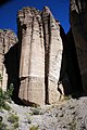
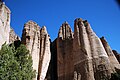
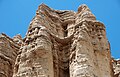
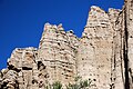
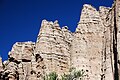
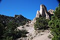
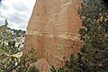
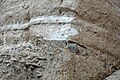
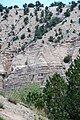
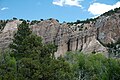
 Sevier River Formation (Miocene; Joe Lott Creek Canyon, Tushar Mountains, Utah, USA) 1.jpg 3,008 × 2,000; 4.96 MB
-
 Sevier River Formation (Miocene; Joe Lott Creek Canyon, Tushar Mountains, Utah, USA) 10.jpg 3,008 × 2,000; 4.73 MB
-
 Sevier River Formation (Miocene; Joe Lott Creek Canyon, Tushar Mountains, Utah, USA) 100.jpg 3,008 × 2,000; 5.02 MB
-
 Sevier River Formation (Miocene; Joe Lott Creek Canyon, Tushar Mountains, Utah, USA) 101.jpg 3,008 × 2,000; 5.66 MB
-
 Sevier River Formation (Miocene; Joe Lott Creek Canyon, Tushar Mountains, Utah, USA) 102.jpg 2,000 × 3,008; 4.46 MB
-
 Sevier River Formation (Miocene; Joe Lott Creek Canyon, Tushar Mountains, Utah, USA) 103.jpg 2,000 × 3,008; 4.88 MB
-
 Sevier River Formation (Miocene; Joe Lott Creek Canyon, Tushar Mountains, Utah, USA) 104.jpg 2,000 × 3,008; 5.01 MB
-
 Sevier River Formation (Miocene; Joe Lott Creek Canyon, Tushar Mountains, Utah, USA) 105.jpg 3,008 × 2,000; 5.26 MB
-
 Sevier River Formation (Miocene; Joe Lott Creek Canyon, Tushar Mountains, Utah, USA) 106.jpg 3,008 × 2,000; 5.81 MB
-
 Sevier River Formation (Miocene; Joe Lott Creek Canyon, Tushar Mountains, Utah, USA) 107.jpg 3,008 × 2,000; 4.39 MB
-

-
 Sevier River Formation (Miocene; Joe Lott Creek Canyon, Tushar Mountains, Utah, USA) 109.jpg 3,008 × 2,000; 4.51 MB
-
 Sevier River Formation (Miocene; Joe Lott Creek Canyon, Tushar Mountains, Utah, USA) 11.jpg 3,008 × 1,918; 4.65 MB
-
 Sevier River Formation (Miocene; Joe Lott Creek Canyon, Tushar Mountains, Utah, USA) 110.jpg 3,008 × 2,000; 4.04 MB
-
 Sevier River Formation (Miocene; Joe Lott Creek Canyon, Tushar Mountains, Utah, USA) 111.jpg 3,008 × 2,000; 4.52 MB
-
 Sevier River Formation (Miocene; Joe Lott Creek Canyon, Tushar Mountains, Utah, USA) 112.jpg 3,008 × 2,000; 5.08 MB
-
 Sevier River Formation (Miocene; Joe Lott Creek Canyon, Tushar Mountains, Utah, USA) 113.jpg 3,008 × 2,000; 4.97 MB
-
 Sevier River Formation (Miocene; Joe Lott Creek Canyon, Tushar Mountains, Utah, USA) 114.jpg 3,008 × 2,000; 4.77 MB
-
 Sevier River Formation (Miocene; Joe Lott Creek Canyon, Tushar Mountains, Utah, USA) 115.jpg 3,008 × 2,000; 3.47 MB
-

-
-
 Sevier River Formation (Miocene; Joe Lott Creek Canyon, Tushar Mountains, Utah, USA) 118.jpg 3,008 × 2,000; 4.25 MB
-
 Sevier River Formation (Miocene; Joe Lott Creek Canyon, Tushar Mountains, Utah, USA) 119.jpg 3,008 × 2,000; 4.53 MB
-
 Sevier River Formation (Miocene; Joe Lott Creek Canyon, Tushar Mountains, Utah, USA) 12.jpg 2,000 × 2,915; 4.79 MB
-
 Sevier River Formation (Miocene; Joe Lott Creek Canyon, Tushar Mountains, Utah, USA) 120.jpg 2,930 × 1,650; 3.13 MB
-
 Sevier River Formation (Miocene; Joe Lott Creek Canyon, Tushar Mountains, Utah, USA) 121.jpg 3,008 × 2,000; 4.63 MB
-
 Sevier River Formation (Miocene; Joe Lott Creek Canyon, Tushar Mountains, Utah, USA) 122.jpg 3,008 × 2,000; 5.01 MB
-
 Sevier River Formation (Miocene; Joe Lott Creek Canyon, Tushar Mountains, Utah, USA) 123.jpg 3,008 × 2,000; 4.02 MB
-
 Sevier River Formation (Miocene; Joe Lott Creek Canyon, Tushar Mountains, Utah, USA) 124.jpg 3,008 × 2,000; 3.76 MB
-
 Sevier River Formation (Miocene; Joe Lott Creek Canyon, Tushar Mountains, Utah, USA) 125.jpg 3,008 × 2,000; 4.57 MB
-
 Sevier River Formation (Miocene; Joe Lott Creek Canyon, Tushar Mountains, Utah, USA) 126.jpg 3,008 × 2,000; 4.92 MB
-
 Sevier River Formation (Miocene; Joe Lott Creek Canyon, Tushar Mountains, Utah, USA) 127.jpg 3,008 × 2,000; 4.58 MB
-
 Sevier River Formation (Miocene; Joe Lott Creek Canyon, Tushar Mountains, Utah, USA) 128.jpg 3,008 × 2,000; 4.41 MB
-
 Sevier River Formation (Miocene; Joe Lott Creek Canyon, Tushar Mountains, Utah, USA) 13.jpg 3,008 × 2,000; 6.05 MB
-
 Sevier River Formation (Miocene; Joe Lott Creek Canyon, Tushar Mountains, Utah, USA) 14.jpg 3,008 × 2,000; 5.85 MB
-
 Sevier River Formation (Miocene; Joe Lott Creek Canyon, Tushar Mountains, Utah, USA) 15.jpg 3,008 × 2,000; 4.78 MB
-
 Sevier River Formation (Miocene; Joe Lott Creek Canyon, Tushar Mountains, Utah, USA) 16.jpg 3,008 × 2,000; 5.09 MB
-
 Sevier River Formation (Miocene; Joe Lott Creek Canyon, Tushar Mountains, Utah, USA) 17.jpg 3,008 × 2,000; 5.47 MB
-
 Sevier River Formation (Miocene; Joe Lott Creek Canyon, Tushar Mountains, Utah, USA) 18.jpg 3,008 × 2,000; 5.02 MB
-
 Sevier River Formation (Miocene; Joe Lott Creek Canyon, Tushar Mountains, Utah, USA) 19.jpg 2,000 × 3,008; 4.14 MB
-
 Sevier River Formation (Miocene; Joe Lott Creek Canyon, Tushar Mountains, Utah, USA) 2.jpg 2,000 × 3,008; 5.14 MB
-
 Sevier River Formation (Miocene; Joe Lott Creek Canyon, Tushar Mountains, Utah, USA) 20.jpg 2,000 × 3,008; 5.04 MB
-

-
 Sevier River Formation (Miocene; Joe Lott Creek Canyon, Tushar Mountains, Utah, USA) 22.jpg 2,000 × 3,008; 5.22 MB
-
 Sevier River Formation (Miocene; Joe Lott Creek Canyon, Tushar Mountains, Utah, USA) 23.jpg 2,000 × 3,008; 4.27 MB
-
 Sevier River Formation (Miocene; Joe Lott Creek Canyon, Tushar Mountains, Utah, USA) 24.jpg 2,000 × 3,008; 5.59 MB
-
 Sevier River Formation (Miocene; Joe Lott Creek Canyon, Tushar Mountains, Utah, USA) 25.jpg 3,008 × 2,000; 5.91 MB
-
 Sevier River Formation (Miocene; Joe Lott Creek Canyon, Tushar Mountains, Utah, USA) 26.jpg 3,008 × 2,000; 6.12 MB
-
 Sevier River Formation (Miocene; Joe Lott Creek Canyon, Tushar Mountains, Utah, USA) 27.jpg 2,000 × 3,008; 4.04 MB
-
 Sevier River Formation (Miocene; Joe Lott Creek Canyon, Tushar Mountains, Utah, USA) 28.jpg 2,000 × 3,008; 3.98 MB
-
 Sevier River Formation (Miocene; Joe Lott Creek Canyon, Tushar Mountains, Utah, USA) 29.jpg 2,000 × 3,008; 4.51 MB
-
 Sevier River Formation (Miocene; Joe Lott Creek Canyon, Tushar Mountains, Utah, USA) 3.jpg 3,008 × 1,781; 5.27 MB
-
 Sevier River Formation (Miocene; Joe Lott Creek Canyon, Tushar Mountains, Utah, USA) 30.jpg 2,000 × 3,008; 4.12 MB
-
 Sevier River Formation (Miocene; Joe Lott Creek Canyon, Tushar Mountains, Utah, USA) 31.jpg 3,008 × 2,000; 4.24 MB
-
 Sevier River Formation (Miocene; Joe Lott Creek Canyon, Tushar Mountains, Utah, USA) 32.jpg 3,008 × 2,000; 4.49 MB
-
 Sevier River Formation (Miocene; Joe Lott Creek Canyon, Tushar Mountains, Utah, USA) 33.jpg 2,000 × 3,008; 4.18 MB
-
 Sevier River Formation (Miocene; Joe Lott Creek Canyon, Tushar Mountains, Utah, USA) 34.jpg 3,008 × 2,000; 3.91 MB
-
 Sevier River Formation (Miocene; Joe Lott Creek Canyon, Tushar Mountains, Utah, USA) 35.jpg 2,000 × 3,008; 3.89 MB
-
 Sevier River Formation (Miocene; Joe Lott Creek Canyon, Tushar Mountains, Utah, USA) 36.jpg 2,000 × 3,008; 3.75 MB
-
 Sevier River Formation (Miocene; Joe Lott Creek Canyon, Tushar Mountains, Utah, USA) 37.jpg 3,008 × 2,000; 3.42 MB
-
 Sevier River Formation (Miocene; Joe Lott Creek Canyon, Tushar Mountains, Utah, USA) 38.jpg 3,008 × 1,823; 4.45 MB
-
 Sevier River Formation (Miocene; Joe Lott Creek Canyon, Tushar Mountains, Utah, USA) 39.jpg 3,008 × 1,789; 4.54 MB
-
 Sevier River Formation (Miocene; Joe Lott Creek Canyon, Tushar Mountains, Utah, USA) 4.jpg 3,008 × 2,000; 4.43 MB
-
 Sevier River Formation (Miocene; Joe Lott Creek Canyon, Tushar Mountains, Utah, USA) 40.jpg 2,000 × 3,008; 4.06 MB
-
 Sevier River Formation (Miocene; Joe Lott Creek Canyon, Tushar Mountains, Utah, USA) 41.jpg 2,000 × 3,008; 4.54 MB
-
 Sevier River Formation (Miocene; Joe Lott Creek Canyon, Tushar Mountains, Utah, USA) 42.jpg 2,000 × 3,008; 4.17 MB
-
 Sevier River Formation (Miocene; Joe Lott Creek Canyon, Tushar Mountains, Utah, USA) 43.jpg 2,000 × 2,840; 3.67 MB
-
 Sevier River Formation (Miocene; Joe Lott Creek Canyon, Tushar Mountains, Utah, USA) 44.jpg 3,008 × 2,000; 4.49 MB
-
 Sevier River Formation (Miocene; Joe Lott Creek Canyon, Tushar Mountains, Utah, USA) 45.jpg 3,008 × 1,460; 3.52 MB
-
 Sevier River Formation (Miocene; Joe Lott Creek Canyon, Tushar Mountains, Utah, USA) 46.jpg 3,008 × 1,613; 3.41 MB
-
 Sevier River Formation (Miocene; Joe Lott Creek Canyon, Tushar Mountains, Utah, USA) 47.jpg 2,000 × 3,008; 4.88 MB
-
 Sevier River Formation (Miocene; Joe Lott Creek Canyon, Tushar Mountains, Utah, USA) 48.jpg 3,008 × 1,787; 3.79 MB
-
 Sevier River Formation (Miocene; Joe Lott Creek Canyon, Tushar Mountains, Utah, USA) 49.jpg 3,008 × 2,000; 4.05 MB
-
 Sevier River Formation (Miocene; Joe Lott Creek Canyon, Tushar Mountains, Utah, USA) 5.jpg 3,008 × 2,000; 5.16 MB
-
 Sevier River Formation (Miocene; Joe Lott Creek Canyon, Tushar Mountains, Utah, USA) 50.jpg 3,007 × 1,642; 3.75 MB
-
 Sevier River Formation (Miocene; Joe Lott Creek Canyon, Tushar Mountains, Utah, USA) 51.jpg 3,008 × 1,710; 4.06 MB
-
 Sevier River Formation (Miocene; Joe Lott Creek Canyon, Tushar Mountains, Utah, USA) 52.jpg 3,008 × 1,787; 3.67 MB
-

-
 Sevier River Formation (Miocene; Joe Lott Creek Canyon, Tushar Mountains, Utah, USA) 54.jpg 2,000 × 2,665; 4.61 MB
-
 Sevier River Formation (Miocene; Joe Lott Creek Canyon, Tushar Mountains, Utah, USA) 55.jpg 3,008 × 1,744; 4.19 MB
-
 Sevier River Formation (Miocene; Joe Lott Creek Canyon, Tushar Mountains, Utah, USA) 56.jpg 3,008 × 1,741; 4.32 MB
-
 Sevier River Formation (Miocene; Joe Lott Creek Canyon, Tushar Mountains, Utah, USA) 57.jpg 3,008 × 1,760; 4.04 MB
-
 Sevier River Formation (Miocene; Joe Lott Creek Canyon, Tushar Mountains, Utah, USA) 58.jpg 3,008 × 1,786; 4.19 MB
-
 Sevier River Formation (Miocene; Joe Lott Creek Canyon, Tushar Mountains, Utah, USA) 59.jpg 3,008 × 2,000; 4.47 MB
-
 Sevier River Formation (Miocene; Joe Lott Creek Canyon, Tushar Mountains, Utah, USA) 6.jpg 3,008 × 2,000; 4.36 MB
-

-
 Sevier River Formation (Miocene; Joe Lott Creek Canyon, Tushar Mountains, Utah, USA) 61.jpg 3,008 × 1,709; 4.02 MB
-
 Sevier River Formation (Miocene; Joe Lott Creek Canyon, Tushar Mountains, Utah, USA) 62.jpg 3,008 × 1,661; 3.76 MB
-
 Sevier River Formation (Miocene; Joe Lott Creek Canyon, Tushar Mountains, Utah, USA) 63.jpg 2,000 × 2,636; 4.77 MB
-
 Sevier River Formation (Miocene; Joe Lott Creek Canyon, Tushar Mountains, Utah, USA) 64.jpg 2,000 × 2,643; 4.78 MB
-
 Sevier River Formation (Miocene; Joe Lott Creek Canyon, Tushar Mountains, Utah, USA) 65.jpg 3,008 × 1,647; 3.97 MB
-
 Sevier River Formation (Miocene; Joe Lott Creek Canyon, Tushar Mountains, Utah, USA) 66.jpg 3,008 × 2,000; 3.59 MB
-
 Sevier River Formation (Miocene; Joe Lott Creek Canyon, Tushar Mountains, Utah, USA) 67.jpg 3,008 × 1,848; 4.11 MB
-
 Sevier River Formation (Miocene; Joe Lott Creek Canyon, Tushar Mountains, Utah, USA) 68.jpg 2,000 × 3,008; 4.71 MB
-
 Sevier River Formation (Miocene; Joe Lott Creek Canyon, Tushar Mountains, Utah, USA) 69.jpg 3,007 × 1,618; 3.47 MB
-
 Sevier River Formation (Miocene; Joe Lott Creek Canyon, Tushar Mountains, Utah, USA) 7.jpg 3,008 × 1,714; 4.58 MB
-
 Sevier River Formation (Miocene; Joe Lott Creek Canyon, Tushar Mountains, Utah, USA) 70.jpg 3,008 × 2,000; 3.86 MB
-
 Sevier River Formation (Miocene; Joe Lott Creek Canyon, Tushar Mountains, Utah, USA) 71.jpg 2,000 × 2,711; 3.85 MB
-
 Sevier River Formation (Miocene; Joe Lott Creek Canyon, Tushar Mountains, Utah, USA) 72.jpg 2,000 × 2,716; 4.02 MB
-
 Sevier River Formation (Miocene; Joe Lott Creek Canyon, Tushar Mountains, Utah, USA) 73.jpg 2,000 × 3,008; 4.71 MB
-
 Sevier River Formation (Miocene; Joe Lott Creek Canyon, Tushar Mountains, Utah, USA) 74.jpg 2,000 × 2,851; 4.96 MB
-
 Sevier River Formation (Miocene; Joe Lott Creek Canyon, Tushar Mountains, Utah, USA) 75.jpg 3,006 × 1,723; 4.22 MB
-
 Sevier River Formation (Miocene; Joe Lott Creek Canyon, Tushar Mountains, Utah, USA) 76.jpg 3,008 × 1,759; 4.44 MB
-
 Sevier River Formation (Miocene; Joe Lott Creek Canyon, Tushar Mountains, Utah, USA) 77.jpg 2,000 × 2,801; 5.24 MB
-
 Sevier River Formation (Miocene; Joe Lott Creek Canyon, Tushar Mountains, Utah, USA) 78.jpg 3,008 × 2,000; 5.21 MB
-
 Sevier River Formation (Miocene; Joe Lott Creek Canyon, Tushar Mountains, Utah, USA) 79.jpg 3,008 × 1,867; 4.03 MB
-
 Sevier River Formation (Miocene; Joe Lott Creek Canyon, Tushar Mountains, Utah, USA) 8.jpg 2,000 × 2,851; 4.49 MB
-
 Sevier River Formation (Miocene; Joe Lott Creek Canyon, Tushar Mountains, Utah, USA) 80.jpg 3,008 × 2,000; 4.15 MB
-
 Sevier River Formation (Miocene; Joe Lott Creek Canyon, Tushar Mountains, Utah, USA) 81.jpg 2,000 × 3,008; 4.29 MB
-
 Sevier River Formation (Miocene; Joe Lott Creek Canyon, Tushar Mountains, Utah, USA) 82.jpg 3,008 × 2,000; 5.41 MB
-

-
 Sevier River Formation (Miocene; Joe Lott Creek Canyon, Tushar Mountains, Utah, USA) 84.jpg 2,000 × 3,008; 4.35 MB
-
 Sevier River Formation (Miocene; Joe Lott Creek Canyon, Tushar Mountains, Utah, USA) 85.jpg 3,008 × 2,000; 3.95 MB
-
 Sevier River Formation (Miocene; Joe Lott Creek Canyon, Tushar Mountains, Utah, USA) 86.jpg 2,000 × 3,008; 3.21 MB
-
 Sevier River Formation (Miocene; Joe Lott Creek Canyon, Tushar Mountains, Utah, USA) 87.jpg 3,008 × 2,000; 5.79 MB
-
 Sevier River Formation (Miocene; Joe Lott Creek Canyon, Tushar Mountains, Utah, USA) 88.jpg 3,008 × 2,000; 6.26 MB
-
 Sevier River Formation (Miocene; Joe Lott Creek Canyon, Tushar Mountains, Utah, USA) 89.jpg 2,000 × 3,008; 5.11 MB
-
 Sevier River Formation (Miocene; Joe Lott Creek Canyon, Tushar Mountains, Utah, USA) 9.jpg 2,000 × 2,875; 4.52 MB
-
 Sevier River Formation (Miocene; Joe Lott Creek Canyon, Tushar Mountains, Utah, USA) 90.jpg 2,932 × 1,944; 3.21 MB
-
 Sevier River Formation (Miocene; Joe Lott Creek Canyon, Tushar Mountains, Utah, USA) 91.jpg 3,008 × 2,000; 4.62 MB
-
 Sevier River Formation (Miocene; Joe Lott Creek Canyon, Tushar Mountains, Utah, USA) 92.jpg 3,008 × 2,000; 4.42 MB
-
 Sevier River Formation (Miocene; Joe Lott Creek Canyon, Tushar Mountains, Utah, USA) 93.jpg 2,000 × 3,008; 4.13 MB
-
 Sevier River Formation (Miocene; Joe Lott Creek Canyon, Tushar Mountains, Utah, USA) 94.jpg 2,000 × 3,008; 4.54 MB
-
 Sevier River Formation (Miocene; Joe Lott Creek Canyon, Tushar Mountains, Utah, USA) 95.jpg 3,008 × 1,901; 4.15 MB
-

-
 Sevier River Formation (Miocene; Joe Lott Creek Canyon, Tushar Mountains, Utah, USA) 97.jpg 3,008 × 1,923; 4.47 MB
-
 Sevier River Formation (Miocene; Joe Lott Creek Canyon, Tushar Mountains, Utah, USA) 98.jpg 3,008 × 2,000; 4.22 MB
-
 Sevier River Formation (Miocene; Joe Lott Creek Canyon, Tushar Mountains, Utah, USA) 99.jpg 2,000 × 3,008; 5.16 MB
-
 Sevier River kz01.jpg 3,084 × 2,056; 1.23 MB
-
 Sevier River Leamington Utah.jpg 1,024 × 768; 168 KB
-
 Sevier River Valley, South of Gunnison Utah 1872 - NARA - 519739.jpg 3,000 × 1,872; 1.43 MB
-
 Sevier River Valley, South of Gunnison Utah 1872 - NARA - 519739.tif 3,000 × 1,872; 5.36 MB
-
 Sevier River.jpg 1,280 × 960; 250 KB
-
 Sevierrivermap.png 500 × 500; 405 KB
-
 Site of Gunnison Massacre BHoU-p469.png 2,952 × 1,982; 137 KB
-

-

-

-

-

-
 Southern Utah map c. 1857, Bancroft p. 550.PNG 332 × 563; 43 KB
-
 Timpanogos Valley BHoU-p13.png 2,870 × 4,082; 225 KB
-
 US Highway 89 - Utah - 9078766779.jpg 3,072 × 2,304; 630 KB
-

-

-

-

-
-

-

-

-

-

-
-

-
-
-

-

-

-
-
-

-


_1.jpg)
_2.jpg)
_3.jpg)

_3.jpg)
_1.jpg)
.jpg)


_1.jpg)
_10.jpg)
_100.jpg)
_101.jpg)
_102.jpg)
_103.jpg)
_104.jpg)
_105.jpg)
_106.jpg)
_107.jpg)
_108.jpg)
_109.jpg)
_11.jpg)
_110.jpg)
_111.jpg)
_112.jpg)
_113.jpg)
_114.jpg)
_115.jpg)
_116.jpg)
_117.jpg)
_118.jpg)
_119.jpg)
_12.jpg)
_120.jpg)
_121.jpg)
_122.jpg)
_123.jpg)
_124.jpg)
_125.jpg)
_126.jpg)
_127.jpg)
_128.jpg)
_13.jpg)
_14.jpg)
_15.jpg)
_16.jpg)
_17.jpg)
_18.jpg)
_19.jpg)
_2.jpg)
_20.jpg)
_21.jpg)
_22.jpg)
_23.jpg)
_24.jpg)
_25.jpg)
_26.jpg)
_27.jpg)
_28.jpg)
_29.jpg)
_3.jpg)
_30.jpg)
_31.jpg)
_32.jpg)
_33.jpg)
_34.jpg)
_35.jpg)
_36.jpg)
_37.jpg)
_38.jpg)
_39.jpg)
_4.jpg)
_40.jpg)
_41.jpg)
_42.jpg)
_43.jpg)
_44.jpg)
_45.jpg)
_46.jpg)
_47.jpg)
_48.jpg)
_49.jpg)
_5.jpg)
_50.jpg)
_51.jpg)
_52.jpg)
_53.jpg)
_54.jpg)
_55.jpg)
_56.jpg)
_57.jpg)
_58.jpg)
_59.jpg)
_6.jpg)
_60.jpg)
_61.jpg)
_62.jpg)
_63.jpg)
_64.jpg)
_65.jpg)
_66.jpg)
_67.jpg)
_68.jpg)
_69.jpg)
_7.jpg)
_70.jpg)
_71.jpg)
_72.jpg)
_73.jpg)
_74.jpg)
_75.jpg)
_76.jpg)
_77.jpg)
_78.jpg)
_79.jpg)
_8.jpg)
_80.jpg)
_81.jpg)
_82.jpg)
_83.jpg)
_84.jpg)
_85.jpg)
_86.jpg)
_87.jpg)
_88.jpg)
_89.jpg)
_9.jpg)
_90.jpg)
_91.jpg)
_92.jpg)
_93.jpg)
_94.jpg)
_95.jpg)
_96.jpg)
_97.jpg)
_98.jpg)
_99.jpg)


_1.jpg)
_2.jpg)
_3.jpg)
_4.jpg)
_5.jpg)


_1.jpg)
_1.jpg)
_10.jpg)
_11.jpg)
_12.jpg)
_2.jpg)
_3.jpg)
_4.jpg)
_5.jpg)
_6.jpg)
_7.jpg)
_8.jpg)
_9.jpg)
_2.jpg)
_3.jpg)
_4.jpg)
_1.jpg)
_1.jpg)
_2.jpg)
_1.jpg)
_2.jpg)
Categories:
- Rivers of Utah
- Great Basin region of Utah
- Bodies of water in Garfield County, Utah
- Bodies of water in Juab County, Utah
- Bodies of water in Kane County, Utah
- Bodies of water in Millard County, Utah
- Bodies of water in Piute County, Utah
- Bodies of water in Sanpete County, Utah
- Bodies of water in Sevier County, Utah
- Rivers of the United States by name
- Fishlake National Forest
- Paunsaugunt Plateau
- Circle Valley (Utah)
- Marysvale Valley
- Marysvale Canyon
- Sevier Valley
- Mills Valley (Utah)
- Sevier Canyon
- Leamington Canyon
- Sevier Desert
- Sevier Lake
- Locations along Interstate 15 in Juab County, Utah
- Locations along Interstate 70 in Sevier County, Utah
- Locations along U.S. Route 6 in Juab County, Utah
- Locations along U.S. Route 6 in Millard County, Utah
- Locations along U.S. Route 50 in Millard County, Utah
- Locations along U.S. Route 50 in Sevier County, Utah
- Locations along U.S. Route 50 in Utah (1953-1976) in Juab County, Utah
- Locations along U.S. Route 50 in Utah (1953-1976) in Millard County, Utah
- Locations along U.S. Route 89 in Garfield County, Utah
- Locations along U.S. Route 89 in Kane County, Utah
- Locations along U.S. Route 89 in Piute County, Utah
- Locations along U.S. Route 89 in Sevier County, Utah
- Locations along U.S. Route 91 in Utah (1926-1974) in Juab County, Utah
- Locations along Utah State Route 4 (1962-1977) in Sevier County, Utah
- Locations along Utah State Route 11 (1910-1977) in Garfield County, Utah
- Locations along Utah State Route 11 (1910-1977) in Kane County, Utah
- Locations along Utah State Route 11 (1910-1977) in Piute County, Utah
- Locations along Utah State Route 11 (1910-1977) in Sevier County, Utah
- Locations along Utah State Route 12 in Garfield County, Utah
- Locations along Utah State Route 24 in Sevier County, Utah
- Locations along Utah State Route 26 (1910-1969) in Juab County, Utah
- Locations along Utah State Route 26 (1910-1969) in Millard County, Utah
- Locations along Utah State Route 27 (1927-1977) in Juab County, Utah
- Locations along Utah State Route 27 (1927-1977) in Millard County, Utah
- Locations along Utah State Route 62 in Piute County, Utah
- Locations along Utah State Route 118
- Locations along Utah State Route 119
- Locations along Utah State Route 125
- Locations along Utah State Route 126 (1931-1933)
- Locations along Utah State Route 132 in Juab County, Utah
- Locations along Utah State Route 136
- Locations along Utah State Route 148 (1933-1945) in Millard County, Utah
- Locations along Utah State Route 256
- Locations along Utah State Route 257