Category:Shire of Banana
Jump to navigation
Jump to search
Deutsch: Das Shire of Banana ist ein lokales Verwaltungsgebiet (LGA) im australischen Bundesstaat Queensland. Das Gebiet ist 28.550 km² groß und hat etwa 14.500 Einwohner. (→Banana Shire)
English: The Shire of Banana is a local government area located in the Capricorn region of Queensland, Australia, inland from the regional city of Gladstone. The shire was named after the burial site of a huge dun coloured bullock named 'Banana'. The council sits in the town of Biloela, which is the largest town in the Shire. (→Shire of Banana)
Français : Le comté de Banana est une zone d'administration locale au sud-est du Queensland en Australie. (→Comté de Banana)
Italiano: La Contea di Banana è una Local Government Area che si trova nel Queensland. Essa si estende su di una superficie di 15.755,6 chilometri quadrati ed ha una popolazione di 14.456 abitanti. La sede del consiglio si trova a Biloela. (→Contea di Banana)
Русский: Графство Банана — район местного самоуправления, расположен в области тропика Козерога на юго-востоке Квинсленда, Австралия, к юго-западу от регионального центра — Гладстона. Название графства произошло от местности, где был похоронен огромный серо-коричневый вол по кличке Банан (Banana). Совет графства находится в Билоиле — крупнейшем городе района. (→Банана (графство))
local government area of Queensland, Australia | |||||
| Upload media | |||||
| Instance of | |||||
|---|---|---|---|---|---|
| Location | Queensland, AUS | ||||
| Capital | |||||
| Legislative body |
| ||||
| Population |
| ||||
| Area |
| ||||
| Elevation above sea level |
| ||||
| official website | |||||
 | |||||
Subcategories
This category has the following 24 subcategories, out of 24 total.
B
C
- Castle Creek, Queensland (1 F)
- Cockatoo, Queensland (1 F)
D
- Dululu (7 F)
E
G
J
K
- Kianga, Queensland (1 F)
L
- Lawgi Dawes, Queensland (4 F)
M
- Moura, Queensland (5 F)
P
R
T
V
W
Media in category "Shire of Banana"
The following 43 files are in this category, out of 43 total.
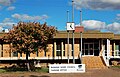
-
 Banana Shire Council offices, Taroom, 2014.JPG 1,920 × 1,080; 480 KB
-
 Baralaba Book Exchange October 2019.jpg 4,417 × 3,024; 2.55 MB
-
 Baralaba café October 2019.jpg 4,325 × 2,763; 1.91 MB
-
 Baralaba Catholic Church October 2019.jpg 3,797 × 2,769; 1.93 MB
-
 Baralaba Clock October 2019.jpg 1,827 × 2,351; 1.7 MB
-
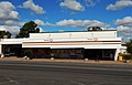
 Baralaba Hotel October 2014.jpg 2,893 × 1,964; 954 KB
-
 Baralaba Hotel sign October 2014.jpg 3,735 × 2,692; 2 MB
-
 Baralaba News October 2014.jpg 4,414 × 3,024; 1.75 MB
-
 Baralaba Post Office Baralaba October 2019.jpg 4,081 × 2,581; 1.75 MB
-
 Baralaba State School emblem October 2019.jpg 4,136 × 2,618; 1.47 MB
-
 Baralaba State School October 2019.jpg 4,571 × 3,009; 3.51 MB
-
 Baralaba State School sign October 2019.jpg 4,135 × 2,613; 2.12 MB
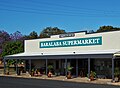
-
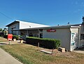
 Baralaba Supermarket and Newsagency October 2019.jpg 3,965 × 2,490; 1.61 MB
-
 Baralaba Supermarket October 2019.jpg 3,975 × 2,688; 1.28 MB
-
 Base of Taroom Leichhardt Tree September 2019.jpg 4,055 × 2,598; 2.44 MB
-
 Corey Oates in Baralaba January 2017.jpg 3,366 × 3,363; 2.84 MB
-
 L Major & Co store Baralaba October 2014.jpg 4,073 × 2,785; 1.76 MB
-
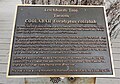
 Plaque on Leichhardt Tree Taroom September 2019.jpg 4,333 × 2,793; 2.32 MB
-
 Police station in Taroom 2 June 2014.jpg 4,406 × 2,978; 2.83 MB
-
 Post office in Baralaba October 2019.jpg 3,956 × 3,005; 1.91 MB
-
 Post office in Taroom June 2014.jpg 3,646 × 2,668; 2.07 MB
-
 St Patrick's Catholic Church in Baralaba October 2019.jpg 4,590 × 3,069; 2.44 MB
-
 StateLibQld 1 105260 Shire Council building, Rannes, ca. 1930.jpg 1,000 × 568; 74 KB
-
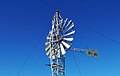 Steel Wings Taroom June 2014.jpg 2,610 × 1,645; 618 KB
-
 Supermarket in Baralaba October 2019.jpg 3,829 × 2,806; 1.46 MB
-
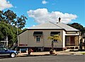
 Taroom Banana Shire office June 2014.jpg 4,182 × 2,682; 2.21 MB
-
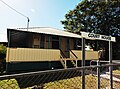 Taroom Court House June 2014.jpg 3,809 × 2,815; 2.04 MB
-
 Taroom FoodWorks June 2014.jpg 4,136 × 2,691; 2.01 MB
-
 Taroom IGA June 2014.jpg 2,745 × 1,763; 725 KB
-
 Taroom Leichhardt Hotel June 2014.jpg 2,960 × 1,964; 1.31 MB
-
 Taroom Leichhardt Hotel verandah June 2014.jpg 3,365 × 2,019; 1.14 MB
-
 Taroom Leichhardt Tree info board September 2019.jpg 4,441 × 3,105; 3.18 MB
-
 Taroom Leichhardt Tree September 2019.jpg 4,605 × 3,422; 4.46 MB
-
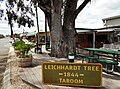 Taroom Leichhardt Tree sign September 2019.jpg 4,317 × 3,203; 2.77 MB
-
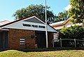
 Taroom Police Station June 2014.jpg 3,812 × 2,644; 1.94 MB
-
 Taroom Post Office June 2014.jpg 3,848 × 2,517; 1.75 MB
-
 Taroom Steel Wings Windmill June 2014.jpg 4,030 × 2,740; 1.98 MB
-
 Taroom True Value Hardware June 2014.jpg 4,474 × 3,271; 1.96 MB
-
 Uniting Church in Baralaba October 2019.jpg 2,793 × 1,732; 1.1 MB
-
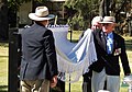 Unveiling of new Taroom War Memorial August 2019.jpg 3,902 × 2,720; 1.72 MB
-
 Waterskiing at Baralaba January 2017.jpg 3,855 × 2,395; 4.35 MB
-
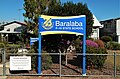
 Welcome to Baralaba sign October 2014.jpg 4,565 × 2,900; 3.25 MB
-
 Welcome to Taroom sign June 2014.jpg 4,445 × 2,917; 3.51 MB


