Category:Singel 157, Amsterdam
Jump to navigation
Jump to search
| Object location | | View all coordinates using: OpenStreetMap |
|---|
 | |||||
| Upload media | |||||
| Instance of |
| ||||
|---|---|---|---|---|---|
| Location | Amsterdam, North Holland, Netherlands | ||||
| Street address |
| ||||
| Located on street | |||||
| Heritage designation |
| ||||
 | |||||
|
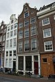
This is a category about rijksmonument number 5192
|
| Address |
|
Media in category "Singel 157, Amsterdam"
The following 8 files are in this category, out of 8 total.
-
 Amsterdam - Singel 157.JPG 3,056 × 4,592; 3.85 MB
-
 Amsterdam - Singel 159.JPG 3,056 × 4,592; 4.4 MB
-
 Amsterdam - Torensteeg 8 - 8I.jpg 3,056 × 4,592; 4.17 MB
-

-
 Cornelis Willem Jacob Schorteldoek (1887-1944), Afb ANWE00361000020.jpg 2,067 × 2,591; 621 KB
-
 Gevels - Amsterdam - 20020889 - RCE.jpg 793 × 1,200; 210 KB
-
 Gevels - Amsterdam - 20020890 - RCE.jpg 805 × 1,200; 185 KB
-
 Stadsarchief Amsterdam, Afb 012000004210.jpg 2,136 × 2,811; 862 KB


_-_Amsterdam_-_20536113_-_RCE.jpg)
,_Afb_ANWE00361000020.jpg)


