Category:Sint-Petruskerk (De Panne)
Jump to navigation
Jump to search
| Object location | | View all coordinates using: OpenStreetMap |
|---|
|
This is a category about onroerend erfgoed number 16180
|
church in De Panne, Belgium  | |||||
| Upload media | |||||
| Instance of | |||||
|---|---|---|---|---|---|
| Dedicated to | |||||
| Location | De Panne, Arrondissement of Veurne, West Flanders, Flemish Region, Belgium | ||||
| Street address |
| ||||
| Heritage designation | |||||
 | |||||
Media in category "Sint-Petruskerk (De Panne)"
The following 10 files are in this category, out of 10 total.
-
 De Panne - Sint-Petruskerk 1.jpg 1,728 × 2,304; 1.47 MB
-
 De Panne - Sint-Petruskerk 2.jpg 1,728 × 2,304; 1.6 MB
-
 De Panne St.-Pieterskerk M.A.Tibbaut.JPG 2,456 × 1,712; 1.14 MB
-
 Kusttram in De Panne vor der Sint Pieterskerk.JPG 3,488 × 2,616; 2.17 MB
-
 Sint Pieterskerk, De Panne - 2.JPG 3,488 × 2,616; 2.25 MB
-
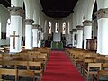 Sint Pieterskerk, De Panne, Mittelschiff, Blick aud den Altar.JPG 3,488 × 2,616; 2.23 MB
-
 Sint Pieterskerk, De Panne, Namensschild.JPG 3,488 × 2,616; 2.18 MB
-
 Sint Pieterskerk, De Panne.JPG 2,616 × 3,488; 2.09 MB
-
 De Panne - Driedaagse van De Panne-Koksijde, etappe 1, 31 maart 2015, vertrek (B39).JPG 3,888 × 4,528; 6.16 MB
-
 De Panne - Driedaagse van De Panne-Koksijde, etappe 3b, 2 april 2015 (D10).JPG 5,184 × 3,444; 7.19 MB


.JPG)
.JPG)