Category:Sint Antoniesbreestraat 1, Amsterdam
Jump to navigation
Jump to search
| Object location | | View all coordinates using: OpenStreetMap |
|---|
.jpg) | |||||
| Upload media | |||||
| Instance of |
| ||||
|---|---|---|---|---|---|
| Location | Amsterdam, North Holland, Netherlands | ||||
| Street address |
| ||||
| Located on street | |||||
| Heritage designation |
| ||||
| Inception |
| ||||
 | |||||
|
This is a category about rijksmonument number 5430
|
| Address |
|
Media in category "Sint Antoniesbreestraat 1, Amsterdam"
The following 5 files are in this category, out of 5 total.
-
 Stadsarchief Amsterdam, Afb 012000005249.jpg 1,488 × 1,932; 361 KB
-
 Stadsarchief Amsterdam, Afb 012000005252.jpg 1,486 × 2,108; 437 KB
-
 Nieuwmarkt en Lastage, Amsterdam, Netherlands - panoramio (44).jpg 4,896 × 3,264; 4.97 MB
-
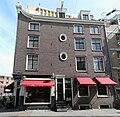 Sint Antoniesbreestraat 1 - Amsterdam.jpg 3,091 × 3,011; 2.13 MB
-
 Sint Antoniebreestraat 1 from Sint Antoniebreestraat.jpg 2,304 × 1,728; 1.08 MB


