Category:Skerryvore
Gaan na navigasie
Gaan na soektog
| Objekligging | | View all coordinates using: OpenStreetMap |
|---|
English: Skerryvore
remote reef off the west coast of Scotland, south-west of the island of Tiree  | |||||
| Laai media op | |||||
| Is 'n | |||||
|---|---|---|---|---|---|
| Onderdeel van | |||||
| Ligging |
| ||||
| Geleë in of aan waterliggaam | |||||
| Width |
| ||||
| Lengte |
| ||||
| Bevolking |
| ||||
 | |||||
Subkategorieë
Hierdie kategorie bevat slegs die volgende subkategorie.
S
- Skerryvore Lighthouse (12 F)
Media in kategorie "Skerryvore"
Die volgende 7 lêers is in hierdie kategorie, uit 'n totaal van 7.
-
 Hynish signal.jpg 422 × 596; 213 KG
-
 Hynish, Isle of Tiree - Pier - geograph.org.uk - 89483.jpg 640 × 480; 110 KG
-
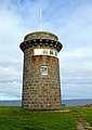
 Skerryvore lighthouse - former barracks (geograph 6888669).jpg 1 372 × 1 000; 876 KG
-

-
 Skerryvore, Costa del Folk, Portugal, October 2016 (30141292442).jpg 4 530 × 3 020; 1,47 MG
-
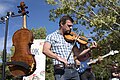 Skerryvore, Costa del Folk, Portugal, October 2016 (30171149361).jpg 4 530 × 3 020; 841 KG
-
 Westbourne, Skerryvore lighthouse replica - geograph.org.uk - 483862.jpg 429 × 640; 126 KG


.jpg)

.jpg)
.jpg)
