Category:Smeeton Westerby
Jump to navigation
Jump to search
English: Smeeton Westerby is a village located approximately 9 miles south east from Leicester. Originally Smeeton and Westerby were two separate hamlets, but they merged some time ago to become the village that it is today.
human settlement in United Kingdom  | |||||
| Upload media | |||||
| Instance of | |||||
|---|---|---|---|---|---|
| Location | Harborough, Leicestershire, East Midlands, England | ||||
| Population |
| ||||
| Area |
| ||||
 | |||||
Media in category "Smeeton Westerby"
The following 200 files are in this category, out of 218 total.
(previous page) (next page)-
 A field of sheep north of the Grand Union Canal - geograph.org.uk - 4091562.jpg 1,600 × 1,048; 440 KB
-
 A meander in Saddington Brook - geograph.org.uk - 4091368.jpg 1,600 × 1,093; 530 KB
-
 A very muddy Debdale Lane - geograph.org.uk - 3388063.jpg 4,000 × 3,000; 3.35 MB
-
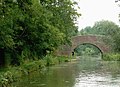
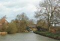
 Binley's Bridge - geograph.org.uk - 417918.jpg 640 × 427; 122 KB
-
 Binley's Bridge along the Grand Union Canal - geograph.org.uk - 3795803.jpg 1,600 × 1,325; 795 KB
-
 Binley's Bridge along the Grand Union Canal - geograph.org.uk - 3795813.jpg 1,600 × 1,175; 772 KB
-

-
-
 Binleys Bridge Farm and Debdale Lane - geograph.org.uk - 3388058.jpg 4,000 × 3,000; 3.66 MB
-
 Boat Lift at Debdale Wharf - geograph.org.uk - 2488613.jpg 640 × 480; 114 KB
-
 Boat on the Grand Union Canal - geograph.org.uk - 2496057.jpg 640 × 480; 165 KB
-
 Bridge 71 crossing the Grand Union Canal - geograph.org.uk - 4091495.jpg 1,600 × 1,186; 433 KB
-

-
 Bridge No 68 south of Kibworth Beauchamp, Leicestershire - geograph.org.uk - 3653634.jpg 1,024 × 1,024; 582 KB
-

-
 Bridge no 68, from the west - geograph.org.uk - 6159588.jpg 1,946 × 1,460; 1.48 MB
-

-

-
 Bridge over the Grand Union Canal - geograph.org.uk - 4997346.jpg 640 × 480; 118 KB
-
 Bridge over the Grand Union Canal - geograph.org.uk - 4997349.jpg 640 × 480; 103 KB
-
 Canal boat moored along the Grand Union Canal - geograph.org.uk - 4091698.jpg 1,600 × 1,298; 562 KB
-

-

-

-
-
 Christ Church in Smeeton Westerby - geograph.org.uk - 3796452.jpg 1,600 × 1,366; 670 KB
-
 Deacon's Farm near Smeeton Westerby - geograph.org.uk - 4091579.jpg 1,600 × 1,200; 587 KB
-
 Debdale Grange overlooking the Grand Union Canal - geograph.org.uk - 3795815.jpg 1,600 × 1,200; 441 KB
-
 Debdale Grange, from the Grand Union Canal - geograph.org.uk - 5553760.jpg 1,024 × 768; 224 KB
-
 Debdale Lane - geograph.org.uk - 2494139.jpg 640 × 480; 137 KB
-
 Debdale Lane - geograph.org.uk - 3386976.jpg 2,893 × 2,186; 1.81 MB
-
 Debdale Lane - geograph.org.uk - 4997330.jpg 480 × 640; 56 KB
-
 Debdale Lane - geograph.org.uk - 4997332.jpg 480 × 640; 78 KB
-
 Debdale Lane - geograph.org.uk - 5287699.jpg 480 × 640; 66 KB
-
 Debdale Lane - geograph.org.uk - 5287700.jpg 480 × 640; 81 KB
-
 Debdale Lane and Debdale Wharf farmhouse - geograph.org.uk - 3387998.jpg 4,000 × 3,000; 3.48 MB
-
 Debdale Lane at Binleys Bridge Farm - geograph.org.uk - 3388073.jpg 3,248 × 2,420; 2.38 MB
-
 Debdale Lane at Fourways Farm - geograph.org.uk - 3388113.jpg 4,000 × 3,000; 3.4 MB
-
 Debdale Lane in Smeeton Westerby - geograph.org.uk - 3388115.jpg 4,000 × 3,000; 3.52 MB
-
 Debdale Lane near Debdale Wharf - geograph.org.uk - 3387528.jpg 4,000 × 3,000; 3.43 MB
-
 Debdale Lane near Fourways Farm - geograph.org.uk - 3388102.jpg 3,321 × 2,197; 2.3 MB
-
 Debdale Lane towards Smeeton Westerby - geograph.org.uk - 3388012.jpg 4,000 × 3,000; 3.63 MB
-
 Debdale Lane, Smeeton Westerby - geograph.org.uk - 4618285.jpg 1,280 × 851; 294 KB
-
 Debdale Wharf - geograph.org.uk - 4616369.jpg 1,280 × 851; 384 KB
-
 Debdale Wharf Bridge - geograph.org.uk - 3387534.jpg 4,000 × 3,000; 3.38 MB
-

-
 Debdale Wharf Bridge, Grand Union Canal - geograph.org.uk - 4618257.jpg 1,280 × 851; 380 KB
-
 Debdale Wharf Bridge, number 65, Grand Union Canal - geograph.org.uk - 4781306.jpg 2,000 × 1,347; 318 KB
-
 East of Binley's Bridge (no 67) - geograph.org.uk - 6159601.jpg 1,703 × 1,277; 958 KB
-
 Electricity pylons along Debdale Lane - geograph.org.uk - 3388041.jpg 4,000 × 3,000; 3.25 MB
-
 Electricity pylons near Debdale Wharf - geograph.org.uk - 3388050.jpg 2,252 × 1,692; 936 KB
-
 Farmland below (north of) Smeeton Hill - geograph.org.uk - 5559156.jpg 1,024 × 768; 187 KB
-
 Farmland near Binleys Bridge Farm - geograph.org.uk - 3388045.jpg 2,430 × 1,692; 876 KB
-
 Farmland near the Grand Union Canal - geograph.org.uk - 4091386.jpg 1,600 × 1,200; 646 KB
-

-
 Fat narrowboat moored west of Debdale Wharf - geograph.org.uk - 6159605.jpg 1,600 × 1,200; 454 KB
-
 Feeder channel from Saddington Reservoir - geograph.org.uk - 5559173.jpg 1,024 × 768; 168 KB
-
 Feeder channel joins the canal - geograph.org.uk - 4091378.jpg 1,600 × 1,200; 649 KB
-
 Field near Debdale Wharf - geograph.org.uk - 2496059.jpg 640 × 480; 91 KB
-
 Fields along the A6 Harborough Road - geograph.org.uk - 3794069.jpg 1,600 × 1,321; 637 KB
-
 Fields on the southern edge of Smeeton Westerby - geograph.org.uk - 4091676.jpg 1,600 × 1,233; 422 KB
-
 Footbridge 68 and the Grand Union Canal - geograph.org.uk - 3795821.jpg 1,333 × 1,600; 666 KB
-
 Footbridge No 68 crossing the Grand Union Canal - geograph.org.uk - 3795820.jpg 1,600 × 1,302; 700 KB
-
 Footpath to Debdale Lane and Beauchamp Farm - geograph.org.uk - 3388079.jpg 3,329 × 2,372; 2.54 MB
-
 Footpath to Smeeton Westerby - geograph.org.uk - 4997325.jpg 480 × 640; 74 KB
-
 Footpath to Smeeton Westerby - geograph.org.uk - 4997326.jpg 480 × 640; 103 KB
-
 Footpath to Smeeton Westerby - geograph.org.uk - 4997328.jpg 640 × 480; 55 KB
-
 Footpath to Smeeton Westerby - geograph.org.uk - 4997334.jpg 480 × 640; 56 KB
-

-
 Fourways Farm near Smeeton Westerby - geograph.org.uk - 3388092.jpg 3,310 × 2,240; 1.71 MB
-
 Full Sun - geograph.org.uk - 2300383.jpg 546 × 800; 108 KB
-
 Gate along Debdale Lane - geograph.org.uk - 3388002.jpg 4,000 × 3,000; 3.43 MB
-
 Gate along Debdale Lane - geograph.org.uk - 3388054.jpg 2,776 × 1,902; 1.68 MB
-
 Gated road - junction with A6 - geograph.org.uk - 5287705.jpg 480 × 640; 86 KB
-
 Grand Union Canal - Bend - geograph.org.uk - 2300328.jpg 800 × 531; 113 KB
-
 Grand Union Canal - Bend - geograph.org.uk - 2300357.jpg 800 × 531; 182 KB
-
-
 Grand Union Canal - Binley's Bridge - geograph.org.uk - 2300453.jpg 800 × 531; 135 KB
-
 Grand Union Canal - Bridge 68 - geograph.org.uk - 2300417.jpg 800 × 531; 195 KB
-
 Grand Union Canal - Bridge 68 - geograph.org.uk - 2300419.jpg 800 × 531; 198 KB
-
 Grand Union Canal - Bridge 71 - geograph.org.uk - 2300354.jpg 800 × 531; 192 KB
-
 Grand Union Canal - Curve - geograph.org.uk - 2300474.jpg 800 × 531; 169 KB
-
 Grand Union Canal - Curves - geograph.org.uk - 2300346.jpg 800 × 531; 77 KB
-
 Grand Union Canal - Curves - geograph.org.uk - 2300351.jpg 800 × 531; 116 KB
-
 Grand Union Canal - geograph.org.uk - 167567.jpg 640 × 480; 68 KB
-
 Grand Union Canal - geograph.org.uk - 167582.jpg 640 × 480; 77 KB
-
 Grand Union Canal - geograph.org.uk - 2300361.jpg 800 × 531; 117 KB
-
 Grand Union Canal - geograph.org.uk - 2300378.jpg 800 × 531; 158 KB
-
 Grand Union Canal - geograph.org.uk - 2300414.jpg 800 × 531; 94 KB
-
 Grand Union Canal - geograph.org.uk - 2300433.jpg 800 × 531; 176 KB
-
 Grand Union Canal - geograph.org.uk - 2300437.jpg 800 × 531; 141 KB
-
 Grand Union Canal - geograph.org.uk - 2300456.jpg 800 × 531; 151 KB
-
 Grand Union Canal - geograph.org.uk - 2300460.jpg 800 × 531; 142 KB
-
 Grand Union Canal - geograph.org.uk - 2300467.jpg 800 × 531; 115 KB
-
 Grand Union Canal - geograph.org.uk - 2496058.jpg 640 × 480; 116 KB
-
 Grand Union Canal - Gumley Bridge - geograph.org.uk - 2300386.jpg 800 × 531; 149 KB
-
 Grand Union Canal - Hill - geograph.org.uk - 2300448.jpg 800 × 531; 63 KB
-
 Grand Union Canal - Hill - geograph.org.uk - 2300463.jpg 800 × 531; 78 KB
-
 Grand Union Canal - Long Hill Bridge - geograph.org.uk - 2300367.jpg 800 × 531; 124 KB
-
 Grand Union Canal - Narrow Boat - geograph.org.uk - 2300390.jpg 800 × 531; 95 KB
-
 Grand Union Canal - Near Binley's Bridge - geograph.org.uk - 2300451.jpg 800 × 531; 204 KB
-
 Grand Union Canal - Smeeton Aqueduct - geograph.org.uk - 2300342.jpg 800 × 531; 87 KB
-
 Grand Union Canal - View from bridge 68 - geograph.org.uk - 2300432.jpg 800 × 531; 170 KB
-

-

-
 Grand Union Canal near Debdale Wharf - geograph.org.uk - 3795793.jpg 1,600 × 1,335; 654 KB
-
 Grand Union Canal near Gumley Bridge - geograph.org.uk - 3796028.jpg 1,600 × 1,198; 562 KB
-

-

-

-

-

-

-

-

-

-

-

-

-

-

-

-
 Grand Union Canal Towpath - geograph.org.uk - 4997353.jpg 640 × 480; 76 KB
-
 Grand Union Canal Towpath - geograph.org.uk - 4997356.jpg 640 × 480; 59 KB
-
 Grand Union Canal Towpath - geograph.org.uk - 4997357.jpg 640 × 480; 93 KB
-
 Grand Union Canal Towpath - geograph.org.uk - 4997358.jpg 640 × 480; 76 KB
-
 Grand Union Canal Towpath - geograph.org.uk - 4997359.jpg 640 × 480; 117 KB
-
 Grand Union Canal Towpath - geograph.org.uk - 4997361.jpg 640 × 480; 81 KB
-
 Grand Union Canal Towpath - geograph.org.uk - 4997362.jpg 640 × 480; 97 KB
-
 Grand Union Canal Towpath - geograph.org.uk - 4997364.jpg 640 × 480; 108 KB
-
 Grand Union Canal Towpath - geograph.org.uk - 4997366.jpg 640 × 480; 58 KB
-
 Grand Union Canal Towpath - geograph.org.uk - 4997367.jpg 640 × 480; 109 KB
-
 Grazing sheep near Debdale Wharf - geograph.org.uk - 3388020.jpg 4,000 × 3,000; 3.43 MB
-
 Gumley Bridge crossing the Grand Union Canal - geograph.org.uk - 3796040.jpg 1,600 × 1,252; 546 KB
-

-
 Gumley Road descending towards Langton Brook - geograph.org.uk - 3796435.jpg 1,600 × 1,256; 619 KB
-
 Gumley Road in Smeeton Westerby - geograph.org.uk - 3796428.jpg 1,600 × 1,107; 513 KB
-
 Gumley Road towards Smeeton Westerby - geograph.org.uk - 3796046.jpg 1,600 × 1,370; 433 KB
-
 Hillcote Farm in Saddington - geograph.org.uk - 4091403.jpg 1,600 × 1,130; 465 KB
-
 Horse jumps, near Debdale Grange - geograph.org.uk - 5559142.jpg 1,024 × 768; 179 KB
-
 Kiboko a canal boat on the Grand Union - geograph.org.uk - 4246161.jpg 1,600 × 1,200; 448 KB
-
 Lambs near Debdale Lane - geograph.org.uk - 3388096.jpg 982 × 762; 327 KB
-
 Lambs near Debdale Wharf - geograph.org.uk - 3388017.jpg 2,207 × 1,788; 1.28 MB
-
 Langton Brook - geograph.org.uk - 3388105.jpg 3,530 × 2,684; 3 MB
-
 Leicester arm of the Grand Union Canal - geograph.org.uk - 5621209.jpg 3,546 × 2,391; 671 KB
-

-
 Leicestershire Countryside - geograph.org.uk - 2300422.jpg 800 × 531; 64 KB
-
 Long Hill Bridge, Grand Union Canal - geograph.org.uk - 4616390.jpg 1,280 × 851; 344 KB
-

-
 Main Street, Smeeton Westerby - geograph.org.uk - 4618607.jpg 1,280 × 851; 266 KB
-
 Main Street, Smeeton Westerby - geograph.org.uk - 589706.jpg 640 × 398; 94 KB
-
 Main Street, Smeeton Westerby - geograph.org.uk - 589710.jpg 640 × 366; 101 KB
-
 March Hare - geograph.org.uk - 2300442.jpg 800 × 531; 163 KB
-

-
 Meeting at Binley's Bridge (no 67) - geograph.org.uk - 6159597.jpg 1,555 × 1,166; 762 KB
-
 Mill Lane - geograph.org.uk - 4998196.jpg 640 × 480; 125 KB
-
 Mill Lane - geograph.org.uk - 4998198.jpg 640 × 480; 113 KB
-
 Muddy towpath along the Grand Union Canal - geograph.org.uk - 3795810.jpg 1,600 × 1,200; 643 KB
-
 Narrowboat moored in Saddington feeder channel - geograph.org.uk - 5559406.jpg 1,024 × 768; 176 KB
-
 Narrowboat outside Debdale Wharf Marina - geograph.org.uk - 2488620.jpg 640 × 480; 113 KB
-
 Narrowboats along the Grand Union Canal - geograph.org.uk - 4091416.jpg 1,600 × 1,200; 923 KB
-
 New houses at Binleys Bridge Farm - geograph.org.uk - 3388070.jpg 4,000 × 3,000; 3.92 MB
-
 Path along the edge of a small wood - geograph.org.uk - 4089336.jpg 1,600 × 1,200; 835 KB
-
 Pile of rubble in a waterlogged field - geograph.org.uk - 4089364.jpg 1,600 × 1,200; 548 KB
-
 Public footpath to the Grand Union Canal - geograph.org.uk - 4089356.jpg 1,600 × 1,200; 537 KB
-
 Saddington Reservoir view - geograph.org.uk - 4523735.jpg 640 × 480; 63 KB
-
 Seat along the Grand Union Canal - geograph.org.uk - 3795798.jpg 1,600 × 1,200; 630 KB
-
 Sheep pasture along Gumley Road - geograph.org.uk - 3796087.jpg 1,600 × 1,101; 269 KB
-
 Sheep pasture near Smeeton Westerby - geograph.org.uk - 4618230.jpg 1,280 × 851; 249 KB
-
 Sign along the A6 Harborough Road - geograph.org.uk - 3794048.jpg 1,600 × 1,111; 531 KB
-

-
 Smeeton Hill near Saddington Reservoir - geograph.org.uk - 2888691.jpg 3,264 × 2,448; 3.14 MB
-
 Smeeton Road Bridge, Leicestershire - geograph.org.uk - 417696.jpg 607 × 640; 145 KB
-
 Smeeton Westerby Leicestershire - geograph.org.uk - 617614.jpg 640 × 384; 92 KB
-
 Smeeton Westerby Village Hall - geograph.org.uk - 4618609.jpg 1,280 × 851; 310 KB
-
 Smeeton Westerby.jpg 1,114 × 1,664; 687 KB
-
 The canal south-east from Smeeton aqueduct - geograph.org.uk - 5559401.jpg 1,024 × 768; 149 KB
-
 Tow path of the Grand Union Canal - geograph.org.uk - 4091689.jpg 1,600 × 1,343; 795 KB
-
 Towards Kibworth - geograph.org.uk - 4998199.jpg 640 × 480; 49 KB
-
 Towards Kibworth - geograph.org.uk - 4998202.jpg 640 × 480; 56 KB
-
 Towards Kibworth - geograph.org.uk - 4998203.jpg 640 × 480; 50 KB
-
 Towards Mill Lane - geograph.org.uk - 4998188.jpg 640 × 480; 47 KB
-
 Towards Mill Lane - geograph.org.uk - 4998191.jpg 640 × 480; 45 KB
-
 Towards Mill Lane - geograph.org.uk - 4998192.jpg 640 × 480; 64 KB
-
 Towards Mill Lane - geograph.org.uk - 4998193.jpg 640 × 480; 58 KB
-
 Towards the Grand Union Canal - geograph.org.uk - 4997336.jpg 640 × 480; 66 KB
-
 Towards the Grand Union Canal - geograph.org.uk - 4997338.jpg 640 × 480; 54 KB
-
 Towards the Grand Union Canal - geograph.org.uk - 4997340.jpg 640 × 480; 68 KB
-
 Towards the Grand Union Canal - geograph.org.uk - 4997342.jpg 640 × 480; 57 KB
-
 Track to Smeeton Westerby - geograph.org.uk - 3387541.jpg 4,000 × 2,557; 3.02 MB
-
 Track to Smeeton Westerby - geograph.org.uk - 4618207.jpg 1,280 × 851; 275 KB
-
 Trees along Debdale Lane - geograph.org.uk - 3388086.jpg 3,651 × 2,645; 3.33 MB
-
 Trees on a field boundary, below Debdale Lane - geograph.org.uk - 6159592.jpg 1,719 × 1,289; 830 KB
-
 View from Smeeton Hill - geograph.org.uk - 4537715.jpg 640 × 480; 65 KB
-
 View from Smeeton Hill - geograph.org.uk - 4537717.jpg 640 × 480; 68 KB
-
 View from Smeeton Hill - geograph.org.uk - 4537720.jpg 640 × 480; 55 KB
-
 View from Smeeton Hill - geograph.org.uk - 4537721.jpg 640 × 480; 55 KB
-
 View from Smeeton Hill - geograph.org.uk - 4537724.jpg 640 × 480; 44 KB
-
 View from the canal - geograph.org.uk - 2300471.jpg 800 × 531; 81 KB
-
 Waterlogged grassland near Saddington Brook - geograph.org.uk - 4091354.jpg 1,600 × 1,297; 678 KB


_-_geograph.org.uk_-_6159601.jpg)


_Smeeton_Hill_-_geograph.org.uk_-_5559156.jpg)


_the_Grand_Union_Canal_-_geograph.org.uk_-_5553750.jpg)


_-_geograph.org.uk_-_6159597.jpg)


