Category:Snowfall of January 2013 in Merseyside
Jump to navigation
Jump to search
Media in category "Snowfall of January 2013 in Merseyside"
The following 86 files are in this category, out of 86 total.
-
 Alleyway, Green Lane, Wallasey.JPG 4,320 × 3,240; 3.61 MB
-
 Bayswater Road, Wallasey.JPG 4,320 × 3,240; 3.06 MB
-
 Bethany Chapel, Holmlands Drive, Prenton.JPG 4,320 × 3,240; 3 MB
-
 Brancote Road, Oxton (1).JPG 4,320 × 3,240; 3.39 MB
-
 Brancote Road, Oxton (2).JPG 4,320 × 3,240; 3.46 MB
-
 Brancote Road, Oxton (3).JPG 4,320 × 3,240; 4.32 MB
-
 Bungalows on Rock Lane West, Rock Ferry.JPG 4,320 × 3,240; 3.09 MB
-
 Cornwall Drive, Prenton.JPG 4,320 × 3,240; 3.37 MB
-
 DENCO extension, Birkenhead.JPG 4,320 × 3,240; 4.06 MB
-
 Egerton Street, New Brighton (1).JPG 4,320 × 3,240; 4.44 MB
-
 Egerton Street, New Brighton (2).JPG 4,320 × 3,240; 3.12 MB
-
 Family Circle Luncheon Club building, Highfield Road, Rock Ferry.JPG 4,320 × 3,240; 2.93 MB
-
 Flats near Mockbeggar Wharf, Wallasey.JPG 4,320 × 3,240; 2.82 MB
-
 Gothic Street, Rock Ferry (1).JPG 4,320 × 3,240; 3.18 MB
-
 Gothic Street, Rock Ferry (2).JPG 4,320 × 3,240; 2.67 MB
-
 Green space, Bayswater Road, Wallasey.JPG 4,320 × 3,240; 3.55 MB
-
 Hanover Close, Oxton (1).JPG 4,320 × 3,240; 4.44 MB
-
 Hanover Close, Oxton (2).JPG 4,320 × 3,240; 4.56 MB
-
 Highfield Church, Rock Ferry (1).JPG 3,240 × 4,320; 4.33 MB
-
 Hill Road Allotments, Birkenhead (1).JPG 4,320 × 3,240; 2.8 MB
-
 Hill Road Allotments, Birkenhead (2).JPG 4,320 × 3,240; 3.31 MB
-
 Holy Family Convent, Highfield Road, Rock Ferry.JPG 4,320 × 3,240; 2.56 MB
-
 Icebreaker operations on the Model Boating Lake at New Brighton.JPG 4,320 × 3,240; 3.56 MB
-
 Ingestre Road, Oxton.JPG 4,320 × 3,240; 4.58 MB
-
 Ionic Street, Rock Ferry.JPG 4,320 × 3,240; 2.97 MB
-
 Lees Avenue, Rock Ferry (1).JPG 4,320 × 3,240; 3.42 MB
-
 Lees Avenue, Rock Ferry (2).JPG 4,320 × 3,240; 3.24 MB
-
 LIDL Supermarket, St Paul's Road, Rock Ferry.JPG 4,320 × 3,240; 2.82 MB
-
 Local Amenities, Old Chester Road, Rock Ferry.JPG 4,320 × 3,240; 3.56 MB
-
 Looking towards Mersey Park, Tranmere in January (1).JPG 4,320 × 3,240; 4.42 MB
-
 Looking towards Mersey Park, Tranmere in January (2).JPG 4,320 × 3,240; 3.99 MB
-
 Mersey Park Primary School (rear view).JPG 4,320 × 3,240; 2.74 MB
-
 Mersey Park Primary School (side view).JPG 4,320 × 3,240; 2.85 MB
-
 Mossley Road, Tranmere.JPG 4,320 × 3,240; 2.5 MB
-
 Mount Road, Prenton.JPG 4,320 × 3,240; 3.65 MB
-
 Mountwood Road, Prenton.JPG 4,320 × 3,240; 5.46 MB
-
 New apartments near Rock Ferry station.JPG 4,320 × 3,240; 3.52 MB
-
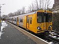
 New Brighton railway station - 2013-01-20 (1).JPG 4,320 × 3,240; 3.06 MB
-
 New Brighton railway station - 2013-01-20 (2).JPG 4,320 × 3,240; 3.47 MB
-
 New Brighton railway station - 2013-01-20 (3).JPG 4,320 × 3,240; 3.06 MB
-
 New Brighton railway station - 2013-01-20 (4).JPG 4,320 × 3,240; 2.91 MB
-
 New Brighton railway station - 2013-01-20 (5).JPG 4,320 × 3,240; 3.74 MB
-
 New Brighton railway station - 2013-01-20 (6).JPG 4,320 × 3,240; 3.41 MB
-
 Northcote Road, Wallasey (1).JPG 4,320 × 3,240; 3.3 MB
-
 Northcote Road, Wallasey (2).JPG 4,320 × 3,240; 3.17 MB
-
 Pier House, New Brighton (1).JPG 4,320 × 3,240; 3.02 MB
-
 Pier House, New Brighton (2).JPG 4,320 × 3,240; 3 MB
-
 Pier House, New Brighton (3).JPG 4,320 × 3,240; 3.08 MB
-
 Prenton Dell shops - 2013-01-26.JPG 4,320 × 3,240; 3.95 MB
-
 Prenton War Memorial (1).JPG 3,240 × 4,320; 3.83 MB
-
 Prenton War Memorial (2).JPG 3,240 × 4,320; 5.74 MB
-
 Prenton War Memorial (3).JPG 3,240 × 4,320; 3.91 MB
-
 Rock Ferry Primary School (1).JPG 4,320 × 3,240; 3.09 MB
-
 Rock Ferry telephone exchange (1).JPG 4,320 × 3,240; 3.64 MB
-
 Rock Ferry telephone exchange (2).JPG 4,320 × 3,240; 4.8 MB
-
 Rock Ferry telephone exchange (3).JPG 4,320 × 3,240; 4.85 MB
-
 Rock Lane West, Rock Ferry (1).JPG 4,320 × 3,240; 3.67 MB
-
 Rosedale Road, Tranmere.JPG 4,320 × 3,240; 2.7 MB
-
 Shakespeare Avenue, Rock Ferry (1).JPG 4,320 × 3,240; 2.76 MB
-
 Shakespeare Avenue, Rock Ferry (2).JPG 4,320 × 3,240; 2.83 MB
-
 St Anne's Catholic Church, Highfield Road, Rock Ferry (1).JPG 4,320 × 3,240; 3.4 MB
-
 St Anne's Social Club, Highfield Road, Rock Ferry.JPG 4,320 × 3,240; 3.38 MB
-
 St Paul's Road Mission Church, Rock Ferry.JPG 4,320 × 3,240; 3.09 MB
-
 Summer Fields Care Home, Rock Ferry.JPG 4,320 × 3,240; 3.4 MB
-
 The Dell pub, Prenton (2).JPG 4,320 × 3,240; 3.41 MB
-
 The Dell pub, Prenton (3).JPG 4,320 × 3,240; 3.34 MB
-
 The Dips, New Brighton in January.JPG 4,320 × 3,240; 3.86 MB
-
 The Little Arno, Oxton - 2013-01-26 (1).JPG 4,320 × 3,240; 3.87 MB
-
 The Little Arno, Oxton - 2013-01-26 (2).JPG 4,320 × 3,240; 3.56 MB
-
 The Tower Grounds, New Brighton (1).JPG 4,320 × 3,240; 5.04 MB
-
 The Tower Grounds, New Brighton (2).JPG 4,320 × 3,240; 5.03 MB
-
 The Tower Grounds, New Brighton (3).JPG 4,320 × 3,240; 4.9 MB
-
 The Tower Grounds, New Brighton (4).JPG 3,240 × 4,320; 3.57 MB
-
 The Tower Grounds, New Brighton (5).JPG 4,320 × 3,240; 4.94 MB
-
 Thorsway, Rock Ferry (1).JPG 3,240 × 4,320; 5.12 MB
-
 Thorsway, Rock Ferry (2).JPG 3,240 × 4,320; 4.25 MB
-
 Trees on Town Road, Tranmere.JPG 3,240 × 4,320; 4.98 MB
-
 Ungated alleyway, Downham Road, Tranmere.JPG 4,320 × 3,240; 3.19 MB
-
 Unrestricted view from Greenway Road, Tranmere.JPG 4,320 × 3,240; 3.26 MB
-
 Viking Centre, Thorsway, Rock Ferry (1).JPG 4,320 × 3,240; 2.67 MB
-
 Viking Centre, Thorsway, Rock Ferry (2).JPG 4,320 × 3,240; 3 MB
-
 Viking Centre, Thorsway, Rock Ferry (3).JPG 4,320 × 3,240; 3.28 MB
-
 Viking Centre, Thorsway, Rock Ferry (4).JPG 4,320 × 3,240; 3.23 MB
-
 Viking Centre, Thorsway, Rock Ferry (5).JPG 4,320 × 3,240; 3.32 MB
-
 Walker Park, Prenton - 2013-01-26.JPG 4,320 × 3,240; 3.53 MB
-
 Well Lane Police Station, Rock Ferry (1).jpg 4,320 × 3,240; 3.48 MB


.JPG)
.JPG)
.JPG)


.JPG)
.JPG)


.JPG)
.JPG)

.JPG)
.JPG)
.JPG)
.JPG)
.JPG)


.JPG)
.JPG)


.JPG)
.JPG)
.JPG)
.JPG)


.JPG)
.JPG)
.JPG)
.JPG)
.JPG)
.JPG)
.JPG)
.JPG)
.JPG)
.JPG)
.JPG)

.JPG)
.JPG)
.JPG)
.JPG)
.JPG)
.JPG)
.JPG)
.JPG)

.JPG)
.JPG)
.JPG)


.JPG)
.JPG)

.JPG)
.JPG)
.JPG)
.JPG)
.JPG)
.JPG)
.JPG)
.JPG)
.JPG)


.JPG)
.JPG)
.JPG)
.JPG)
.JPG)

.jpg)