Category:Somerton, Somerset
Vai alla navigazione
Vai alla ricerca
town in Somerset, England  | |||||
| Carica un file multimediale | |||||
| Istanza di | |||||
|---|---|---|---|---|---|
| Luogo | South Somerset, Somerset, Sud Ovest dell'Inghilterra, Inghilterra | ||||
| Distinto da | |||||
| sito web ufficiale | |||||
 | |||||
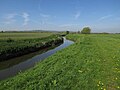
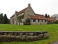
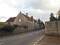
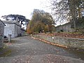
English: Somerton is a small town in South Somerset, England. It is situated on the River Cary, near Yeovil, Street and Glastonbury. Somerton has a wide market square surrounded by old stone houses and an octagonal, roofed Market Cross as a focal point at the centre.
Français : Somerton habitants.
Polski: Somerton - miasto w Wielkiej Brytanii, w Anglii w hrabstwie Somerset, nad rzeką Cary między Yeovil i Street. W centrum charakterystyczny ośmiokątny budynek Market Cross.
Română: Somerton este un oraş în comitatul Somerset, regiunea South West, Anglia. Oraşul se află în districtul South Somerset.
Sottocategorie
Questa categoria contiene le 8 sottocategorie indicate di seguito, su un totale di 8.
H
- Hext Almshouses (2 F)
L
M
O
- Old Town Hall, Somerton (3 F)
S
- Market Cross, Somerton, Somerset (12 F)
U
- Unicorn Hotel, Somerton (3 F)
Pagine nella categoria "Somerton, Somerset"
Questa categoria contiene un'unica pagina, indicata di seguito.
File nella categoria "Somerton, Somerset"
Questa categoria contiene 200 file, indicati di seguito, su un totale di 337.
(pagina precedente) (pagina successiva)-
 'Natural Meats', Butchers, West Street, Somerton - geograph.org.uk - 2167432.jpg 1 600 × 1 200; 438 KB
-
 2013 Morgan Plus 4.jpg 4 896 × 3 672; 7,15 MB
-

-
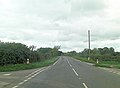
 A372 near Highbrooks Farm - geograph.org.uk - 5265116.jpg 1 024 × 787; 193 KB
-
 A372 passes The Lime Kiln Inn - geograph.org.uk - 4011541.jpg 3 537 × 2 578; 1 010 KB
-
 A372 west of Glenda Spooner Farm - geograph.org.uk - 4011564.jpg 3 648 × 2 736; 1,19 MB
-
 A372 west of Highbrooks Farm - geograph.org.uk - 4011553.jpg 3 552 × 2 601; 1,03 MB
-
 Approach to Somerton - geograph.org.uk - 2469479.jpg 640 × 480; 116 KB
-
 Approaching Somerton on the B3153 - geograph.org.uk - 5245450.jpg 1 024 × 746; 243 KB
-
 Approaching the railway Bridge on the B3153 - geograph.org.uk - 5377107.jpg 1 024 × 762; 227 KB
-
 Arable field near Somerton - geograph.org.uk - 1912384.jpg 640 × 480; 146 KB
-
 Ashen Cross - geograph.org.uk - 5265244.jpg 1 024 × 805; 136 KB
-
 Ashen Cross, Mill Lane - geograph.org.uk - 495933.jpg 640 × 480; 61 KB
-
 B3151 - geograph.org.uk - 5777759.jpg 640 × 426; 41 KB
-
 B3151 - geograph.org.uk - 5817847.jpg 1 024 × 851; 111 KB
-
 B3151 on Kingsdon Hill - geograph.org.uk - 5357537.jpg 1 024 × 768; 315 KB
-
 B3153 road nr Somerton - geograph.org.uk - 1805054.jpg 1 024 × 629; 169 KB
-
 B3153 road to Somerton - geograph.org.uk - 349362.jpg 640 × 480; 296 KB
-
 Badgers Cross Farm - geograph.org.uk - 5265753.jpg 1 024 × 786; 123 KB
-
 Bancombe Road - geograph.org.uk - 5356812.jpg 1 024 × 768; 204 KB
-
 Barbers, Somerton - geograph.org.uk - 1014436.jpg 451 × 640; 85 KB
-
 Bare field and water trough, Hurcot - geograph.org.uk - 5631896.jpg 1 024 × 768; 239 KB
-
 Barn at Hurcot - geograph.org.uk - 5631885.jpg 1 024 × 768; 155 KB
-
 Bench Mark, Market Place, Somerton - geograph.org.uk - 1913889.jpg 480 × 640; 163 KB
-
 Bend on Huish Road - geograph.org.uk - 5357530.jpg 1 024 × 776; 221 KB
-
 Bernard Stacey, Somerton - geograph.org.uk - 2483657.jpg 640 × 480; 134 KB
-
 Big Yellow digger - geograph.org.uk - 5552276.jpg 640 × 426; 75 KB
-
 Bradley Hill Lane - geograph.org.uk - 5986285.jpg 1 600 × 1 200; 405 KB
-
 Broad Street, Somerton - geograph.org.uk - 1961580.jpg 640 × 480; 308 KB
-
 Broad Street, Somerton - geograph.org.uk - 978321.jpg 640 × 428; 65 KB
-
 Bus stop on Langport Road - geograph.org.uk - 5245787.jpg 1 024 × 812; 161 KB
-
 By the Reading to Taunton Line - geograph.org.uk - 5552273.jpg 640 × 426; 81 KB
-
 Cartway Lane, Somerton - geograph.org.uk - 5245793.jpg 1 024 × 796; 132 KB
-
 Cary Valley - geograph.org.uk - 1589599.jpg 640 × 429; 57 KB
-
 Cary valley - geograph.org.uk - 4768697.jpg 2 492 × 1 204; 516 KB
-
 Cary Valley - geograph.org.uk - 5452729.jpg 640 × 426; 36 KB
-
 Cary View - geograph.org.uk - 5356404.jpg 1 024 × 801; 187 KB
-
 Catsgore Farm - geograph.org.uk - 5608678.jpg 1 024 × 768; 169 KB
-
 Catsgore Road - geograph.org.uk - 5608679.jpg 1 024 × 768; 166 KB
-
 Catsgore Road - geograph.org.uk - 5628825.jpg 640 × 427; 194 KB
-
 Catsgore, entrance sign - geograph.org.uk - 2414855.jpg 640 × 433; 53 KB
-
 Cottage in Lower Somerton - geograph.org.uk - 5628826.jpg 640 × 427; 195 KB
-
 Cottages, Lower Somerton - geograph.org.uk - 1014544.jpg 640 × 480; 92 KB
-
 Cover crop by Liver Moor Drove - geograph.org.uk - 5357752.jpg 1 600 × 1 120; 475 KB
-
 Cows by Liver Moor Drove - geograph.org.uk - 5353733.jpg 1 600 × 1 200; 489 KB
-
 CTC sign at Unicorn Hotel - geograph.org.uk - 4181201.jpg 1 064 × 1 600; 403 KB
-

-

-
 Direction Sign - Signpost on the B3151 at Midney - geograph.org.uk - 6098932.jpg 1 788 × 1 162; 214 KB
-
 Ditch on Somerton Moor - geograph.org.uk - 5986164.jpg 1 600 × 1 200; 570 KB
-
 Ditch on Somerton Moor - geograph.org.uk - 5986168.jpg 1 600 × 1 200; 517 KB
-
 Drain on Butleigh Moor - geograph.org.uk - 5375930.jpg 1 024 × 731; 155 KB
-
 Drainage cut on Somerton Moor - geograph.org.uk - 5986159.jpg 1 600 × 1 200; 599 KB
-
 Drinking trough in Cow Square, Somerset - geograph.org.uk - 978333.jpg 640 × 428; 125 KB
-
 Drove on Walton Moor - geograph.org.uk - 5375194.jpg 1 024 × 768; 234 KB
-
 Eighteen Feet Rhyne - geograph.org.uk - 5375695.jpg 1 024 × 768; 180 KB
-
 Etsome Hill Cottages - geograph.org.uk - 5356412.jpg 1 024 × 765; 131 KB
-
 Etsome Road - geograph.org.uk - 5356409.jpg 1 024 × 787; 169 KB
-
 Farm Track Near Hurcot - geograph.org.uk - 5632534.jpg 640 × 427; 193 KB
-
 Farmland near Hurcot - geograph.org.uk - 2905333.jpg 640 × 380; 48 KB
-
 Farmland near Somerton - geograph.org.uk - 4768694.jpg 3 052 × 1 330; 917 KB
-
 Farmland, Carey Valley - geograph.org.uk - 5112985.jpg 640 × 426; 39 KB
-
 Farmland, Hurcot - geograph.org.uk - 4936227.jpg 640 × 437; 53 KB
-
 Farmland, Hurcott - geograph.org.uk - 4862444.jpg 640 × 521; 48 KB
-
 Farmland, Somerton - geograph.org.uk - 5112979.jpg 640 × 426; 41 KB
-
 Farmland, The Cary Valley - geograph.org.uk - 4936220.jpg 640 × 426; 38 KB
-
 Farmland, Welham Farm - geograph.org.uk - 5112996.jpg 640 × 426; 39 KB
-
 Field by Grove Lane - geograph.org.uk - 5986283.jpg 1 600 × 999; 296 KB
-
 Field by Liver Moor Drove - geograph.org.uk - 5357751.jpg 1 600 × 1 245; 481 KB
-
 Field by River Cary - geograph.org.uk - 5354063.jpg 1 600 × 1 143; 519 KB
-
 Field near Spyall - geograph.org.uk - 5628197.jpg 640 × 427; 183 KB
-
 Field Next to Ashen Cross Quarry - geograph.org.uk - 5628201.jpg 640 × 427; 208 KB
-
 Field Next to Catsgore Rd - geograph.org.uk - 5628195.jpg 640 × 427; 206 KB
-
 Field Next to River Cary - geograph.org.uk - 5632531.jpg 640 × 480; 186 KB
-
 Field, north of Park Lane - geograph.org.uk - 5357278.jpg 1 024 × 791; 198 KB
-
 Fields by Bradley Hill Lane - geograph.org.uk - 5986286.jpg 1 600 × 1 189; 293 KB
-
 Fields in the Cary valley - geograph.org.uk - 5357115.jpg 1 024 × 780; 166 KB
-
 Fishing Lakes - geograph.org.uk - 5184401.jpg 640 × 380; 45 KB
-
 Fishing lakes - geograph.org.uk - 5452720.jpg 640 × 426; 44 KB
-
 Fishing lakes - geograph.org.uk - 5509790.jpg 640 × 425; 39 KB
-
 Fishing lakes by River Cary - geograph.org.uk - 5552277.jpg 640 × 426; 61 KB
-
 Fishing lakes by the River Cary - geograph.org.uk - 5433138.jpg 640 × 309; 42 KB
-
 Fishing lakes by the River Cary - geograph.org.uk - 5668302.jpg 640 × 426; 61 KB
-
 Flock of starlings in tree, Somerton, Somerset 01.jpg 5 152 × 3 864; 4,44 MB
-
 Flock of starlings in tree, Somerton, Somerset 02.jpg 5 152 × 3 864; 4,67 MB
-
 Flock of starlings in tree, Somerton, Somerset 03.jpg 5 152 × 3 864; 4,52 MB
-
 Footbridge near Walton Sluice - geograph.org.uk - 5298792.jpg 1 024 × 768; 203 KB
-
 Footpath by River Cary - geograph.org.uk - 5353681.jpg 1 600 × 1 200; 401 KB
-
 Former Bank In Market Place - geograph.org.uk - 4479783.jpg 1 600 × 1 200; 410 KB
-
 Gated entrance, Little Park Farm - geograph.org.uk - 5356835.jpg 1 024 × 801; 148 KB
-
 Grassy Field - geograph.org.uk - 495954.jpg 640 × 480; 122 KB
-
 Great Coombe Spinney - geograph.org.uk - 5357507.jpg 1 024 × 780; 236 KB
-
 Greystones House - geograph.org.uk - 5245434.jpg 1 024 × 781; 184 KB
-
 Grove Lane - geograph.org.uk - 5356424.jpg 1 024 × 768; 350 KB
-
 Grove Lane - geograph.org.uk - 5986308.jpg 1 600 × 1 200; 751 KB
-
 Headland strip - geograph.org.uk - 5816002.jpg 1 024 × 681; 88 KB
-
 Hedge and track - geograph.org.uk - 5033892.jpg 640 × 426; 40 KB
-
 Hedge near Hurcot - geograph.org.uk - 4936225.jpg 640 × 426; 44 KB
-
 Highbrooks Road - geograph.org.uk - 5265261.jpg 1 024 × 792; 211 KB
-
 Highbrooks Road - geograph.org.uk - 5265273.jpg 1 024 × 768; 205 KB
-
 Horse Mill Lane, Somerton - geograph.org.uk - 3929845.jpg 4 000 × 3 000; 2,88 MB
-
 House on Langport Road - geograph.org.uk - 5245467.jpg 1 024 × 768; 192 KB
-
 Housing development at Northfield Farm - geograph.org.uk - 5245473.jpg 1 024 × 768; 125 KB
-
 Huish Road - geograph.org.uk - 5357516.jpg 1 024 × 768; 238 KB
-
 Huish Road - geograph.org.uk - 5694965.jpg 1 024 × 768; 232 KB
-
 Hurcot farmhouse - geograph.org.uk - 5631897.jpg 1 024 × 768; 189 KB
-
 Hurcott Railway Bridge - geograph.org.uk - 3929206.jpg 4 000 × 3 000; 3,4 MB
-
 Hurcott, Fields to the south-east - geograph.org.uk - 2935762.jpg 900 × 596; 383 KB
-
 Junction of B3151 and B3153 - geograph.org.uk - 1456871.jpg 640 × 477; 386 KB
-
 Kingsdon Drove - geograph.org.uk - 5651702.jpg 640 × 427; 235 KB
-
 Kingsdon, Somerset (8591270740).jpg 3 648 × 2 736; 2,47 MB
-
 Lane leading towards Hurcott near Somerton - geograph.org.uk - 5618949.jpg 5 184 × 2 920; 5,25 MB
-
 Liver Moor Drove - geograph.org.uk - 5357747.jpg 1 600 × 1 185; 698 KB
-
 Looking down from Grove Lane - geograph.org.uk - 5353662.jpg 1 600 × 1 198; 359 KB
-
 Looking east along West Street (B3165) - geograph.org.uk - 4933139.jpg 3 264 × 2 448; 2,17 MB
-
 Looking northeast along West Street (B3165) - geograph.org.uk - 4933121.jpg 3 264 × 2 448; 1,94 MB
-
 Lower Hurcot Farmhouse - geograph.org.uk - 5631881.jpg 1 024 × 791; 155 KB
-
 Lower Somerton - geograph.org.uk - 1014519.jpg 640 × 449; 90 KB
-
 Lower Somerton 01.jpg 5 152 × 3 864; 4,37 MB
-
 Lower Somerton 02.jpg 5 152 × 3 864; 4,31 MB
-
 Lower Somerton 03.jpg 5 152 × 3 864; 4,44 MB
-
 Lower Somerton 04.jpg 5 152 × 3 864; 4,5 MB
-
 Lower Somerton 05.jpg 5 152 × 3 864; 4,35 MB
-
 Macmillan Way - geograph.org.uk - 5653255.jpg 640 × 427; 212 KB
-
 Macmillan Way West - geograph.org.uk - 5694964.jpg 1 024 × 761; 171 KB
-
 Main line to Paddington - geograph.org.uk - 5245620.jpg 1 024 × 789; 243 KB
-
 Maize stubble by River Cary - geograph.org.uk - 5986296.jpg 1 600 × 1 258; 564 KB
-
 Market Cross, Somerton - geograph.org.uk - 4172705.jpg 1 774 × 1 183; 530 KB
-
 Market Square, Somerton - geograph.org.uk - 1961587.jpg 640 × 480; 330 KB
-
 Marketplace, Somerton - geograph.org.uk - 2167430.jpg 1 600 × 1 200; 382 KB
-
 Meadow land beside the River Cary - geograph.org.uk - 4491689.jpg 1 600 × 1 200; 444 KB
-
-
 Melbury - geograph.org.uk - 5265768.jpg 1 024 × 749; 340 KB
-
 Mill Lane Junction with B3151 - geograph.org.uk - 2113301.jpg 640 × 480; 110 KB
-
 Narrow house on Acre Lane - geograph.org.uk - 5357471.jpg 1 024 × 772; 161 KB
-
 New build in Somerton - geograph.org.uk - 5552275.jpg 640 × 426; 79 KB
-
 Newly ploughed field, east of Highbrooks Road - geograph.org.uk - 5265266.jpg 1 024 × 768; 277 KB
-
 Oilseed rape, Hurcott - geograph.org.uk - 2483705.jpg 640 × 480; 112 KB
-
 Oilseed rape, Somerton - geograph.org.uk - 2483700.jpg 640 × 480; 157 KB
-

-
 Old signs, West Street, Somerton - geograph.org.uk - 2480734.jpg 640 × 345; 88 KB
-
 Old Somerton Mill - geograph.org.uk - 5357498.jpg 1 024 × 768; 240 KB
-
 Orchard on Grove Lane - geograph.org.uk - 5356415.jpg 1 024 × 768; 196 KB
-
 Ordnance Survey Flush Bracket 10717 - geograph.org.uk - 3929237.jpg 4 000 × 3 000; 3,8 MB
-
 Ordnance Survey Flush Bracket 10817 - geograph.org.uk - 3929851.jpg 4 000 × 3 000; 4,09 MB
-
 Ordnance Survey Flush Bracket S6092 - geograph.org.uk - 3929897.jpg 4 000 × 3 000; 3,77 MB
-
 Park Bridge over River Cary - geograph.org.uk - 5353743.jpg 1 600 × 1 200; 432 KB
-
 Park Lane - geograph.org.uk - 5356845.jpg 1 024 × 768; 188 KB
-
 Pasture, Melbury Farm - geograph.org.uk - 2480730.jpg 640 × 359; 81 KB
-
 Path by River Cary - geograph.org.uk - 5986289.jpg 1 600 × 1 227; 443 KB
-
 Path by River Cary - geograph.org.uk - 5986300.jpg 1 600 × 1 200; 484 KB
-
 Perry Hill Road - geograph.org.uk - 5265279.jpg 1 024 × 786; 173 KB
-
 Pesters Lane - geograph.org.uk - 2438729.jpg 3 072 × 2 304; 3,11 MB
-
 Pesters Lane - geograph.org.uk - 5265253.jpg 1 024 × 793; 130 KB
-
 Post office at The Triangle, Somerton - geograph.org.uk - 5245581.jpg 1 024 × 768; 133 KB
-
 Quarry workings, Hurcott - geograph.org.uk - 2483718.jpg 640 × 442; 93 KB
-
 Railway Bridge at Hurcot - geograph.org.uk - 5632533.jpg 640 × 427; 263 KB
-
 Railway bridge near Hurcot - geograph.org.uk - 5631880.jpg 1 024 × 768; 260 KB
-
 Railway bridge on Littleton Hill - geograph.org.uk - 5305023.jpg 1 024 × 797; 193 KB
-
 Railway bridge, Hurcot - geograph.org.uk - 5631901.jpg 1 024 × 818; 284 KB
-
 Railway bridge, West Street, Somerton - geograph.org.uk - 1961636.jpg 640 × 480; 295 KB
-
 Railway girder bridge on West Street - geograph.org.uk - 5245752.jpg 1 024 × 768; 208 KB
-
 Railway Viaduct above River Cary - geograph.org.uk - 5356444.jpg 1 024 × 773; 191 KB
-
 Railway, Somerton - geograph.org.uk - 2483651.jpg 640 × 359; 90 KB
-
 Randle Lodge - geograph.org.uk - 5357478.jpg 1 024 × 768; 244 KB
-
 Red Lion Court, Somerton (geograph 5245596).jpg 1 024 × 781; 197 KB
-
 Redundant radio relay building - geograph.org.uk - 5265764.jpg 1 024 × 668; 136 KB
-
 Rhyne on Somerton Moor - geograph.org.uk - 5357331.jpg 1 024 × 768; 254 KB
-
 Rhyne on Somerton Moor - geograph.org.uk - 5357340.jpg 1 024 × 768; 203 KB
-
 Rhyne on Walton Moor - geograph.org.uk - 5375706.jpg 1 024 × 768; 147 KB
-
 River Cary - geograph.org.uk - 1014500.jpg 480 × 640; 114 KB
-
 River Cary - geograph.org.uk - 231027.jpg 640 × 480; 95 KB
-
 River Cary - geograph.org.uk - 231037.jpg 640 × 480; 95 KB
-
 River Cary - geograph.org.uk - 4862443.jpg 640 × 426; 55 KB
-
 River Cary - geograph.org.uk - 4936216.jpg 640 × 307; 26 KB
-
 River Cary - geograph.org.uk - 5112981.jpg 640 × 426; 50 KB
-
 River Cary - geograph.org.uk - 5184402.jpg 640 × 571; 52 KB
-
 River Cary - geograph.org.uk - 5452728.jpg 640 × 426; 42 KB
-
 River Cary - geograph.org.uk - 5509786.jpg 640 × 426; 40 KB
-
 River Cary - geograph.org.uk - 5557781.jpg 640 × 426; 58 KB
-
 River Cary - geograph.org.uk - 5772590.jpg 640 × 426; 53 KB
-
 River Cary - geograph.org.uk - 5904481.jpg 1 024 × 681; 96 KB
-
 River Drove - geograph.org.uk - 5357328.jpg 1 024 × 768; 214 KB
-
 Road drops down towards Somerton - geograph.org.uk - 2469472.jpg 640 × 480; 73 KB
-
 Road through Hurcot - geograph.org.uk - 5631900.jpg 1 024 × 794; 202 KB
-
 Road to Hurcot - geograph.org.uk - 5631892.jpg 1 024 × 771; 219 KB
-
 Rural Lane - geograph.org.uk - 1828668.jpg 640 × 445; 61 KB
-
 Sealed off gateway - geograph.org.uk - 2480729.jpg 640 × 359; 118 KB
-
 Sign for the White Hart - geograph.org.uk - 1914398.jpg 480 × 640; 100 KB
-
 Signpost on Macmillan Way West - geograph.org.uk - 5493317.jpg 3 072 × 2 048; 1,47 MB
-
 Site of Somerton station (geograph 2483662).jpg 640 × 480; 116 KB
-
 Slippery Batch - geograph.org.uk - 5356826.jpg 1 024 × 784; 130 KB
-
 Slopes of Castley Hill - geograph.org.uk - 5184405.jpg 640 × 512; 36 KB
-
 Slopes of the Cary Valley - geograph.org.uk - 5557783.jpg 640 × 426; 35 KB
-
 Sluice on Eighteen Feet Rhyne - geograph.org.uk - 5298777.jpg 1 024 × 768; 190 KB
-
 Solar farm by Grove Lane - geograph.org.uk - 5353669.jpg 1 600 × 1 155; 409 KB
-
 Solar Farm by Grove Lane - geograph.org.uk - 5986305.jpg 1 600 × 1 049; 351 KB
-
 Solar farm by River Cary - geograph.org.uk - 5986309.jpg 1 600 × 1 022; 264 KB
-
 Solar power farm below Bradley Hill - geograph.org.uk - 5356431.jpg 1 024 × 761; 146 KB
-
 Somerton (35743697722).jpg 4 896 × 3 672; 7,71 MB


.jpg)


_-_geograph.org.uk_-_4933139.jpg)
_-_geograph.org.uk_-_4933121.jpg)


.jpg)


.jpg)


.jpg)