Category:South Fambridge
Jump to navigation
Jump to search
village in Essex, United Kingdom  | |||||
| Upload media | |||||
| Instance of | |||||
|---|---|---|---|---|---|
| Location | Ashingdon, Rochford, Essex, East of England, England | ||||
 | |||||
Subcategories
This category has only the following subcategory.
A
Media in category "South Fambridge"
The following 37 files are in this category, out of 37 total.
-
 "Ferry Steps", South Fambridge - geograph.org.uk - 322738.jpg 640 × 475; 43 KB
-
 Airfield Commemoration stone, South Fambridge - geograph.org.uk - 1987789.jpg 3,008 × 2,000; 1.58 MB
-
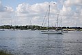 Boats at South Fambridge - geograph.org.uk - 3253729.jpg 640 × 430; 61 KB
-
 Brandy Hole Marshes - geograph.org.uk - 1093343.jpg 640 × 426; 53 KB
-
 Crops near South Fambridge - geograph.org.uk - 3251076.jpg 640 × 430; 36 KB
-
 Crops near South Fambridge - geograph.org.uk - 3251077.jpg 640 × 430; 44 KB
-
 Crops near South Fambridge Hall - geograph.org.uk - 3251066.jpg 640 × 430; 68 KB
-
 Crops near South Fambridge Hall - geograph.org.uk - 3251067.jpg 640 × 430; 82 KB
-
 Entering South Fambridge - geograph.org.uk - 3175932.jpg 640 × 430; 53 KB
-
 Farmland, South Fambridge - geograph.org.uk - 3175962.jpg 640 × 430; 70 KB
-
 Farmland, South Fambridge - geograph.org.uk - 3253748.jpg 640 × 430; 47 KB
-
 Looking across to South Fambridge - geograph.org.uk - 497868.jpg 640 × 427; 67 KB
-
 Mews Bar, South Fambridge - geograph.org.uk - 3175949.jpg 640 × 430; 66 KB
-
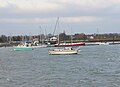 Moorings at Fambridge - geograph.org.uk - 1093303.jpg 640 × 465; 60 KB
-
 Norpitts No.1 Sluice - geograph.org.uk - 1708327.jpg 640 × 480; 59 KB
-

-
 Old groyne west of South Fambridge - geograph.org.uk - 160898.jpg 640 × 480; 115 KB
-
 Old groyne west of South Fambridge - geograph.org.uk - 1987798.jpg 3,008 × 2,000; 1.37 MB
-
 Pillbox east of South Fambridge - geograph.org.uk - 648301.jpg 640 × 524; 57 KB
-
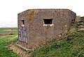 Pillbox, South Fambridge - geograph.org.uk - 641395.jpg 640 × 434; 96 KB
-
 River Crouch South Fambridge - geograph.org.uk - 3628609.jpg 640 × 208; 28 KB
-

-
 Salt marsh east of South Fambridge sluice - geograph.org.uk - 1708225.jpg 2,640 × 1,980; 1.03 MB
-
 Sea Wall South Fambridge - geograph.org.uk - 3628632.jpg 640 × 244; 39 KB
-
 South Fambridge - geograph.org.uk - 2164282.jpg 1,024 × 552; 117 KB
-
 South Fambridge - geograph.org.uk - 3175943.jpg 640 × 373; 66 KB
-
 South fambridge 200209.jpg 2,472 × 3,296; 3.77 MB
-
 South Fambridge Sign - geograph.org.uk - 129407.jpg 640 × 480; 78 KB
-
 South fambridge sign.jpg 2,980 × 2,472; 1.94 MB
-
 South Fambridge Sluice - geograph.org.uk - 583788.jpg 640 × 497; 85 KB
-
 South Fambridge Village Sign - geograph.org.uk - 2191976.jpg 2,000 × 1,659; 1.88 MB
-
 St. Thomas Road, South Fambridge - geograph.org.uk - 322731.jpg 640 × 491; 74 KB
-

-
 The Mews Bar, South Fambridge - geograph.org.uk - 1987783.jpg 3,008 × 2,000; 1.67 MB
-
 The Seawall Path at South Fambridge - geograph.org.uk - 1987794.jpg 640 × 426; 85 KB
-
 Willows in the mist - geograph.org.uk - 583792.jpg 485 × 640; 81 KB
-
 Works at South Fambridge - geograph.org.uk - 3253738.jpg 640 × 430; 71 KB


