Category:Spitalkirche (Mödling)
Jump to navigation
Jump to search
| Object location | | View all coordinates using: OpenStreetMap |
|---|
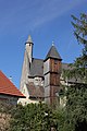
church building in Lower Austria, Austria  | |||||
| Upload media | |||||
| Instance of | |||||
|---|---|---|---|---|---|
| Named after | |||||
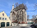
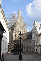
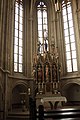
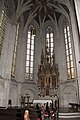
| Location | Mödling, Mödling District, Lower Austria, Austria | ||||
| Street address |
| ||||
| Architectural style | |||||
| Heritage designation | |||||
 | |||||
Media in category "Spitalkirche (Mödling)"
The following 22 files are in this category, out of 22 total.
-
 Alte Feuerwehr und Spitalskirche.jpg 3,868 × 2,584; 1,003 KB
-
 GuentherZ 2010-11-20 0102 Moedling Kirche Relief.jpg 1,800 × 1,205; 1.19 MB
-
 Mödling - Spitalskirche.JPG 3,543 × 2,679; 9.19 MB
-
 Mödling 1561.JPG 2,264 × 3,396; 3.92 MB
-
 Mödling 1930.JPG 2,592 × 3,888; 1.19 MB
-
 Mödling 1932.JPG 2,592 × 3,888; 1.11 MB
-
 Mödling 1935.jpg 2,592 × 3,888; 1.35 MB
-
 Mödling 1936.JPG 2,592 × 3,888; 1,017 KB
-
 Mödling 1941.JPG 2,592 × 3,888; 1.21 MB
-
 Mödling 8982.jpg 2,592 × 3,888; 1.38 MB
-
 Mödling 8983.jpg 2,592 × 3,888; 1.46 MB
-
 Mödling Spitalskirche 8025.JPG 3,456 × 5,184; 10.08 MB
-
 Mödling Spitalskirche 8026.JPG 3,456 × 5,184; 8.8 MB
-
 Mödling Spitalskirche 8028.JPG 3,456 × 5,184; 7.34 MB
-
 Mödling Spitalskirche 8038.JPG 3,456 × 5,184; 5.98 MB
-
 Mödling-Spitalskirche 3758.JPG 3,456 × 5,184; 4.08 MB
-
 Mödling-Spitalskirche 3760.JPG 3,456 × 5,184; 3.79 MB
-
 Mödling-Spitalskirche 3761.JPG 3,456 × 5,184; 3.14 MB
-
 Mödling.JPG 6,378 × 3,724; 20.98 MB
-
 P1030877 (2358487765).jpg 1,056 × 594; 177 KB
-
 Spitalkirche moedling.jpg 1,024 × 768; 517 KB
-
 Spitalskirche (Mödling).jpg 824 × 1,024; 531 KB


.jpg)

.jpg)