Category:Springfield, Massachusetts
comune statunitense del Massachusetts     | |||||
| Carica un file multimediale | |||||
| Istanza di | |||||
|---|---|---|---|---|---|
| Parte di |
| ||||
| Prende il nome da | |||||
| Luogo | contea di Hampden, Massachusetts, Stati Uniti d'America | ||||
| Capo del governo |
| ||||
| Fondatore | |||||
| Data di fondazione o creazione |
| ||||
| Popolazione |
| ||||
| Superficie |
| ||||
| Altezza sul mare |
| ||||
| Distinto da | |||||
| sito web ufficiale | |||||
 | |||||
Springfield, Massachusetts; USA is the largest city on the Connecticut River, and the third largest city in New England. As of 2011, the city's population is approximately 160,000. The Greater Springfield MSA's population is approximately 700,000, although it is contiguous and interconnected with Hartford, Connecticut's MSA, which brings the combined MSAs' population to 1.9 million. The region is called The Knowledge Corridor.
Springfield's most photographic attractions include the Basketball Hall of Fame, (basketball was invented in Springfield in 1891;) the Springfield Armory, founded by George Washington in 1777; Forest Park, designed by Frederick Law Olmsted; The Quadrangle, a grouping of five museums surrounding the Dr. Seuss National Memorial; SIx Flags New England amusement park; The Big E, New England's collective state fair; and Springfield's residential and commercial architecture.
Sottocategorie
Questa categoria contiene le 20 sottocategorie indicate di seguito, su un totale di 20.
A
B
D
E
H
I
M
P
S
T
U
Pagine nella categoria "Springfield, Massachusetts"
Questa categoria contiene un'unica pagina, indicata di seguito.
File nella categoria "Springfield, Massachusetts"
Questa categoria contiene 30 file, indicati di seguito, su un totale di 30.
-
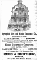 1871 Reed BostonAlmanac.png 345 × 554; 140 KB
-

-
 American Elm, Florence Street, Springfield, MA - June 2020.jpg 2 272 × 1 704; 2,25 MB
-
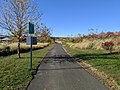
 Connecticut River Walk and Bikeway, Springfield MA.jpg 4 032 × 3 024; 5,75 MB
-
 East Forest Park Branch Library, Springfield MA.jpg 4 032 × 3 024; 4,4 MB
-
 East Springfield Branch Library, Springfield MA.jpg 4 032 × 3 024; 11,03 MB
-

-
 Forest Park Heights Historic District Sign, Sumner Avenue, Springfield, Massachusetts.jpg 2 592 × 1 552; 1 022 KB
-
 Levee, Connecticut River Walk and Bikeway, Springfield MA.jpg 4 032 × 3 024; 5,04 MB
-
 Noise Curtains on I-91 (25508215254).jpg 1 632 × 1 224; 544 KB
-
-
 Roger L Putnam Vocational Technical High School, Springfield MA.jpg 4 032 × 3 024; 9,06 MB
-
 Sign, Connecticut River Walk and Bikeway, Springfield MA.jpg 4 032 × 3 024; 6,16 MB
-
 Springfield Central High School, Springfield MA.jpg 4 032 × 3 024; 8,55 MB
-
 Springfield CW 2024.svg 1 003 × 588; 8 KB
-
 Springfield droning - 35507981281.jpg 4 000 × 3 000; 2,61 MB
-
 Springfield droning - 35507981821.jpg 3 923 × 2 405; 2,26 MB
-
 Springfield droning - 35507982251.jpg 3 719 × 3 000; 2,59 MB
-
 Springfield droning.jpg 4 000 × 3 000; 2,84 MB
-
 Springfield Massachusetts Product.svg 277 × 246; 32 KB
-
 Springfield Municipal Group emblem.svg 302 × 225; 112 KB
-
 Springfield Water and Sewer.svg 1 089 × 1 096; 34 KB
-
 Springfield, United States (Unsplash MUXn2uF41gk).jpg 4 608 × 3 072; 1,14 MB
-
 SpringfieldMa badge.png 393 × 469; 161 KB
-
 SpringfieldPD Ensign.svg 212 × 274; 1,17 MB
-
 Swan, Stanley Park, Springfirld, MA 1974 (6329233903).jpg 1 163 × 961; 126 KB
-
 The X Pub, Springfield MA.jpg 4 032 × 3 024; 3,46 MB
-
 The X, Springfield MA.jpg 4 032 × 3 024; 3,47 MB
-
 Vintage red Pontiac Firebird (Unsplash).jpg 4 608 × 3 072; 1 023 KB
-
 Watershops Pond, Springfield MA.jpg 4 032 × 3 024; 4,45 MB


.jpg)


.jpg)

.jpg)


.jpg)
