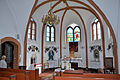
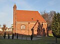
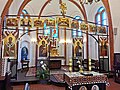
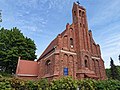
Category:St. Gertrude's Chapel in Trzebiatów
Jump to navigation
Jump to search
| Object location | | View all coordinates using: OpenStreetMap |
|---|
.jpg) .jpg) | |||||
| Upload media | |||||
| Instance of | |||||
|---|---|---|---|---|---|
| Location | Trzebiatów, Gmina Trzebiatów, Gryfice County, West Pomeranian Voivodeship, Poland | ||||
| Heritage designation | |||||
 | |||||
Polski: Trzebiatów - dawna kaplica cmentarna p.w. św. Gertrudy, obecnie cerkiew greckokatolicka pw. św. ap. Piotra i Pawła
| Address |
|
Media in category "St. Gertrude's Chapel in Trzebiatów"
The following 13 files are in this category, out of 13 total.
-
 Kaplica św. Gertrudy w Trzebiatowie.JPG 6,000 × 4,000; 8.64 MB
-
 Trzebiatow kaplica sw Gertrudy (1).jpg 4,107 × 2,897; 2.18 MB
-
 Trzebiatow kaplica sw Gertrudy (2).jpg 3,824 × 2,829; 2.39 MB
-
 Trzebiatow kaplica sw Gertrudy (3).jpg 2,559 × 3,975; 1.88 MB
-
 Trzebiatow kaplica sw Gertrudy (4).jpg 4,608 × 3,072; 2.06 MB
-
 Trzebiatow kaplica sw Gertrudy (5).jpg 4,608 × 3,072; 2.17 MB
-
 Trzebiatow kaplica sw Gertrudy (6).jpg 1,191 × 1,490; 331 KB
-
 Trzebiatow kaplica sw Gertrudy (7).jpg 4,608 × 3,072; 3.83 MB
-
 Trzebiatow St. Gertrude's Chapel 2011-12.jpg 3,641 × 2,630; 4.26 MB
-
 Trzebiatow4.JPG 1,536 × 2,048; 1.31 MB
-
 Іконостас тшеб'ятівської церкви.jpg 3,648 × 2,736; 4.1 MB
-
 Внутрішній вигляд церкви (після ремонту).jpg 3,648 × 2,736; 3.31 MB
-
 Зовнішній вигляд церкви.jpg 3,648 × 2,736; 3.95 MB

.jpg)
.jpg)
.jpg)
.jpg)
.jpg)
.jpg)


Categories:
- Churches in Trzebiatów
- Cultural heritage monuments in Trzebiatów
- Saints Peter and Paul churches in West Pomeranian Voivodeship
- Saint Gertrude churches in Poland
- Greek Catholic churches in West Pomeranian Voivodeship
- Koszalin Greek Catholic deanery
- Churches in the Ukrainian Catholic Eparchy of Wrocław-Koszalin
- Brick Gothic churches in West Pomeranian Voivodeship
- Gothic chapels in Poland
- Pomeranian Way of Saint James