Category:St. Jakobs-Kapelle (Höngen 23, Laupersdorf)
Jump to navigation
Jump to search
| Object location | | View all coordinates using: OpenStreetMap |
|---|
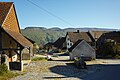
chapel building in Höngen in the canton of Solothurn, Switzerland  | |||||
| Upload media | |||||
| Instance of | |||||
|---|---|---|---|---|---|
| Part of | |||||
| Location | Höngen, Laupersdorf, Thal District, Thal-Gäu, Solothurn, Switzerland | ||||
| Street address |
| ||||
| Heritage designation | |||||
 | |||||
Media in category "St. Jakobs-Kapelle (Höngen 23, Laupersdorf)"
The following 3 files are in this category, out of 3 total.
-
 Laupersdorf Höngen Kapelle 01.jpg 5,424 × 3,616; 21.38 MB
-
 Laupersdorf Höngen Kapelle und Waschhaus.jpg 2,271 × 2,445; 4.44 MB
-
 Laupersdorf Höngen Zentrum 02.jpg 5,424 × 3,616; 23.25 MB

