Category:St. Stephanus (Bürrig)
Jump to navigation
Jump to search
| Object location | | View all coordinates using: OpenStreetMap |
|---|
roman catholic church  | |||||
| Upload media | |||||
| Instance of | |||||
|---|---|---|---|---|---|
| Dedicated to | |||||
| Location | Bürrig, Leverkusen, Cologne Government Region, North Rhine-Westphalia, Germany | ||||
| Architectural style | |||||
| Heritage designation | |||||
| Religion or worldview | |||||
 | |||||
Media in category "St. Stephanus (Bürrig)"
The following 13 files are in this category, out of 13 total.
-
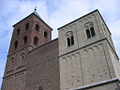 Bürrig Stephanus.jpg 1,024 × 768; 265 KB
-
 Levsanktstephanus.JPG 2,777 × 2,670; 515 KB
-
 St Stephanus Buerrig Chorapsis mit Graebern.jpg 4,938 × 3,578; 12.77 MB
-
 St. Stephanus Leverkusen-Bürrig1.JPG 1,280 × 1,894; 718 KB
-
 St. Stephanus Leverkusen-Bürrig2.JPG 1,550 × 1,327; 528 KB
-
 St. Stephanus Leverkusen-Bürrig2a.jpg 1,712 × 1,239; 532 KB
-
 St. Stephanus Leverkusen-Bürrig2b.jpg 1,537 × 1,450; 596 KB
-
 St. Stephanus Leverkusen-Bürrig2c.jpg 1,272 × 2,026; 773 KB
-
 St. Stephanus Leverkusen-Bürrig2d.jpg 1,607 × 1,480; 786 KB
-
 St. Stephanus Leverkusen-Bürrig2e.jpg 1,801 × 1,509; 709 KB
-
 St. Stephanus Leverkusen-Bürrig3.JPG 1,627 × 1,226; 540 KB
-
 St. Stephanus Leverkusen-Bürrig4.JPG 1,773 × 1,311; 700 KB
-
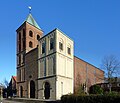
 St.Stephanus Leverkusen.JPG 1,920 × 2,560; 389 KB


