Category:St Ann's Well (Buxton)
Jump to navigation
Jump to search
| Object location | | View all coordinates using: OpenStreetMap |
|---|
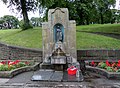
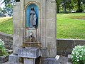
St Ann's Well lies below the Slopes Park in Buxton and provides clean water for passers by.

Grade II listed well in Buxton, High Peak, Derbyshire, UK  | |||||
| Upload media | |||||
| Instance of | |||||
|---|---|---|---|---|---|
| Location | Buxton, High Peak, Derbyshire, East Midlands, England | ||||
| Heritage designation |
| ||||
 | |||||
Media in category "St Ann's Well (Buxton)"
The following 28 files are in this category, out of 28 total.
-
 055383 st anns well.jpg 1,200 × 1,600; 382 KB
-
 Benkid77 Buxton 1 080809.JPG 2,736 × 3,648; 3.38 MB
-
 Buxton St. Ann's pumproom 2.JPG 960 × 1,280; 529 KB
-
 Buxton St. Ann's pumproom 3.JPG 1,280 × 960; 374 KB
-
 Buxton St. Ann's pumproom.JPG 1,280 × 960; 560 KB
-
 Buxton Well Dressing - geograph.org.uk - 1722001.jpg 610 × 640; 162 KB
-
 Buxton, The Well of Living Waters - geograph.org.uk - 3044884.jpg 805 × 1,000; 1.04 MB
-
 Buxton, well dressing 2022, by St Ann's Well.jpg 2,164 × 2,500; 1.9 MB
-
 Buxtoncres1.jpg 800 × 533; 65 KB
-
 DSC04786 (22612446174).jpg 4,608 × 2,592; 4.47 MB
-
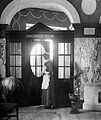
 Entrance to Chalybeate room, St. Anne's Well. Wellcome L0011220.jpg 1,560 × 1,282; 529 KB
-
 Entrance to Chalybeate room, St. Anne's Well. Wellcome L0011221.jpg 1,300 × 1,550; 542 KB
-
 Free Buxton water. - geograph.org.uk - 1723467.jpg 507 × 640; 117 KB
-
 Free Water - geograph.org.uk - 1354945.jpg 640 × 480; 57 KB
-
 Free Water - geograph.org.uk - 876303.jpg 640 × 480; 69 KB
-
 Inscription, St Anne's Well - geograph.org.uk - 981804.jpg 640 × 480; 62 KB
-
 Source of Buxton Spring Water - geograph.org.uk - 1280039.jpg 640 × 480; 106 KB
-
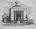
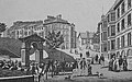 St Ann's Drinking Well of 1852 by Henry Currey.jpg 810 × 504; 322 KB
-
 St Ann's Drinking Well of 1895.jpg 863 × 528; 310 KB
-
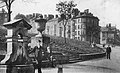
 St Ann's Well of 1783 in Buxton.jpg 947 × 592; 432 KB
-
 St Ann's Well, Buxton, Derbyshire, England.jpg 4,466 × 3,258; 6.27 MB
-
 St Anne's Drinking Well by John Carr in 1784.jpg 628 × 512; 235 KB
-
 St Anne's Well - geograph.org.uk - 1831856.jpg 640 × 480; 101 KB
-
 St Anne's Well, Buxton - geograph.org.uk - 981747.jpg 640 × 480; 72 KB
-
 St Anns Well 1 - Buxton.jpg 2,304 × 3,201; 1.49 MB
-
 St Anns Well 2 - Buxton.jpg 2,304 × 3,456; 879 KB
-
 St. Ann's Well, Buxton - geograph.org.uk - 4429002.jpg 480 × 640; 95 KB
-
 Undressed Well, Buxton - geograph.org.uk - 556849.jpg 640 × 480; 141 KB


.jpg)


