Category:St Erth
Jump to navigation
Jump to search
village and civil parish in Cornwall, United Kingdom .jpg) Eglwys Sant Ercus, St Erth | |||||
| Upload media | |||||
| Instance of | |||||
|---|---|---|---|---|---|
| Location | Cornwall, South West England, England | ||||
 | |||||
Brezhoneg: Rummad:Kêrioù Breizh-Veur
Deutsch: St Erth ( Kornisch: Lannudhno oder Praze Pras) ist ein Ort und eine Gemeinde
English: St Erth (Cornish: Lannudhno/Praze Pras) is a village and civil parish in Cornwall, England, in the United Kingdom. The parish shares boundaries with Ludgvan in the west, Hayle in the north, and St Hilary in the south.
Subcategories
This category has the following 5 subcategories, out of 5 total.
Media in category "St Erth"
The following 200 files are in this category, out of 266 total.
(previous page) (next page)-

-
 2 Bronze Age gold fragments.jpg 2,048 × 1,536; 798 KB
-
 A crop with yellow flowers at Trewinnard Manor - geograph.org.uk - 4061356.jpg 3,872 × 2,592; 6.54 MB
-
 A defined path near Tregethas Farm - geograph.org.uk - 4061265.jpg 3,872 × 2,592; 6.93 MB
-
 A sign of the times. - panoramio.jpg 4,000 × 2,248; 5.82 MB
-
 A wet field of sprouts - geograph.org.uk - 3803330.jpg 1,024 × 680; 211 KB
-
 A30 Bridge - geograph.org.uk - 5135973.jpg 640 × 282; 28 KB
-
 A30 bridge over Chenhalls Road - geograph.org.uk - 5465242.jpg 640 × 480; 88 KB
-
 A30 Bridge over the River Hayle - geograph.org.uk - 5135972.jpg 640 × 426; 43 KB
-
 A30 towards Redruth - geograph.org.uk - 5462594.jpg 640 × 480; 51 KB
-
 A30 viaduct at Hayle - geograph.org.uk - 2515771.jpg 640 × 427; 150 KB
-
-

-
 Ancient cross in St Erth - geograph.org.uk - 1331234.jpg 480 × 640; 107 KB
-
 Approaching roundabout for St Ives - geograph.org.uk - 4040937.jpg 640 × 442; 50 KB
-
 Approaching St Erth station junction - geograph.org.uk - 4040939.jpg 640 × 432; 52 KB
-
 Approaching Tremelling Cottage - geograph.org.uk - 3106078.jpg 640 × 427; 111 KB
-
 Arrival from St Ives - geograph.org.uk - 5749521.jpg 1,024 × 768; 147 KB
-
 B3301 passes The Old Quay House - geograph.org.uk - 3189988.jpg 3,648 × 2,048; 1.04 MB
-
 B3302 Calais Road junction with Conker Road - geograph.org.uk - 3189856.jpg 2,885 × 2,044; 937 KB
-
 B3302 Hayle Road has become Calais Road - geograph.org.uk - 3188971.jpg 3,073 × 2,048; 761 KB
-
 B3302 is Tolroy Road - geograph.org.uk - 3189877.jpg 2,835 × 2,048; 902 KB
-
 B3302 Mellanear Road crossroads - geograph.org.uk - 3189874.jpg 3,648 × 2,048; 1.33 MB
-
 B3302 overbridge south of Hayle - geograph.org.uk - 4040933.jpg 640 × 421; 50 KB
-
 Barn at Treven Farm - geograph.org.uk - 5845149.jpg 640 × 480; 110 KB
-
 Blue skies at St Erth - geograph.org.uk - 5410128.jpg 1,024 × 768; 232 KB
-
 Bosence farm - geograph.org.uk - 3690095.jpg 800 × 450; 232 KB
-
 Bridge Over A30 Near Hayle - geograph.org.uk - 3023633.jpg 640 × 412; 43 KB
-
 Bridge over the A30 at Tolroy - geograph.org.uk - 5190473.jpg 640 × 480; 60 KB
-
 Bridlepath approaching Battery Mill - geograph.org.uk - 3106067.jpg 640 × 427; 118 KB
-
 Bridlepath approaching Tremelling - geograph.org.uk - 3106086.jpg 427 × 640; 142 KB
-
 Bridleway towards Tredrea Manor - geograph.org.uk - 2546231.jpg 640 × 405; 299 KB
-
 Bronze Age axe head from St Erth hoard.jpg 2,048 × 1,536; 858 KB
-
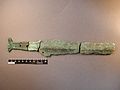 Bronze Age sword from St Erth hoard.jpg 2,048 × 1,536; 792 KB
-
 Building, St Erth Station - geograph.org.uk - 6015894.jpg 1,024 × 681; 170 KB
-
 Buildings at Kirthen Wood Farm - geograph.org.uk - 221525.jpg 640 × 480; 97 KB
-
 Bunkers Hill, Mably Farm - geograph.org.uk - 5466472.jpg 640 × 480; 123 KB
-

-
 Bushes by the Cornish Main Line - geograph.org.uk - 5123726.jpg 640 × 426; 97 KB
-
 Cabbage Field - Recently Harvested - geograph.org.uk - 105445.jpg 492 × 640; 151 KB
-
 Car park by the Cornish Main Line - geograph.org.uk - 5124635.jpg 640 × 361; 69 KB
-
 Caravan Club CL Members Only - geograph.org.uk - 1653291.jpg 640 × 480; 68 KB
-
 Cattle at Treloweth - geograph.org.uk - 2546242.jpg 592 × 640; 328 KB
-

-
 Cereal crop off Trenhayle Lane - geograph.org.uk - 5462600.jpg 640 × 480; 68 KB
-
 Cereal crop, St Erth Praze - geograph.org.uk - 5462606.jpg 640 × 480; 52 KB
-
 Chapel Hill, St Erth - geograph.org.uk - 1222206.jpg 640 × 427; 86 KB
-
 Chapel Hill, St Erth - geograph.org.uk - 1222241.jpg 640 × 428; 101 KB
-
 Chapel Hill, St Erth - geograph.org.uk - 4062395.jpg 3,872 × 2,592; 1.4 MB
-
 Chenhall Rd - geograph.org.uk - 5123709.jpg 640 × 426; 53 KB
-
 Cholera grave at St Erth - geograph.org.uk - 3090921.jpg 427 × 640; 104 KB
-
 Chynoweth Farm ^ Barn - geograph.org.uk - 4137409.jpg 800 × 600; 212 KB
-
 Coarse fishery entrance - geograph.org.uk - 3103129.jpg 640 × 427; 116 KB
-
 Conker Road - geograph.org.uk - 5466465.jpg 640 × 480; 55 KB
-
 Converted barn at Country Skittles - geograph.org.uk - 2341101.jpg 640 × 481; 58 KB
-
 Cottages on The Green Lane, St Erth - geograph.org.uk - 4062317.jpg 3,872 × 2,592; 5.78 MB
-
 Countess Bridge Lane - geograph.org.uk - 3108759.jpg 427 × 640; 131 KB
-
 Country Lane near Treven Farm - geograph.org.uk - 105451.jpg 640 × 480; 106 KB
-
 Crop field near Mably Farm - geograph.org.uk - 5466471.jpg 640 × 480; 50 KB
-

-
 Departure for Penzance - geograph.org.uk - 5749187.jpg 1,024 × 768; 190 KB
-
 Disused garage near Hayle - geograph.org.uk - 1857835.jpg 640 × 480; 57 KB
-
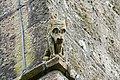 Dog-like grotesque - geograph.org.uk - 3102839.jpg 640 × 427; 118 KB
-
 Elizabeth II postbox on Calais Road, St Erth Praze - geograph.org.uk - 5465409.jpg 2,515 × 1,980; 1.06 MB
-

-
 Entrance to BK Fisheries - geograph.org.uk - 4062335.jpg 3,872 × 2,592; 6.01 MB
-
 Entrance to holiday village, Hayle - geograph.org.uk - 5536430.jpg 640 × 480; 97 KB
-
 Entrance to sprouts field - geograph.org.uk - 3803689.jpg 1,024 × 680; 222 KB
-
 Farmland by the Cornish Main Line - geograph.org.uk - 5135968.jpg 640 × 426; 44 KB
-
 Farmland off Tredrea Lane - geograph.org.uk - 2546220.jpg 640 × 477; 251 KB
-
 Farmland west of Conker Road - geograph.org.uk - 3803337.jpg 800 × 531; 128 KB
-
 Farmland, Polgrean - geograph.org.uk - 5131462.jpg 640 × 361; 37 KB
-
 Field and hedgerow - geograph.org.uk - 5466468.jpg 640 × 480; 45 KB
-
 Field by Cornish Main Line - geograph.org.uk - 6015882.jpg 1,024 × 681; 111 KB
-

-
 Field entrance hub at Tregethas Farm - geograph.org.uk - 4061380.jpg 3,872 × 2,592; 6.15 MB
-
 Field entrance near Porthcollum Farm - geograph.org.uk - 5845203.jpg 640 × 480; 81 KB
-
 Field entrance off Conker Road - geograph.org.uk - 5466456.jpg 640 × 480; 47 KB
-
 Field near Treven Farm - geograph.org.uk - 5845155.jpg 640 × 480; 85 KB
-
 Field of barley at Bosence Farm - geograph.org.uk - 5845229.jpg 640 × 480; 87 KB
-

-
 Fields off Bosence Road - geograph.org.uk - 5845227.jpg 480 × 640; 76 KB
-
 Fishing pond in the Hayle valley - geograph.org.uk - 4061404.jpg 3,872 × 2,592; 6.46 MB
-
 Footbridge. (before). - panoramio.jpg 3,648 × 2,056; 5.65 MB
-
 Footpath to Arch Lane - geograph.org.uk - 2546211.jpg 640 × 444; 270 KB
-
 Ford at Nineveh - geograph.org.uk - 36083.jpg 640 × 480; 147 KB
-
 Ford by Kirthen Wood Haven - geograph.org.uk - 231732.jpg 640 × 480; 155 KB
-
 Fore Street, St Erth - geograph.org.uk - 4062387.jpg 3,872 × 2,592; 4.15 MB
-
 Forget-me-nots at the side of the A30 - geograph.org.uk - 5749532.jpg 1,024 × 768; 398 KB
-
 Fourth grotesque - geograph.org.uk - 3102852.jpg 640 × 427; 103 KB
-
 Garage on Mellanear Road (B3302) - geograph.org.uk - 5462590.jpg 640 × 480; 52 KB
-
 George V postbox on Tredrea Lane, St Erth - geograph.org.uk - 5465405.jpg 1,539 × 2,396; 702 KB
-
 George V postbox, St Erth Post Office - geograph.org.uk - 5465400.jpg 1,068 × 1,734; 316 KB
-
 Grazing west of St Erth - geograph.org.uk - 5463187.jpg 640 × 480; 54 KB
-
 Grotesque with forward ears - geograph.org.uk - 3102842.jpg 640 × 427; 70 KB
-
 Hayle , Griggs Hill - geograph.org.uk - 2510984.jpg 4,288 × 2,848; 4.67 MB
-
 Hayle River near St Erth - geograph.org.uk - 182864.jpg 640 × 480; 111 KB
-
 Higher Porthcollum Farm - geograph.org.uk - 3096306.jpg 640 × 427; 84 KB
-
 House on Calais Road, St Erth Praze - geograph.org.uk - 5465412.jpg 640 × 480; 63 KB
-
 House on Tredrea Lane, Little Mill - geograph.org.uk - 5463177.jpg 640 × 480; 77 KB
-
 Houses on the A30, Canon's Town - geograph.org.uk - 5464550.jpg 640 × 480; 57 KB
-
 Houses on Tredrea Lane, Little Mill - geograph.org.uk - 5463181.jpg 640 × 480; 68 KB
-
 Industrial unit - geograph.org.uk - 6015896.jpg 1,024 × 681; 132 KB
-
 . . Into Cannons Town. - panoramio.jpg 3,924 × 2,248; 3.39 MB
-
 Joining the A30 Northbound, Lelant - geograph.org.uk - 3023632.jpg 640 × 480; 57 KB
-
 Karting track - geograph.org.uk - 5123710.jpg 640 × 426; 49 KB
-
 Karting track, Paradise Park - geograph.org.uk - 5123713.jpg 640 × 426; 55 KB
-
 Karting, Hayle - geograph.org.uk - 6015900.jpg 1,024 × 681; 159 KB
-
 Lagoon by Hayle Estuary - geograph.org.uk - 5135980.jpg 640 × 426; 53 KB
-
 Lagoon by Hayle Estuary - geograph.org.uk - 5135983.jpg 640 × 332; 54 KB
-
 Lagoon by the Hayle Estuary - geograph.org.uk - 5135986.jpg 640 × 304; 34 KB
-
 Lagoon off the Hayle Estuary - geograph.org.uk - 5465225.jpg 640 × 480; 46 KB
-
 Lake by the Hayle Estuary - geograph.org.uk - 5135978.jpg 640 × 353; 33 KB
-
 Lamb and Flag Inn. - panoramio.jpg 4,000 × 2,248; 5.39 MB
-
 Lane at Tregethas Farm - geograph.org.uk - 3093651.jpg 640 × 427; 107 KB
-
 Lanuthnoe hilltop - geograph.org.uk - 3108753.jpg 640 × 427; 87 KB
-
 Leaving St Erth Praze - geograph.org.uk - 5462613.jpg 640 × 480; 57 KB
-
 Lion-like grotesque - geograph.org.uk - 3102834.jpg 640 × 427; 57 KB
-
 Little weir - geograph.org.uk - 3103190.jpg 640 × 427; 102 KB
-

-
 Lower Porthcollum - geograph.org.uk - 3096319.jpg 640 × 427; 118 KB
-
 Marker stone - geograph.org.uk - 3093666.jpg 640 × 427; 130 KB
-
 Meeting of six routes - geograph.org.uk - 4062230.jpg 3,872 × 2,592; 6.66 MB
-
 Mellanear Road (B3302) - geograph.org.uk - 5462596.jpg 640 × 480; 52 KB
-
 Miniature Water Wheel - geograph.org.uk - 21354.jpg 640 × 480; 200 KB
-

-
 National Cycle Route 3, Little Mill - geograph.org.uk - 5463179.jpg 640 × 480; 64 KB
-
 Next stop end of the line - geograph.org.uk - 1704152.jpg 640 × 415; 76 KB
-
-

-
 Old Wayside Cross (geograph 6497144).jpg 960 × 720; 194 KB
-
 Open to one and all - geograph.org.uk - 3711982.jpg 1,224 × 918; 541 KB
-
 Orchid by the Hayle River - geograph.org.uk - 182882.jpg 640 × 480; 138 KB
-
 Outbuildings at Trevessa Farm - geograph.org.uk - 3093637.jpg 640 × 427; 70 KB
-
 Park ^ ride car park - geograph.org.uk - 6293662.jpg 800 × 600; 106 KB
-
 Path by the River Hayle - geograph.org.uk - 4062446.jpg 3,872 × 2,592; 7.27 MB
-
 Path by the River Hayle - geograph.org.uk - 4062455.jpg 3,872 × 2,592; 5.2 MB
-
 Path through wheat near Tregethas Farm - geograph.org.uk - 4061292.jpg 3,872 × 2,592; 7.12 MB
-
 Penwith , Arch Lane - geograph.org.uk - 2495130.jpg 2,859 × 1,845; 1.94 MB
-
 Penwith , The A30 Roadside - geograph.org.uk - 2495292.jpg 4,288 × 2,848; 5 MB
-
 Penwith Erth.png 217 × 208; 32 KB
-

-
 Pond near Trewinnard Mill - geograph.org.uk - 182875.jpg 640 × 480; 147 KB
-
 Porthcollum Lane - geograph.org.uk - 3096313.jpg 427 × 640; 110 KB
-
 Pottery, St Erth Praze - geograph.org.uk - 5466444.jpg 640 × 480; 54 KB
-
 Puddles in the Gateway - geograph.org.uk - 106999.jpg 640 × 480; 125 KB
-
 Pump beside the lane - geograph.org.uk - 3093657.jpg 640 × 427; 120 KB
-
 Pylons along the Valley - geograph.org.uk - 107002.jpg 640 × 418; 61 KB
-
 R. Hayle ^ Carbis Mill. - panoramio.jpg 3,648 × 2,736; 6.33 MB
-
 R. Hayle. - panoramio.jpg 3,648 × 2,056; 5.24 MB
-
 R.Hayle near Relubbus. - panoramio.jpg 3,648 × 2,736; 5.68 MB
-
 Ragwort beside the River Hayle - geograph.org.uk - 3103147.jpg 640 × 427; 102 KB
-
 River Hayle - geograph.org.uk - 5123716.jpg 640 × 426; 56 KB
-
 River Hayle - geograph.org.uk - 6015898.jpg 1,024 × 681; 131 KB
-
 River Hayle, St Erth - geograph.org.uk - 5463174.jpg 640 × 480; 100 KB
-
 Road (B3280) and Bridge at Relubbus - geograph.org.uk - 5384846.jpg 4,000 × 3,000; 3.19 MB
-
 Road (Gurlyn Hill) from Bosworgy to Relubbus - geograph.org.uk - 5384849.jpg 4,000 × 3,000; 4.43 MB
-
 Road junction on The Causeway, Hayle - geograph.org.uk - 6268049.jpg 1,024 × 768; 518 KB
-
 Row of houses in Battery Mill Lane - geograph.org.uk - 3106054.jpg 640 × 427; 102 KB
-
 Ruined and overgrown - geograph.org.uk - 3096301.jpg 640 × 427; 107 KB
-

-

-
 Scarecrow twin at Treven Farm - geograph.org.uk - 5845171.jpg 640 × 480; 71 KB
-
 Seat at St Erth Station - geograph.org.uk - 5123723.jpg 640 × 426; 88 KB
-
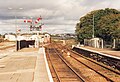
 Semaphore signals, St Erth - geograph.org.uk - 4078011.jpg 1,024 × 575; 111 KB
-

-

-
 Sign for the Star Inn, St Erth - geograph.org.uk - 5463162.jpg 522 × 640; 62 KB
-
 Sign on the Smugglers Inn, St Erth Praze - geograph.org.uk - 5462612.jpg 640 × 552; 123 KB
-
 Site of ford in Countess Bridge Lane - geograph.org.uk - 5845178.jpg 640 × 480; 126 KB
-
 Smugglers Inn, St Erth Praze - geograph.org.uk - 3803315.jpg 1,024 × 680; 269 KB
-
 Split footpath post. - panoramio.jpg 3,648 × 2,736; 6.24 MB
-
 St Erth Methodist Church - geograph.org.uk - 4062405.jpg 3,872 × 2,592; 5.15 MB
-

-
 St Erth Parish Church - geograph.org.uk - 4062354.jpg 3,872 × 2,592; 5.3 MB
-
 St Erth Parish Church - geograph.org.uk - 4925323.jpg 1,728 × 3,072; 1.6 MB
-
 St Erth Parish Church - geograph.org.uk - 5463168.jpg 480 × 640; 60 KB
-
 St Erth Pits, St Erth.jpg 2,402 × 2,113; 2.56 MB
-
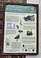 St Erth Pits.jpg 1,913 × 2,669; 1.38 MB
-
 St Erth Post Office - geograph.org.uk - 5465403.jpg 2,848 × 2,136; 1.36 MB
-
 St Erth Post Office in Chapel Hill - geograph.org.uk - 1331250.jpg 640 × 480; 75 KB
-
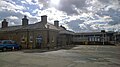
 St Erth Railway Station - geograph.org.uk - 4499547.jpg 1,024 × 691; 842 KB
-
 St Erth railway station - geograph.org.uk - 4925327.jpg 3,072 × 1,728; 1.28 MB
-
 St Erth railway station - geograph.org.uk - 5749523.jpg 1,024 × 770; 132 KB
-
 St Erth railway station - geograph.org.uk - 5794341.jpg 1,600 × 1,089; 649 KB
-
 St Erth railway station - geograph.org.uk - 6140912.jpg 5,472 × 3,648; 6.29 MB
-
 St Erth railway station - geograph.org.uk - 6140913.jpg 5,472 × 3,648; 6.97 MB
-
 St Erth railway station - geograph.org.uk - 6140915.jpg 5,472 × 3,648; 6.77 MB
-
 St Erth railway station - geograph.org.uk - 6140916.jpg 5,472 × 3,648; 5.88 MB
-
 St Erth railway station - geograph.org.uk - 6140919.jpg 5,472 × 3,648; 5.89 MB
-

-
 St Erth service station - geograph.org.uk - 2511076.jpg 640 × 427; 211 KB
-
 St Erth station - geograph.org.uk - 4078006.jpg 1,024 × 575; 186 KB
-
 St Erth Station - geograph.org.uk - 5123720.jpg 640 × 403; 95 KB
-
 St Erth Station - geograph.org.uk - 5123722.jpg 640 × 426; 126 KB
-
 St Erth Station - geograph.org.uk - 5135957.jpg 640 × 426; 60 KB
-
 St Erth Station - geograph.org.uk - 5617163.jpg 640 × 480; 72 KB
-
 St Erth Station - geograph.org.uk - 6015879.jpg 1,024 × 681; 155 KB
-
 St Erth Station - geograph.org.uk - 6015889.jpg 1,024 × 540; 100 KB
-
 St Erth Station - geograph.org.uk - 6015890.jpg 1,024 × 681; 170 KB


._-_panoramio.jpg)


_-_geograph.org.uk_-_5462590.jpg)


_-_geograph.org.uk_-_5462596.jpg)

_-_geograph.org.uk_-_5462602.jpg)


.jpg)


_and_Bridge_at_Relubbus_-_geograph.org.uk_-_5384846.jpg)
_from_Bosworgy_to_Relubbus_-_geograph.org.uk_-_5384849.jpg)


