Category:St Goran
Jump to navigation
Jump to search
civil parish in Cornwall, England, UK | |||||
| Upload media | |||||
| Instance of | |||||
|---|---|---|---|---|---|
| Location | Cornwall, South West England, England | ||||
| Population |
| ||||
 | |||||
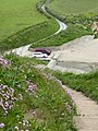
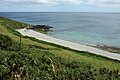
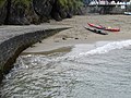
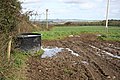
English: St. Goran is a village and Civil parish in mid-Cornwall, United Kingdom. The area includes Gorran Churchtown, Gorran Haven, and Gorran High Lanes.
Subcategories
This category has the following 10 subcategories, out of 10 total.
Media in category "St Goran"
The following 200 files are in this category, out of 494 total.
(previous page) (next page)-
 "Day on the Sand" at Gorran Haven - geograph.org.uk - 2054715.jpg 640 × 427; 126 KB
-
 A bench with a view - geograph.org.uk - 6560171.jpg 1,024 × 768; 224 KB
-
 A Cornish sobriety test^ - geograph.org.uk - 6561092.jpg 640 × 480; 61 KB
-
 A fine pair - geograph.org.uk - 6560165.jpg 1,024 × 768; 217 KB
-
 Above Great Perhaver Beach - geograph.org.uk - 2101045.jpg 1,024 × 768; 168 KB
-
-
 Barn and Stockyard - geograph.org.uk - 256434.jpg 640 × 427; 73 KB
-
 Black Rock - geograph.org.uk - 51042.jpg 640 × 380; 60 KB
-
 Boat in Lambsowden Cove (9273).jpg 4,288 × 2,848; 6.59 MB
-
 Boat near Gorran Haven and Pabyer Point (9332).jpg 4,288 × 2,848; 5.01 MB
-
 Boatyard and harbour, Gorran Haven - geograph.org.uk - 2054811.jpg 640 × 421; 108 KB
-
 Bollard and buoys - geograph.org.uk - 2124189.jpg 640 × 480; 103 KB
-
 Bow Beach and Cadythew Rocks - geograph.org.uk - 2301798.jpg 640 × 480; 127 KB
-
 Bow Beach from the SWC - geograph.org.uk - 2124171.jpg 640 × 480; 97 KB
-
 Bow or Vault Beach - geograph.org.uk - 2101019.jpg 1,024 × 768; 234 KB
-
 Bow or Vault Beach - geograph.org.uk - 5221554.jpg 3,072 × 2,048; 1.2 MB
-
 Bow or Vault Beach - geograph.org.uk - 5221571.jpg 3,072 × 2,048; 1.21 MB
-
 Bow or Vault Beach - geograph.org.uk - 5222116.jpg 3,064 × 1,660; 1.32 MB
-
 Bow or Vault Beach - geograph.org.uk - 5262198.jpg 640 × 452; 81 KB
-

-
 Buildings at Penare - geograph.org.uk - 3037329.jpg 640 × 480; 89 KB
-
 Bunting, Canton, Gorran Haven - geograph.org.uk - 6001388.jpg 1,024 × 768; 211 KB
-
 Bus stop with seat - geograph.org.uk - 4151617.jpg 4,000 × 3,000; 3.88 MB
-
 Butterfly, Gorran Haven - geograph.org.uk - 6001458.jpg 1,024 × 768; 136 KB
-
 Buzzard above Black Rock (9267).jpg 4,288 × 2,848; 2.96 MB
-
 Buzzard above Black Rock (9268).jpg 4,288 × 2,848; 3.02 MB
-
 Buzzard above Black Rock (9269).jpg 4,288 × 2,848; 3.03 MB
-
 Buzzard above Black Rock (9270).jpg 4,288 × 2,848; 3.55 MB
-
 Buzzard above Black Rock (9271).jpg 4,288 × 2,848; 3.51 MB
-
 Cadythew Rock - geograph.org.uk - 2444975.jpg 800 × 600; 401 KB
-
 Cadythew Rock - geograph.org.uk - 5107634.jpg 640 × 428; 57 KB
-

-
 Caerhays Castle - geograph.org.uk - 5111870.jpg 640 × 480; 73 KB
-
 Caerhays Castle - geograph.org.uk - 5707870.jpg 3,046 × 2,033; 1.23 MB
-
 Cafe in Gorran Haven - geograph.org.uk - 6001399.jpg 1,024 × 768; 149 KB
-
 Calm waters at Gorran Haven - geograph.org.uk - 2054779.jpg 640 × 427; 94 KB
-
 Camping at Treveague Farm - geograph.org.uk - 2443427.jpg 800 × 600; 439 KB
-
 Canoes on the beach - geograph.org.uk - 2093777.jpg 2,048 × 1,536; 1.33 MB
-
 Canton, Gorran Haven - geograph.org.uk - 5220918.jpg 3,072 × 2,048; 1.09 MB
-
 Car park and road to Hemmick Beach - geograph.org.uk - 2443458.jpg 800 × 600; 463 KB
-
 Cardinal buoy for the Gwineas - geograph.org.uk - 166315.jpg 640 × 480; 237 KB
-
 Carlithey Point, Dodman - geograph.org.uk - 2428054.jpg 640 × 480; 298 KB
-
 Carn Rock - geograph.org.uk - 6560861.jpg 1,024 × 768; 225 KB
-
 Cattle above Hemmick Beach - geograph.org.uk - 2153012.jpg 1,024 × 768; 251 KB
-
 Cattle Field - geograph.org.uk - 255018.jpg 640 × 427; 122 KB
-
 Cattle on Dodman Point (9301).jpg 4,288 × 2,848; 6.86 MB
-
 Cattle on the Dodman - geograph.org.uk - 3036985.jpg 640 × 480; 76 KB
-
 Cattle south of Penare - geograph.org.uk - 5222365.jpg 3,072 × 2,048; 1.46 MB
-
 Chapel Point - geograph.org.uk - 5653802.jpg 640 × 480; 139 KB
-
 Chapel Point and Gribbin Head from Pabyer Point (9357).jpg 4,288 × 2,848; 5.16 MB
-
 Charles Peach's house in the Canton - geograph.org.uk - 2442707.jpg 800 × 600; 403 KB
-
 Church Street, Gorran Haven - geograph.org.uk - 5050520.jpg 2,048 × 3,072; 1.19 MB
-
 Church Street, Gorran Haven - geograph.org.uk - 5266468.jpg 1,485 × 2,019; 544 KB
-
 Church Street, Gorran Haven - geograph.org.uk - 5429781.jpg 2,048 × 3,072; 689 KB
-
 Church Street, Gorran Haven - geograph.org.uk - 6001408.jpg 768 × 1,024; 125 KB
-
 Circles in the sea - geograph.org.uk - 2054808.jpg 640 × 480; 81 KB
-
 Cliffs at Dodman Point (9314).jpg 4,288 × 2,848; 6.38 MB
-
 Cliffs at Gorran Haven - geograph.org.uk - 5429777.jpg 2,048 × 1,536; 760 KB
-
 Cliffs at Pabyer Point (9356).jpg 4,288 × 2,848; 6.37 MB
-
 Cliffs near Gorran Haven (9331).jpg 4,288 × 2,848; 6.07 MB
-
 Cliffs near Gorran Haven (9333).jpg 4,288 × 2,848; 6.71 MB
-
 Cliffs near High Point (9295).jpg 4,288 × 2,848; 6.33 MB
-
 Coast near Pabyer Point - geograph.org.uk - 4457149.jpg 4,000 × 3,000; 4.37 MB
-
 Coast northeast of Dodman Point - geograph.org.uk - 5222262.jpg 2,770 × 1,950; 1.25 MB
-
 Coast northeast of Gorran Haven - geograph.org.uk - 5221126.jpg 2,962 × 1,813; 1.45 MB
-
 Coast path above Bow Beach - geograph.org.uk - 5221567.jpg 3,072 × 2,048; 1.72 MB
-
 Coast path above Bow Beach - geograph.org.uk - 5221572.jpg 3,072 × 2,048; 1.5 MB
-
 Coast path above Bow Beach - geograph.org.uk - 5221671.jpg 3,072 × 2,048; 1.61 MB
-
 Coast path above Bow Beach - geograph.org.uk - 5221712.jpg 3,072 × 2,048; 1.58 MB
-
 Coast path above Creeb Point - geograph.org.uk - 2151446.jpg 1,024 × 768; 163 KB
-
 Coast path above Helencane Cove - geograph.org.uk - 3037281.jpg 640 × 480; 90 KB
-
 Coast path above High Point - geograph.org.uk - 3037135.jpg 640 × 480; 89 KB
-
 Coast path above High Point - geograph.org.uk - 3037177.jpg 640 × 480; 94 KB
-
 Coast path approaching Gorran Haven - geograph.org.uk - 5221083.jpg 3,072 × 2,048; 1.06 MB
-
 Coast path approaching Maenease Point - geograph.org.uk - 2101015.jpg 1,024 × 768; 278 KB
-
 Coast path at the Bulwark - geograph.org.uk - 5222210.jpg 2,048 × 3,072; 2.34 MB
-
 Coast path dropping to Caerhays Castle - geograph.org.uk - 3798074.jpg 1,600 × 1,064; 429 KB
-

-
 Coast path near Dodman - geograph.org.uk - 5045915.jpg 1,920 × 1,203; 877 KB
-
 Coast path near Pabyer Point - geograph.org.uk - 2153208.jpg 1,024 × 768; 225 KB
-
 Coast path north of Gell Point - geograph.org.uk - 3037196.jpg 640 × 480; 92 KB
-
 Coast path on the Dodman - geograph.org.uk - 3037069.jpg 480 × 640; 122 KB
-
 Coast path rising from Caerhays Castle - geograph.org.uk - 3798079.jpg 1,600 × 1,064; 564 KB
-

-
 Coast southeast of Gorran Haven - geograph.org.uk - 5221087.jpg 3,072 × 2,048; 1.47 MB
-
 Coast to Dodman Point - geograph.org.uk - 5221764.jpg 3,072 × 2,048; 1.46 MB
-
 Coastal Path Gorran Haven - geograph.org.uk - 4571819.jpg 683 × 1,024; 257 KB
-
 Coastal slope at Lamledra - geograph.org.uk - 3037422.jpg 640 × 480; 74 KB
-
 Coastline at Dodman Point - geograph.org.uk - 2100995.jpg 1,024 × 768; 209 KB
-
 Colona Beach - geograph.org.uk - 2124240.jpg 637 × 475; 117 KB
-
 Cormorants near Gorran Haven (9334).jpg 4,288 × 2,848; 6.62 MB
-
 Corner Cottage, Tregavarras.jpg 4,608 × 3,456; 3.67 MB
-
 Cottage on NCR 3 - geograph.org.uk - 2124121.jpg 640 × 480; 151 KB
-
 Cottage, Gorran Haven - geograph.org.uk - 5050588.jpg 2,936 × 1,943; 1.05 MB
-
 Cottage, Gorran Haven - geograph.org.uk - 5429779.jpg 2,048 × 3,072; 1.18 MB
-
 Cottages at Treveague Farm - geograph.org.uk - 2443419.jpg 800 × 600; 417 KB
-
 Cottages in Gorran Haven - geograph.org.uk - 5266458.jpg 1,170 × 1,361; 178 KB
-
 Country lane near Tregilgas - geograph.org.uk - 4241178.jpg 640 × 480; 82 KB
-
 Country Lane with high banks - geograph.org.uk - 4241503.jpg 640 × 480; 57 KB
-
 Country Lane, Tubbs Mill - geograph.org.uk - 4241164.jpg 640 × 480; 141 KB
-
 County lane towards Trevarrick - geograph.org.uk - 4241166.jpg 640 × 480; 119 KB
-
 Cove near Turbot Point - geograph.org.uk - 4457153.jpg 4,000 × 3,000; 4.38 MB
-
 Coves and bays near Boswinger - geograph.org.uk - 2124115.jpg 633 × 471; 128 KB
-

-
 Cross on Dodman Point (9306).jpg 4,288 × 2,848; 4.58 MB
-
 Cross on Dodman Point (9307).jpg 4,288 × 2,848; 6.55 MB
-
 Cross on Dodman Point (9308).jpg 2,848 × 4,288; 4.89 MB
-
 Cross on Dodman Point (9311).jpg 2,848 × 4,288; 5.52 MB
-
 Cross on Dodman Point - geograph.org.uk - 2100994.jpg 768 × 1,024; 146 KB
-
 Dodman Cross - geograph.org.uk - 2124155.jpg 640 × 480; 75 KB
-
 Dodman Point (9303).jpg 4,288 × 2,848; 6.81 MB
-
 Dodman Point (9304).jpg 4,288 × 2,848; 6.2 MB
-
 Dodman Point (9305).jpg 4,288 × 2,848; 6.33 MB
-
 Dodman Point (9324).jpg 4,288 × 2,848; 6.31 MB
-
 Dodman Point - geograph.org.uk - 2427995.jpg 640 × 480; 288 KB
-
 Dodman Point - geograph.org.uk - 2428006.jpg 480 × 640; 322 KB
-
 Dodman Point - geograph.org.uk - 2428045.jpg 640 × 480; 301 KB
-
 Dodman Point - geograph.org.uk - 2428048.jpg 640 × 480; 292 KB
-
 Dodman Point - geograph.org.uk - 2428061.jpg 640 × 480; 325 KB
-
 Dodman Point - geograph.org.uk - 3037042.jpg 640 × 480; 126 KB
-
 Dodman Point from above Vault Beach (9326).jpg 4,288 × 2,848; 5.98 MB
-
 Dodman Point, the cross, and view out to sea - geograph.org.uk - 2252065.jpg 1,024 × 681; 162 KB
-
 Driveway to Trevennen Farm - geograph.org.uk - 6135505.jpg 6,000 × 4,000; 6.45 MB
-
 Dry stone wall and farm buildings at Treveor - geograph.org.uk - 6135371.jpg 6,000 × 4,000; 4.11 MB
-
 East side of the Dodman - geograph.org.uk - 2444930.jpg 800 × 600; 436 KB
-
 Entrance to Tregarton Park - geograph.org.uk - 5429632.jpg 3,072 × 2,048; 1.39 MB
-
 Evening at Boswinger - geograph.org.uk - 2124136.jpg 640 × 480; 95 KB
-
 Exit to National Trust car park, Penare - geograph.org.uk - 5220549.jpg 3,072 × 2,048; 1.74 MB
-
 Exit unclear - geograph.org.uk - 6561098.jpg 1,024 × 768; 226 KB
-
 Fairy rings in grassland near Trevennen Farm - geograph.org.uk - 6135501.jpg 6,000 × 4,000; 7.06 MB
-
 Farm track beside country lane - geograph.org.uk - 4242361.jpg 640 × 480; 76 KB
-
 Farmhouse at Penare - geograph.org.uk - 2443465.jpg 800 × 600; 468 KB
-
 Farmland above Vault Beach - geograph.org.uk - 1388792.jpg 640 × 411; 60 KB
-
 Farmland, St Goran - geograph.org.uk - 6683015.jpg 1,024 × 683; 262 KB
-
 Fence and bulwark on Dodman Point (9300).jpg 4,288 × 2,848; 6.49 MB
-
 Field awaiting spring cultivation near Trevarrick - geograph.org.uk - 6135516.jpg 6,000 × 4,000; 6.56 MB
-
 Field beyond Cliff Road, Gorran Haven - geograph.org.uk - 6001461.jpg 1,024 × 768; 275 KB
-
 Field boundary near Lamedra Farm - geograph.org.uk - 5262182.jpg 640 × 480; 78 KB
-
 Field north of Gorran Haven (9354).jpg 4,288 × 2,848; 6.38 MB
-
 Field opposite Caerhayes Castle (9247).jpg 4,288 × 2,848; 6.29 MB
-
 Fields above Gorran Haven - geograph.org.uk - 2082920.jpg 1,024 × 681; 240 KB
-
 Fields and spoil heaps north of Pabyer Point (9360).jpg 4,288 × 2,848; 6.16 MB
-
 Fields near Gorran Churchtown - geograph.org.uk - 5261856.jpg 3,072 × 2,048; 1.32 MB
-
 Fields near Gorran Haven - geograph.org.uk - 4457148.jpg 4,000 × 2,344; 1.82 MB
-
 Fishing activity - geograph.org.uk - 2093775.jpg 2,048 × 1,536; 1.33 MB
-
 Fishing at Pen-a-maen - geograph.org.uk - 2054781.jpg 640 × 479; 103 KB
-
 Foot path on Bell Hill - geograph.org.uk - 6561122.jpg 1,024 × 768; 192 KB
-
 Footpath from Penare to Treveague Farm - geograph.org.uk - 2443431.jpg 800 × 600; 413 KB
-
 Footpath junction, Dodman - geograph.org.uk - 3037115.jpg 640 × 480; 112 KB
-
 Footpath near Penare - geograph.org.uk - 5220557.jpg 3,072 × 2,048; 1.3 MB
-
 Footpath on Pen-a-maen - geograph.org.uk - 2054803.jpg 640 × 427; 100 KB
-
 Footpath to Dodman Point - geograph.org.uk - 2425639.jpg 640 × 480; 284 KB
-
 Footpath to Dodman Point - geograph.org.uk - 2425642.jpg 640 × 480; 279 KB
-
 Footpath to Gorran Haven - geograph.org.uk - 2443413.jpg 800 × 600; 491 KB
-
 Footpath to Gorran Haven - geograph.org.uk - 5220608.jpg 2,048 × 3,072; 1.71 MB
-
 Footpath to Gorran School - geograph.org.uk - 6135392.jpg 6,000 × 4,000; 6.86 MB
-
 Footpath to Treveague - geograph.org.uk - 5220600.jpg 3,072 × 2,048; 1.55 MB
-
 Footpath to Treveague Farm - geograph.org.uk - 2443397.jpg 800 × 600; 495 KB
-
 Ford and Bridge at Hemmick Beach - geograph.org.uk - 5107714.jpg 640 × 428; 74 KB
-
 Ford at Hemmick Beach - geograph.org.uk - 4680616.jpg 6,000 × 4,000; 6.53 MB
-
 Ford at Hemmick Beach - geograph.org.uk - 5783668.jpg 640 × 480; 75 KB
-

-
 Foxhole Lane, Gorran Haven - geograph.org.uk - 6001402.jpg 1,024 × 768; 133 KB
-
 Gap in the wall - geograph.org.uk - 2124235.jpg 640 × 480; 91 KB
-
 Gate above Portmellon - geograph.org.uk - 5429995.jpg 3,072 × 2,048; 1.01 MB
-
 Gate on path to Gorran Haven - geograph.org.uk - 5220882.jpg 2,048 × 3,072; 1.47 MB
-

-
 Gate on the South West Coast Path - geograph.org.uk - 2529082.jpg 640 × 480; 151 KB
-
 Gated field entrance near Tubbs Mill - geograph.org.uk - 4241171.jpg 640 × 480; 140 KB
-
 Gated Road - geograph.org.uk - 5107650.jpg 640 × 428; 71 KB
-
 Gig shed, St. Goran Rowing Club - geograph.org.uk - 4151654.jpg 4,000 × 3,000; 3.27 MB
-
 Gig shed, St. Goran Rowing Club - geograph.org.uk - 4151910.jpg 4,000 × 3,000; 3.95 MB
-
 Gorran church - geograph.org.uk - 2445065.jpg 800 × 600; 466 KB
-
 Gorran Churchtown from the west - geograph.org.uk - 2082926.jpg 1,024 × 681; 261 KB
-
 Gorran Churchtown, grave in parish churchyard - geograph.org.uk - 2082921.jpg 681 × 1,024; 212 KB
-
 Gorran Churchtown, grave in parish churchyard - geograph.org.uk - 2082925.jpg 681 × 1,024; 248 KB
-
-
 Gorran Churchtown, public footpath sign - geograph.org.uk - 2082928.jpg 1,024 × 681; 205 KB
-
 Gorran Haven - beach on the ebb tide - geograph.org.uk - 6001405.jpg 1,024 × 768; 157 KB
-
 Gorran Haven - geograph.org.uk - 2101030.jpg 1,024 × 768; 184 KB
-
 Gorran Haven - geograph.org.uk - 2101032.jpg 1,024 × 768; 174 KB
-
 Gorran Haven - geograph.org.uk - 2301786.jpg 640 × 480; 57 KB
-
 Gorran Haven - geograph.org.uk - 3037449.jpg 640 × 480; 81 KB
-
 Gorran Haven - geograph.org.uk - 4571801.jpg 683 × 1,024; 378 KB
-
 Gorran Haven - harbour - geograph.org.uk - 6001406.jpg 1,024 × 768; 172 KB
-
 Gorran Haven Algae - geograph.org.uk - 4571812.jpg 683 × 1,024; 520 KB
-
 Gorran Haven and Maenease Point (9353).jpg 4,288 × 2,848; 5.02 MB
-
 Gorran Haven and Maenease Point (9355).jpg 4,288 × 2,848; 5.9 MB
-
 Gorran Haven at High Tide - geograph.org.uk - 4571807.jpg 683 × 1,024; 267 KB
-
 Gorran Haven Beach (9336).jpg 4,288 × 2,848; 6.37 MB
-
 Gorran Haven Beach (9338).jpg 4,288 × 2,848; 7.04 MB
-
 Gorran Haven Beach (9339).jpg 4,288 × 2,848; 6.28 MB
-
 Gorran Haven Beach (9340).jpg 4,288 × 2,848; 6.6 MB
-
 Gorran Haven Beach (9342).jpg 4,288 × 2,848; 6.58 MB
-
 Gorran Haven Beach (9344).jpg 4,288 × 2,848; 4.76 MB
-
 Gorran Haven Beach (9345).jpg 4,288 × 2,848; 4.95 MB
-
 Gorran Haven beach - geograph.org.uk - 2054316.jpg 640 × 427; 93 KB
-
 Gorran Haven Beach - geograph.org.uk - 5050529.jpg 2,696 × 2,012; 1.3 MB
-
 Gorran Haven beach - geograph.org.uk - 5653768.jpg 2,560 × 1,440; 1.46 MB
-
 Gorran Haven beach - geograph.org.uk - 6001436.jpg 1,024 × 768; 144 KB


.jpg)
.jpg)


.jpg)
.jpg)
.jpg)
.jpg)
.jpg)


.jpg)


.jpg)


.jpg)

.jpg)
.jpg)
.jpg)
.jpg)


.jpg)


.jpg)
.jpg)
.jpg)
.jpg)


.jpg)
.jpg)
.jpg)
.jpg)


.jpg)


.jpg)


.jpg)
.jpg)

.jpg)


.jpg)
.jpg)

.jpg)
.jpg)
.jpg)
.jpg)
.jpg)
.jpg)
.jpg)


