Category:St Leonards, Dorset
Jump to navigation
Jump to search
English: St Leonards is a village in south east Dorset, England, situated on the A31 road in the north of the Bournemouth-Poole urban area, adjacent to St Ives and Ashley Heath. The St Leonards and St Ives civil parish has a population of 6,672 .
village in Dorset, England, UK  | |||||
| Upload media | |||||
| Instance of | |||||
|---|---|---|---|---|---|
| Location | St. Leonards and St. Ives, East Dorset, Dorset, South West England, England | ||||
 | |||||
Subcategories
This category has only the following subcategory.
Media in category "St Leonards, Dorset"
The following 53 files are in this category, out of 53 total.
-
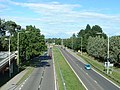 A31 Road at St. Leonards - geograph.org.uk - 37660.jpg 640 × 480; 116 KB
-
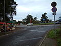 A31 roundabout, St. Leonards, Dorset - geograph.org.uk - 84702.jpg 640 × 481; 98 KB
-

-

-

-

-

-

-

-

-
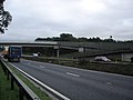 Footbridge over A31 - geograph.org.uk - 267623.jpg 640 × 480; 72 KB
-
 Lions Lane Ashley Heath - geograph.org.uk - 1060778.jpg 640 × 428; 96 KB
-
 St Leonards Community Hospital - geograph.org.uk - 2210006.jpg 1,024 × 768; 149 KB
-
 St Leonards Hospital, old and new - geograph.org.uk - 1994136.jpg 640 × 427; 129 KB
-
 St Leonards Hotel - geograph.org.uk - 1740614.jpg 640 × 480; 90 KB
-
 St Leonards, A31 - geograph.org.uk - 2186224.jpg 1,024 × 768; 170 KB
-
 St Leonards, Acorn Building - geograph.org.uk - 2209968.jpg 1,024 × 748; 197 KB
-
 St Leonards, footpath - geograph.org.uk - 2002898.jpg 768 × 1,024; 198 KB
-
 St Leonards, forestry car-park - geograph.org.uk - 2209957.jpg 1,024 × 768; 229 KB
-
 St Leonards, forestry road - geograph.org.uk - 2209962.jpg 1,024 × 768; 146 KB
-
 St Leonards, forestry road - geograph.org.uk - 2210015.jpg 1,024 × 768; 157 KB
-
 St Leonards, forestry track - geograph.org.uk - 2210081.jpg 768 × 1,024; 273 KB
-
 St Leonards, gorse - geograph.org.uk - 2210049.jpg 768 × 1,024; 198 KB
-
 St Leonards, green - geograph.org.uk - 2002887.jpg 1,024 × 737; 188 KB
-
 St Leonards, holiday park - geograph.org.uk - 2209982.jpg 1,024 × 746; 203 KB
-
 St Leonards, hospital site - geograph.org.uk - 2186242.jpg 1,024 × 768; 204 KB
-
 St Leonards, park homes - geograph.org.uk - 2209991.jpg 1,024 × 746; 149 KB
-
 St Leonards, playground - geograph.org.uk - 2002895.jpg 1,024 × 768; 216 KB
-
 St Leonards, recreation ground - geograph.org.uk - 2002894.jpg 1,024 × 756; 171 KB
-
 St Leonards, roundabout - geograph.org.uk - 2209976.jpg 1,024 × 768; 159 KB
-
 St Leonards, tennis club - geograph.org.uk - 2002897.jpg 1,024 × 768; 240 KB
-
 St Leonards, The Woodman - geograph.org.uk - 2186197.jpg 1,024 × 755; 116 KB
-
 St Leonards, village hall - geograph.org.uk - 2002891.jpg 1,024 × 768; 134 KB
-
 St. Leonards, A31 - geograph.org.uk - 2345289.jpg 1,024 × 768; 192 KB
-
 St. Leonards, Boundary Lane - geograph.org.uk - 2345267.jpg 768 × 1,024; 324 KB
-
 St. Leonards, Brocks Pine - geograph.org.uk - 2345305.jpg 768 × 1,024; 169 KB
-
 St. Leonards, cattle grazing - geograph.org.uk - 2345407.jpg 1,024 × 768; 194 KB
-
 St. Leonards, farm buildings - geograph.org.uk - 2345317.jpg 1,024 × 768; 295 KB
-
 St. Leonards, footbridge - geograph.org.uk - 2345284.jpg 768 × 1,024; 400 KB
-
 St. Leonards, horse grazing - geograph.org.uk - 2361662.jpg 1,024 × 768; 220 KB
-
 St. Leonards, paddocks - geograph.org.uk - 2345277.jpg 1,024 × 768; 286 KB
-

-

-
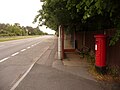
 St. Leonards, postbox No. BH24 4 - geograph.org.uk - 1225849.jpg 640 × 480; 97 KB
-
-

-

-
 St. Leonards, security gates - geograph.org.uk - 2345398.jpg 1,024 × 757; 183 KB
-
 St. Leonards, stile - geograph.org.uk - 2345272.jpg 768 × 1,024; 382 KB
-
 The St Leonards Hotel - geograph.org.uk - 1737497.jpg 640 × 480; 66 KB
-

-
 Lane with no name, St Leonards - geograph.org.uk - 267438.jpg 480 × 640; 97 KB
-
 Roundabout on A31, St Leonards - geograph.org.uk - 267431.jpg 640 × 480; 66 KB


_-_geograph.org.uk_-_1992418.jpg)
_-_geograph.org.uk_-_1992435.jpg)
_-_geograph.org.uk_-_1994027.jpg)


