Category:St Michael's Church, Elmley Lovett
Jump to navigation
Jump to search
| Object location | | View all coordinates using: OpenStreetMap |
|---|
church in Elmley Lovett, Worcestershire, United Kingdom  | |||||
| Upload media | |||||
| Instance of | |||||
|---|---|---|---|---|---|
| Dedicated to | |||||
| Location | Elmley Lovett, Wychavon, Worcestershire, West Midlands, England | ||||
| Diocese | |||||
| Heritage designation |
| ||||
| Religion or worldview | |||||
 | |||||
Media in category "St Michael's Church, Elmley Lovett"
The following 14 files are in this category, out of 14 total.
-
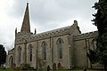 St Michael's Church, Elmley Lovett - geograph.org.uk - 136462.jpg 640 × 426; 89 KB
-

-

-
 St. Michael's Church (01) - churchyard path - geograph.org.uk - 2131493.jpg 1,024 × 757; 265 KB
-
 St. Michael's Church (02) - lychgate - geograph.org.uk - 2132014.jpg 782 × 1,024; 264 KB
-

-
 St. Michael's Church (04) - geograph.org.uk - 2132092.jpg 771 × 1,024; 280 KB
-
 St. Michael's Church (05) - geograph.org.uk - 2132260.jpg 1,024 × 741; 242 KB
-

-
 St. Michael's Church (07) - noticeboard - geograph.org.uk - 2131447.jpg 751 × 1,024; 270 KB
-
 St. Michael's Church (08) - geograph.org.uk - 2132293.jpg 1,024 × 765; 188 KB
-
 St. Michael's Church (09) - doorway - geograph.org.uk - 2132308.jpg 750 × 1,024; 185 KB
-
 St. Michael's Church (10) - tower and spire - geograph.org.uk - 2132774.jpg 782 × 1,024; 166 KB
-


_-_churchyard_path_-_geograph.org.uk_-_2131493.jpg)
_-_lychgate_-_geograph.org.uk_-_2132014.jpg)
_-_dedication_on_lychgate_-_geograph.org.uk_-_2132028.jpg)
_-_geograph.org.uk_-_2132092.jpg)
_-_geograph.org.uk_-_2132260.jpg)
_-_old_cross_in_churchyard_-_geograph.org.uk_-_2132282.jpg)
_-_noticeboard_-_geograph.org.uk_-_2131447.jpg)
_-_geograph.org.uk_-_2132293.jpg)
_-_doorway_-_geograph.org.uk_-_2132308.jpg)
_-_tower_and_spire_-_geograph.org.uk_-_2132774.jpg)
_-_kissing_gate_in_churchyard_-_geograph.org.uk_-_2132794.jpg)
Categories:
- 1840s Gothic Revival churches in England
- 19th-century churches in Worcestershire
- Anglican churches in Worcestershire
- Churches in England built in 1840
- Churches in the Anglican Diocese of Worcester
- Elmley Lovett
- Gothic Revival churches in Worcestershire
- Grade II* listed churches in Worcestershire
- Saint Michael churches in Worcestershire
- Aisleless churches in Worcestershire