Category:Stadion Gladbeck
Jump to navigation
Jump to search
| Object location | | View all coordinates using: OpenStreetMap |
|---|
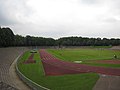
association football venue in Gladbeck, Germany  | |||||
| Upload media | |||||
| Instance of | |||||
|---|---|---|---|---|---|
| Location | Gladbeck, Recklinghausen, Münster Government Region, North Rhine-Westphalia, Germany | ||||
| Owned by |
| ||||
| Occupant |
| ||||
| Operator |
| ||||
| Heritage designation | |||||
| Inception |
| ||||
| Date of official opening |
| ||||
| Maximum capacity |
| ||||
 | |||||
Media in category "Stadion Gladbeck"
The following 5 files are in this category, out of 5 total.
-
 Gladbeck 007.jpg 3,072 × 2,304; 1.35 MB
-
 Gladbeck 010.jpg 3,072 × 2,304; 1.4 MB
-
 Gladbeck 011.jpg 3,072 × 2,304; 2.11 MB
-
 Stadion gladbeck nacht.jpg 2,004 × 1,332; 1.3 MB
-
 Stadion Gladbeck Tribuene.jpg 2,262 × 1,556; 3.03 MB


