Category:Standing stones in Dumfries and Galloway
Jump to navigation
Jump to search
Subcategories
This category has the following 2 subcategories, out of 2 total.
D
- Drumtroddan Standing Stones (8 F)
L
- Laggangairn Standing Stones (4 F)
Media in category "Standing stones in Dumfries and Galloway"
The following 16 files are in this category, out of 16 total.
-
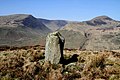 A standing stone at Peatshiel Sike - geograph.org.uk - 2891073.jpg 640 × 427; 281 KB
-
 A standing stone at Peatshiel Sike - geograph.org.uk - 2891076.jpg 640 × 442; 265 KB
-
 A standing stone at Peatshiel Sike - geograph.org.uk - 2891079.jpg 640 × 427; 203 KB
-
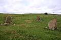 Park of Tongland Standing Stones.jpg 640 × 427; 271 KB
-
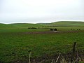 Rough grazing near Auchentibbert - geograph.org.uk - 621773.jpg 640 × 480; 56 KB
-
 Skip Knowe Standing Stone, Newton Wamphray, Annandale, Dumfries and Galloway.jpg 4,896 × 2,752; 3.69 MB
-
 Standing stone at Knock and Maize - geograph.org.uk - 164290.jpg 640 × 480; 62 KB
-
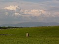
 Standing Stone near Poldean - geograph.org.uk - 1043350.jpg 640 × 567; 158 KB
-
 Standing Stone on the roadside - geograph.org.uk - 1450749.jpg 640 × 480; 84 KB
-
 Standing Stone SE of Bagbie Sheds - geograph.org.uk - 1289595.jpg 640 × 428; 52 KB
-
 Terally Bay - geograph.org.uk - 663501.jpg 640 × 480; 77 KB
-
 The Crouse Stone - geograph.org.uk - 450940.jpg 640 × 480; 52 KB
-
 The Hole Stone, Crouse - geograph.org.uk - 165893.jpg 640 × 480; 62 KB
-
 The Skip Knowe Standing Stone, Newton Wamphray, Annandale, Dumfries and Galloway.jpg 4,896 × 2,752; 6.08 MB
-
 The Skip Knowe Standing Stones, Newton Wamphray, Annandale, Dumfries and Galloway.jpg 4,896 × 2,752; 7.51 MB
-


