Category:Standon, Staffordshire
Jump to navigation
Jump to search
village and civil parish in Staffordshire, UK _All_Saints_Church_-_geograph.org.uk_-_69760.jpg) | |||||
| Upload media | |||||
| Instance of | |||||
|---|---|---|---|---|---|
| Location | Stafford, Staffordshire, West Midlands, England | ||||
 | |||||
Subcategories
This category has the following 2 subcategories, out of 2 total.
H
- Standon Hall (1 F)
Media in category "Standon, Staffordshire"
The following 85 files are in this category, out of 85 total.
-
 1801-2011, Standon population time series.jpg 819 × 460; 44 KB
-
 A519 towards Newcstle-under-Lyme - geograph.org.uk - 6173343.jpg 800 × 600; 86 KB
-
 A519-Birchouse Lane junction - geograph.org.uk - 1962755.jpg 640 × 480; 52 KB
-
 Beginning of public footpath - geograph.org.uk - 5758301.jpg 900 × 1,600; 630 KB
-
 Butthouse Lane - geograph.org.uk - 5758807.jpg 1,600 × 900; 457 KB
-
 Cattle near Weston House Farm - geograph.org.uk - 6172750.jpg 800 × 600; 53 KB
-
 Cereal crop towards small woodland - geograph.org.uk - 6172729.jpg 800 × 600; 127 KB
-
 Chapel in Cranberry - geograph.org.uk - 1016091.jpg 640 × 480; 82 KB
-
 Chatcull Wood - geograph.org.uk - 808187.jpg 640 × 512; 73 KB
-
 Close up, Elizabeth II postbox on Rock Lane, Standon - geograph.org.uk - 6173427.jpg 1,828 × 2,815; 1.41 MB
-
 Close up, Elizabeth II postbox on the A519, Cotes Heath - geograph.org.uk - 6173425.jpg 1,996 × 2,751; 1.16 MB
-
 Close up, Elizabeth II postbox, Standon Mill - geograph.org.uk - 6173430.jpg 1,711 × 3,473; 1.12 MB
-
 Cotes Heath Village Hall - geograph.org.uk - 6173339.jpg 800 × 600; 83 KB
-
 Cotes House Farm - geograph.org.uk - 6173349.jpg 800 × 600; 106 KB
-
 Cotes Lane - geograph.org.uk - 6173348.jpg 800 × 600; 84 KB
-
 Cotes Lane towards Swynnerton - geograph.org.uk - 6173351.jpg 800 × 600; 105 KB
-
 Cotes milepost in its setting - geograph.org.uk - 1983526.jpg 819 × 614; 189 KB
-
 Cottages in Standon - geograph.org.uk - 207391.jpg 640 × 480; 117 KB
-

-
 Elizabeth II postbox on Cotes Lane, Cotes - geograph.org.uk - 6173406.jpg 2,262 × 3,950; 1.41 MB
-
 Elizabeth II postbox on Cotes Lane, Cotes - geograph.org.uk - 6173409.jpg 5,184 × 3,888; 4.06 MB
-
 Elizabeth II postbox on Rock Lane, Standon - geograph.org.uk - 6173426.jpg 4,814 × 3,485; 3.78 MB
-
 Elizabeth II postbox on the A519, Cotes Heath - geograph.org.uk - 6173424.jpg 5,184 × 3,888; 4.32 MB
-
 Elizabeth II postbox, Standon Mill - geograph.org.uk - 6173429.jpg 5,184 × 3,888; 3.73 MB
-
 Farm buildings - geograph.org.uk - 5756389.jpg 1,600 × 900; 330 KB
-
 Farmland near Millmeece - geograph.org.uk - 2820639.jpg 640 × 430; 34 KB
-
 Farmland north of Millmeece - geograph.org.uk - 3680217.jpg 640 × 368; 34 KB
-
 Farmland off Sandy Bank - geograph.org.uk - 5758802.jpg 1,600 × 900; 286 KB
-
 Farmland south of Cotes Heath - geograph.org.uk - 3680219.jpg 640 × 430; 44 KB
-
 Farmland, Cotes Hall Farm - geograph.org.uk - 3680225.jpg 640 × 335; 27 KB
-
 Farmland, Cotes Heath - geograph.org.uk - 2820638.jpg 640 × 430; 46 KB
-

-
 Gated farm track off Maer Lane - geograph.org.uk - 6172758.jpg 800 × 600; 109 KB
-
 Gorse View - geograph.org.uk - 6172762.jpg 800 × 528; 83 KB
-
 Grassland near Standon Hall - geograph.org.uk - 6173310.jpg 800 × 600; 119 KB
-
 Grazing, Shortwood Farm - geograph.org.uk - 6172718.jpg 800 × 600; 119 KB
-
 House on Mill Lane, Standon - geograph.org.uk - 6173319.jpg 800 × 600; 117 KB
-
 House on Mill Lane, Standon - geograph.org.uk - 6173324.jpg 800 × 600; 105 KB
-

-
 Houses at Cranberry - geograph.org.uk - 3839795.jpg 640 × 430; 46 KB
-
 Houses on Back Lane, Cranberry - geograph.org.uk - 2820632.jpg 640 × 430; 58 KB
-
 Houses on Rock Lane, Standon - geograph.org.uk - 6173316.jpg 800 × 600; 121 KB
-
 Houses on Station Road, Cotes Heath - geograph.org.uk - 6173340.jpg 800 × 561; 101 KB
-
 Last throw of the dice^ - geograph.org.uk - 858295.jpg 640 × 427; 73 KB
-
 Lodge, Standon Hall.jpg 800 × 600; 132 KB
-
 Maer Lane towards Standon - geograph.org.uk - 6172755.jpg 800 × 600; 108 KB
-
 Maer Lane, Standon - geograph.org.uk - 6173314.jpg 800 × 600; 84 KB
-
 Meece Brook - geograph.org.uk - 5349717.jpg 640 × 426; 44 KB
-
 Meece Brook Valley - geograph.org.uk - 4977342.jpg 640 × 377; 42 KB
-
 Meece Brook Valley - geograph.org.uk - 5349707.jpg 640 × 426; 41 KB
-
 Meece Brook Valley - geograph.org.uk - 5349710.jpg 640 × 426; 42 KB
-
 Meece Valley - geograph.org.uk - 4977340.jpg 640 × 426; 44 KB
-
 Mill Lane, Standon - geograph.org.uk - 6173326.jpg 800 × 600; 181 KB
-
 Mill Meece Marsh, Cotes Heath - geograph.org.uk - 6173337.jpg 800 × 600; 101 KB
-
 Minor road near Shortwood Farm - geograph.org.uk - 6172724.jpg 800 × 600; 112 KB
-
 Minor road near to Standon Old Hall - geograph.org.uk - 5758313.jpg 1,600 × 900; 475 KB
-
 Minor road towards Standon - geograph.org.uk - 6173311.jpg 800 × 600; 153 KB
-

-
 Near Millmeece - geograph.org.uk - 3839801.jpg 640 × 430; 32 KB
-
 Nelson Hall (1979) - geograph.org.uk - 1069982.jpg 640 × 415; 54 KB
-
 Newcastle Road (A159) - geograph.org.uk - 6173346.jpg 640 × 480; 73 KB
-
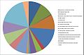
 Occupations for Standon from the 1881 Census..jpg 978 × 639; 73 KB
-
 Occupations for Standon from the 2011 Census.jpg 978 × 639; 88 KB
-

-
 Ploughed field - geograph.org.uk - 3839800.jpg 640 × 430; 51 KB
-
 Pylon, Bowers Bent - geograph.org.uk - 5349698.jpg 640 × 426; 54 KB
-
 Rock Lane, Standon - geograph.org.uk - 6173317.jpg 800 × 600; 129 KB
-
 Rough grassland Meece Brook Valley - geograph.org.uk - 4977348.jpg 640 × 426; 48 KB
-
 Shortwood Cottages - geograph.org.uk - 6172735.jpg 800 × 600; 127 KB
-
 Solitary tree - geograph.org.uk - 3839797.jpg 640 × 339; 23 KB
-
 South of Cotes Heath - geograph.org.uk - 3839799.jpg 640 × 430; 56 KB
-
 South of Dove Farm - geograph.org.uk - 5349714.jpg 640 × 291; 35 KB
-
 Standon Mill - geograph.org.uk - 6173327.jpg 800 × 485; 65 KB
-
 Standon population time series 1801-2011.jpg 1,008 × 630; 44 KB
-
 Standon Rough - geograph.org.uk - 769134.jpg 640 × 513; 71 KB
-
 Standon Rough - geograph.org.uk - 769136.jpg 640 × 512; 74 KB
-
 Station Road, Cotes Heath - geograph.org.uk - 6173341.jpg 800 × 600; 89 KB
-
 The Old Rectory - geograph.org.uk - 5758814.jpg 1,600 × 900; 493 KB
-
 Towards the Chatcull Brook - geograph.org.uk - 808200.jpg 640 × 480; 64 KB
-
 Village Club, Sandon.jpg 1,280 × 883; 304 KB
-
 Water Pumping Station near Millmeece - geograph.org.uk - 1019067.jpg 640 × 480; 62 KB
-
 West Coast Main Line, Cotes Heath - geograph.org.uk - 6173332.jpg 800 × 600; 140 KB
-
 Weston Hall - geograph.org.uk - 5758789.jpg 1,600 × 900; 330 KB
-
 Weston House Farm - geograph.org.uk - 208193.jpg 640 × 480; 90 KB
-
 Weston Lane - geograph.org.uk - 5758797.jpg 1,600 × 900; 322 KB


_-_geograph.org.uk_-_1069982.jpg)
_-_geograph.org.uk_-_6173346.jpg)


.jpg)


