Category:Stanley, County Durham
Jump to navigation
Jump to search
town and civil parish in County Durham, England  | |||||
| Upload media | |||||
| Instance of | |||||
|---|---|---|---|---|---|
| Location | County Durham, North East England, England | ||||
| Different from | |||||
 | |||||
English: Stanley — a former colliery town and civil parish in County Durham, England.
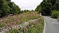
- Centred on a hilltop between Chester-le-Street and Consett, the town lies south west of Gateshead.
Nederlands: Stanley is een plaats in het bestuurlijke gebied Derwentside, in het Engelse graafschap Durham. De plaats telt 16.306 inwoners.
Polski: Stanley - miasto w Wielkiej Brytanii, w Anglii, w regionie North East England, w hrabstwie Durham. W 2001r. miasto to zamieszkiwało 16 306 osób.
Română: Stanley este un oraş în comitatul County Durham, regiunea North East, Anglia. Oraşul se află în districtul Derwentside.
Subcategories
This category has the following 14 subcategories, out of 14 total.
A
C
- Clough Dene (9 F)
- Craghead (34 F)
G
- Gillingham's (bus company) (1 F)
Q
- Quaking Houses (4 F)
S
- Shield Row (14 F)
- St Andrew's Church, Stanley (4 F)
T
- Tanfield Lea (10 F)
W
- West Kyo (5 F)
Media in category "Stanley, County Durham"
The following 200 files are in this category, out of 533 total.
(previous page) (next page)-
 "Iceland", Stanley - geograph.org.uk - 3807077.jpg 640 × 480; 69 KB
-
 "The Olive Stone", Tantobie - geograph.org.uk - 4227861.jpg 640 × 480; 114 KB
-
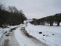
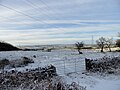 A snowy landscape - geograph.org.uk - 5626339.jpg 4,608 × 3,456; 6.51 MB
-
 A693 at East Stanley - geograph.org.uk - 3058284.jpg 4,608 × 3,456; 5.08 MB
-
 A693 at Oxhill - geograph.org.uk - 3377103.jpg 1,500 × 1,136; 1.42 MB
-
 A693 bypassing Annfield Plain - geograph.org.uk - 2451312.jpg 1,500 × 1,125; 1.54 MB
-
 A693 entering Oxhill - geograph.org.uk - 4227907.jpg 640 × 480; 112 KB
-
 A693 entering Stanley - geograph.org.uk - 3924631.jpg 1,500 × 1,125; 1.38 MB
-
 Aged Miners' Homes at Craghead - geograph.org.uk - 4216712.jpg 4,608 × 3,456; 4.6 MB
-
 Andrew's House - geograph.org.uk - 2456889.jpg 3,888 × 2,107; 1.38 MB
-
 Annfield Electricity Substation - geograph.org.uk - 5899076.jpg 1,600 × 1,021; 213 KB
-
 Annfield House - geograph.org.uk - 4801030.jpg 4,608 × 3,456; 5.99 MB
-
 Annfield Plain bypass - geograph.org.uk - 5680537.jpg 4,608 × 3,456; 5.46 MB
-
 Annfield Plain Library - geograph.org.uk - 4801192.jpg 4,608 × 3,456; 5.79 MB
-
 Asda - geograph.org.uk - 106413.jpg 640 × 480; 39 KB
-
 At the top of Coppy Lane - geograph.org.uk - 3052665.jpg 4,608 × 3,456; 5.7 MB
-
 B6168 towards Mountsett - geograph.org.uk - 2876487.jpg 640 × 480; 55 KB
-
 B6173 through Clough Dene - geograph.org.uk - 2876527.jpg 640 × 480; 66 KB
-
 Badgers Wood, Stanley - geograph.org.uk - 1803699.jpg 640 × 480; 91 KB
-
 Barley field on east side of Beamishburn Road - geograph.org.uk - 3616641.jpg 1,500 × 935; 1.36 MB
-
 Beamish Burn - geograph.org.uk - 1660152.jpg 600 × 450; 340 KB
-
 Beamish Burn - geograph.org.uk - 1660168.jpg 600 × 450; 368 KB
-
 Beamish Burn - geograph.org.uk - 3453883.jpg 4,000 × 3,000; 4.7 MB
-
 Beamish Burn - geograph.org.uk - 5873739.jpg 5,184 × 3,888; 902 KB
-
 Beamish Hall Hotel - geograph.org.uk - 2824544.jpg 640 × 480; 85 KB
-
 Beamish Hall Hotel - geograph.org.uk - 3444451.jpg 640 × 480; 85 KB
-
 Beamish Mary Inn, near Stanley - geograph.org.uk - 2087020.jpg 640 × 480; 82 KB
-
 Beamish Museum (20) - geograph.org.uk - 5581274.jpg 4,320 × 3,240; 5.24 MB
-
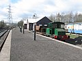
 Beamish Open Air Museum - railway station yard - geograph.org.uk - 6010632.jpg 5,184 × 2,920; 1.86 MB
-
 Beamish Park Golf Club 15th Fairway and Green - geograph.org.uk - 5874115.jpg 5,184 × 3,456; 1.15 MB
-
 Beamish Park Golf Club 15th Fairway and Green - geograph.org.uk - 5874117.jpg 5,184 × 3,456; 566 KB
-
 Beamishburn Road near the Blue Bell Inn at South Causey - geograph.org.uk - 5932571.jpg 4,000 × 3,000; 2.95 MB
-
 Beckley Farm - geograph.org.uk - 4228492.jpg 640 × 480; 123 KB
-
 Beckley Farm, Tanfield - geograph.org.uk - 3977769.jpg 4,436 × 3,216; 4.02 MB
-
 Bench on the village green, Tanfield - geograph.org.uk - 4227928.jpg 640 × 480; 229 KB
-
 Berties bar 15-12-2013 - geograph.org.uk - 3848438.jpg 3,072 × 2,048; 2.59 MB
-
 Birch trees beyond paddock - geograph.org.uk - 5284235.jpg 1,500 × 801; 1.19 MB
-
 Black Horse Inn - geograph.org.uk - 3807084.jpg 640 × 480; 87 KB
-
 Blackett Street, Catchgate - geograph.org.uk - 4801228.jpg 4,608 × 3,456; 4.77 MB
-
 Blackthorn in flower beside the old railway - geograph.org.uk - 6133082.jpg 4,608 × 3,456; 3.46 MB
-
 Bloemfontein Place, Craghead - geograph.org.uk - 4777884.jpg 4,484 × 3,284; 5.2 MB
-
 Boggy field - geograph.org.uk - 2495355.jpg 3,264 × 2,448; 1.94 MB
-
 Bottom end of Barcusclose Lane - geograph.org.uk - 3056469.jpg 4,608 × 3,456; 5.1 MB
-
 Bottom of Tyne Road, South Stanley - geograph.org.uk - 6254858.jpg 4,455 × 3,341; 2.24 MB
-
 Boundary House Farm - geograph.org.uk - 3944412.jpg 4,608 × 3,456; 5.69 MB
-
 Brenda's Fish Bar - geograph.org.uk - 1631602.jpg 640 × 471; 73 KB
-
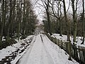
 Bridge carrying railway path - geograph.org.uk - 2068334.jpg 2,000 × 1,500; 2.27 MB
-

-
 Bridge on the Railway Path at Oxhill - geograph.org.uk - 2856351.jpg 4,608 × 3,456; 5.79 MB
-
 Bridleway sign, Green Lane - geograph.org.uk - 2907065.jpg 1,024 × 768; 182 KB
-
 Buildings at Home Farm - geograph.org.uk - 5866834.jpg 1,500 × 843; 1.06 MB
-
 Bungalow on Hangingstone Lane - geograph.org.uk - 4894661.jpg 640 × 480; 72 KB
-
 Bus depot at East Stanley - geograph.org.uk - 3058295.jpg 4,608 × 3,456; 5.05 MB
-
 Bushblades Lane heading west - geograph.org.uk - 2876261.jpg 640 × 480; 49 KB
-
 Bushblades Lane heading west - geograph.org.uk - 2876269.jpg 640 × 480; 58 KB
-
 Bushblades Lane towards the B6168 - geograph.org.uk - 2876274.jpg 640 × 480; 72 KB
-
 Busy farmyard at White House Farm - geograph.org.uk - 6278011.jpg 4,608 × 3,456; 2.67 MB
-
 Car park for the former Harperley Hotel - geograph.org.uk - 4226879.jpg 640 × 480; 159 KB
-
 Catchgate - geograph.org.uk - 5999965.jpg 1,500 × 1,125; 1.57 MB
-
 Catchgate Methodist Church - geograph.org.uk - 4801151.jpg 4,608 × 3,456; 7.03 MB
-
 Catchgate village centre - geograph.org.uk - 4801210.jpg 4,608 × 3,456; 5.87 MB
-
 Causey Arch - geograph.org.uk - 4420969.jpg 640 × 480; 138 KB
-
 Causey Arch - geograph.org.uk - 4519231.jpg 1,024 × 768; 300 KB
-

-
 Causey Burn - geograph.org.uk - 2702245.jpg 1,500 × 2,000; 1.71 MB
-
 Causey Burn Culvert - geograph.org.uk - 3710767.jpg 768 × 1,024; 350 KB
-
 Causey Burn,Causey Gill - geograph.org.uk - 2334925.jpg 640 × 480; 130 KB
-
 Causey Drive, Stanley - geograph.org.uk - 1803713.jpg 640 × 480; 59 KB
-
 Causey House Tea Room - geograph.org.uk - 4228495.jpg 640 × 480; 217 KB
-
 Cemetery, Stanley - geograph.org.uk - 3193000.jpg 640 × 480; 92 KB
-
 Cereal field, west of South Moor golf course - geograph.org.uk - 2907051.jpg 1,024 × 768; 140 KB
-
 Chapel Street, Tantobie - geograph.org.uk - 1803603.jpg 640 × 480; 67 KB
-
 Children's Play area, Woodside Grove - geograph.org.uk - 4227911.jpg 640 × 480; 155 KB
-
 Chinese takeaway on Park Road - geograph.org.uk - 2876246.jpg 640 × 480; 58 KB
-
 Church of St Thomas at Harelaw - geograph.org.uk - 3473988.jpg 4,608 × 3,456; 5.74 MB
-
 Coal and water facilities - geograph.org.uk - 5899101.jpg 1,600 × 962; 340 KB
-
 Coming into Craghead from the east - geograph.org.uk - 6253369.jpg 4,608 × 3,456; 3.92 MB
-
 Consett and Sunderland Railway Path - geograph.org.uk - 3012305.jpg 1,500 × 1,125; 2.09 MB
-

-

-

-
 Converted chapel on Shieldrow Lane - geograph.org.uk - 4227904.jpg 640 × 480; 80 KB
-
 Converted chapel, Shieldrow Lane - geograph.org.uk - 2876252.jpg 640 × 480; 42 KB
-
 Converted outbuildings at Tanfield Lane Farm - geograph.org.uk - 4774091.jpg 4,608 × 3,456; 5.11 MB
-
 Coppy Lane - geograph.org.uk - 1660195.jpg 600 × 450; 234 KB
-
 Coppy Lane - geograph.org.uk - 1660198.jpg 600 × 450; 339 KB
-
 Coppy Lane - geograph.org.uk - 1660201.jpg 600 × 450; 217 KB
-
 Cottage near Beamish Hall - geograph.org.uk - 1660159.jpg 600 × 450; 252 KB
-
 Countryside view from Stanley - geograph.org.uk - 5877683.jpg 4,608 × 3,456; 2.82 MB
-
 Craighead Lane heading west - geograph.org.uk - 2876095.jpg 640 × 480; 66 KB
-
 Crane gantry at Harelaw Industrial Estate - geograph.org.uk - 5211199.jpg 4,608 × 3,456; 6.52 MB
-
 Crossroads at East Castle - geograph.org.uk - 4770937.jpg 4,608 × 3,456; 4.39 MB
-
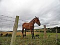 Curious young horse at East Kyo - geograph.org.uk - 5991284.jpg 4,608 × 3,456; 2.49 MB
-
 Dene north of Stoney Heap - geograph.org.uk - 6133119.jpg 4,608 × 3,456; 4.42 MB
-
 Derwent Rise, off South Moor Road - geograph.org.uk - 2906279.jpg 1,024 × 768; 127 KB
-
 Development land and wind turbines - geograph.org.uk - 4894685.jpg 640 × 480; 38 KB
-
 Disused workings west of Green Lane - geograph.org.uk - 2907080.jpg 1,024 × 768; 157 KB
-
 Dry stone wall - geograph.org.uk - 5682244.jpg 4,608 × 3,456; 4.49 MB
-
 Durham Road, Anfield Plain - geograph.org.uk - 3066916.jpg 4,608 × 3,456; 5.29 MB
-
 East Castle House - geograph.org.uk - 4770926.jpg 4,492 × 3,296; 4.89 MB
-
 East Kyo Farm - geograph.org.uk - 2876256.jpg 640 × 480; 54 KB
-
 East Kyo Farm - geograph.org.uk - 3971437.jpg 4,432 × 3,208; 3.92 MB
-
 East Kyo Stud Farm - geograph.org.uk - 4226871.jpg 640 × 480; 111 KB
-
 East Street, Stanley - geograph.org.uk - 3329304.jpg 3,975 × 2,737; 3.1 MB
-
-
 East View, South Moor Road - geograph.org.uk - 2906285.jpg 1,024 × 768; 151 KB
-
 Eastern part of Kyo Bogs - geograph.org.uk - 2493899.jpg 3,264 × 2,448; 1.64 MB
-
 Edward Street (B6313) in Craghead - geograph.org.uk - 5331046.jpg 4,000 × 3,000; 2.26 MB
-

-
 Elite Buildings Stanley - geograph.org.uk - 3878881.jpg 3,072 × 2,048; 1.98 MB
-
 Elite Buildings Stanley - geograph.org.uk - 3878912.jpg 3,072 × 2,048; 2.69 MB
-
 Elite Buildings Stanley - geograph.org.uk - 3878931.jpg 3,072 × 2,048; 2.42 MB
-
 End of the village speed limit, Tower Road - geograph.org.uk - 2907547.jpg 1,024 × 768; 147 KB
-
 Entrance to East Kyo Stud Farm - geograph.org.uk - 5991289.jpg 3,254 × 2,780; 1.79 MB
-
 Entrance to Fox and Parrot Wood - geograph.org.uk - 6253331.jpg 4,608 × 3,456; 4.55 MB
-
 Entrance to Langleymoor Plantation - geograph.org.uk - 3065074.jpg 4,608 × 3,456; 5.43 MB
-
 Entrance to Raisenside Farm, Dipton - geograph.org.uk - 4770066.jpg 4,608 × 3,456; 5.6 MB
-
 Entrance to Tanfield Grange Farm - geograph.org.uk - 4774703.jpg 4,608 × 3,456; 5.12 MB
-

-
 Farm on Barcusclose Lane - geograph.org.uk - 3058152.jpg 4,608 × 3,456; 5.14 MB
-

-
 Farm vehicles in a muddy field - geograph.org.uk - 3052697.jpg 4,608 × 3,456; 4.72 MB
-
 Farmhouse at Raisenside, Dioton - geograph.org.uk - 4770059.jpg 3,793 × 2,783; 3.15 MB
-
 Farmhouse at Stanleyburn Farm, South Moor - geograph.org.uk - 4777829.jpg 4,608 × 3,456; 7.16 MB
-
 Farmland above Newhouse Burn - geograph.org.uk - 2911358.jpg 1,024 × 768; 135 KB
-
 Farmland off Craighead Lane - geograph.org.uk - 2876094.jpg 640 × 480; 81 KB
-
 Farmland, Hare Law - geograph.org.uk - 2876273.jpg 640 × 480; 50 KB
-
 Farmland, Stanley - geograph.org.uk - 2876215.jpg 640 × 480; 32 KB
-
 Farmyard at Stanleyburn Farm - geograph.org.uk - 4777837.jpg 4,594 × 3,436; 5.52 MB
-
 Farmyard chickens, Beamish - geograph.org.uk - 2666299.jpg 426 × 640; 194 KB
-
 Fern Terrace, White-le-Head - geograph.org.uk - 2860718.jpg 4,608 × 3,456; 5.16 MB
-
 Field adjacent to minor road - geograph.org.uk - 3616524.jpg 1,500 × 843; 1.57 MB
-
 Field alongside the railway - geograph.org.uk - 1985641.jpg 1,024 × 768; 189 KB
-
 Field and scrubland - geograph.org.uk - 1984565.jpg 1,024 × 768; 140 KB
-
 Field at angle of Wagtail Lane and Newacres Road - geograph.org.uk - 3438367.jpg 1,500 × 996; 1.09 MB
-
 Field at Harperley Hall Farm - geograph.org.uk - 4227830.jpg 640 × 480; 156 KB
-
 Field boundary, Tanfield Grange Farm - geograph.org.uk - 4228491.jpg 640 × 480; 131 KB
-

-
 Field north of Acton Dene - geograph.org.uk - 2087207.jpg 640 × 480; 72 KB
-
 Field of barley - geograph.org.uk - 1985658.jpg 1,024 × 768; 183 KB
-
 Field of sheep at Harperley Hall Farm - geograph.org.uk - 4227838.jpg 640 × 480; 129 KB
-
 Field off Beamishburn Road - geograph.org.uk - 3807085.jpg 640 × 480; 102 KB
-

-
 Field path towards Pontop Pike - geograph.org.uk - 2247661.jpg 1,024 × 768; 222 KB
-
 Field to the east of Harperley Lane - geograph.org.uk - 5990591.jpg 3,877 × 3,058; 2.35 MB
-
 Fines House, Annfield Plain - geograph.org.uk - 4065199.jpg 4,608 × 3,456; 6.02 MB
-
 Footbridge in Tanfield Woods - geograph.org.uk - 2855985.jpg 4,608 × 3,456; 5.75 MB
-
 Footbridge in the woods - geograph.org.uk - 6254641.jpg 4,455 × 3,341; 5.62 MB
-
 Footbridge over Causey Burn - geograph.org.uk - 2316755.jpg 640 × 480; 104 KB
-
 Footbridge over Causey Burn - geograph.org.uk - 3471414.jpg 800 × 533; 186 KB
-
 Footbridge over the Causey Burn - geograph.org.uk - 3054185.jpg 4,608 × 3,456; 5.12 MB
-
 Footpath across a busy road - geograph.org.uk - 5681145.jpg 4,608 × 3,456; 5.18 MB
-
 Footpath along Chaytor Terrace, Craghead - geograph.org.uk - 4777924.jpg 4,608 × 3,456; 4.79 MB
-
 Footpath along lane at Coppy - geograph.org.uk - 5866967.jpg 1,500 × 1,000; 1.81 MB
-
 Footpath alongside the railway - geograph.org.uk - 1985625.jpg 1,024 × 768; 216 KB
-
 Footpath entrance at Greencroft - geograph.org.uk - 5625664.jpg 3,979 × 2,985; 6.22 MB
-
 Footpath gateway - geograph.org.uk - 5682250.jpg 4,608 × 3,456; 5.95 MB
-
 Footpath into South Stanley Wood - geograph.org.uk - 6254584.jpg 4,421 × 3,315; 4.77 MB
-
 Former coal mine site - geograph.org.uk - 5349473.jpg 4,332 × 3,048; 4.43 MB
-
 Former council offices, Front Street, Stanley (geograph 6839345).jpg 5,184 × 3,456; 1.99 MB
-
 Former pub at Flint Hill - geograph.org.uk - 5989882.jpg 4,608 × 3,456; 3.29 MB
-
 Former pub in White-le-Head - geograph.org.uk - 2863544.jpg 4,608 × 3,456; 5.8 MB
-
 Former schoolmaster's house, Harelaw - geograph.org.uk - 3474025.jpg 4,608 × 3,456; 4.62 MB
-
 Former Stag Inn - geograph.org.uk - 3064151.jpg 4,608 × 3,456; 4.79 MB
-
 Former village school, Harelaw - geograph.org.uk - 3474043.jpg 4,608 × 3,456; 5.56 MB
-

-
 Front Street in Annfield Plain - geograph.org.uk - 5996395.jpg 4,608 × 3,456; 2.34 MB
-
 Funeral Parlour at Fines House - geograph.org.uk - 4795435.jpg 4,048 × 2,864; 3.81 MB
-
 Gateway and public path - geograph.org.uk - 5212010.jpg 4,428 × 3,202; 4.48 MB
-
 Gateway to reclaimed site - geograph.org.uk - 3066841.jpg 4,608 × 3,456; 5.24 MB
-
 Gladstone Street, No Place - geograph.org.uk - 2086959.jpg 640 × 480; 79 KB
-
 Gorse - geograph.org.uk - 784319.jpg 640 × 480; 98 KB
-
 Gorse at the edge of South Moor golf course - geograph.org.uk - 2906383.jpg 1,024 × 768; 84 KB
-
 Grassed area with social housing in Stanley - geograph.org.uk - 3924623.jpg 1,500 × 1,028; 1.16 MB
-
 Grazing cattle - geograph.org.uk - 5349755.jpg 4,608 × 3,456; 4.83 MB
-
 Grazing land - geograph.org.uk - 1447254.jpg 640 × 480; 73 KB
-
 Grazing land off Bushblades Lane - geograph.org.uk - 2876265.jpg 640 × 480; 111 KB
-
 Grazing land, East Kyo Farm - geograph.org.uk - 2876257.jpg 640 × 480; 70 KB
-
 Grazing off Hangingstone Lane - geograph.org.uk - 4894682.jpg 640 × 480; 74 KB
-
 Green Lane - geograph.org.uk - 2907061.jpg 1,024 × 768; 136 KB
-
 Green on Beamish Park Golf Club - geograph.org.uk - 2426386.jpg 1,024 × 768; 268 KB
-
 Green pasture, east of Green Lane - geograph.org.uk - 2907072.jpg 1,024 × 768; 143 KB
-
 Greencroft Parkway - geograph.org.uk - 4894690.jpg 640 × 480; 72 KB
-
 Greencroft Pond - geograph.org.uk - 3225241.jpg 640 × 480; 97 KB
-
 Greencroft Pond - geograph.org.uk - 3225246.jpg 640 × 480; 92 KB
-
 Hangingstone Lane - geograph.org.uk - 2911214.jpg 1,024 × 768; 139 KB
-
 Hangingstone Lane - geograph.org.uk - 2911347.jpg 1,024 × 768; 161 KB
-
 Hangingstone Lane - geograph.org.uk - 4894659.jpg 640 × 480; 74 KB
-
 Hangingstone Lane - geograph.org.uk - 4894672.jpg 640 × 480; 72 KB
-
 Hangstone Lane - geograph.org.uk - 5349837.jpg 4,608 × 3,456; 5.24 MB
-
 Happy Bales - geograph.org.uk - 6278000.jpg 4,608 × 3,456; 2.31 MB
-
 Harperley Bridge near Stanley - geograph.org.uk - 5991272.jpg 4,608 × 3,456; 5.44 MB
-
 Harperley crossroads - geograph.org.uk - 5991227.jpg 4,608 × 3,456; 4.28 MB
-
 Harperley Hall Farm - geograph.org.uk - 3971469.jpg 4,608 × 3,456; 6.3 MB
-
 Harperley Hall Farm Nursery - geograph.org.uk - 4227818.jpg 640 × 480; 146 KB
-
 Harperley Hall farm Nursery - geograph.org.uk - 5990122.jpg 4,608 × 3,456; 3.62 MB
-
 Harperley Lane - geograph.org.uk - 5990110.jpg 4,608 × 3,456; 4.03 MB
-
 Haymaking near Clough Dene - geograph.org.uk - 4137459.jpg 4,608 × 3,456; 5.51 MB
-
 Heading south on Hangingstone Lane - geograph.org.uk - 4894664.jpg 640 × 480; 66 KB
-
 Heathland at Kyo Bogs - geograph.org.uk - 5993550.jpg 4,608 × 3,456; 2.81 MB


_-_geograph.org.uk_-_5581274.jpg)


_in_Craghead_-_geograph.org.uk_-_5331046.jpg)


_off_Bushblades_Lane_-_geograph.org.uk_-_2876268.jpg)


_off_Hangingstone_Lane_-_geograph.org.uk_-_4894677.jpg)


.jpg)


