Category:Steenschuur 16, Leiden
Jump to navigation
Jump to search
| Object location | | View all coordinates using: OpenStreetMap |
|---|
 | |||||
| Upload media | |||||
| Instance of |
| ||||
|---|---|---|---|---|---|
| Location | Leiden, South Holland, Netherlands | ||||
| Street address |
| ||||
| Heritage designation |
| ||||
 | |||||
|
This is a category about rijksmonument number 25600
|
| Address |
|
Media in category "Steenschuur 16, Leiden"
The following 8 files are in this category, out of 8 total.
-

-
 Gevels - Leiden - 20137371 - RCE.jpg 1,200 × 804; 245 KB
-
 Gevels - Leiden - 20137382 - RCE.jpg 803 × 1,200; 204 KB
-
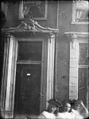
 Ingang - Leiden - 20137390 - RCE.jpg 898 × 1,200; 218 KB
-
 Ingang - Leiden - 20137391 - RCE.jpg 895 × 1,200; 160 KB
-
 Leiden - Steenschuur 16.JPG 2,736 × 3,648; 4.71 MB
-
 Steenschuur 16, Leiden.JPG 2,048 × 3,072; 2.88 MB
-
 Zuid-zijde tussen Levendaal- en Korevaarstr. - Leiden - 20137362 - RCE.jpg 1,200 × 957; 321 KB


