Category:Steenschuur 17, Leiden
Jump to navigation
Jump to search
| Object location | | View all coordinates using: OpenStreetMap |
|---|
building in Leiden, Netherlands  | |||||
| Upload media | |||||
| Instance of | |||||
|---|---|---|---|---|---|
| Location | Leiden, South Holland, Netherlands | ||||
| Street address |
| ||||
| Heritage designation |
| ||||
 | |||||
|
This is a category about rijksmonument number 25592
|
| Address |
|
Media in category "Steenschuur 17, Leiden"
The following 11 files are in this category, out of 11 total.
-
 -Levendaal, overzicht - Leiden - 20137364 - RCE.jpg 1,179 × 1,200; 321 KB
-
 Gevel - Leiden - 20137396 - RCE.jpg 805 × 1,200; 208 KB
-

-
-
 Hoek Levendaal, overzicht - Leiden - 20137363 - RCE.jpg 1,183 × 1,200; 302 KB
-
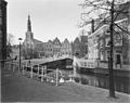
 Leiden - Steenschuur 17.JPG 2,736 × 3,648; 4.62 MB
-
 Noordwand binnenplaatsje voor de afbraak - Leiden - 20137392 - RCE.jpg 951 × 1,200; 272 KB
-
 Schouw 1e etage achterkamer - Leiden - 20137395 - RCE.jpg 953 × 1,200; 148 KB
-
 Schouw 1e etage, voorkamer - Leiden - 20137394 - RCE.jpg 963 × 1,200; 190 KB
-
 Voorgevel - Leiden - 20137397 - RCE.jpg 967 × 1,200; 306 KB
-
 Zuidwand binnenplaats - Leiden - 20137393 - RCE.jpg 961 × 1,200; 258 KB


