Category:Stiftskerk, Weerselo
Jump to navigation
Jump to search
| Object location | | View all coordinates using: OpenStreetMap |
|---|
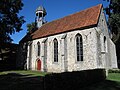
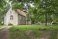
church building in Dinkelland, Netherlands  | |||||
| Upload media | |||||
| Instance of | |||||
|---|---|---|---|---|---|
| Location | Weerselo, Dinkelland, Overijssel, Netherlands | ||||
| Street address |
| ||||
| Located on street |
| ||||
| Heritage designation |
| ||||
 | |||||
Nederlands: Stiftskerk - anno 12e eeuw
|
This is a category about rijksmonument number 38415
|
| Address |
|
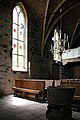
Media in category "Stiftskerk, Weerselo"
The following 40 files are in this category, out of 40 total.
-
 2013 Open deur Stiftskerk Het Stift.jpg 3,000 × 4,000; 4.08 MB
-
 2013 Stiftskerk Weerselo.jpg 4,000 × 3,000; 3.27 MB
-
 38415 Weerselo Stiftkerk -1 08.JPG 2,974 × 1,983; 1.23 MB
-
 38415 Weerselo Stiftkerk interieur-1 08.JPG 1,988 × 2,981; 1.03 MB
-
 Doopvont - Weerselo - 20251621 - RCE.jpg 885 × 1,200; 156 KB
-
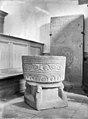 Doopvont - Weerselo - 20251622 - RCE.jpg 885 × 1,200; 178 KB
-
 Doopvont - Weerselo - 20251623 - RCE.jpg 888 × 1,200; 168 KB
-
 Doopvont - Weerselo - 20251624 - RCE.jpg 887 × 1,200; 165 KB
-
 Exterieur - Weerselo - 20251633 - RCE.jpg 1,200 × 1,200; 301 KB
-
 Exterieur - Weerselo - 20251634 - RCE.jpg 1,200 × 1,200; 350 KB
-
 Exterieur - Weerselo - 20251635 - RCE.jpg 1,200 × 1,200; 360 KB
-
 Intenieur, aanzicht orgel, orgelnummer 1624 - Weerselo - 20417188 - RCE.jpg 806 × 1,200; 189 KB
-
 Interieur - Weerselo - 20251628 - RCE.jpg 813 × 1,200; 176 KB
-
 Interieur naar het oosten - Weerselo - 20251619 - RCE.jpg 891 × 1,200; 107 KB
-
 Interieur naar het oosten - Weerselo - 20251620 - RCE.jpg 885 × 1,200; 112 KB
-
 Interieur naar het westen met orgel - Weerselo - 20251630 - RCE.jpg 1,200 × 959; 193 KB
-
 Interieur, aanzicht orgel, orgelnummer 1844 - Weerselo - 20374905 - RCE.jpg 920 × 1,200; 159 KB
-
 Kerk naar het noord-westen - Weerselo - 20251616 - RCE.jpg 875 × 1,200; 209 KB
-
 Kerk vanuit het zuid-westen - Weerselo - 20251618 - RCE.jpg 1,200 × 879; 219 KB
-
 Kerk vanuit het zuiden - Weerselo - 20251617 - RCE.jpg 1,200 × 880; 171 KB
-
 Opgestapelde grafzerken - Weerselo - 20251625 - RCE.jpg 1,200 × 872; 133 KB
-
 Overzicht - Weerselo - 20251610 - RCE.jpg 1,200 × 804; 307 KB
-

-

-
 Overzicht noordoostgevel - Weerselo - 20351497 - RCE.jpg 1,190 × 1,200; 509 KB
-
 Overzicht oostgevel en zuidgevel - Weerselo - 20382952 - RCE.jpg 1,200 × 1,200; 477 KB
-
 Overzicht stiftschuur met de kerk op de achtergrond - Weerselo - 20382959 - RCE.jpg 1,200 × 1,200; 530 KB
-
 Overzicht voorgevel en rechter zijgevel - Weerselo - 20382955 - RCE.jpg 1,200 × 1,200; 506 KB
-

-

-
 Priesterzerken - Weerselo - 20251626 - RCE.jpg 882 × 1,200; 178 KB
-
 Priesterzerken - Weerselo - 20251627 - RCE.jpg 880 × 1,200; 184 KB
-
 Stift Weerselo.jpg 5,513 × 3,675; 9.81 MB
-
 Stiftskerk Heilige Remigius Het Stift 2.jpg 2,576 × 1,952; 1.99 MB
-
 Stiftskerk Heilige Remigius Het Stift.jpg 2,576 × 1,952; 1.85 MB
-
 Stiftskerk Interieur Het Stift.jpg 2,576 × 1,952; 1.62 MB
-
 Stiftskerk noordzijde, het Stift 11, monument nr 38415.jpg 2,800 × 2,544; 2.31 MB
-
 Stiftskerk Orgel Het Stift.jpg 2,576 × 1,952; 1.41 MB
-
 Stiftskerk zuidzijde, rijksmonument nr 38415.JPG 4,345 × 2,895; 5.1 MB
-
 Waterput 't Stift.JPG 3,000 × 4,000; 5.21 MB


