Category:Stillington, North Yorkshire
Jump to navigation
Jump to search
village and civil parish in North Yorkshire, United Kingdom  | |||||
| Upload media | |||||
| Instance of | |||||
|---|---|---|---|---|---|
| Location | Hambleton, North Yorkshire, Yorkshire and the Humber, England | ||||
| Population |
| ||||
| Area |
| ||||
 | |||||
English: Stillington is a village and civil parish in the Hambleton district of North Yorkshire, England. It lies on the York to Helmsley road about ten miles north of York.
Subcategories
This category has only the following subcategory.
N
Media in category "Stillington, North Yorkshire"
The following 150 files are in this category, out of 150 total.
-
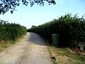
 A minor road to Stillington - geograph.org.uk - 2467067.jpg 800 × 600; 176 KB
-

-
 Along the beck south of Easingwold Golf Course - geograph.org.uk - 5501311.jpg 1,600 × 1,200; 796 KB
-
 Barn at Roseberry Farm - geograph.org.uk - 348461.jpg 640 × 480; 77 KB
-
 Barn in concrete yard - geograph.org.uk - 5626996.jpg 1,500 × 1,125; 1.58 MB
-
 Bishopton Crossing. - geograph.org.uk - 187094.jpg 640 × 479; 96 KB
-
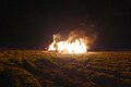
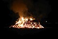 Bonfire at Stillington - geograph.org.uk - 5592947.jpg 640 × 427; 128 KB
-
 Building at Home Farm, Stillington - geograph.org.uk - 4028846.jpg 4,000 × 3,000; 2.04 MB
-
 Carr Lane, Stillington - geograph.org.uk - 2372760.jpg 1,024 × 768; 239 KB
-
 Corners on Sand Lane - geograph.org.uk - 3174689.jpg 2,560 × 1,920; 2.16 MB
-
 Cottage Farm at Stillington - geograph.org.uk - 5627007.jpg 1,500 × 1,125; 1.84 MB
-
 Crayke Lane - geograph.org.uk - 3355144.jpg 1,024 × 751; 284 KB
-
 Crayke Lane - geograph.org.uk - 6070953.jpg 1,024 × 768; 599 KB
-
 Crayke Lane towards West Lane - geograph.org.uk - 3524670.jpg 1,024 × 735; 221 KB
-
 Crowds at Stillington Bonfire - geograph.org.uk - 5592936.jpg 640 × 427; 196 KB
-
 Cyclists in Stillington - geograph.org.uk - 4941508.jpg 640 × 427; 105 KB
-
 Cyclists in Stillington - geograph.org.uk - 6151685.jpg 1,024 × 768; 623 KB
-
 Double bend on Sand Lane - geograph.org.uk - 5764962.jpg 640 × 427; 239 KB
-
 Easingwold Golf course 2 - geograph.org.uk - 4965067.jpg 960 × 717; 183 KB
-
 Evidence of tree felling - geograph.org.uk - 1867609.jpg 3,264 × 2,448; 2.35 MB
-
 Farmland west of Stillington - geograph.org.uk - 4770357.jpg 1,024 × 768; 161 KB
-
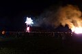
 Fireworks at Stillington - geograph.org.uk - 5592941.jpg 640 × 427; 145 KB
-
 Fireworks at Stillington - geograph.org.uk - 6333921.jpg 1,024 × 768; 346 KB
-
 Floral display on Carr Lane - geograph.org.uk - 2372763.jpg 1,024 × 768; 279 KB
-
 Footbridge over the infant River Foss near Stillington - geograph.org.uk - 5938069.jpg 1,600 × 1,200; 1.16 MB
-
 Footpath at the eastern end of Easingwold Golf Course - geograph.org.uk - 5501303.jpg 1,600 × 1,200; 961 KB
-
 Footpath from West Lane - geograph.org.uk - 5764906.jpg 640 × 427; 228 KB
-
 Footpath off Jack Lane, Stillington - geograph.org.uk - 4038406.jpg 1,600 × 1,200; 1 MB
-
 Fox Inn Farm - geograph.org.uk - 4028808.jpg 4,000 × 3,000; 2.39 MB
-
 Graycarr Lodge - geograph.org.uk - 1867612.jpg 2,176 × 1,632; 757 KB
-
 Graycarr Lodge Farmhouse - geograph.org.uk - 5501313.jpg 1,600 × 1,200; 556 KB
-
 Green Lane - geograph.org.uk - 5916991.jpg 3,239 × 4,319; 3.29 MB
-
 Green Lane approaching West Lane - geograph.org.uk - 3174735.jpg 2,560 × 1,920; 2.05 MB
-
 Gypsy Camp corner of Moor and Sands Lane's - geograph.org.uk - 3129418.jpg 3,264 × 2,448; 2.38 MB
-
 Gypsy Camp on the Crossroads - geograph.org.uk - 3129411.jpg 3,264 × 2,448; 2.05 MB
-
 Gypsy horses feeding at roadside - geograph.org.uk - 3129399.jpg 3,264 × 2,448; 2.19 MB
-
 Gypsy horses on Moor Lane - geograph.org.uk - 3129425.jpg 3,264 × 2,448; 2.08 MB
-
 Ings Lane - geograph.org.uk - 3354608.jpg 1,024 × 752; 205 KB
-
 Ings Lane - geograph.org.uk - 5764958.jpg 640 × 427; 219 KB
-
 Ings Lane near West Lane - geograph.org.uk - 5764908.jpg 640 × 427; 207 KB
-
 Ings Lane toward junction with West Lane - geograph.org.uk - 3174675.jpg 2,560 × 1,920; 2.06 MB
-
 Jack Lane - geograph.org.uk - 4965238.jpg 960 × 717; 156 KB
-
 Jack Lane north of Stillington - geograph.org.uk - 4038421.jpg 1,600 × 1,200; 953 KB
-
 Long straight on Sand Lane - geograph.org.uk - 3174698.jpg 2,560 × 1,920; 2.22 MB
-
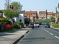
 Looking towards Main Street, Stillington - geograph.org.uk - 3523363.jpg 1,024 × 768; 139 KB
-
 Main Street, Stillington - geograph.org.uk - 4028826.jpg 4,000 × 3,000; 3 MB
-
 Mill Bridge from Skeugh Lane (Track) - geograph.org.uk - 3110089.jpg 3,264 × 2,448; 1.85 MB
-
 Mill Lane - geograph.org.uk - 5773012.jpg 640 × 427; 282 KB
-
 Mobile Boxes - geograph.org.uk - 264846.jpg 640 × 480; 96 KB
-
 Moor Lane - geograph.org.uk - 3354595.jpg 1,024 × 752; 457 KB
-
 Moor Lane, east - geograph.org.uk - 3354597.jpg 1,024 × 768; 210 KB
-
 Moor Lane, heading west from Wandell Balk - geograph.org.uk - 4770350.jpg 1,024 × 768; 221 KB
-
 Near Greycarr Lodge - geograph.org.uk - 4965158.jpg 960 × 717; 159 KB
-
 New Rules For Walkers - geograph.org.uk - 297798.jpg 640 × 480; 103 KB
-
 Ordnance Survey Cut Mark with Bolt - geograph.org.uk - 4029180.jpg 4,000 × 3,000; 3.8 MB
-
 Ordnance Survey Flush Bracket 2353 - geograph.org.uk - 4029197.jpg 4,000 × 3,000; 4.01 MB
-
 Ordnance Survey Flush Bracket 2354 - geograph.org.uk - 4029170.jpg 4,000 × 3,000; 4.18 MB
-
 Ordnance Survey Flush Bracket 2355 - geograph.org.uk - 4028977.jpg 4,000 × 3,000; 3.85 MB
-
 Path to the bonfire - geograph.org.uk - 6333920.jpg 1,024 × 768; 444 KB
-
 Pennyflats - geograph.org.uk - 5764960.jpg 640 × 427; 240 KB
-
 Pennyflats Farm from Roseberry Lane - geograph.org.uk - 3129438.jpg 3,264 × 2,448; 1.93 MB
-
 Pond Cottage Antiques, Stillington - geograph.org.uk - 4038429.jpg 1,600 × 1,200; 1.03 MB
-
 Power lines heading northwest over West Lane - geograph.org.uk - 3174752.jpg 2,560 × 1,920; 1.73 MB
-
 Pylon north of Stillington Road - geograph.org.uk - 5764904.jpg 640 × 427; 200 KB
-
 Pylons across the plain - geograph.org.uk - 5916993.jpg 3,086 × 4,117; 2.2 MB
-
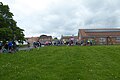
 Refreshments on the green - geograph.org.uk - 4470739.jpg 640 × 428; 87 KB
-
 Road junction by Four Acres - geograph.org.uk - 5916996.jpg 4,320 × 2,925; 2.03 MB
-
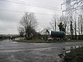
 Road junction in Stillington - geograph.org.uk - 5911948.jpg 3,240 × 2,851; 1.53 MB
-
 Roseberry Lane at Pennyflats Farm - geograph.org.uk - 2467063.jpg 800 × 600; 259 KB
-
 Roseberry Lane towards Huby - geograph.org.uk - 2467057.jpg 800 × 600; 347 KB
-
 Shad Lane - geograph.org.uk - 3354591.jpg 1,024 × 768; 275 KB
-
 Sheep with hay fodder - geograph.org.uk - 348450.jpg 640 × 480; 69 KB
-
 Spectators at Stillington Bonfire - geograph.org.uk - 5183270.jpg 640 × 427; 98 KB
-
 St Nicholas Church, Stillington - geograph.org.uk - 5938057.jpg 1,600 × 1,200; 612 KB
-
 St Nicholas Church, Stillington, Yorkshire - geograph.org.uk - 4986761.jpg 5,472 × 3,648; 6.8 MB
-
 St Nicholas' Parish Church - geograph.org.uk - 2554921.jpg 1,280 × 960; 682 KB
-
 St Nicholas' Parish Church - geograph.org.uk - 2554957.jpg 1,280 × 960; 801 KB
-
 St Nicholas, Stillington - Chancel - geograph.org.uk - 5660697.jpg 900 × 692; 219 KB
-
 St Nicholas, Stillington - East end - geograph.org.uk - 5660694.jpg 900 × 661; 201 KB
-
 St Nicholas, Stillington - geograph.org.uk - 5660692.jpg 900 × 639; 292 KB
-
 St Nicholas, Stillington - geograph.org.uk - 5660693.jpg 900 × 552; 230 KB
-
 St Nicholas, Stillington - Sanctuary - geograph.org.uk - 5660698.jpg 900 × 665; 230 KB
-

-

-
 St Nicholas, Stillington - West end - geograph.org.uk - 5660699.jpg 900 × 676; 222 KB
-
 Stillington bonfire - geograph.org.uk - 4731701.jpg 640 × 540; 67 KB
-
 Stillington Bonfire - geograph.org.uk - 5183269.jpg 640 × 427; 88 KB
-
 Stillington Bonfire - geograph.org.uk - 5592943.jpg 640 × 427; 143 KB
-
 Stillington Bonfire - geograph.org.uk - 6333923.jpg 1,024 × 768; 292 KB
-
 Stillington Bonfire and Fireworks - geograph.org.uk - 5592940.jpg 640 × 427; 156 KB
-
 Stillington Bonfire entrance - geograph.org.uk - 4731698.jpg 640 × 595; 73 KB
-
 Stillington fireworks - geograph.org.uk - 4731702.jpg 640 × 427; 54 KB
-
 Stillington Green - geograph.org.uk - 5390153.jpg 640 × 427; 226 KB
-
 Stillington Mill - geograph.org.uk - 212003.jpg 640 × 480; 107 KB
-
 Stillington Primary School - geograph.org.uk - 365193.jpg 640 × 480; 82 KB
-
 Stillington Village, Yorkshire - geograph.org.uk - 4986756.jpg 5,472 × 3,648; 6.67 MB
-
 Stillington, North Yorkshire.jpg 640 × 427; 129 KB
-
 The Bay Tree, Stillington - geograph.org.uk - 3523367.jpg 1,024 × 768; 173 KB
-
 The Church of St Nicholas at Stillington - geograph.org.uk - 4028841.jpg 4,000 × 3,000; 2.63 MB
-
 The food tent - geograph.org.uk - 4731700.jpg 640 × 324; 43 KB
-
 The Green in Stillington - geograph.org.uk - 6151681.jpg 768 × 1,024; 700 KB
-
 The Lane To Skeugh Farm - geograph.org.uk - 209743.jpg 640 × 480; 101 KB
-
 The Parish Church of St Nicholas, Stillington - geograph.org.uk - 2554962.jpg 1,280 × 960; 775 KB
-
 The Post Office And Stores, Stillington - geograph.org.uk - 209746.jpg 640 × 480; 109 KB
-
 The road to Easingwold - geograph.org.uk - 1867625.jpg 2,448 × 3,264; 1.75 MB
-
 The road to Roseberry Hill - geograph.org.uk - 4770353.jpg 1,024 × 768; 148 KB
-
 The Village Hall, Stillington - geograph.org.uk - 3522797.jpg 1,024 × 768; 249 KB
-
 The White Bear Inn, Stillington - geograph.org.uk - 3523375.jpg 768 × 1,024; 134 KB
-
 The White Bear, Stillington - geograph.org.uk - 2554940.jpg 1,280 × 960; 525 KB
-
 The White Bear, Stillington - geograph.org.uk - 591047.jpg 640 × 412; 61 KB
-
 Track from Sand Lane into Folly Wood - geograph.org.uk - 3174679.jpg 2,560 × 1,920; 2.16 MB
-
 Track to Hazel Hill - geograph.org.uk - 5988898.jpg 768 × 1,024; 821 KB
-
 Track to Stillington Pumping Station. - geograph.org.uk - 187088.jpg 640 × 479; 104 KB
-
 Tree on Roseberry Lane, near Stillington - geograph.org.uk - 4770165.jpg 1,024 × 768; 180 KB
-
 Under the power lines - geograph.org.uk - 3354601.jpg 1,024 × 768; 184 KB
-
 Unused Shelter - geograph.org.uk - 748255.jpg 640 × 427; 110 KB
-
 View to Fox Inn Farm - geograph.org.uk - 3354616.jpg 1,024 × 670; 220 KB
-
 Village Green - geograph.org.uk - 4470741.jpg 640 × 428; 67 KB
-
 Wandell Balk - geograph.org.uk - 4770347.jpg 1,024 × 768; 140 KB
-
 West Lane at the junction with Ings Lane - geograph.org.uk - 2467077.jpg 800 × 600; 191 KB
-
 West Lane from the junction with Green Lane - geograph.org.uk - 3174749.jpg 2,560 × 1,920; 1.78 MB
-
 West Lane meets Crayke Lane - geograph.org.uk - 5764907.jpg 640 × 427; 225 KB
-
 White Bear Inn Sign - geograph.org.uk - 2554945.jpg 640 × 853; 269 KB
-
 A Tributary Of The River Foss - geograph.org.uk - 209744.jpg 480 × 640; 108 KB
-
 Bridge East of Stillington - geograph.org.uk - 181304.jpg 640 × 480; 145 KB
-
 Bungalow at Foxton, near Sedgefield - geograph.org.uk - 167553.jpg 640 × 480; 109 KB
-
 Elstob Hill Farm. - geograph.org.uk - 187179.jpg 640 × 344; 43 KB
-
 Farmland at SE583690 - geograph.org.uk - 181306.jpg 640 × 480; 103 KB
-
 Farmland near Stillington - geograph.org.uk - 262711.jpg 640 × 480; 99 KB
-
 Harryfield Lane - geograph.org.uk - 533586.jpg 640 × 359; 75 KB
-
 Hedgerow along Bishopton Beck - geograph.org.uk - 167539.jpg 640 × 480; 93 KB
-
 Hedgerow near West House Farm, Foxton - geograph.org.uk - 167555.jpg 480 × 640; 95 KB
-
 Lane near Pennyflats Farm - geograph.org.uk - 330767.jpg 640 × 480; 133 KB
-
 Launds Farm - geograph.org.uk - 533452.jpg 640 × 359; 51 KB
-
 Milepost one mile west of Stillington - geograph.org.uk - 330780.jpg 640 × 480; 151 KB
-
 Not All Public Highways Are Paved - geograph.org.uk - 260348.jpg 640 × 480; 99 KB
-
 Over the fields to Crayke - geograph.org.uk - 9963.jpg 640 × 480; 132 KB
-
 Private road near Shotton - geograph.org.uk - 167547.jpg 640 × 480; 86 KB
-

-
 Sign for the White Bear, Stillington - geograph.org.uk - 591048.jpg 480 × 640; 74 KB
-
 T junction west of Stillington - geograph.org.uk - 330774.jpg 640 × 480; 79 KB
-
 The "Ride Away" Equestrian Centre - geograph.org.uk - 262707.jpg 640 × 480; 99 KB
-
 The B1363 - geograph.org.uk - 260349.jpg 640 × 480; 108 KB
-
 The B1363 - geograph.org.uk - 262700.jpg 640 × 480; 101 KB
-
 The Bay Tree Bar and Restaurant - geograph.org.uk - 212007.jpg 640 × 480; 107 KB
-
 The Road To Mowbray House - geograph.org.uk - 297796.jpg 640 × 480; 104 KB
-
 Townend pond, Stillington - geograph.org.uk - 365189.jpg 640 × 480; 107 KB
-

-
 View towards the North East and Stillington - geograph.org.uk - 9966.jpg 640 × 480; 132 KB
-
 West Farm Lake, Stillington - geograph.org.uk - 167536.jpg 640 × 480; 78 KB


_-_geograph.org.uk_-_3110089.jpg)


