Category:Stirton
Jump to navigation
Jump to search

hamlet in North Yorkshire, UK | |||||
| Upload media | |||||
| Instance of | |||||
|---|---|---|---|---|---|
| Location | Stirton with Thorlby, Craven, North Yorkshire, Yorkshire and the Humber, England | ||||
 | |||||
Media in category "Stirton"
The following 35 files are in this category, out of 35 total.
-
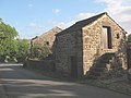
 Barn at the centre of Stirton - geograph.org.uk - 1390330.jpg 640 × 480; 171 KB
-
 Barn on Bog Lane, Stirton - geograph.org.uk - 1388869.jpg 640 × 480; 100 KB
-
 Bog Lane sewage treatment works - geograph.org.uk - 1390336.jpg 640 × 480; 173 KB
-
 Bog Lane, Stirton - geograph.org.uk - 3308794.jpg 4,000 × 3,000; 3.85 MB
-
-
 Culvert Lane - geograph.org.uk - 1391153.jpg 640 × 480; 158 KB
-
 Culvert Lane - overgrown - geograph.org.uk - 1391198.jpg 640 × 480; 225 KB
-
 Culvert Lane passing under the canal - geograph.org.uk - 1391205.jpg 640 × 480; 154 KB
-
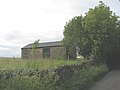
 Derelict barns in Stirton - geograph.org.uk - 1390329.jpg 640 × 480; 102 KB
-
 Field adjacent to the A65 at Stirton - geograph.org.uk - 1390325.jpg 640 × 480; 105 KB
-
 Fields north of Stirton - geograph.org.uk - 122205.jpg 640 × 480; 100 KB
-

-
 Late spring flowers on Bog Lane - geograph.org.uk - 1390337.jpg 640 × 480; 232 KB
-
 Level crossing at Niffany - geograph.org.uk - 1391228.jpg 640 × 480; 116 KB
-

-
 Pennine gas pipeline - geograph.org.uk - 534527.jpg 640 × 480; 79 KB
-
 Sheep field above Stirton - geograph.org.uk - 2395020.jpg 3,872 × 2,592; 3.19 MB
-
 Sheep on the Aire flood plain - geograph.org.uk - 1395545.jpg 640 × 480; 74 KB
-
 Stirton - geograph.org.uk - 122201.jpg 640 × 480; 152 KB
-
 Stirton stocks.jpg 4,032 × 3,024; 3.25 MB
-
 Stirton, Crossroads - geograph.org.uk - 4192236.jpg 4,320 × 3,240; 5.34 MB
-
 Stone barn with upper level - geograph.org.uk - 1390328.jpg 640 × 480; 92 KB
-
 Tall tree with sheep - geograph.org.uk - 1390327.jpg 640 × 480; 164 KB
-
 Tarn House caravan park - geograph.org.uk - 534532.jpg 640 × 480; 101 KB
-
 Tarn House Inn - geograph.org.uk - 534531.jpg 640 × 480; 80 KB
-
 Tarn House lodge - geograph.org.uk - 1390334.jpg 640 × 480; 98 KB
-
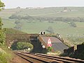
 The Midland line at Niffany - geograph.org.uk - 1391242.jpg 640 × 480; 174 KB
-
 Transmitter above the A65 - geograph.org.uk - 1390335.jpg 640 × 480; 108 KB
-
 Typical scenery in Airedale - geograph.org.uk - 1391185.jpg 640 × 480; 99 KB
-
 Victorian postbox in Stirton - geograph.org.uk - 1396748.jpg 640 × 480; 236 KB
-
 View south-east from near Stirton - geograph.org.uk - 1388865.jpg 640 × 480; 84 KB
-
 Village stocks, Stirton - geograph.org.uk - 1390331.jpg 640 × 480; 253 KB
-
 White Hills golf driving range - geograph.org.uk - 1390333.jpg 640 × 480; 109 KB
-
 White Hills Lane - geograph.org.uk - 1390332.jpg 640 × 480; 200 KB
-
 Below the Leeds Liverpool Canal - geograph.org.uk - 312167.jpg 580 × 435; 129 KB


