Category:Stoney Stanton
Vai alla navigazione
Vai alla ricerca
English: Stoney Stanton is a village in the Blaby district of Leicestershire, England, with a population of over 7,000 in 2001. It constitutes a civil parish. The village is on a rocky outcrop and was the site of a quarry, which was closed in 1958. It has been since flooded and as Stoney Cove is a major diving centre, one of the biggest in Europe and a steady source of business for the local area. Through the first half of the 20th Century granite quarrying was a major activity in Stoney Stanton due to the village's location upon a rocky outcrop of ancient granodiorite, a hard stone much prized for road making. It also had a symbol of the textile industry, a Couture Tights factory, within the village until the closure of the factory a few years ago. Calor Gas also has a large depot on the borders of the village.
Italiano: Stoney Stanton è un paese di 7.000 abitanti della contea del Leicestershire, in Inghilterra.
village in the United Kingdom  | |||||
| Carica un file multimediale | |||||
| Istanza di | |||||
|---|---|---|---|---|---|
| Luogo | Blaby, Leicestershire, Midlands Orientali, Inghilterra | ||||
| Popolazione |
| ||||
| Considerato essere uguale a | Stoney Stanton (pagina Wikimedia duplicata, parrocchia civile dell'Inghilterra) | ||||
 | |||||
Sottocategorie
Questa categoria contiene le 3 sottocategorie indicate di seguito, su un totale di 3.
S
- Stoney Cove dive centre (25 F)
- Stoney Stanton War Memorial (2 F)
File nella categoria "Stoney Stanton"
Questa categoria contiene 112 file, indicati di seguito, su un totale di 112.
-
 A walk in the woods - geograph.org.uk - 5760874.jpg 1 600 × 900; 611 KB
-
 Approach to Highfields Farm - geograph.org.uk - 4812396.jpg 640 × 492; 97 KB
-
 Approaching Soper's Bridge - geograph.org.uk - 5921921.jpg 4 000 × 3 000; 3,2 MB
-
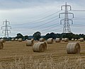 Bales and pylons near Stoney Stanton - geograph.org.uk - 940475.jpg 640 × 521; 78 KB
-
 Bend in Sapcote Road - geograph.org.uk - 5295113.jpg 640 × 480; 89 KB
-
 Bridge over River Soar, near Croft - geograph.org.uk - 215353.jpg 640 × 480; 135 KB
-
 Bridleway crosses the River Soar - geograph.org.uk - 5921916.jpg 4 000 × 3 000; 3,3 MB
-
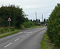
 Broughton Road (B581) - geograph.org.uk - 5223019.jpg 640 × 480; 55 KB
-
 Broughton Road, Leicestershire - geograph.org.uk - 511388.jpg 640 × 471; 133 KB
-
 Bulls Head, Stoney Stanton - geograph.org.uk - 511492.jpg 640 × 572; 113 KB
-

-

-
 Bus stop on New Road, Stoney Stanton - geograph.org.uk - 5295127.jpg 640 × 480; 96 KB
-

-

-
 Coventry Road (B4114) - geograph.org.uk - 5223013.jpg 640 × 480; 62 KB
-
 Coventry Road - geograph.org.uk - 5793602.jpg 1 600 × 900; 392 KB
-
 Croft Quarry, aerial 2018 (1) - geograph.org.uk - 5846006.jpg 1 024 × 683; 191 KB
-
 Cyclists along Stanton Lane - geograph.org.uk - 2876115.jpg 2 532 × 2 248; 2,48 MB
-
 Elizabeth II postbox on Huncote Road, Stoney Stanton - geograph.org.uk - 5295508.jpg 2 136 × 2 848; 1,17 MB
-
 Elizabeth II postbox on Long Street, Stoney Stanton - geograph.org.uk - 5295515.jpg 2 136 × 2 848; 1,18 MB
-
 Elizabeth II postbox on St Michaels Court, Stoney Stanton - geograph.org.uk - 5295524.jpg 2 136 × 2 848; 1,17 MB
-
 Entering Stoney Stanton - geograph.org.uk - 867435.jpg 640 × 324; 63 KB
-
 Former Clint Hill Quarry - geograph.org.uk - 4812402.jpg 640 × 440; 92 KB
-
 Gates to former Clint Hill Quarry - geograph.org.uk - 4812403.jpg 640 × 492; 136 KB
-
 Gateway to Private Property - geograph.org.uk - 4812397.jpg 640 × 445; 106 KB
-
 Grazing near Stoney Stanton - geograph.org.uk - 5295114.jpg 640 × 480; 57 KB
-
 Grazing off Broughton Road - geograph.org.uk - 5223017.jpg 640 × 480; 62 KB
-
 Henderson Inclined Cableway.png 1 274 × 940; 1,3 MB
-
 Highfields Farm Sign - geograph.org.uk - 4812398.jpg 640 × 547; 119 KB
-
 Hinckley Road towards Stoney Stanton - geograph.org.uk - 4812395.jpg 640 × 374; 62 KB
-

-
 Houses on Lee Close, Stoney Stanton - geograph.org.uk - 5295131.jpg 640 × 480; 70 KB
-

-
 Huncote Road - geograph.org.uk - 4808908.jpg 640 × 480; 77 KB
-
 Huncote Road - geograph.org.uk - 5761163.jpg 1 600 × 900; 416 KB
-
 Huncote Road near Stoney Stanton - geograph.org.uk - 2876108.jpg 2 618 × 1 971; 1,96 MB
-
 Huncote Road, Stoney Stanton - geograph.org.uk - 5295511.jpg 640 × 442; 49 KB
-
 Line to Hinckley - geograph.org.uk - 4808910.jpg 640 × 480; 71 KB
-
 Living rock church - geograph.org.uk - 5789426.jpg 1 600 × 900; 267 KB
-
 Long Street northwards - geograph.org.uk - 4811107.jpg 640 × 436; 48 KB
-
 Long Street southwards - geograph.org.uk - 4812405.jpg 640 × 412; 52 KB
-
 Long Street, Stoney Stanton - geograph.org.uk - 5295133.jpg 640 × 480; 58 KB
-

-
 Looking across Long Street to the Blue Bell - geograph.org.uk - 5427989.jpg 4 000 × 3 000; 2,47 MB
-

-
 M69 near Highgate Lodge Farm - geograph.org.uk - 4589826.jpg 1 600 × 1 061; 227 KB
-
 Manor Brook Close, Stoney Stanton - geograph.org.uk - 5295137.jpg 640 × 480; 65 KB
-
 Methodist church, Stoney Stanton - geograph.org.uk - 238697.jpg 517 × 640; 81 KB
-
 New development on Huncote Road - geograph.org.uk - 4808907.jpg 640 × 480; 66 KB
-
 Old boundary path - geograph.org.uk - 4808905.jpg 480 × 640; 148 KB
-
 Private road to Highfields Farm - geograph.org.uk - 5761162.jpg 1 600 × 900; 246 KB
-
 Public Bridleway to Sapcote - geograph.org.uk - 511402.jpg 640 × 495; 172 KB
-
 Railway line from Leicester to Birmingham - geograph.org.uk - 5431786.jpg 4 000 × 3 000; 872 KB
-
 Random track to nowhere - geograph.org.uk - 4808946.jpg 640 × 480; 89 KB
-
 Road to Stoney Cove Diving Centre - geograph.org.uk - 5295111.jpg 640 × 480; 103 KB
-
 Sapcote Road, Stoney Stanton - geograph.org.uk - 511499.jpg 640 × 401; 90 KB
-

-

-

-
 Sign for the Mill on the Soar - geograph.org.uk - 5223016.jpg 471 × 640; 64 KB
-

-
 Smithy Farm Drive, Stoney Stanton - geograph.org.uk - 3056500.jpg 2 000 × 1 498; 483 KB
-
 St Michael's church - geograph.org.uk - 5430679.jpg 3 516 × 2 476; 468 KB
-
 St Michael's Church at Stoney Stanton - geograph.org.uk - 6492759.jpg 501 × 800; 106 KB
-
 St Michael's Church, Stoney Stanton - geograph.org.uk - 5295125.jpg 640 × 480; 74 KB
-
 St Michaels Court, Stoney Stanton - geograph.org.uk - 5295528.jpg 640 × 480; 71 KB
-
 Stanton Lane westwards - geograph.org.uk - 4811109.jpg 640 × 494; 56 KB
-
 Stonebridge Cottage along Stanton Lane - geograph.org.uk - 2876109.jpg 2 751 × 1 899; 2,29 MB
-
 Hinckley Road in Stoney Stanton - geograph.org.uk - 940457.jpg 640 × 418; 69 KB
-
 Stoney Stanton Calor Centre Sign - geograph.org.uk - 4812399.jpg 640 × 444; 72 KB
-
 Stoney Stanton Church - geograph.org.uk - 3217774.jpg 640 × 480; 73 KB
-
 Stoney Stanton Church - geograph.org.uk - 3221601.jpg 640 × 480; 86 KB
-
 Stoney Stanton Scout Headquarters - geograph.org.uk - 3221593.jpg 640 × 504; 68 KB
-
 Stoney Stanton Social Club - geograph.org.uk - 940467.jpg 640 × 457; 61 KB
-
 Stoney Stanton Village Centre - geograph.org.uk - 3221585.jpg 640 × 441; 50 KB
-
 Stoney Stanton Village Hall - geograph.org.uk - 3221574.jpg 640 × 480; 63 KB
-
 Stoney Stanton Village Hall - geograph.org.uk - 5295128.jpg 640 × 480; 70 KB
-
 Stoney Stanton-Church Walk - geograph.org.uk - 3227673.jpg 640 × 480; 120 KB
-
 Stoney Stanton-Disused Quarry - geograph.org.uk - 3221550.jpg 640 × 480; 98 KB
-
 Stoney Stanton-Long Street - geograph.org.uk - 3227661.jpg 640 × 480; 64 KB
-
 Stoney Stanton-Manor Brook Close - geograph.org.uk - 3217791.jpg 640 × 480; 59 KB
-
 Stoney Stanton-Nock Verges - geograph.org.uk - 3227645.jpg 640 × 480; 83 KB
-
 Stoney Stanton-The Blue Bell - geograph.org.uk - 3227659.jpg 640 × 480; 54 KB
-
 Stoney Stanton-The Bull's Head - geograph.org.uk - 3227655.jpg 640 × 480; 72 KB
-
 Stoney Stanton-The Star Inn - geograph.org.uk - 3227650.jpg 640 × 480; 76 KB
-
 The Blue Bell Inn - geograph.org.uk - 511509.jpg 640 × 489; 84 KB
-
 The Blue Bell, Stoney Stanton - geograph.org.uk - 5295129.jpg 640 × 480; 61 KB
-
 The Bulls Head, Stoney Stanton - geograph.org.uk - 5295118.jpg 640 × 480; 71 KB
-
 The Francis Arms, Stoney Stanton - geograph.org.uk - 5295138.jpg 640 × 480; 68 KB
-
 The Mill on the Soar - geograph.org.uk - 5223014.jpg 640 × 480; 71 KB
-

-
 The South Leicestershire Railway looking towards Nuneaton - geograph.org.uk - 5808679.jpg 4 000 × 3 000; 3,32 MB
-
 The Star Inn, Stoney Stanton - geograph.org.uk - 5295122.jpg 640 × 516; 81 KB
-
 The Star Inn, Stoney Stanton - geograph.org.uk - 5295123.jpg 640 × 480; 67 KB
-

-
 Towards Stoney Stanton Calor Centre - geograph.org.uk - 4812400.jpg 640 × 478; 83 KB
-
 Tractor at work - geograph.org.uk - 4812401.jpg 640 × 477; 135 KB
-
 View towards Low Spinney Wind Farm - geograph.org.uk - 2876107.jpg 1 778 × 1 160; 868 KB
-

-
 Farmland near Sapcote - geograph.org.uk - 511403.jpg 640 × 418; 108 KB
-
 Farmland near Stoney Stanton - geograph.org.uk - 284980.jpg 640 × 480; 128 KB
-
 Footpath north of Stoney Stanton - geograph.org.uk - 284971.jpg 640 × 480; 100 KB
-
 Fosse Way, Stoney Bridge - geograph.org.uk - 211171.jpg 640 × 480; 104 KB
-
 Hinckley Road, Stoney Stanton - geograph.org.uk - 120163.jpg 640 × 480; 81 KB
-
 Huncote Road near Stoney Stanton - geograph.org.uk - 511547.jpg 640 × 519; 108 KB
-
 Huncote Road, Stoney Stanton - geograph.org.uk - 511516.jpg 640 × 478; 97 KB
-
 Occupation Road near Stoney Stanton - geograph.org.uk - 511530.jpg 640 × 480; 93 KB
-
 Public Bridleway - geograph.org.uk - 511393.jpg 640 × 481; 128 KB
-
 Stoney Cove national dive centre - geograph.org.uk - 79155.jpg 640 × 393; 75 KB
-
 Stoney Stanton Works - geograph.org.uk - 511542.jpg 640 × 480; 90 KB
-
 Straw Bales, nr. Sutton Lodge - geograph.org.uk - 211144.jpg 640 × 480; 94 KB


_-_geograph.org.uk_-_5223019.jpg)


_-_geograph.org.uk_-_5223013.jpg)

_-_geograph.org.uk_-_5846006.jpg)


_-_geograph.org.uk_-_5223011.jpg)


