Category:Stow-on-the-Wold
Vai alla navigazione
Vai alla ricerca
insediamento in Inghilterra  | |||||
| Carica un file multimediale | |||||
| Audio della pronuncia | |||||
|---|---|---|---|---|---|
| Istanza di | |||||
| Luogo | Cotswold, Gloucestershire, Sud Ovest dell'Inghilterra, Inghilterra | ||||
| sito web ufficiale | |||||
 | |||||
Sottocategorie
Questa categoria contiene le 9 sottocategorie indicate di seguito, su un totale di 9.
File nella categoria "Stow-on-the-Wold"
Questa categoria contiene 200 file, indicati di seguito, su un totale di 453.
(pagina precedente) (pagina successiva)-
 'The Bell at Stow' - geograph.org.uk - 4664515.jpg 1 024 × 683; 191 KB
-
 20 on Market Square, Stow-on-the-Wold - geograph.org.uk - 5922149.jpg 837 × 1 024; 194 KB
-
 7, Park Street, Stow - geograph.org.uk - 5527946.jpg 1 591 × 2 122; 1,32 MB
-
 A memory of the corn laws - geograph.org.uk - 721824.jpg 640 × 480; 98 KB
-
 A424-B4077 junction. Stow - geograph.org.uk - 2652045.jpg 640 × 480; 51 KB
-

-

-
 A429 at the Stow Lodge Hotel - geograph.org.uk - 2652017.jpg 640 × 480; 75 KB
-
 A429 enters Stow-on-the-Wold - geograph.org.uk - 3958895.jpg 3 648 × 2 736; 3,23 MB
-
 A429 heading north - geograph.org.uk - 3399035.jpg 640 × 480; 98 KB
-

-

-
 A429 Stow-on-the Wold Town Sign - geograph.org.uk - 5328196.jpg 640 × 474; 87 KB
-
 A429, Fosse Way - geograph.org.uk - 6117535.jpg 1 037 × 778; 621 KB
-
 A429-A424 junction, Stow - geograph.org.uk - 2652029.jpg 640 × 480; 81 KB
-
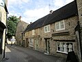
 Antique shops, Stow-on-the-Wold - geograph.org.uk - 3399025.jpg 640 × 480; 66 KB
-
 Approaching Stow-on-the-Wold - geograph.org.uk - 1949269.jpg 4 000 × 3 000; 3,38 MB
-
 Autumn colours by the B4068 - geograph.org.uk - 3744349.jpg 1 500 × 999; 289 KB
-
 B4450 junction with A436 - geograph.org.uk - 181281.jpg 640 × 480; 101 KB
-
 Barclays in Stow-on-the-Wold - geograph.org.uk - 5910613.jpg 1 024 × 813; 186 KB
-
 Barn at Parson's Corner, Stow-on-the-Wold - geograph.org.uk - 4941899.jpg 4 288 × 3 216; 2,7 MB
-
 Beaumayne Terrace, Back Walls, Stow-on-the-Wold - geograph.org.uk - 5913439.jpg 1 021 × 1 024; 245 KB
-
 Beauport.jpg 6 000 × 4 000; 7,51 MB
-
 Bench mark on the Milestone - geograph.org.uk - 2144782.jpg 600 × 800; 193 KB
-
 Benchmark on 'The Bell at Stow' - geograph.org.uk - 4664497.jpg 683 × 1 024; 297 KB
-
 Benchmark on 'The Porch House' - geograph.org.uk - 4664462.jpg 683 × 1 024; 281 KB
-
 Benchmark on buttress of St Edward's Church - geograph.org.uk - 4664400.jpg 1 024 × 683; 317 KB
-
 Benchmark on Enoch's Tower - geograph.org.uk - 4664529.jpg 1 024 × 683; 365 KB
-
 Benchmark on Fosseway Farm Cottage - geograph.org.uk - 4639674.jpg 683 × 1 024; 341 KB
-
 Benchmark on porch of St Edward's Church - geograph.org.uk - 4639902.jpg 1 024 × 683; 284 KB
-
 Benchmark on St Edward's Well, Stow-on-the-Wold.jpg 4 603 × 3 095; 11,85 MB
-
 Benchmark on Unicorn Hotel (south face) - geograph.org.uk - 4590756.jpg 683 × 1 024; 313 KB
-
 Benchmark on Unicorn Hotel - geograph.org.uk - 4590679.jpg 683 × 1 024; 281 KB
-
 Benchmarked milestone beside Evesham Road - geograph.org.uk - 4544140.jpg 683 × 1 024; 272 KB
-
 Blue Cross charity shop, Stow-on-the-Wold - geograph.org.uk - 5977646.jpg 1 024 × 867; 276 KB
-

-
 Borzoi in Stow-on-the-Wold - geograph.org.uk - 5910591.jpg 766 × 1 024; 184 KB
-
 BP filling station on Fosse Way - geograph.org.uk - 3580440.jpg 1 024 × 768; 115 KB
-
 BP filling station, Stow-on-the-Wold - geograph.org.uk - 5996184.jpg 1 024 × 768; 140 KB
-

-
 Brewery House - geograph.org.uk - 552196.jpg 640 × 480; 64 KB
-

-
 Building on Evesham Road - geograph.org.uk - 3192034.jpg 575 × 640; 331 KB
-
 Burgage House.jpg 6 000 × 4 000; 6,08 MB
-

-
 Candy Cox in Stow-on-the-Wold - geograph.org.uk - 5913568.jpg 889 × 1 024; 308 KB
-
 Chantry And Gatepiers 01.jpg 4 000 × 6 000; 10,07 MB
-
 Chantry And Gatepiers 02.jpg 6 000 × 4 000; 7,92 MB
-
 Christopher Clarke Antiques on Fosse Way - geograph.org.uk - 6268973.jpg 1 892 × 1 236; 1,46 MB
-
 Christopher Clarke Antiques, Stow-on-the-Wold - geograph.org.uk - 5995764.jpg 1 024 × 827; 165 KB
-
 Church Alley - Stow - geograph.org.uk - 941221.jpg 470 × 640; 236 KB
-
 Church Room - Church Walk, Stow - geograph.org.uk - 941239.jpg 640 × 513; 249 KB
-
 Church Street, Stow on the Wold (geograph 7043110).jpg 1 024 × 768; 208 KB
-
 Church Street, Stow-on-the-Wold - geograph.org.uk - 5601433.jpg 6 000 × 4 000; 4,97 MB
-
 Church Street, Stow-on-the-Wold - geograph.org.uk - 5977658.jpg 1 221 × 1 600; 421 KB
-
 Church Walk - Stow - geograph.org.uk - 941237.jpg 640 × 509; 259 KB
-

-
 Coppers.jpg 6 000 × 4 000; 10,78 MB
-
 Corner of field beside the A424 - geograph.org.uk - 4544180.jpg 1 024 × 683; 280 KB
-
 Cotswold Art Supplies shop in Stow-on-the-Wold - geograph.org.uk - 5977669.jpg 959 × 1 024; 269 KB
-
 Cotswold Art Supplies, Stow - geograph.org.uk - 5519627.jpg 1 958 × 1 469; 1,16 MB
-
 Cotswold Cricket Museum, Stow-on-the-Wold (1436).jpg 2 848 × 4 288; 5,36 MB
-
 Cotswold Galleries.jpg 6 000 × 4 000; 8,86 MB
-

-
 Cottage on Evesham Road, Stow-on-the-Wold - geograph.org.uk - 6251114.jpg 1 920 × 1 280; 1,46 MB
-
 Cottages in Stow on the Wold - geograph.org.uk - 5517931.jpg 1 958 × 1 469; 1,17 MB
-
-
 Cripps And Wood.jpg 6 000 × 4 000; 10,29 MB
-
 Cross Purposes - geograph.org.uk - 5256851.jpg 2 560 × 1 920; 1,77 MB
-
 Digbeth Street, junction with Park Street - geograph.org.uk - 6117551.jpg 3 456 × 2 592; 3,5 MB
-
 Digbeth Street, Stow on the Wold (geograph 7043051).jpg 1 024 × 768; 205 KB
-
 Distinctive grave in Stow-on-the-Wold Cemetery - geograph.org.uk - 5996194.jpg 1 024 × 768; 368 KB
-

-
 Driveway to Bretton House - geograph.org.uk - 1947456.jpg 4 000 × 3 000; 2,43 MB
-
 East along Sheep Street, Stow-on-the-Wold - geograph.org.uk - 5995774.jpg 1 024 × 828; 128 KB
-

-

-
 Edge of town - geograph.org.uk - 1949266.jpg 4 000 × 3 000; 1,9 MB
-
 Edward VII postbox on the High Street - geograph.org.uk - 3857216.jpg 1 200 × 1 600; 476 KB
-
 Enoch's Tower, Oddington Road - geograph.org.uk - 4664542.jpg 683 × 1 024; 146 KB
-
 Entrance road, Tesco, Stow-on-The-Wold - geograph.org.uk - 4591990.jpg 1 920 × 1 356; 853 KB
-
 Entrance to nursing home - geograph.org.uk - 3857243.jpg 1 600 × 1 067; 468 KB
-
 Evesham Road (A424) - geograph.org.uk - 3399031.jpg 640 × 480; 65 KB
-
 Evesham Road (A424) north of Stow-on-The-Wold - geograph.org.uk - 4959216.jpg 1 600 × 1 281; 717 KB
-
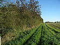
 Field below Stow-on-the-Wold - geograph.org.uk - 4269699.jpg 1 024 × 680; 285 KB
-
 Fields to the northeast of Stow-on-the-Wold.jpg 3 264 × 4 896; 9,52 MB
-
 Fleece Alley - geograph.org.uk - 552198.jpg 480 × 640; 82 KB
-
 Fleece Alley, Stow-on-the-Wold - geograph.org.uk - 1359594.jpg 439 × 640; 99 KB
-
 Footpath leaves road - geograph.org.uk - 1947847.jpg 4 000 × 3 000; 2,3 MB
-
 Fork in the road - geograph.org.uk - 2144790.jpg 1 024 × 768; 143 KB
-
 Fork off Fosse Way to Broadwell - geograph.org.uk - 3580444.jpg 1 024 × 768; 136 KB
-
 Former saddlery, Stow - geograph.org.uk - 5530465.jpg 2 122 × 1 591; 1,23 MB
-
 Foss Way in Stow-on-the-Wold - geograph.org.uk - 2053060.jpg 640 × 480; 81 KB
-
 Fosse Gallery.jpg 6 000 × 4 000; 8,73 MB
-
 Fosse Lane, Stow-on-the-Wold - geograph.org.uk - 3399034.jpg 640 × 480; 87 KB
-
 Fosse Manor Hotel - geograph.org.uk - 1468262.jpg 640 × 427; 96 KB
-

-
 Fosse Way in Stow-on-the-Wold - geograph.org.uk - 2053050.jpg 640 × 480; 64 KB
-

-
 Garwick cottage, Stow - geograph.org.uk - 5527943.jpg 1 591 × 2 122; 1,28 MB
-
 Gates of Moria - geograph.org.uk - 4718972.jpg 3 648 × 5 472; 5,06 MB
-
 Gloucestershire farmland - geograph.org.uk - 1839438.jpg 4 000 × 3 000; 3,79 MB
-

-
 Google Street View car in Stow-on-the-Wold - geograph.org.uk - 5996379.jpg 1 024 × 768; 200 KB
-

-
 Grade II listed red phonebox, Stow-on-the-Wold - geograph.org.uk - 5922178.jpg 1 024 × 969; 276 KB
-
 Grade II listed Unicorn, Stow-on-the-Wold - geograph.org.uk - 5995787.jpg 1 024 × 853; 200 KB
-
 Green Elms Stow Antiques.jpg 6 000 × 4 000; 11,82 MB
-
 Hackett's in Stow-on-the-Wold - geograph.org.uk - 5913475.jpg 650 × 1 024; 155 KB
-
 Heading north on the A424 - geograph.org.uk - 1526072.jpg 640 × 427; 58 KB
-
 High Street public toilets, Stow-on-the-Wold - geograph.org.uk - 5922116.jpg 1 024 × 953; 234 KB
-
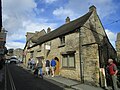
 House in Stow - geograph.org.uk - 447267.jpg 640 × 477; 108 KB
-
 House on Brewery Yard, Stow-on-the-Wold.jpg 4 753 × 3 215; 7,2 MB
-

-
 House on the corner at Stow-on-the-Wold - geograph.org.uk - 5753987.jpg 640 × 427; 125 KB
-
 Huffkins Bakery ^ Tearooms, Stow - geograph.org.uk - 5520876.jpg 1 958 × 1 469; 918 KB
-
 Hufkins.jpg 6 000 × 4 000; 8,1 MB
-
 Humphries Shoes shop in Stow-on-the-Wold - geograph.org.uk - 5996427.jpg 1 024 × 838; 200 KB
-
 Huntingdon Antiques, Premises On Corner Opposite Churchyard Entry 01.jpg 6 000 × 4 000; 7,94 MB
-
 Huntingdon Antiques, Premises On Corner Opposite Churchyard Entry 02.jpg 6 000 × 4 000; 8,82 MB
-
 Huntingdon Antiques.jpg 6 000 × 4 000; 8,13 MB
-
 Hyde Mill - geograph.org.uk - 447305.jpg 640 × 477; 90 KB
-
 Illegible milestone - geograph.org.uk - 1947916.jpg 3 000 × 4 000; 4,35 MB
-

-
 Inscription on St Edward's Well, Stow-on-the-Wold.jpg 4 896 × 3 264; 10,84 MB
-
 Jacana Stow.jpg 4 000 × 6 000; 6,64 MB
-
 John Blockley Gallery And Adjoining Gallery.jpg 6 000 × 4 000; 8,04 MB
-
 John Entwistle 1944-2002 (BBC Music Day).jpg 1 500 × 2 000; 1,26 MB
-
 Junction ahead - geograph.org.uk - 2144800.jpg 1 024 × 768; 272 KB
-
 Junction of A424 and A429 - geograph.org.uk - 4544155.jpg 1 024 × 683; 224 KB
-

-

-
 Junction of the A424 with the A429 - geograph.org.uk - 4273463.jpg 1 024 × 680; 334 KB
-
 Just off the Market Square - geograph.org.uk - 718855.jpg 640 × 480; 70 KB
-
 Keep Clear area, Back Walls, Stow-on-The-Wold - geograph.org.uk - 5913395.jpg 1 024 × 788; 311 KB
-

-
 King's Arms, Stow-on-the-Wold - geograph.org.uk - 5977620.jpg 775 × 1 024; 191 KB
-

-
 Kings Arms name sign, Stow-on-the-Wold - geograph.org.uk - 5977628.jpg 678 × 1 024; 199 KB
-
 Kissing gate by Talbot Square - geograph.org.uk - 5753991.jpg 640 × 427; 104 KB
-
 Lambswold, The Square, Stow-on-the-Wold - geograph.org.uk - 5910778.jpg 816 × 1 024; 185 KB
-
 Laurence-Bowen.jpg 640 × 480; 119 KB
-

-
 LBD Boutique in Stow-on-the-Wold - geograph.org.uk - 5996462.jpg 930 × 1 024; 279 KB
-
 Leaving Stow-on-the-Wold - geograph.org.uk - 2053063.jpg 640 × 480; 55 KB
-
 Leaving Stow-on-The-Wold - geograph.org.uk - 5952515.jpg 1 600 × 900; 491 KB
-
 Lloyds Bank, Stow-on-the-Wold - geograph.org.uk - 5911030.jpg 823 × 1 024; 204 KB
-
 Lower Park Street - geograph.org.uk - 3062619.jpg 3 552 × 2 540; 1,85 MB
-
 Lucy's Tearoom.jpg 6 000 × 4 000; 7,94 MB
-
 Main road junction - geograph.org.uk - 1624121.jpg 640 × 480; 64 KB
-
 Majestic Wine Warehouse, Stow-on-the-Wold - geograph.org.uk - 5911041.jpg 1 024 × 628; 145 KB
-
 Market cross - geograph.org.uk - 4249337.jpg 2 048 × 1 536; 1,52 MB
-
 Market Cross and Hotel - geograph.org.uk - 3857209.jpg 1 600 × 1 068; 361 KB
-
 Market Cross and King's Arms, Stow-on-the-Wold - geograph.org.uk - 3198880.jpg 4 320 × 3 240; 5,6 MB
-
 Market Cross, Stow-on-the-Wold - geograph.org.uk - 1017272.jpg 640 × 480; 98 KB
-
 Market Square - geograph.org.uk - 4095261.jpg 1 600 × 1 064; 571 KB
-
 Market Square - geograph.org.uk - 4174170.jpg 7 590 × 2 359; 4,37 MB
-
 Market Square - geograph.org.uk - 4174666.jpg 1 024 × 683; 207 KB
-
 Market Square - Stow on the Wold.jpg 3 426 × 1 478; 1,47 MB
-

-
 Market Square, Stow on the Wold - geograph.org.uk - 1009180.jpg 640 × 480; 121 KB
-
 Market Square, Stow-on-the-Wold - geograph.org.uk - 1839423.jpg 4 000 × 3 000; 2,08 MB
-
 Market Square, Stow-on-the-Wold - geograph.org.uk - 2505392.jpg 800 × 600; 135 KB
-
 Market Square, Stow-on-the-Wold - geograph.org.uk - 2534953.jpg 1 024 × 680; 139 KB
-
 Market Square, Stow-on-the-Wold - geograph.org.uk - 2534968.jpg 1 024 × 680; 222 KB
-
 Market Square, Stow-on-the-Wold - geograph.org.uk - 2603643.jpg 800 × 600; 433 KB
-
 Market Square, Stow-on-the-Wold - geograph.org.uk - 5601438.jpg 6 000 × 4 000; 7,28 MB
-
 Market Square, Stow-on-the-Wold in 1984 - geograph.org.uk - 2198765.jpg 755 × 507; 110 KB
-
 Meggie's, Stow-on-the-Wold - geograph.org.uk - 5977648.jpg 1 018 × 1 024; 245 KB
-
 Milestone - Stow on the Wold - geograph.org.uk - 4547085.jpg 640 × 480; 123 KB
-
 Milestone by the tree - geograph.org.uk - 2144772.jpg 1 024 × 768; 283 KB
-
 Milestone on the Evesham road - geograph.org.uk - 2144776.jpg 600 × 800; 189 KB
-
 Morris in the Market Place - geograph.org.uk - 3065313.jpg 3 648 × 2 736; 1,89 MB
-
 M^S Simply Food, Stow-on-the-Wold - geograph.org.uk - 5996180.jpg 1 024 × 830; 158 KB
-
 Narrow alley in Stow-on-the-Wold - geograph.org.uk - 5913485.jpg 1 024 × 768; 220 KB
-
 Newlands Court - geograph.org.uk - 1949273.jpg 4 000 × 3 000; 2,34 MB
-
 Nothing Happened - geograph.org.uk - 5256862.jpg 2 560 × 1 920; 1,71 MB
-

-

-
 Ordnance Survey Cut Mark - geograph.org.uk - 4547083.jpg 640 × 480; 128 KB
-
 Ordnance Survey Cut Mark with Rivet - geograph.org.uk - 5601334.jpg 4 000 × 3 000; 3,96 MB
-
 Ordnance Survey Flush Bracket (G2528) - geograph.org.uk - 4548911.jpg 480 × 640; 112 KB
-
 Ordnance Survey Flush Bracket 1705 - geograph.org.uk - 5601352.jpg 4 000 × 3 000; 4,61 MB
-
 Ordnance Survey Flush Bracket G2528 - geograph.org.uk - 5601356.jpg 4 000 × 3 000; 4,82 MB
-
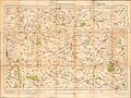 Ordnance Survey One-Inch Sheet 93 Stow on the Wold, Published 1919.jpg 11 894 × 8 926; 10,48 MB
-
 OS benchmark - The Porch House, Stow-on-the-Wold - geograph.org.uk - 5527947.jpg 1 142 × 857; 574 KB
-
 OS flush bracket G2528 - geograph.org.uk - 5517943.jpg 979 × 1 306; 762 KB
-
 Our Lady and St Kenelm Church, Stow-on-the-Wold by Des Blenkinsopp Geograph 3062623.jpg 3 408 × 2 428; 1,32 MB
-
 Out of the recreation ground - geograph.org.uk - 1947905.jpg 4 000 × 3 000; 4,34 MB
-
 P1010041eob.jpg 1 806 × 1 204; 1,36 MB
-
 P1010042pui.jpg 1 576 × 1 050; 1,16 MB
-
 Park House And Extension.jpg 6 000 × 4 000; 11,9 MB
-
 Park Street - Stow - geograph.org.uk - 941258.jpg 640 × 458; 227 KB
-
 Parson's Corner, Stow-on-the-Wold - geograph.org.uk - 5922026.jpg 1 024 × 784; 162 KB
-
 Part of High Street in Stow-on-the-Wold - geograph.org.uk - 5595938.jpg 4 000 × 3 000; 3,07 MB
-
 Passage to Market Square - geograph.org.uk - 3756742.jpg 999 × 1 500; 210 KB
-
 Passage to Talbot Square - geograph.org.uk - 3756746.jpg 999 × 1 500; 169 KB
-
 Pasture by the A429 - geograph.org.uk - 3857248.jpg 1 600 × 1 068; 510 KB
-
 Path across field from Talbot Square - geograph.org.uk - 5754004.jpg 640 × 427; 62 KB
-


_-_geograph.org.uk_-_4590756.jpg)


.jpg)


.jpg)


.jpg)


_-_geograph.org.uk_-_3399031.jpg)
_north_of_Stow-on-The-Wold_-_geograph.org.uk_-_4959216.jpg)


.jpg)


_-_geograph.org.uk_-_5520874.jpg)


_-_geograph.org.uk_-_4548911.jpg)


,_Stow-on-the-Wold_-_geograph.org.uk_-_5910696.jpg)