Category:Streets in Courbevoie
Jump to navigation
Jump to search
Arrondissement of Antony: Antony · Bagneux · Bourg-la-Reine · Châtenay-Malabry · Châtillon · Clamart · Fontenay-aux-Roses · Malakoff · Le Plessis-Robinson · Sceaux · Montrouge ·
Arrondissement of Boulogne-Billancourt: Boulogne-Billancourt · Chaville · Issy-les-Moulineaux · Marnes-la-Coquette · Meudon · Sèvres · Vanves · Ville-d'Avray ·
Arrondissement of Nanterre: Asnières-sur-Seine · Bois-Colombes · Clichy · Colombes · Courbevoie · Garches · La Garenne-Colombes · Gennevilliers · Levallois-Perret · Nanterre · Neuilly-sur-Seine · Puteaux · Rueil-Malmaison · Saint-Cloud · Suresnes · Vaucresson · Villeneuve-la-Garenne ·
| Upload media | |||||
| Instance of |
| ||||
|---|---|---|---|---|---|
| Location | Courbevoie, arrondissement of Nanterre, Hauts-de-Seine, Île-de-France, Metropolitan France, France | ||||
| |||||
Subcategories
This category has the following 3 subcategories, out of 3 total.
Pages in category "Streets in Courbevoie"
This category contains only the following page.
Media in category "Streets in Courbevoie"
The following 30 files are in this category, out of 30 total.
-
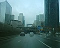
 A14 - Tunnel de Nanterre-La defense - Entree Est direction Nanterre (2).JPG 3,264 × 2,448; 3.06 MB
-
 A14 - Tunnel de Nanterre-La defense - Entree Est direction Nanterre.JPG 3,264 × 2,448; 3.09 MB
-
 N13 La Défense 03-03-06.jpg 600 × 480; 43 KB
-
 Avenue des Tilleuls.jpg 3,683 × 2,382; 5.81 MB
-
 Carte postale - Courbevoie - Crue de la Seine - Courbevoie (sur le quai d'Asnières).jpg 3,641 × 2,357; 5.7 MB
-
 Carte postale - Courbevoie - Crue de la Seine - Courbevoie - Un sauvetage - 9FI-COU 191.jpg 3,662 × 2,361; 5.56 MB
-
 Carte postale - Courbevoie - Crue de la Seine - Courbevoie en bas du Pont - 9FI-COU 200.jpg 3,628 × 2,398; 6.01 MB
-
 Carte postale - Courbevoie - Crue de la Seine - Courbevoie en bas du Pont.jpg 3,674 × 2,340; 6.63 MB
-
 Carte postale - Courbevoie - Crue de la Seine - Courbevoie inondé - 9FI-COU 188.jpg 3,645 × 2,357; 6.19 MB
-
 Carte postale - Courbevoie - Crue de la Seine - Courbevoie inondé - 9FI-COU 190.jpg 3,649 × 2,336; 5.71 MB
-
 Carte postale - Courbevoie - Crue de la Seine - Janvier 1910 - Les Quais - 9FI-COU 212.jpg 3,649 × 2,398; 5.62 MB
-
 Carte postale - Courbevoie - Crue de la Seine - Janvier 1910 - Les Quais.jpg 3,662 × 2,369; 6.13 MB
-
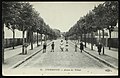
 Carte postale - Courbevoie - L'Avenue des Bruyères, près de l'avenue Pasteur - 9FI-COU 1.jpg 3,649 × 2,361; 6.05 MB
-
 Carte postale - Courbevoie - La Poste - 9FI-COU 218.jpg 2,469 × 3,628; 6.97 MB
-
 Carte postale - Courbevoie - Rue d'Alsace - Les Ecoles Groupe Jules-Ferry - 9FI-COU 93.jpg 2,394 × 3,578; 6.58 MB
-
 Courbevoie.Place du Port.Tabac.Au Petit Navire.jpg 928 × 580; 96 KB
-
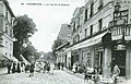 Courbevoie.Rue de la Station.jpg 715 × 456; 64 KB
-
 Crue de la Seine - Courbevoie - Un sauvetage.jpg 3,699 × 2,390; 6.02 MB
-
 Crue de la Seine - En bas du Pont.jpg 3,666 × 2,411; 5.72 MB
-
 Crue de la Seine - Janvier 1910 - Les Quais.jpg 3,658 × 2,394; 5.77 MB
-
 Crue de la Seine janvier 1910 - Courbevoie - Rue Traversiere - Maison ecroulee.jpg 3,637 × 2,327; 6.48 MB
-
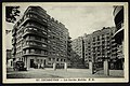
 Elément du Centre Charras, Courbevoie, France 01.jpg 1,836 × 3,264; 2.24 MB
-
 Impasse des Epines.png 763 × 1,020; 1.13 MB
-
 Intervention of a police team in Paris region - 2020-09-20.jpg 3,024 × 4,032; 4.31 MB
-
 La Banlieue parisienne inondee Crue de Janvier 1910 - La Rue de Saint-Germain.jpg 3,649 × 2,398; 5.56 MB
-
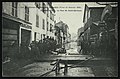
 Les Gardes Mobiles-Courbevoie-1900.jpg 3,674 × 2,436; 5.7 MB
-
 Les Gardes Mobiles.jpg 3,687 × 2,407; 5.9 MB
-
 Rue Perret - Inondations - Janvier 1910.jpg 3,603 × 2,348; 5.27 MB
-
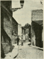
 Voie reliant la rue de Strasbourg à l'Allée Saint-Odile 01.jpg 2,448 × 3,264; 3.91 MB
-
 Voie reliant la rue de Strasbourg à l'Allée Saint-Odile 02.jpg 3,264 × 2,448; 3.86 MB
.JPG)


.jpg)


