Category:Sunk Island photographs taken on 2007-01-28
Jump to navigation
Jump to search
Media in category "Sunk Island photographs taken on 2007-01-28"
The following 14 files are in this category, out of 14 total.
-
 Channel Farm, Sunk Island - geograph.org.uk - 323859.jpg 640 × 478; 87 KB
-
 Channel Road, Sunk Island - geograph.org.uk - 323865.jpg 640 × 474; 83 KB
-
 Cross Drain, Sunk Island - geograph.org.uk - 323854.jpg 477 × 640; 102 KB
-
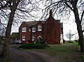
 Crown Estate Cottages, Sunk Island - geograph.org.uk - 323861.jpg 640 × 480; 59 KB
-
 Crown Estate Cottages, Sunk Island - geograph.org.uk - 323864.jpg 445 × 640; 98 KB
-
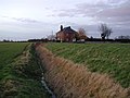
 East Bank Farm, Sunk Island - geograph.org.uk - 323866.jpg 640 × 477; 144 KB
-
 East Bank Road, Sunk Island - geograph.org.uk - 323868.jpg 640 × 480; 81 KB
-
 East of Sunk Island - geograph.org.uk - 323858.jpg 640 × 386; 67 KB
-
 Newlands, Sunk Island - geograph.org.uk - 323857.jpg 640 × 462; 77 KB
-
 Stray Road, Sunk Island - geograph.org.uk - 323855.jpg 640 × 476; 90 KB
-
 Stray Road, Sunk Island - geograph.org.uk - 323856.jpg 640 × 451; 70 KB
-
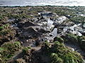 Sunk Island Sands - geograph.org.uk - 323851.jpg 640 × 477; 156 KB
-
 Sunk Island Sands - geograph.org.uk - 323852.jpg 640 × 479; 94 KB
-
 The Humber Bank, Sunk Island - geograph.org.uk - 323853.jpg 438 × 640; 87 KB


