Category:Swinton, Greater Manchester
Vai alla navigazione
Vai alla ricerca
English: Swinton is a town within the City of Salford, in Greater Manchester, England. It stands on gently sloping ground on the southwest side of the River Irwell, and within the bounds of the orbital M60 motorway. It is west-northwest of Manchester. Swinton and the adjoining town of Pendlebury together have a population of 41,347.
Română: Swinton este un oraş în cadrul districtul metropolitan Salford în comitatul Greater Manchester, regiunea North West, Anglia.
town within the City of Salford, in Greater Manchester, England  | |||||
| Carica un file multimediale | |||||
| Istanza di | |||||
|---|---|---|---|---|---|
| Luogo | City of Salford, Grande Manchester, Nord Ovest dell'Inghilterra, Inghilterra | ||||
| Distinto da | |||||
 | |||||
Sottocategorie
Questa categoria contiene le 11 sottocategorie indicate di seguito, su un totale di 11.
B
M
- Moorside railway station (16 F)
S
- Swinton and Pendlebury (7 F)
- Swinton North (1 F)
- Swinton South (1 F)
V
File nella categoria "Swinton, Greater Manchester"
Questa categoria contiene 53 file, indicati di seguito, su un totale di 53.
-
 Dont think this bin will take any more ! (6861377341).jpg 3 889 × 2 794; 2,32 MB
-
 Eccles Road junction with the East Lancs Road - geograph.org.uk - 2068736.jpg 2 048 × 1 536; 1,67 MB
-
 Field at Rear of Sindsley Road, Wardley - geograph.org.uk - 6106287.jpg 1 600 × 1 201; 388 KB
-
 Footbridge over the M60 North of Wardley - geograph.org.uk - 6106312.jpg 1 600 × 1 203; 686 KB
-

-
 Former railway track near Ellesmere Park - geograph.org.uk - 5212270.jpg 6 000 × 4 000; 5,68 MB
-
 Fr Christopher Barley and his new curate (4774944254).jpg 2 775 × 1 850; 671 KB
-
 GB v AUS 09-11-1963 at Station Road 1.jpg 600 × 398; 108 KB
-
 Greenhouse and rain in Swinton, Greater Manchester.jpg 3 258 × 4 338; 2,09 MB
-
 Harry Crandon grave.jpg 2 048 × 1 536; 2,67 MB
-
 Holloway Drive, Salford - geograph.org.uk - 2906513.jpg 640 × 480; 142 KB
-
 Leaf-strewn path up to the railway route - geograph.org.uk - 5211364.jpg 6 000 × 4 000; 5,67 MB
-
 Level Headed ! (6974512306).jpg 4 320 × 3 240; 1,92 MB
-
 Lights on ! (6735836337).jpg 3 000 × 4 000; 2,51 MB
-
 Microwave (7716455212).jpg 2 450 × 4 338; 1,27 MB
-
 Mirrorized ! (7145904663).jpg 2 148 × 3 265; 500 KB
-
 Oak Court, Swinton, Manchester - geograph.org.uk - 2743447.jpg 4 048 × 3 040; 2,51 MB
-
 Open space in Wardley - geograph.org.uk - 4347085.jpg 2 426 × 3 633; 5,53 MB
-
 Path near Campbell Road Wood - geograph.org.uk - 5212289.jpg 6 000 × 4 000; 5,33 MB
-
 Path North of Wardley Grange - geograph.org.uk - 6106221.jpg 1 600 × 1 200; 728 KB
-
 Path South of the M60 at Wardley Moss - geograph.org.uk - 6106278.jpg 1 600 × 1 200; 569 KB
-
 Path Through Woodland at Clifton Moss - geograph.org.uk - 6106330.jpg 1 576 × 1 183; 843 KB
-
 Pegs ! (7450414746).jpg 4 320 × 2 432; 1,49 MB
-
 Priestley Road, Salford - geograph.org.uk - 2906520.jpg 640 × 480; 112 KB
-
 Queensmere Dam - geograph.org.uk - 1775685.jpg 2 816 × 2 112; 1,8 MB
-
 Queensmere Dam - geograph.org.uk - 1775696.jpg 2 714 × 2 036; 881 KB
-
 Rain in a Swinton garden, Greater Manchester.jpg 4 338 × 3 258; 2,5 MB
-
 Rubbish to collect ! (6803389714).jpg 4 370 × 3 290; 4,37 MB
-
 Sindsley Brook - geograph.org.uk - 5728080.jpg 5 640 × 3 760; 7,35 MB
-
 Spire (6699857803).jpg 2 178 × 4 320; 2,12 MB
-

-
 Statue in the rain at Swinton, Greater Manchester.jpg 3 258 × 4 338; 2,32 MB
-
 Sun Burst after a rain shower (6881662684).jpg 4 370 × 3 290; 955 KB
-
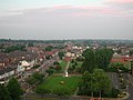
 Swinton and Pendlebury from the air - geograph.org.uk - 4248022.jpg 640 × 480; 157 KB
-
 Swinton Park - geograph.org.uk - 2481272.jpg 4 170 × 2 856; 6,81 MB
-
 Swinton Square (geograph 4254209).jpg 3 888 × 2 241; 1,59 MB
-
 Swinton wakes ups ! (6700158941).jpg 4 320 × 3 240; 5,14 MB
-
 Swinton-Moorside Cricket Club - Pavilion - geograph.org.uk - 2969472.jpg 1 600 × 1 200; 219 KB
-
 Swinton-Moorside Cricket Club - Scorebox - geograph.org.uk - 2969483.jpg 1 600 × 1 200; 442 KB
-
 The chancel of St Margaret, Swinton (4774310989).jpg 1 723 × 2 693; 562 KB
-
 The great British Summer !! (7509453418).jpg 2 456 × 4 344; 2,09 MB
-
 The great British Summer !! (7509453698).jpg 4 344 × 2 456; 1,44 MB
-
 The great British Summer !! (7509454136).jpg 4 344 × 2 456; 1,37 MB
-
 The great British Summer !! (7509454712).jpg 4 344 × 2 456; 2,1 MB
-
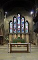
 The High Altar, St Margaret, Swinton (4774313111).jpg 2 750 × 1 834; 713 KB
-
 The new deacon, Fr Michael Childs (4774946560).jpg 1 867 × 2 800; 757 KB
-
 Track to Wardley Grange from the A6 - geograph.org.uk - 6106212.jpg 1 600 × 1 200; 513 KB
-
 Underpass below the A580 - geograph.org.uk - 5324281.jpg 1 600 × 1 200; 514 KB
-
 Undeveloped land between Swinton and Eccles - geograph.org.uk - 5212275.jpg 6 000 × 4 000; 3,93 MB
-
 View from Salford Civic Centre Clock Tower - geograph.org.uk - 2856524.jpg 1 024 × 768; 309 KB
-
 View from the A6 Manchester Rd, Wardley.jpg 4 648 × 2 028; 2,08 MB
-
 View from the top of Salford Civic Centre - geograph.org.uk - 2856519.jpg 1 024 × 768; 306 KB
-
 Deans Brook - geograph.org.uk - 49724.jpg 640 × 480; 107 KB
.jpg)


.jpg)


.jpg)
.jpg)
.jpg)
.jpg)


.jpg)


.jpg)

.jpg)


.jpg)


.jpg)
.jpg)


.jpg)
.jpg)
.jpg)
.jpg)
.jpg)
.jpg)
.jpg)


