Category:Sydenham, Oxfordshire
Jump to navigation
Jump to search
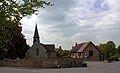
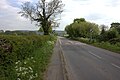
English: Sydenham is a village and civil parish about southeast of Thame in Oxfordshire. To the south the parish is bounded by the ancient Lower Icknield Way, and on its other side largely by brooks that merge as Cuttle Brook, a tributary of the River Thame.
village and civil parish in South Oxfordshire district, Oxfordshire, England  | |||||
| Upload media | |||||
| Instance of | |||||
|---|---|---|---|---|---|
| Location | South Oxfordshire, Oxfordshire, South East England, England | ||||
| Area |
| ||||
| official website | |||||
 | |||||
Subcategories
This category has the following 3 subcategories, out of 3 total.
S
- Sydenham WWI Tablet (1 F)
V
Media in category "Sydenham, Oxfordshire"
The following 118 files are in this category, out of 118 total.
-
 A field of sheep near Manor Farm - geograph.org.uk - 5791073.jpg 6,000 × 4,000; 7.34 MB
-
 A field-edge path - geograph.org.uk - 5791093.jpg 6,000 × 4,000; 7.78 MB
-
 B4445 towards Thame - geograph.org.uk - 5947262.jpg 1,024 × 684; 177 KB
-
 B4445 towards Thame - geograph.org.uk - 5947446.jpg 1,024 × 684; 216 KB
-
 Barn at Manor Farm, Sydenham - geograph.org.uk - 6283322.jpg 1,024 × 768; 211 KB
-
 Bridleway after Middle Farm - geograph.org.uk - 5390325.jpg 5,202 × 3,465; 3.49 MB
-
 Bungalow on Thame Road, Sydenham - geograph.org.uk - 4875571.jpg 2,048 × 1,536; 808 KB
-
 Chapel conversion, Sydenham - geograph.org.uk - 5390478.jpg 4,781 × 3,443; 3.21 MB
-
 Church of St Mary - geograph.org.uk - 2894247.jpg 3,648 × 2,736; 2.14 MB
-
 Converted barns on the edge of Sydenham village - geograph.org.uk - 5390510.jpg 5,202 × 3,465; 4.83 MB
-
 Cottages, Sydenham - geograph.org.uk - 5947253.jpg 1,024 × 684; 249 KB
-
 Covert in Thame Park - geograph.org.uk - 5791162.jpg 6,000 × 4,000; 6.31 MB
-
 Dark clouds over Sydenham - geograph.org.uk - 3904383.jpg 640 × 480; 50 KB
-
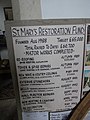
 Display Board at Sydenham, Oxon - geograph.org.uk - 5478480.jpg 2,592 × 1,944; 1.36 MB
-
 Empty houses at Sydenham - geograph.org.uk - 5390506.jpg 5,202 × 3,465; 4.43 MB
-
 Farmland and pylon, Sydenham - geograph.org.uk - 2233391.jpg 480 × 640; 135 KB
-
 Farmland, Sydenham - geograph.org.uk - 2233371.jpg 640 × 480; 184 KB
-
 Farmland, Sydenham - geograph.org.uk - 2813750.jpg 640 × 480; 187 KB
-
 Field at Sydenham Grange Farm - geograph.org.uk - 4376676.jpg 4,000 × 3,000; 2.04 MB
-
 Field of sheep near Sydenham Grange Farm - geograph.org.uk - 5792178.jpg 6,000 × 4,000; 7.16 MB
-
 Flower bed by coronation and jubilee plaques, Sydenham - geograph.org.uk - 5513042.jpg 3,648 × 2,736; 3.07 MB
-
 Footbridge and gate on path out of New Park, Thame - geograph.org.uk - 5512791.jpg 3,648 × 2,736; 3.89 MB
-
 Footbridge on public footpath overgrown by brambles - geograph.org.uk - 5512124.jpg 3,648 × 2,736; 4.67 MB
-
 Houses on the road to Emmington - geograph.org.uk - 5390502.jpg 5,202 × 3,465; 3.93 MB
-
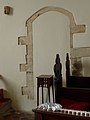
 Inside St Mary, Sydenham (I) - geograph.org.uk - 4099712.jpg 480 × 640; 47 KB
-
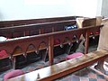
 Inside St Mary, Sydenham (II) - geograph.org.uk - 4099713.jpg 640 × 480; 54 KB
-
 Inside St Mary, Sydenham (III) - geograph.org.uk - 4099715.jpg 640 × 480; 57 KB
-
 Inside St Mary, Sydenham (IV) - geograph.org.uk - 4099729.jpg 480 × 640; 59 KB
-
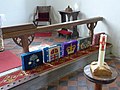 Inside St Mary, Sydenham (IX) - geograph.org.uk - 4099742.jpg 640 × 480; 70 KB
-
 Inside St Mary, Sydenham (V) - geograph.org.uk - 4099730.jpg 640 × 480; 70 KB
-
 Inside St Mary, Sydenham (VI) - geograph.org.uk - 4099732.jpg 640 × 480; 48 KB
-
 Inside St Mary, Sydenham (VII) - geograph.org.uk - 4099733.jpg 480 × 640; 34 KB
-
 Inside St Mary, Sydenham (VIII) - geograph.org.uk - 4099739.jpg 480 × 640; 70 KB
-
 Inside St Mary, Sydenham (XI) - geograph.org.uk - 4099745.jpg 480 × 640; 38 KB
-
 Inside St Mary, Sydenham (XII) - geograph.org.uk - 4099747.jpg 480 × 640; 30 KB
-
 Junction to Kingston Blount - geograph.org.uk - 941261.jpg 640 × 480; 58 KB
-
 Lambs off to play together - geograph.org.uk - 5792091.jpg 6,000 × 4,000; 5.66 MB
-
 Land for sheep in New Park - geograph.org.uk - 5791132.jpg 6,000 × 4,000; 6.45 MB
-
 Lop-sided tree near Manor Farm - geograph.org.uk - 5791052.jpg 6,000 × 4,000; 4.07 MB
-
 Notice inside Red Telephone Box at Sydenham,Oxon - geograph.org.uk - 5478438.jpg 2,592 × 1,944; 1.4 MB
-
 Official route of public footpath overgrown - geograph.org.uk - 5512114.jpg 3,648 × 2,736; 4.47 MB
-
 Old Post Office, Sydenham - geograph.org.uk - 5390515.jpg 5,202 × 3,465; 4.42 MB
-
 Paddock by Manor farm - geograph.org.uk - 1019789.jpg 640 × 360; 83 KB
-
 Pasture, Sydenham - geograph.org.uk - 2233363.jpg 640 × 480; 152 KB
-
 Pasture, Sydenham - geograph.org.uk - 2813804.jpg 640 × 480; 124 KB
-
 Path through New Park - geograph.org.uk - 5791113.jpg 6,000 × 4,000; 7.43 MB
-
 Path towards Thame Park - geograph.org.uk - 4391847.jpg 4,000 × 3,000; 2.15 MB
-
 Red K6 Telephone Box at Sydenham, Oxon - geograph.org.uk - 5478447.jpg 1,944 × 2,592; 947 KB
-
 Road from Emmington to Sydenham - geograph.org.uk - 5390523.jpg 5,202 × 3,465; 3.67 MB
-
 Road into Sydenham - geograph.org.uk - 5790928.jpg 6,000 × 4,000; 7.16 MB
-
 Road junction and church, Sydenham - geograph.org.uk - 5390496.jpg 4,983 × 3,016; 2.98 MB
-
 Road towards Sydenham - geograph.org.uk - 5947245.jpg 1,024 × 684; 361 KB
-
 Rush hour in Sydenham - geograph.org.uk - 4099698.jpg 640 × 480; 90 KB
-
 Sewell's Lane - geograph.org.uk - 5790959.jpg 6,000 × 4,000; 4.28 MB
-
 Sheep in Thame Park - geograph.org.uk - 5791147.jpg 6,000 × 4,000; 6.19 MB
-
 Sheep in Thame Park - geograph.org.uk - 5792045.jpg 5,545 × 3,696; 6.14 MB
-
 Sheep near Sydenham Grange Farm - geograph.org.uk - 5792083.jpg 6,000 × 4,000; 7.03 MB
-
 Sheep on path across New Park, Thame - geograph.org.uk - 5512772.jpg 3,648 × 2,736; 2.26 MB
-
 Sheep under trees in New Park, Thame - geograph.org.uk - 5512874.jpg 3,465 × 2,598; 1.81 MB
-
 Shelter and defibrillator, Sydenham - geograph.org.uk - 5390494.jpg 5,202 × 3,465; 4.75 MB
-
 Signpost at junction of Chalford Road and Stert Road - geograph.org.uk - 5390396.jpg 5,202 × 3,465; 4.01 MB
-

-
 St Mary's Church, Sydenham - geograph.org.uk - 5390490.jpg 5,202 × 3,465; 3.19 MB
-
 St Mary's Church, Sydenham - geograph.org.uk - 5790939.jpg 6,000 × 4,000; 4.04 MB
-
 St Mary's Sydenham - geograph.org.uk - 3904403.jpg 4,320 × 3,240; 4.35 MB
-
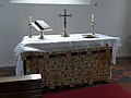 St Mary, Sydenham, altar - geograph.org.uk - 4099749.jpg 640 × 480; 50 KB
-
 St Mary, Sydenham, churchyard (a) - geograph.org.uk - 4099763.jpg 480 × 640; 94 KB
-
 St Mary, Sydenham, churchyard (b) - geograph.org.uk - 4099764.jpg 640 × 480; 101 KB
-
 St Mary, Sydenham, churchyard (c) - geograph.org.uk - 4099765.jpg 640 × 480; 94 KB
-
 St Mary, Sydenham, churchyard (d) - geograph.org.uk - 4099766.jpg 640 × 480; 95 KB
-
 St Mary, Sydenham, font - geograph.org.uk - 4099701.jpg 480 × 640; 58 KB
-
 St Mary, Sydenham, lectern - geograph.org.uk - 4099735.jpg 480 × 640; 59 KB
-
 St Mary, Sydenham, memorial (i) - geograph.org.uk - 4099704.jpg 640 × 480; 56 KB
-
 St Mary, Sydenham, memorial (ii) - geograph.org.uk - 4099707.jpg 640 × 480; 57 KB
-
 St Mary, Sydenham, memorial (iii) - geograph.org.uk - 4099710.jpg 480 × 640; 49 KB
-
 St Mary, Sydenham, memorial (iv) - geograph.org.uk - 4099711.jpg 640 × 480; 44 KB
-
 St Mary, Sydenham, organ - geograph.org.uk - 4099741.jpg 480 × 640; 58 KB
-
 St Mary, Sydenham, porch - geograph.org.uk - 4099760.jpg 640 × 480; 97 KB
-

-
 St Mary, Sydenham, pulpit - geograph.org.uk - 4099750.jpg 640 × 480; 51 KB
-
 St Mary, Sydenham, spire - geograph.org.uk - 4099755.jpg 480 × 640; 58 KB
-

-
-
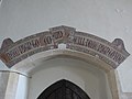
 St Mary, Sydenham, The Lord's Prayer - geograph.org.uk - 4099709.jpg 480 × 640; 61 KB
-
 St Mary, Sydenham, wall - geograph.org.uk - 4099728.jpg 480 × 640; 69 KB
-
 Stile on public footpath into New Park, Thame - geograph.org.uk - 5512127.jpg 3,648 × 2,736; 4.39 MB
-
 Sydenham at the junction of Thame Road - geograph.org.uk - 4875594.jpg 2,048 × 1,536; 953 KB
-
 Sydenham cottages on the road from the south - geograph.org.uk - 5390471.jpg 5,202 × 3,465; 4.14 MB
-
 Sydenham Grange farm - geograph.org.uk - 1019893.jpg 640 × 360; 88 KB
-
 Sydenham Grove - geograph.org.uk - 5791022.jpg 6,000 × 4,000; 6.63 MB
-
 Sydenham Grove-geograph-4391666-by-Des-Blenkinsopp.jpg 3,804 × 2,752; 1.41 MB
-
 Sydenham InnAtEmmington.jpg 3,000 × 2,000; 1.56 MB
-
 Sydenham OldSchool south.jpg 2,990 × 1,495; 2.17 MB
-
 Sydenham OldSchool SouthEast.jpg 2,640 × 1,980; 2.71 MB
-
 Thame Park house amongst the trees - geograph.org.uk - 1019857.jpg 640 × 360; 63 KB
-
 Thame Road looking towards Chinnor - geograph.org.uk - 5390530.jpg 5,202 × 3,465; 4.47 MB
-
 Thame Road, Sydenham - geograph.org.uk - 4875578.jpg 2,048 × 1,536; 961 KB
-
 Thame Road, Sydenham - geograph.org.uk - 5501014.jpg 2,238 × 1,636; 1.31 MB
-
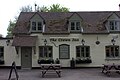 The Crown Inn, Sydenham - geograph.org.uk - 5390484.jpg 5,202 × 3,465; 3.24 MB
-
 The Crown Inn, Sydenham-geograph-3915494-by-Stefan-Czapski.jpg 1,024 × 764; 158 KB
-
 The Crown, Sydenham, Oxfordshire-geograph-2894236-by-Stuart-Logan.jpg 3,525 × 2,556; 1.6 MB
-
 The Inn at Emmington - geograph.org.uk - 2807779.jpg 800 × 600; 89 KB
-
 The Inn at Emmington - geograph.org.uk - 2807780.jpg 600 × 800; 86 KB
-
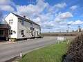 The Inn at Emmington - geograph.org.uk - 4384149.jpg 4,000 × 3,000; 1.5 MB
-
 The Inn at Emmington - geograph.org.uk - 5390528.jpg 5,202 × 3,465; 3.67 MB
-
 The Old Post Office - geograph.org.uk - 5790972.jpg 6,000 × 4,000; 6.34 MB
-
 The village sign for Sydenham - geograph.org.uk - 2807784.jpg 800 × 600; 101 KB
-
 Track and houses near Manor Farm Sydenham - geograph.org.uk - 5512120.jpg 3,648 × 2,736; 2.88 MB
-
 Track past Sydenham Grange Farm - geograph.org.uk - 5792147.jpg 6,000 × 4,000; 5.44 MB
-
 Track to Sydenham Grange Farm - geograph.org.uk - 5792182.jpg 6,000 × 4,000; 6.69 MB
-
 Traffic jam in Sydenham - geograph.org.uk - 4099758.jpg 640 × 480; 61 KB
-
 Un-named lane to Sydenham - geograph.org.uk - 2894258.jpg 3,536 × 2,576; 1.46 MB
-
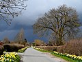 Verge-side daffodils - geograph.org.uk - 3904380.jpg 4,320 × 3,240; 6.49 MB
-
 Vicarage End, Sydenham - geograph.org.uk - 5390474.jpg 5,202 × 3,465; 4.95 MB
-
 Village green at Sydenham - geograph.org.uk - 5790949.jpg 6,000 × 4,000; 4.78 MB
-
 Wheat field near Sydenham Grange Farm - geograph.org.uk - 5792164.jpg 6,000 × 4,000; 4.42 MB
-
 Wooden Barn, Sydenham-geograph-4391650-by-Des-Blenkinsopp.jpg 4,000 × 3,000; 1.61 MB
-
 Young wheat crop near Sydenham Grange Farm - geograph.org.uk - 5792066.jpg 6,000 × 4,000; 7.46 MB


_-_geograph.org.uk_-_4099712.jpg)
_-_geograph.org.uk_-_4099713.jpg)
_-_geograph.org.uk_-_4099715.jpg)
_-_geograph.org.uk_-_4099729.jpg)
_-_geograph.org.uk_-_4099742.jpg)
_-_geograph.org.uk_-_4099730.jpg)
_-_geograph.org.uk_-_4099732.jpg)
_-_geograph.org.uk_-_4099733.jpg)
_-_geograph.org.uk_-_4099739.jpg)
_-_geograph.org.uk_-_4099745.jpg)
_-_geograph.org.uk_-_4099747.jpg)


_-_geograph.org.uk_-_3937590.jpg)


_-_geograph.org.uk_-_4099763.jpg)
_-_geograph.org.uk_-_4099764.jpg)
_-_geograph.org.uk_-_4099765.jpg)
_-_geograph.org.uk_-_4099766.jpg)


_-_geograph.org.uk_-_4099704.jpg)
_-_geograph.org.uk_-_4099707.jpg)
_-_geograph.org.uk_-_4099710.jpg)
_-_geograph.org.uk_-_4099711.jpg)


_-_geograph.org.uk_-_4099752.jpg)
_-_geograph.org.uk_-_4099753.jpg)


