Category:TIFF versions of Sanborn maps of Manhattan published in 1912
Jump to navigation
Jump to search
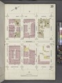
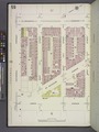
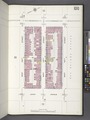
Maps from: Insurance Maps of the City of New York Borough of Manhattan. Volume Seven. (New York: Sanborn Map Company, 1912), comprising 108 plates (maps), street index, title page, and two-page volume key. (One page of the volume key is missing from this category).
Online at The New York Public Library Digital Collections website, Atlas 121. Vol. 7, 1912, part 1 and part 2.
Media in category "TIFF versions of Sanborn maps of Manhattan published in 1912"
The following 113 files are in this category, out of 113 total.
-
 Index NYPL1990607.tiff 5,366 × 7,128, 2 pages; 109.49 MB
-
 Index NYPL1991986.tiff 5,362 × 7,121, 2 pages; 109.3 MB
-

-

-
 Key NYPL1990608.tiff 5,366 × 7,128, 2 pages; 109.49 MB
-
 Manhattan V. 7, Plate No. 1 (Map bounded by Hudson River, West 57th St., West End Ave., West 72nd Ave.) NYPL1990609.tiff 5,366 × 7,128, 2 pages; 109.49 MB
-
 Manhattan V. 7, Plate No. 2 (Map bounded by Hudson River, West 87th St., West End Ave., West 75th St.) NYPL1990610.tiff 5,366 × 7,128, 2 pages; 109.49 MB
-
 Manhattan V. 7, Plate No. 3 (Map bounded by West End Ave., West 75th St., Amsterdam Ave., West 72nd St.) NYPL1990611.tiff 5,366 × 7,128, 2 pages; 109.49 MB
-
 Manhattan V. 7, Plate No. 4 (Map bounded by West End Ave., West 78th St., Amsterdam Ave., West 75th St.) NYPL1990612.tiff 5,366 × 7,128, 2 pages; 109.49 MB
-
 Manhattan V. 7, Plate No. 5 (Map bounded by Amsterdam Ave., West 75th St., Columbus Ave., West 72nd St.) NYPL1990613.tiff 5,366 × 7,128, 2 pages; 109.49 MB
-
 Manhattan V. 7, Plate No. 6 (Map bounded by W. 78th St., Columbus Ave., W. 75th St. Amsterdam Ave.) NYPL1990614.tiff 5,366 × 7,128, 2 pages; 109.49 MB
-
 Manhattan V. 7, Plate No. 7 (Map bounded by Columbus Ave., W. 75th St., Central Park West, W. 72nd St.) NYPL1990615.tiff 5,366 × 7,128, 2 pages; 109.49 MB
-
 Manhattan V. 7, Plate No. 8 (Map bounded by Columbus Ave., Manhattan Sq., Central Park West, W. 75th St.) NYPL1990616.tiff 5,394 × 7,182, 2 pages; 110.9 MB
-
 Manhattan V. 7, Plate No. 9 (Map bounded by Columbus Ave., W. 81st St., Central Park West, Manhattan Sq.) NYPL1990617.tiff 5,405 × 7,203, 2 pages; 111.45 MB
-
 Manhattan V. 7, Plate No. 10 (Map bounded by Columbus Ave., W. 84th St., Central Park West, W. 81st St.) NYPL1990618.tiff 5,394 × 7,182, 2 pages; 110.9 MB
-
 Manhattan V. 7, Plate No. 11 (Map bounded by Amsterdam Ave., W. 81st St., Columbus Ave., W. 78th St.) NYPL1990619.tiff 5,394 × 7,182, 2 pages; 110.9 MB
-
 Manhattan V. 7, Plate No. 12 (Map bounded by Amsterdam Ave., W. 84th St., Columbus Ave., W. 81st St.) NYPL1990620.tiff 5,394 × 7,182, 2 pages; 110.9 MB
-
 Manhattan V. 7, Plate No. 13 (Map bounded by West End Ave., W. 81st St., Amsterdam Ave., W. 78th St.) NYPL1990621.tiff 5,409 × 7,209, 2 pages; 111.62 MB
-
 Manhattan V. 7, Plate No. 14 (Map bounded by West End Ave., W. 84th St., Amsterdam Ave., W. 81st St.) NYPL1990622.tiff 5,409 × 7,209, 2 pages; 111.62 MB
-
 Manhattan V. 7, Plate No. 15 (Map bounded by Hudson River, W. 81st St., West End Ave., W. 78th st.) NYPL1990623.tiff 5,409 × 7,209, 2 pages; 111.62 MB
-
 Manhattan V. 7, Plate No. 16 (Map bounded by Hudson River, W. 84th St., West End Ave., W. 81st St.) NYPL1990624.tiff 5,409 × 7,209, 2 pages; 111.62 MB
-
 Manhattan V. 7, Plate No. 17 (Map bounded by Hudson River, W. 87th St., West End Ave., W. 84th St.) NYPL1990625.tiff 5,369 × 7,134, 2 pages; 109.65 MB
-
 Manhattan V. 7, Plate No. 18 (Map bounded by Hudson River, W. 90th. St., West End Ave., W. 78th St.) NYPL1990626.tiff 5,409 × 7,209, 2 pages; 111.62 MB
-
 Manhattan V. 7, Plate No. 19 (Map bounded by West End Ave., W. 87th St., Amsterdam Ave., W. 84th St.) NYPL1990627.tiff 5,369 × 7,134, 2 pages; 109.65 MB
-
 Manhattan V. 7, Plate No. 20 (Map bounded by West End Ave., W. 90th St., Amsterdam Ave., W. 78th St.) NYPL1990628.tiff 5,409 × 7,209, 2 pages; 111.62 MB
-
 Manhattan V. 7, Plate No. 21 (Map bounded by Amsterdam Ave., W. 87th St., Columbus Ave., West 84th St.) NYPL1990629.tiff 5,369 × 7,134, 2 pages; 109.65 MB
-
 Manhattan V. 7, Plate No. 22 (Map bounded by Amsterdam Ave., W. 90th St., Columbus Ave., W. 87th St.) NYPL1990630.tiff 5,409 × 7,209, 2 pages; 111.62 MB
-
 Manhattan V. 7, Plate No. 23 (Map bounded by Columbus Ave., W. 87th St., Central Park West, W. 84th St.) NYPL1990631.tiff 5,409 × 7,209, 2 pages; 111.62 MB
-
 Manhattan V. 7, Plate No. 24 (Map bounded by Columbus Ave., W. 90th St., Central Park West., West 78th St.) NYPL1990632.tiff 5,409 × 7,209, 2 pages; 111.62 MB
-
 Manhattan V. 7, Plate No. 25 (Map bounded by Hudson River, W. 93rd St., West End Ave., W. 90th St.) NYPL1990633.tiff 5,409 × 7,209, 2 pages; 111.62 MB
-
 Manhattan V. 7, Plate No. 26 (Map bounded by Hudson River, W. 96th St., West End Ave., W. 93rd St.) NYPL1990634.tiff 5,409 × 7,209, 2 pages; 111.62 MB
-
 Manhattan V. 7, Plate No. 27 (Map bounded by West End Ave., W. 93rd St., Amsterdam Ave., W. 90th St.) NYPL1990635.tiff 5,409 × 7,209, 2 pages; 111.62 MB
-
 Manhattan V. 7, Plate No. 28 (Map bounded by West End Ave., W. 96rd St., Amsterdam Ave., W. 93rd St.) NYPL1990636.tiff 5,343 × 7,084, 2 pages; 108.35 MB
-
 Manhattan V. 7, Plate No. 29 (Map bounded by Amsterdam Ave., W. 93rd St., Columbus Ave., W. 90th St.) NYPL1990637.tiff 5,326 × 7,052, 2 pages; 107.52 MB
-
 Manhattan V. 7, Plate No. 30 (Map bounded by Amsterdam Ave., W. 96th St., Columbus Ave., W. 93rd St.) NYPL1990638.tiff 5,326 × 7,052, 2 pages; 107.52 MB
-
 Manhattan V. 7, Plate No. 31 (Map bounded by Columbus Ave., W. 93rd St., Central Park West, W. 90th St.) NYPL1990639.tiff 5,326 × 7,052, 2 pages; 107.52 MB
-
 Manhattan V. 7, Plate No. 32 (Map bounded by Columbus Ave., W. 96rd St., Central Park West, W. 93th St.) NYPL1990640.tiff 5,326 × 7,052, 2 pages; 107.52 MB
-
 Manhattan V. 7, Plate No. 33 (Map bounded by Hudson River, W. 99th St., West End Ave., W. 96th St.) NYPL1990641.tiff 5,326 × 7,052, 2 pages; 107.52 MB
-
 Manhattan V. 7, Plate No. 34 (Map bounded by Hudson River, W. 102nd St., West End Ave., W. 99th St.) NYPL1990642.tiff 5,326 × 7,052, 2 pages; 107.52 MB
-
 Manhattan V. 7, Plate No. 35 (Map bounded by West End Ave., W. 99th St., Amsterdam Ave., W. 96th St.) NYPL1990643.tiff 5,326 × 7,052, 2 pages; 107.52 MB
-
 Manhattan V. 7, Plate No. 36 (Map bounded by West End Ave., W. 102nd St., Amsterdam Ave., West 99th St.) NYPL1990644.tiff 5,326 × 7,052, 2 pages; 107.52 MB
-
 Manhattan V. 7, Plate No. 37 (Map bounded by Amsterdam Ave., W. 99th St., Columbus Ave., W. 96th St.) NYPL1990645.tiff 5,326 × 7,052, 2 pages; 107.52 MB
-
 Manhattan V. 7, Plate No. 38 (Map bounded by Amsterdam Ave., W. 102nd St., Columbus Ave., W. 99th St.) NYPL1990646.tiff 5,326 × 7,052, 2 pages; 107.52 MB
-
 Manhattan V. 7, Plate No. 39 (Map bounded by Columbus Ave., W. 99th St., Central Park West, W. 96th St.) NYPL1990647.tiff 5,326 × 7,052, 2 pages; 107.52 MB
-
 Manhattan V. 7, Plate No. 40 (Map bounded by Columbus Ave., W. 102nd St., Central Park West, W. 99th St.) NYPL1990648.tiff 5,326 × 7,052, 2 pages; 107.52 MB
-
 Manhattan V. 7, Plate No. 41 (Map bounded by Hudson River, W. 105th St., West End Ave., W. 102nd St.) NYPL1990649.tiff 5,326 × 7,052, 2 pages; 107.52 MB
-
 Manhattan V. 7, Plate No. 42 (Map bounded by Hudson River, W. 108th St., West End Ave., W. 105th St.) NYPL1990650.tiff 5,326 × 7,052, 2 pages; 107.52 MB
-
 Manhattan V. 7, Plate No. 43 (Map bounded by West End Ave., W. 105th St., Amsterdam Ave., W. 102nd St.) NYPL1990651.tiff 5,326 × 7,052, 2 pages; 107.52 MB
-
 Manhattan V. 7, Plate No. 44 (Map bounded by West End Ave., W. 108th St., Amsterdam Ave., W. 105th St.) NYPL1990652.tiff 5,326 × 7,052, 2 pages; 107.52 MB
-
 Manhattan V. 7, Plate No. 45 (Map bounded by Amsterdam Ave., W. 105th St., Columbus Ave., W. 102) NYPL1990653.tiff 5,326 × 7,052, 2 pages; 107.52 MB
-
 Manhattan V. 7, Plate No. 46 (Map bounded by Amsterdam Ave., W. 108th St., Columbus Ave., W. 105th St.) NYPL1990654.tiff 5,326 × 7,052, 2 pages; 107.52 MB
-
 Manhattan V. 7, Plate No. 47 (Map bounded by Columbus Ave., W. 105th St., Central Park West, W. 102nd St.) NYPL1990655.tiff 5,326 × 7,052, 2 pages; 107.52 MB
-
 Manhattan V. 7, Plate No. 48 (Map bounded by Columbus Ave., W. 108th St., Central Park West, W. 105th St.) NYPL1990656.tiff 5,342 × 7,083, 2 pages; 108.32 MB
-
 Manhattan V. 7, Plate No. 49 (Map bounded by Hudson River, Cathedral Parkway, Broadway, W. 108th St.) NYPL1990657.tiff 5,369 × 7,134, 2 pages; 109.65 MB
-
 Manhattan V. 7, Plate No. 50 (Map bounded by Hudson River, W. 113th St., Broadway, Cathedral Parkway) NYPL1991988.tiff 5,410 × 7,212, 2 pages; 111.69 MB
-
 Manhattan V. 7, Plate No. 51 (Map bounded by Broadway, Cathedral Parkway, Amsterdam Ave., W. 108th St.) NYPL1990658.tiff 5,369 × 7,134, 2 pages; 109.65 MB
-
 Manhattan V. 7, Plate No. 52 (Map bounded by Broadway, W. 113th St., Amsterdam Ave., Cathedral Parkway) NYPL1991989.tiff 5,406 × 7,204, 2 pages; 111.48 MB
-
 Manhattan V. 7, Plate No. 53 (Map bounded by Amsterdam Ave., Cathedral Parkway, Columbus Ave., W. 108th St.) NYPL1990659.tiff 5,369 × 7,134, 2 pages; 109.65 MB
-
 Manhattan V. 7, Plate No. 54 (Map bounded by Amsterdam Ave., W. 113rd St., Morningside Park, Cathedral Ave.) NYPL1991990.tiff 5,406 × 7,204, 2 pages; 111.48 MB
-
 Manhattan V. 7, Plate No. 55 (Map bounded by Columbus Ave., Cathedral Parkway, Central Park West, W. 108th St.) NYPL1990660.tiff 5,369 × 7,134, 2 pages; 109.65 MB
-
 Manhattan V. 7, Plate No. 56 (Map bounded by Morningside Drive, West 113th St., 8th Ave., Cathedral Parkway) NYPL1991991.tiff 5,406 × 7,204, 2 pages; 111.48 MB
-
 Manhattan V. 7, Plate No. 57 (Map bounded by 8th Ave., W. 113th St., 7th Ave., Cathedral Parkway) NYPL1991992.tiff 5,362 × 7,120, 2 pages; 109.29 MB
-
 Manhattan V. 7, Plate No. 58 (Map bounded by 8th Ave., W. 116th St., 7th Ave., W. 113th St.) NYPL1991993.tiff 5,406 × 7,204, 2 pages; 111.48 MB
-
 Manhattan V. 7, Plate No. 59 (Map bounded by 7th Ave., W. 113th St., Lenox Ave., Cathedral Parkway) NYPL1991994.tiff 5,362 × 7,120, 2 pages; 109.29 MB
-
 Manhattan V. 7, Plate No. 60 (Map bounded by 7th Ave., W. 116th St., Lenox Ave., W. 113th St.) NYPL1991995.tiff 5,410 × 7,213, 2 pages; 111.7 MB
-
 Manhattan V. 7, Plate No. 61 (Map bounded by Lenox Ave., W. 113th St., 5th Ave., Cathedral Ave.) NYPL1991996.tiff 5,402 × 7,197, 2 pages; 111.29 MB
-
 Manhattan V. 7, Plate No. 62 (Map bounded by Lenox Ave., W. 116th St., 5th Ave., W. 113th St.) NYPL1991997.tiff 5,410 × 7,213, 2 pages; 111.7 MB
-
 Manhattan V. 7, Plate No. 63 (Map bounded by Hudson River, W. 116th St., Broadway, W. 113th St.) NYPL1991998.tiff 5,402 × 7,197, 2 pages; 111.29 MB
-
 Manhattan V. 7, Plate No. 64 (Map bounded by Hudson River, W. 119th St., Broadway, W. 116th St.) NYPL1991999.tiff 5,410 × 7,213, 2 pages; 111.7 MB
-
 Manhattan V. 7, Plate No. 65 (Map bounded by Broadway, W. 116th St., Amsterdam Ave., W. 113th St.) NYPL1992000.tiff 5,402 × 7,197, 2 pages; 111.29 MB
-
 Manhattan V. 7, Plate No. 66 (Map bounded by Broadway, W. 119th St., Amsterdam Ave., W. 116th St.) NYPL1992001.tiff 5,410 × 7,213, 2 pages; 111.7 MB
-
 Manhattan V. 7, Plate No. 67 (Map bounded by Amsterdam Ave., W. 116th St., Morningside Ave., W. 113th St.) NYPL1992002.tiff 5,407 × 7,207, 2 pages; 111.55 MB
-
 Manhattan V. 7, Plate No. 68 (Map bounded by Amsterdam Ave., W. 119th St., Morningside Ave., W. 116th St.) NYPL1992003.tiff 5,410 × 7,213, 2 pages; 111.7 MB
-
 Manhattan V. 7, Plate No. 69 (Map bounded by Morningside Park, S. 116th St., 8th Ave., W. 113th St.) NYPL1992004.tiff 5,407 × 7,207, 2 pages; 111.55 MB
-
 Manhattan V. 7, Plate No. 70 (Map bounded by Morningside Park, W. 119th St., 8th Ave., W. 116th St.) NYPL1992005.tiff 5,410 × 7,213, 2 pages; 111.7 MB
-
 Manhattan V. 7, Plate No. 71 (Map bounded by 8th Ave., W. 119th St., 7th Ave., W. 116t St.) NYPL1992006.tiff 5,407 × 7,207, 2 pages; 111.55 MB
-
 Manhattan V. 7, Plate No. 72 (Map bounded by 8th Ave., W. 122nd St., 7th Ave., W. 119th St.) NYPL1992007.tiff 5,410 × 7,213, 2 pages; 111.7 MB
-
 Manhattan V. 7, Plate No. 73 (Map bounded by 7th Ave., W. 119th St., Lenox Ave., W. 116th St.) NYPL1992008.tiff 5,367 × 7,130, 2 pages; 109.54 MB
-
 Manhattan V. 7, Plate No. 74 (Map bounded by 7th Ave., W. 122nd St., Lenox Ave., W. 119th St.) NYPL1992009.tiff 5,410 × 7,213, 2 pages; 111.7 MB
-
 Manhattan V. 7, Plate No. 75 (Map bounded by Lenox Ave., W. 119th St., 5th Ave., W. 116th St.) NYPL1992010.tiff 5,402 × 7,196, 2 pages; 111.28 MB
-
 Manhattan V. 7, Plate No. 76 (Map bounded by Lenox Ave., W. 122nd St., 5th Ave., W. 119th St.) NYPL1992011.tiff 5,410 × 7,213, 2 pages; 111.7 MB
-
 Manhattan V. 7, Plate No. 77 (Map bounded by Hudson River, W. 122nd St., Broadway, W. 119th St.) NYPL1992012.tiff 5,402 × 7,196, 2 pages; 111.28 MB
-
 Manhattan V. 7, Plate No. 78 (Map bounded by Hudson River, W. 125th St., Broadway, W. 122nd St.) NYPL1992013.tiff 5,410 × 7,213, 2 pages; 111.7 MB
-
 Manhattan V. 7, Plate No. 79 (Map bounded by Broadway, W. 122nd St., Amsterdam Ave., W. 120th St.) NYPL1992014.tiff 5,402 × 7,196, 2 pages; 111.28 MB
-
 Manhattan V. 7, Plate No. 80 (Map bounded by Broadway, W. 125th St., Amsterdam Ave., 122nd St.) NYPL1992015.tiff 5,410 × 7,213, 2 pages; 111.7 MB
-
 Manhattan V. 7, Plate No. 81 (Map bounded by Amsterdam Ave., W. 122nd. St., Morningside Ave., W. 119th St.) NYPL1992016.tiff 5,402 × 7,196, 2 pages; 111.28 MB
-
 Manhattan V. 7, Plate No. 82 (Map bounded by Amsterdam Ave., W. 125th St., Morningside Ave., W. 122nd St.) NYPL1992017.tiff 5,410 × 7,213, 2 pages; 111.7 MB
-
 Manhattan V. 7, Plate No. 83 (Map bounded by Morningside Park, W. 122nd St., 8th Ave., W. 119th St.) NYPL1992018.tiff 5,402 × 7,196, 2 pages; 111.28 MB
-
 Manhattan V. 7, Plate No. 84 (Map bounded by Morningside Ave., W. 125th St., 8th Ave., W. 122nd St.) NYPL1992019.tiff 5,410 × 7,213, 2 pages; 111.7 MB
-
 Manhattan V. 7, Plate No. 85 (Map bounded by 8th Ave., W. 125th St., 7th Ave., W. 122nd St.) NYPL1992020.tiff 5,402 × 7,196, 2 pages; 111.28 MB
-
 Manhattan V. 7, Plate No. 86 (Map bounded by 8th Ave., W. 128th St., 7th Ave., W. 125th St.) NYPL1992021.tiff 5,410 × 7,213, 2 pages; 111.7 MB
-
 Manhattan V. 7, Plate No. 87 (Map bounded by 7th Ave., W. 125th St., Lenox Ave., W. 122nd St.) NYPL1992022.tiff 5,393 × 7,180, 2 pages; 110.84 MB
-
 Manhattan V. 7, Plate No. 88 (Map bounded by 7th Ave., W. 128th St., Lenox Ave., W. 125th St.) NYPL1992023.tiff 5,410 × 7,213, 2 pages; 111.7 MB
-
 Manhattan V. 7, Plate No. 89 (Map bounded by Lenox Ave., W. 125th St., 5th Ave., Mount Morris Park, W. 122nd St.) NYPL1992024.tiff 5,393 × 7,180, 2 pages; 110.84 MB
-
 Manhattan V. 7, Plate No. 90 (Map bounded by Lenox Ave., W. 128th St., 5th Ave., W. 125th St.) NYPL1992025.tiff 5,410 × 7,213, 2 pages; 111.7 MB
-
 Manhattan V. 7, Plate No. 91 (Map bounded by Riverside Park, W. 127th St., Broadway, W. 125th St.) NYPL1992026.tiff 5,393 × 7,180, 2 pages; 110.84 MB
-
 Manhattan V. 7, Plate No. 92 (Map bounded by 12th Ave. W. 130th St., Broadway, W. 127th St.) NYPL1992027.tiff 5,410 × 7,213, 2 pages; 111.7 MB
-
 Manhattan V. 7, Plate No. 93 (Map bounded by Claremont Ave., Lawrence St., Amsterdam Ave., W. 125th St.) NYPL1992028.tiff 5,393 × 7,180, 2 pages; 110.84 MB
-
 Manhattan V. 7, Plate No. 94 (Map bounded by Broadway, W. 130th St., Amsterdam Ave., W. 127th St.) NYPL1992029.tiff 5,410 × 7,213, 2 pages; 111.7 MB
-
 Manhattan V. 7, Plate No. 95 (Map bounded by Amsterdam Ave., W. 128th St., St. Nicholas Terrace, W. 125th St.) NYPL1992030.tiff 5,378 × 7,151, 2 pages; 110.09 MB
-
 Manhattan V. 7, Plate No. 96 (Map bounded by Amsterdam Ave., W. 130th St., St. Nicholas Terrace, W. 128th St.) NYPL1992031.tiff 5,410 × 7,213, 2 pages; 111.7 MB
-
 Manhattan V. 7, Plate No. 97 (Map bounded by Morningside Ave., W. 128th St., 8th Ave., W. 125th St.) NYPL1992032.tiff 5,378 × 7,151, 2 pages; 110.09 MB
-
 Manhattan V. 7, Plate No. 98 (Map bounded by St. Nicholas Terrace, W. 130th St., 8th Ave., W. 128th St.) NYPL1992033.tiff 5,410 × 7,213, 2 pages; 111.7 MB
-
 Manhattan V. 7, Plate No. 99 (Map bounded by 8th Ave., W. 130th St., 7th Ave., W. 128th St.) NYPL1992034.tiff 5,378 × 7,151, 2 pages; 110.09 MB
-
 Manhattan V. 7, Plate No. 100 (Map bounded by 7th Ave., W. 130th St., Lenox Ave., W. 128th St.) NYPL1992035.tiff 5,410 × 7,212, 2 pages; 111.69 MB
-
 Manhattan V. 7, Plate No. 101 (Map bounded by Lenox Ave., W. 130th St., 5th Ave., W. 128th St.) NYPL1992036.tiff 5,378 × 7,151, 2 pages; 110.09 MB
-
 Manhattan V. 7, Plate No. 102 (Map bounded by Hudson River, W. 72nd St., Riverside Park) NYPL1992037.tiff 5,410 × 7,213, 2 pages; 111.7 MB
-
 Manhattan V. 7, Plate No. 103 (Map bounded by Hudson River, W. 96th St., Hudson River) NYPL1992038.tiff 5,378 × 7,151, 2 pages; 110.09 MB
-
 Manhattan V. 7, Plate No. 104 (Map bounded by Hudson River, Riverside Park) NYPL1992039.tiff 5,410 × 7,213, 2 pages; 111.7 MB
-
 Manhattan V. 7, Plate No. 105 (Map bounded by Hudson River, W. 130th St., Riverside Park) NYPL1992040.tiff 5,410 × 7,213, 2 pages; 111.7 MB
-
 Manhattan V. 7, Plate No. 106 (Map bounded by Central Park West, E. 84th St., 5th Ave., E. 72nd St.) NYPL1990661.tiff 5,392 × 7,177, 2 pages; 110.78 MB
-

-
