Category:Taiwan photographs taken on 2015-04-29
Jump to navigation
Jump to search
Countries of Asia: Bahrain · Bangladesh · Bhutan · People's Republic of China · India · Indonesia‡ · Iran · Israel · Japan · Jordan · Kuwait · Malaysia · Nepal · Pakistan · Philippines · Russia‡ · South Korea · Thailand · Turkey‡ · Vietnam
Limited recognition: Taiwan – Other territories: Hong Kong
‡: partly located in Asia
Limited recognition: Taiwan – Other territories: Hong Kong
‡: partly located in Asia
| ← | 29 April 2015 | → | ||
| ← | April 2015 | → | ||

Taiwan photographs taken on 29 April 2015.
Image files should be categorized here automatically using {{taken on}} template. Direct categorisation is also possible, if automatic is impossible.
Media in category "Taiwan photographs taken on 2015-04-29"
The following 76 files are in this category, out of 76 total.
-
 Big Mouth (17834219562).jpg 4,020 × 3,015; 3.71 MB
-
 Big Mouth (17834238332).jpg 3,066 × 2,300; 1.96 MB
-
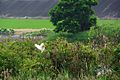
 Big Red Eye (17452152510).jpg 1,930 × 1,448; 740 KB
-
 Changuang Temple 禪光寺 - panoramio.jpg 3,188 × 2,390; 2.4 MB
-
 Closer Look (17650836419).jpg 3,224 × 2,418; 2.35 MB
-
 Liwu River 立霧溪 - panoramio (1).jpg 4,608 × 3,456; 5.08 MB
-
 Liwu River 立霧溪 - panoramio.jpg 4,608 × 3,456; 4.59 MB
-
 Lvshui Trail 綠水步道 - panoramio.jpg 4,608 × 3,456; 5.47 MB
-
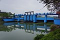
 Meifu Tidal Gate 美福防潮閘門 - panoramio.jpg 6,000 × 4,000; 5.75 MB
-
 Noisy Guy (17563733399).jpg 2,280 × 1,710; 1.63 MB
-
 Noisy Guy (17750352941).jpg 2,194 × 2,925; 2.95 MB
-
 Shakadang Bridge 砂卡礑大橋 - panoramio.jpg 2,952 × 2,214; 1.39 MB
-
 Shakadang Trail 砂卡礑步道 - panoramio (1).jpg 3,264 × 2,448; 3.77 MB
-
 Shakadang Trail 砂卡礑步道 - panoramio (2).jpg 3,264 × 2,448; 2.47 MB
-
 Shakadang Trail 砂卡礑步道 - panoramio.jpg 3,264 × 2,448; 4.34 MB
-
 Shakadang Tunnel 砂卡礑隧道 - panoramio.jpg 3,188 × 2,390; 1.49 MB
-
 Sluice Gate of Meifu Drainage Canal 美福排水幹線閘門 - panoramio.jpg 6,000 × 4,000; 5.25 MB
-
 Swallow Grotto Trail 燕子口步道 - panoramio.jpg 4,608 × 3,456; 6.61 MB
-
 Swallow Grotto Trail 雁子口步道 - panoramio.jpg 4,608 × 3,456; 4.53 MB
-
 Swallow Grotto 燕子口 - panoramio (1).jpg 4,608 × 3,456; 4.33 MB
-
 Swallow Grotto 燕子口 - panoramio (2).jpg 2,932 × 2,198; 1.61 MB
-
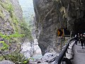
 Taroko Gorge 太魯閣 - panoramio.jpg 3,264 × 2,448; 3.72 MB
-
 Taroko Visitor Center 太魯閣遊客中心 - panoramio (1).jpg 3,127 × 2,345; 1.44 MB
-
 Xianxia Tunnel 仙霞隧道 - panoramio.jpg 3,264 × 2,448; 2.06 MB
-
 Xinnan Zhennan Temple 新南鎮南宮 - panoramio.jpg 6,000 × 4,000; 5.84 MB
-
 Yilan Museum of Art 宜蘭美術館 - panoramio.jpg 5,748 × 3,832; 5.49 MB
-
 Yilan River 宜蘭河 - panoramio (1).jpg 5,655 × 3,770; 5.43 MB
-
 Yilan River 宜蘭河 - panoramio.jpg 6,000 × 4,000; 7.12 MB
-
 Yilan Water Recycling Center 宜蘭水資源回收中心 - panoramio.jpg 3,581 × 2,386; 2.27 MB
-
 天祥梅園 Tianxiang Plum Garden - panoramio.jpg 4,402 × 3,302; 3.75 MB
-
 天祥稚暉橋 Tianxiang Zhihui Bridge - panoramio.jpg 4,608 × 3,456; 4.81 MB
-
 太魯閣 Taroko Gorge - panoramio (1).jpg 4,608 × 3,456; 5.46 MB
-
 太鲁閣 Taroko Gorge - panoramio.jpg 2,847 × 2,135; 1.44 MB
-
 失親兒福利基金會利澤簡活動中心 Orphans Welfare Foundation Lizejian Activity Center - panoramio.jpg 3,712 × 5,568; 5.45 MB
-
 宜蘭水資源回收中心 Yilan Water Recycling Center - panoramio.jpg 5,735 × 3,821; 6.06 MB
-
 宜蘭美術館 Yilan Museum of Art - panoramio.jpg 6,000 × 4,000; 5.94 MB
-
 山棕 Arenga engreri - panoramio.jpg 4,500 × 3,374; 4.29 MB
-
 岳王亭吊橋 Yuewangting Suspension Footbridge - panoramio.jpg 4,500 × 3,374; 4.14 MB
-
 新莊新月橋FUJI3530.JPG 9,600 × 2,160; 5.94 MB
-
 毬蘭 Hoya carnosa - panoramio.jpg 3,264 × 2,448; 2.16 MB
-
 溪畔 Xipan - panoramio.jpg 4,500 × 3,374; 3.42 MB
-
 燕子口 Swallow Grotto - panoramio (4).jpg 4,091 × 3,067; 2.27 MB
-
 燕子口 Swallow Grotto - panoramio (5).jpg 3,264 × 2,448; 3.53 MB
-
 燕子口步道 Swallow Grotto Trail - panoramio.jpg 4,608 × 3,456; 5.84 MB
-
 珊瑚莿桐 Erythrina corallodendron L. - panoramio.jpg 6,000 × 4,000; 6.19 MB
-
 砂卡礑大橋 Shakadang Bridge - panoramio (1).jpg 3,188 × 2,390; 2.19 MB
-
 砂卡礑大橋 Shakadang Bridge - panoramio (2).jpg 3,264 × 2,448; 4.17 MB
-
 砂卡礑大橋 Shakadang Bridge - panoramio.jpg 3,118 × 2,338; 1.96 MB
-
 砂卡礑橋 Shakadang Bridge - panoramio.jpg 4,289 × 3,217; 3.18 MB
-
 砂卡礑步道 Shakadang Trail - panoramio (1).jpg 3,188 × 2,390; 1.54 MB
-
 砂卡礑步道 Shakadang Trail - panoramio (2).jpg 4,608 × 3,456; 4.8 MB
-
 砂卡礑步道 Shakadang Trail - panoramio (3).jpg 4,608 × 3,456; 5 MB
-
 砂卡礑步道 Shakadang Trail - panoramio.jpg 3,188 × 2,390; 1.98 MB
-
 砂卡礑步道 Shakadong Trail - panoramio.jpg 3,264 × 2,448; 4.17 MB
-
 砂卡礑步道 Shakakang Trail - panoramio.jpg 4,608 × 3,456; 6.66 MB
-
 砂卡礑溪 Shakadang Creek - panoramio.jpg 3,264 × 2,448; 2.61 MB
-
 禪光寺 Changuang Temple - panoramio.jpg 4,500 × 3,374; 4.24 MB
-
 禪光寺吊橋 Changuangsi Suspension Bridge - panoramio.jpg 4,133 × 3,100; 4.12 MB
-
 立霧溪 Liwu River - panoramio (2).jpg 4,608 × 3,456; 4.28 MB
-
 立霧溪 Liwu River - panoramio (3).jpg 3,264 × 2,448; 1.75 MB
-
 立霧溪 Liwu River - panoramio (4).jpg 3,456 × 4,608; 6.79 MB
-
 立霧溪 Liwu River - panoramio (5).jpg 4,608 × 3,456; 6.54 MB
-
 立露溪 Liwu River - panoramio.jpg 4,608 × 3,456; 5.66 MB
-
 綠水合流步道 Lvshui Heliu Trail - panoramio.jpg 3,264 × 2,448; 2.49 MB
-
 美福排水幹線 Meifu Drainage Channel - panoramio.jpg 6,000 × 4,000; 5.09 MB
-
 美福排水幹道 Meifu Drainage Ditch - panoramio.jpg 6,000 × 4,000; 6.16 MB
-
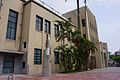
 臺灣銀行宜蘭分行 20150429.jpg 6,000 × 4,000; 6.22 MB
-
 花蓮港燈塔 Lighthouse of Hualian Port - panoramio.jpg 2,519 × 1,890; 584 KB
-
 蘭陽溪蔥田 Green Onion Field on Lanyang River - panoramio.jpg 6,000 × 4,000; 7.22 MB
-
 襌光寺 Changuang Temple - panoramio.jpg 4,608 × 3,456; 4.68 MB
-
 襌光寺道路 Road to Changuang Temple - panoramio.jpg 4,608 × 3,456; 5.71 MB
-
 長春橋 Changchun Bridge - panoramio (1).jpg 3,264 × 2,448; 1.87 MB
-
 長春橋 Changchun Bridge - panoramio (2).jpg 3,264 × 2,448; 2.37 MB
-
 長春橋 Eternal Spring Bridge - panoramio.jpg 3,264 × 2,448; 2.31 MB
-
 長春祠 Eternal Spring Shrine - panoramio (1).jpg 4,608 × 3,456; 4.42 MB
-
 長春祠 Eternal Spring Shrine - panoramio.jpg 2,390 × 3,188; 1.93 MB
.jpg)
.jpg)
.jpg)

.jpg)
.jpg)


.jpg)
.jpg)

.jpg)
.jpg)


.jpg)
.jpg)

.jpg)


.jpg)


.jpg)


.jpg)
.jpg)


.jpg)
.jpg)


.jpg)
.jpg)
.jpg)


.jpg)
.jpg)
.jpg)
.jpg)


.jpg)
.jpg)

.jpg)
