Category:Taubertalradweg
Jump to navigation
Jump to search
long-distance cycling route in Germany  | |||||
| Upload media | |||||
| Instance of | |||||
|---|---|---|---|---|---|
| Part of |
| ||||
| Location | |||||
| Length |
| ||||
| official website | |||||
 | |||||
Deutsch: Der Taubertalradweg ist ein 101 Kilometer langer Radwanderweg in Tauberfranken. Er verbindet Rothenburg ob der Tauber mit Wertheim an der Mündung der Tauber in den Main. Der Weg verläuft in seiner ganzen Länge durch das Tal der Tauber und hat nur wenig Steigungen. An beiden Enden sowie entlang der Strecke gibt es Personenbahnhöfe.
English: The Taubertalradweg (in English: Tauber valley cycle path), is a German bicycle path running about 101 km along the Tauber River in Germany. The Taubertalradweg connects Rothenburg ob der Tauber via Bad Mergentheim and Tauberbischofsheim with Wertheim at the confluence of the Tauber into the Main River. The path runs along its whole length through the valley of the Tauber and has only little climbs. At both ends and along the route there are passenger stations.
Subcategories
This category has the following 8 subcategories, out of 8 total.
B
T
Media in category "Taubertalradweg"
The following 10 files are in this category, out of 10 total.
-
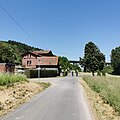
 2023-05-29 Taubertalradweg, Bahnhof Distelhausen und Taubertalbrücke 2.jpg 2,736 × 2,736; 2.85 MB
-
 2023-05-29 Taubertalradweg, Bahnhof Distelhausen und Taubertalbrücke 3.jpg 2,736 × 2,736; 2.87 MB
-
 2023-05-29 Taubertalradweg, Bahnhof Distelhausen und Taubertalbrücke 4.jpg 2,736 × 2,736; 3.17 MB
-
 2023-05-29 Taubertalradweg, Bahnhof Distelhausen und Taubertalbrücke 5.jpg 2,736 × 2,736; 3.09 MB
-
 2023-05-29 Taubertalradweg, Bahnhof Distelhausen und Taubertalbrücke.jpg 2,736 × 2,736; 2.85 MB
-
 Liebliches Taubertal Autofreier Sonntag - 1.jpeg 3,096 × 4,128; 5.36 MB
-
 Liebliches Taubertal Autofreier Sonntag - 2.jpeg 4,128 × 3,096; 3.76 MB
-
 Taubertalradweg Logo.jpg 362 × 331; 33 KB
-
 TBB St. Martin Radwegekirche Ausschnitt.jpg 2,336 × 4,160; 1.83 MB
-
 TBB St. Martin Radwegekirche groß.jpg 2,235 × 2,282; 2.24 MB


