Category:Theresienturm (Heilbronn)
Jump to navigation
Jump to search
| Object location | | View all coordinates using: OpenStreetMap |
|---|
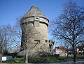
high-raise bunker in Heilbronn, Germany  | |||||
| Upload media | |||||
| Instance of | |||||
|---|---|---|---|---|---|
| Location | Heilbronn, Stuttgart Government Region, Baden-Württemberg, Germany | ||||
| Heritage designation | |||||
| Inception |
| ||||
 | |||||
Media in category "Theresienturm (Heilbronn)"
The following 24 files are in this category, out of 24 total.
-
 Einlassbauwerk Theresienturm.jpg 2,592 × 4,608; 6.41 MB
-
 General-Wever-Turm-Heilbronn.jpg 2,669 × 4,000; 5.33 MB
-
 General-wever-turm-heilbronn2.JPG 1,049 × 800; 251 KB
-
 Heilbronn 01082010 3.JPG 3,648 × 2,736; 3.23 MB
-
 Heilbronn General-Wever-Turm Mannschaftsraum 2000.jpg 800 × 570; 277 KB
-
 Heilbronn General-Wever-Turm S 20071228.jpg 1,155 × 1,500; 251 KB
-
 Heilbronn General-Wever-Turm SO 20071228.jpg 1,577 × 1,500; 444 KB
-
 Heilbronn vom Riesenrad 2011 4.JPG 3,648 × 2,736; 2.53 MB
-
 Heilbronn-theresienwiese-2015-1.JPG 2,048 × 1,536; 1.16 MB
-
 Heilbronn-theresienwiese-2015-2.JPG 2,048 × 1,536; 1.16 MB
-
 HeilbronnOttoKonzBrückeTheresienwiese.jpg 2,560 × 1,920; 1.12 MB
-
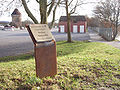 Hn-gedenktafel-theresienwiese.jpg 1,200 × 900; 458 KB
-
 HN-polizistenmord-gedenktafel.jpg 2,397 × 1,884; 1.87 MB
-
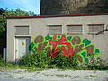
 HNX-graffiti-2015-165.JPG 2,048 × 1,536; 1.12 MB
-
 HNX-graffiti-2015-166.JPG 2,048 × 1,536; 1.11 MB
-
 HNX-graffiti-2015-167.JPG 2,048 × 1,536; 1.28 MB
-
 Theresienturm 2019.jpg 4,608 × 2,592; 4.93 MB
-
 Theresienwiese-heilbronn-2015.jpg 960 × 720; 85 KB
-
 Transformer Unterlaender Volksfest2010.JPG 3,648 × 2,736; 3.05 MB
-
 Unterlaender Volksfest 2011 vom Riesenrad 2.JPG 3,648 × 2,736; 2.5 MB
-
 Unterlaender Volksfest Area 3.JPG 2,736 × 3,648; 1.4 MB
-
 Unterlaender Volksfest04082018.png 4,830 × 3,220; 27.07 MB
-
 Unterlander Volksfest29072017 2.png 4,980 × 3,320; 26.96 MB
-
 Unterlander Volksfest30072016 2.png 3,472 × 2,604; 17.58 MB


